Today we sailed along the North West coast of California, following the coastline at a distance of about 12 miles but sometimes coming closer when the coast line bulged out. There is one area where this really happens; we call it Isla Cedros and here the Mexican coast makes a sharp angle before it more or less continues straight to Cabo Falso. We could see the coast line for most of the day as it was a reasonably clear day, which is not always the case as we are now in the area where we go from the northern cooler weather to a more tropical scene.
This is one stretch of sailing that I have always marveled about. The length of this part of Mexico which we call California. Due to the Mercator projection of the maps of the world, the USA and Canada look a lot bigger than Mexico. In square miles it is but when traveling up and down the coast it is a different story. Most of us when we look at atlases and sea charts look at the Mercator projection. Invented by a Dutch / Flemish Gentleman called Mercator (that was his Latin name) and dreamed up to give the sailors of the world a chart that was easy to navigate on. What it does it is to ensure that the nautical mile that we use for going around the world is always correct for the chart that we use. Most of our sea charts only cover a small area, as we need detailed charts which indicate all the sea depths, and then the distortion on a larger scale does not matter. But if you put all these charts together then you would get the world map as we know it. And then the picture of the world is not correct.
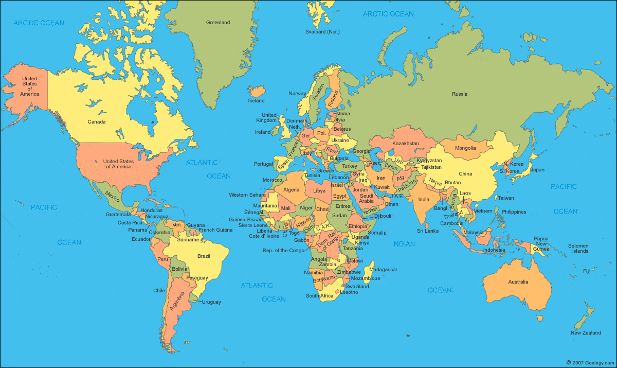
The world as we are taught to see it. I always thought Greenland was very big……….
Greenland appears larger than Africa, while Africa is 14 times bigger. Africa looks about the same size as Europe but it is 3 times bigger. Same Alaska versus Brazil, Brazil is five times larger than Alaska. But by using a Mercator projection, the top and the bottom of the world is stretched out and that makes it look a lot larger. So good for sailors but not good for understanding the world. A solution was known for a long time to this, but never gathered much momentum as it was politically quite convenient to see a lot of colonies and other lesser countries “to seem to be a lot smaller than those of the established powers”
A more logical projection for understanding the real size of the countries of the world started to be promoted in the mid 1980’s. It is now commonly known as the Gall-Peters projection named after the two promoters. The projection (= the way you project a globe on a flat piece of paper) had been known for a long time. Their argument was that each country should be shown in real size relation to each other and that thus each country could take pride in being the size it was. (Gall published about it back in 1855, Peters was the promoter in 1986) Politics always had a place in map making and some might remember the phrase “the all red route” where you could sail all the way around the world and never leave the British Empire. All countries subject to the British Crown were red on the world maps.
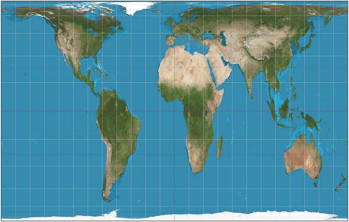
The way the world really looks like, if we use that projection that shows the real size of each country.
But for us to understand why it takes as long to sail along the Mexican coast as it does to sail along the American coast the Gall-Peters projection is useful. It also shows that Australia is about the same size as the USA with a bit of Canada thrown in for good measure. My home country, the Netherlands, does not look much different on whatever projection you use. Small is small and remains small. Luckily the Dutch are used to making a lot of noise and as a result most people know who we are and where we are located.
A little piece of Holland is moving at great speed towards Cabo San Lucas. The ms Nieuw Amsterdam is scheduled to arrive at the anchorage tomorrow morning at 07.00 hrs. and to start tender operations around 08.00 hrs. We are the only ship in, and thus we are at anchorage number one, which means only a short ride into town.Weather 82oF / 28oC no wind and no clouds. I hope our guests have invested in Sun block 50 otherwise it might be a painful first encounter with Mexico. Our Indonesian crew is very happy, final weather that makes sense to them and reminds them of normal living conditions.
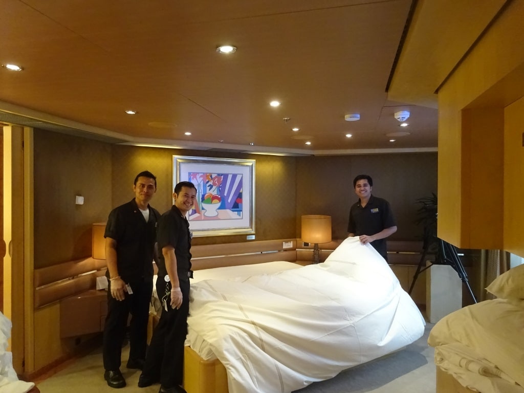
The smiles are coming out. Looking forward to warmer weather. This was change over day in San Diego with 3 cabin stewards changing the bed in the penthouse.

October 10, 2017 at 5:30 pm
Hmmm. Perhaps my memory does not serve me well. But, the ‘older’ ms Veendam seems to have a larger Penthouse bedroom corner that I remember seeing on a tour around the ship in 2008. Is that possible that on board the ms Nieuw Amsterdam the ‘De Lux’ cabins are not consistently bigger than the older mid-size ships?