Between 18.00 hrs. and 21.00 hrs. the cruise ships left Skagway one by one and the ms Noordam was the one who closed the door behind them. Thus we had a steady parade sailing down the Lynn Canal with the highlight being the metropolis of Haines on our starboard side at 10 pm. We will be calling at Haines on our way back. As we had nice and sunny weather for most of the day in Skagway, we were all afraid that a white curtain would descend on the waters again but it did not happen. I think that the amount of warm air available was not yet enough to create a small world. We saw patches of wispy white smoke hanging over the valleys but there was not enough energy to solidify or extend to the open waters.
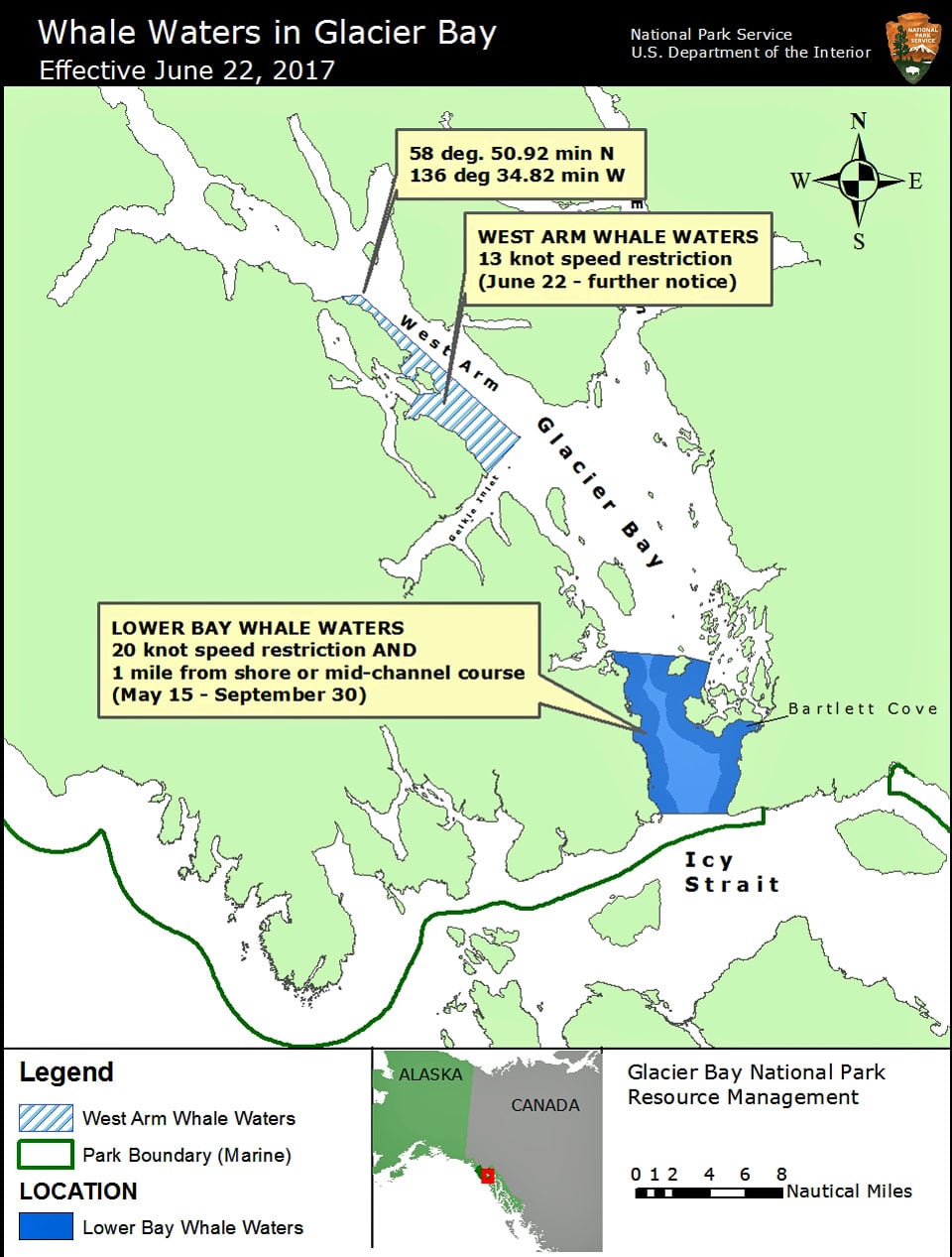
This diagram is send out regularly by the National Park Rangers to ensure safe traffic in Glacier Bay.
And so we sailed with glorious weather into Glacier Bay and boarded the Rangers at 07.00 hrs. I mentioned last week that if wildlife in the lower bay would increase then speed restrictions would be imposed so nobody was amazed when that announcement came in last night. We had to stay under 20 knots in the lower bay, the entrance of Glacier Bay, and there will be further speed restrictions in the future. On the West Arm side it has gone down to 15 knots but we always stay on the East side as there is more to see anyway. And we saw a lot, stellar sea lions, mountain goats and also a good number of Bears foraging around at the water’s edge. The bridge team has a sort of competition going about who spots the first Bear. A tray of soda drinks is provided by the captain as an incentive and thus everybody keeps a good look out. Not only at the navigation but also on the shore line. Bears are not easy to spot as they are black or brown, so what we normally do is not to look for a bear but look for a small rock that moves. In the same way as we look for ships. We do not search for ships; we scan the horizons for changes in the pattern and for anomalies and that normally turns out to be a ship or something else of interest.
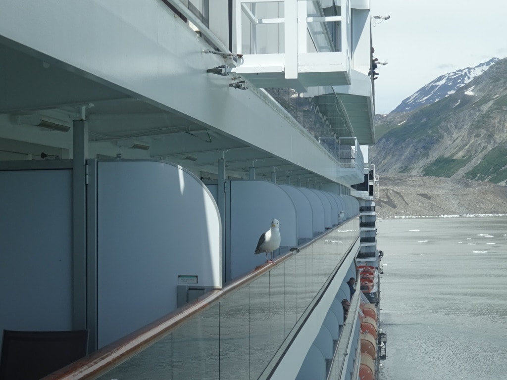
We always have unwanted hitch hikers on board while in the Bay, sometimes because the guests feed them. We try to educate everybody not to do so but there are always a few who do not listen. It does not stop the sea gulls from patiently waiting…. in case of.
Glacier Bay is changing every year and as I have been coming here since 1982, I seen a fair number of changes. Marjorie and Grand Pacific Glacier moving forward and touching and then a few years later moving apart again. I have somewhere in the archives a photo of me touching with my right hand Marjorie Glacier and with the left hand Grand Pacific Glacier. That was in the days that we were still allowed to lower lifeboats and potter around taking photos and picking up a piece of glacier ice. Sweet memories. Through the years I have seen more and more trees growing up and covering the lower slopes of the mountains that had been bare before. Global warming is definatelly having an impact. In the late 80’s the Glaciers started to retreat again and Marjorie has been doing that ever since albeit very slowly.
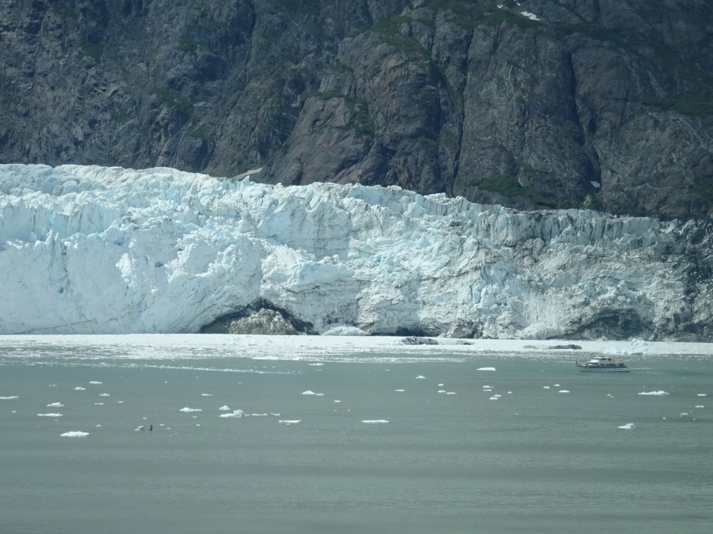
A big rock under Majorie Glacier now exposed. I wonder how long it will take until it will no longer be a Tide water glacier.
This year is seems to go a bit faster as we now have a rock exposed in the middle which I have never seen before. When looking at the Radar we can indeed see that the face of the glacier is further back than ever before. Also when we sailed passed Lamplugh Glacier near John Hopkins Inlet; we saw that had retreated now so far that you could walk in front of it. I will try for a photo next cruise. This time the ship had to alternate the route as the Crystal Serenity was also in the bay and during the time we passed Lamplugh I was somewhere in the dungeons of the ship. By 5 pm. we were saying good bye to the Rangers and then set course for the Gulf of Alaska and Seward.
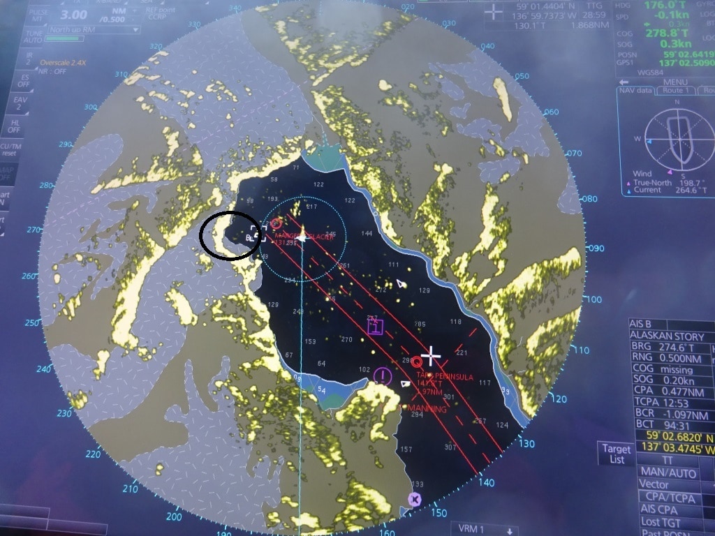
I have never seen the gap this deep into the glacier.
Tomorrow we are at sea and then it is the end of the cruise for most guests in Seward. Weather: overcast with chance of showers and a low swell running from the south, so we might experience a gentle movement of the ship.

June 24, 2017 at 8:20 pm
It will be interesting to my wife and me when you comment on Haines as it was one of our favorite stops along with Ketchikan. Not so commercial.
June 24, 2017 at 9:01 pm
I was just thinking —- with all this “global warming” controversy, I was wondering if the Captains of the ships in the HAL fleet, or the rest of the Carnival Corporation ships, keep a record of ocean temperatures as part of the logs or maybe even ocean salinity as they make their own fresh water? I understand that the more saline the water the more it holds heat and the reverse if salinity is low. Might add data to the data base as the ships continue to ply waters that may not be covered except by satellite. And plus you are there on top of the water tested, not hundreds of miles in the air. Just curious.
June 25, 2017 at 7:06 pm
Thank you for reading my blog.
Every Holland America ship keeps meteorological observations every 4 or 6 hours. So thus nearly every professional merchant and regular navy ship. All that information goes to the weather people who worldwide combine all this raw data that is coming in. I do not know if what all that date indicates but the scientific world is quite worried if you see what they publish, so maybe or ships observations also helps to aid to this understanding.
Best regards
Capt. Albert
June 25, 2017 at 2:29 pm
Just a question , how does the captain decide how to dock? Sometimes they back into to the dock or pull straight in. I see this difference fairly commonly in Vancouver , Skagway and Seward.
June 25, 2017 at 6:56 pm
Thank you for reading my blog.
there can be a lot of reasons. Number one is always we like to dock nose out, so we can leave quickly if needed. If we have to dock nose in than the side depends on maintenance or repairs, good location for gangways, flow of traffic on the dock etc. It is seldom the captains decision in a direct way. most of the time the way of docking is dictated by economical needs. Where we are going to depends on what space there is available and that is figured out by some bright spark on the shore side who tries make the puzzle work with different size ships and different size dock lengths.
best regards
Capt. Albert
June 25, 2017 at 6:14 pm
Capt Albert:
As always, I am mesmerized by your insight and wonderful accounting of the HAL voyages you are on. I have been reading your blogs over 12 years now, and love every one of them…..Ruud
June 25, 2017 at 6:51 pm
thank you for having been there from the beginning.
Best regards
Capt. Albert