I always love it when the weather follows the weather forecast. Then at least what you have planned for happens and you can deal with it. Not that I mind it if the forecast says there will be storm and there isn’t one, that seldom happens, but if it has to be stormy then it is nice if you can go and plan and prepare along with what the forecast says. Thus today we were fully in synch with the weather gods. We did have a windy night last night but the ship rode the short jagged swell of the North Sea very well.
The North Sea causes a ships movement which is totally different from any other sea I have sailed on. The North Sea is shallow (often not deeper than 150 feet), has a lot of current or better said currents as the flow comes from various directions, and when the wind blows it cannot really build up any deep and long waves. This results in a short and abrupt swell pattern which can give a very unpleasant motion. Here helps the length of the Koningsdam with over 300 meters it sits on the crest of several waves at the same time and thus there is hardly any rolling or pitching motion. Just a sort of jittery movement which goes through the ship when the hull adjusts to the constant onslaught of the multiple waves crests.
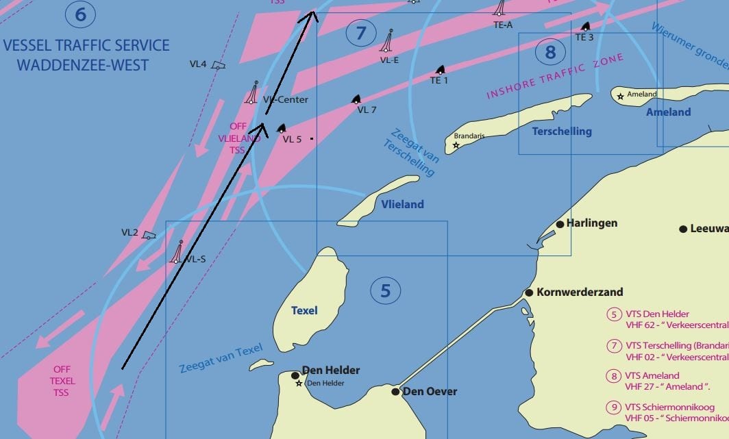
Cutting through the Stream of traffic while above the Dutch Island of Tessel.
While sailing along the coast we followed the various Vessel Traffic Separation Schemes. A lot of through traffic comes from the English Channel in the south, more traffic comes from Rotterdam and Amsterdam (like us) and there is traffic coming from Scandinavia and North of Scotland on its way to the German ports such as Hamburg and Bremen. This all meets north of the Frisian Islands and to keep things a little bit under control we have Highways at Sea here, including an exclusion zone in the middle to keep the opposite flows apart. It is always fun for cruise ship navigators to race through here and pass all the other ships as if standing still. There is always a crucial moment when you leave the system or “change streets” while wriggling your way through the other ships that are staying on the “same road”.
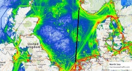
There is a lot of traffic in the North Sea. The green spot in the middle is caused by Offshore vessels servicing the oil rigs. (Courtesy www.Marinetraffic.com)
The ships movement changed more and more when we came into open waters and deeper, further away from the Dutch coast. As was expected that movement changed even more when the ship “fell” off the North Sea shelf and came in water of 60 meters and over. Now the waves could expand downwards and stretch out and the Koningsdam started to pitch as now it rode two waves at the same time instead of being carried by a multitude of small ones. Thus for a short while we got the ke-deng of the bow slamming into the waves, the famous pitching movement. The stabilizers were quite good in taking care of the sideways or rolling movement. But the pitching remained.
As explained yesterday, this was expected and thus in the early afternoon the ship reduced speed to get rid of that movement. When reducing speed you give the hull more chance to ride up and down the waves instead of being propelled so fast forward that a head on collision – pitch – is the only option. That did not mean that the ship was now suddenly quiet but it reduced the motion to what I call “bearable”. Again whether the guests agree with me remains to be seen but then they do not sail every day of their lives. Still there many of them were up and about; although maybe less than normal as breakfast this morning was a quiet affair.
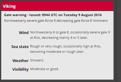
Still bad at 09.44 English time this morning, but decreasing later. So things are looking up again.
Based on the weather forecast remaining correct, the waves should start to reduce from the highest of 7 meters to gradually about 3 or 4 meters. So slowly but steadily the ships movement should be getting less as well.
At 2 pm we made it to the Norwegian coast and will now sail along until we come to the pilot station of Brysse around 06.00 tomorrow morning. Once the pilot is on board, we will sail to Hellesylt for disembarking the tour. As there is no other ship docked, we can go alongside there briefly, march the 300+ guests ashore and then sail on to the end of the Geirangerfjord for the remainder of the call. We are expected there at noon time. The ship will drift there and we will run a regular tender service for the remainder of the day.
Behind a good storm there is normally a good amount of rain clouds filled with rain and we will get those tomorrow. And thus the weather forecast calls for a rainy day will chilly temperatures of around 41oF / 5oC with a bit of a breeze. But for more guests anything will be better than yet another wobbly day and the ship sells rain poncho’s on the gangway so what can go wrong?

August 10, 2016 at 5:28 pm
Captain A
We are just back from a cruise to Alaska and the beautiful Tracy Arm Fjord–where I know you have been many times. We have never been to Norway so my question is: How do you compare the fjords in Norway to those in Alaska? Are they similar in length, height of the mountains, etc. or is it not possible to make a comparison?
Thank you,
Roger T
August 11, 2016 at 12:58 am
Good morning,
I hope you enjoyed your cruise. In general the fjords in Norway are more narrower and much steeper. Very fascinating to sail through. They are different then the inside passage as quite often you have to go outside to get into the next one, while Canada and alaska have the Inside passage. It is hard to compare as both are majestic but very different in layout and the way you experience it.
I know this does not help very much but it is hard to compare two things, which are the same in basics, mountains & water, but so very different in reality.
Best regards
Capt. Albert
August 13, 2016 at 4:13 pm
Hi Captain Albert,
Just reading about the storm you went through and was wondering what is the roughest seas you’ve ever encountered? Also, is there anywhere in the world you haven’t sailed?
Linda Olsen
August 14, 2016 at 3:39 am
Thank you for reading my blog.
It was a good storm but not by far the worst. Highest waves observed were 35 feet which is quite decent. 1986 Rotterdam we went through 80 feet in autumn and that was sligthly different business. I have been nearly everywhere, except some parts of Africa and I have not done the North west passage yet, but I might make it there as the ice is less every year.
Best regards
Capt. Albert
August 18, 2016 at 8:45 pm
Your comment of “riding 35 foot waves is pretty decent for those that sail every day of their lives” is still pretty impressive for landlubbers, Captain. Even for the most experienced surfers on the Hawaiian islands it’s a special occasion and people come out to see the daredevils taking their turns to ride those waves. 80 Foot waves have also been tried by the expert surfers (dear Google has photos to prove it) But, your “ke-deng” takes the cake. Join the islanders of the Pacific; we’re great at imitating sounds 🙂