- Captain Albert's Website and Blog -

Ocean Liner History and Stories from the Sea, Past and Present. With an In Depth focus on Holland America Line

Author: Captain Albert (page 31 of 228)

06 June 2018; Baltic Sea.

What the English language calls the Baltic is called by the Dutch and the Germans the Oost zee, or OstSee, or translated the East Sea. Logical as it is to the East of those countries. But it causes confusion sometimes when a Dutch sailor in his best English advises a Harbormaster in an English port that he came with his ship from the EAST SEA. But for the international world the word Baltic is used and it is a bit uncertain where it is derived from. Wikipedia gives at least four options, but to me it seems that Sea behind the Balts = the Belt Islands between Demark and Sweden is closest to the most viable options.

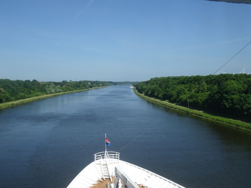
So we plunged last night into the Baltic Sea after we came out of the Kieler Kanal and had sailed through the Kieler Bight. The Baltic Sea is a shallow sea and if they would close the entrance to the Baltic off at Helsingborg and Helsingr then you could have extended valleys of dry land here, interspersed with mighty rivers carrying all the drainage water from the various countries. The mind boggles what would then happen to the ships, the local infrastructure but also to the boundaries of the surrounding countries. For that reason there is a description in the Finnish language of the Baltic being the “Peace Sea” as through the centuries it kept the various warren factions somewhat apart. It did not always work but the water required those who were intent on conquest to build ships and others to spend their money on forts to protect them. If the sea had been dry land, then any major army could have just marched south or north and things would have been greatly different.

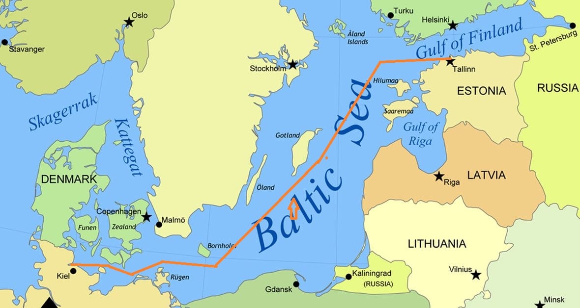
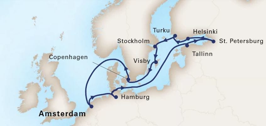
Our Route through the Baltic Sea. Going North we are favoring the Polish side; coming south we will favor the Swedish side.

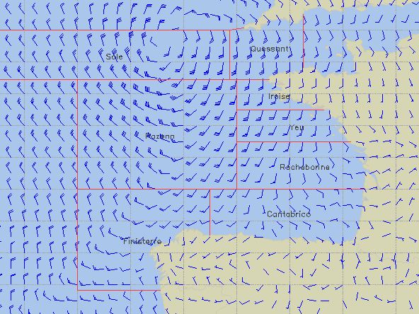
The Baltic Sea has always been an important trading route from spring to late autumn. Then the sea would freeze over and all the ships would have to wait until the next spring. Nowadays the icebreakers are so powerful that the ports can be reached all year round as long as the ships are following the exact track made by the icebreakers. For the cruise ships that is not much of a challenge we are only here in the summer time. But we still pass the islands that were important points and landmarks for the old navigators in the sailing days.

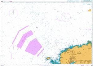
One such is the island of Bornholm. Located halfway between Poland and Sweden. In the Dutch language we have a saying “achter Bornholm liggen”, to lay behind Bornholm. This referred to what the ships would do if there was a storm blowing. You can shelter behind the island in all directions so where ever the storm is blowing from, you can find shelter at the opposite side behind the island. This was done so often that the phrase became part of the Dutch Language and was even used by those living far far from the sea. There are extensive ferry connections with the island and there is the port of Ronne on the west coast. A ship as the Prinsendam is about the biggest size that fits inside but larger cruise ships will have to anchor.

Today we did not have to lay behind Bornholm as the weather was really good. So we kept Bornholm nicely on our port side and sailed further up the coastline, passing Gotland also on the portside around 17.00 hrs. this afternoon. Gothland is home to the town of Visby which we will visit later on in the cruise. Because the Baltic Sea is so very busy there are assigned shipping lanes everywhere and Bornholm is used as a sort of Separation Island. If you are out of the Baltic and up past Denmark to the North Sea then normally you stay north of Bornholm. Coming into the Baltic and going north, you normally you stay south of Bornholm.

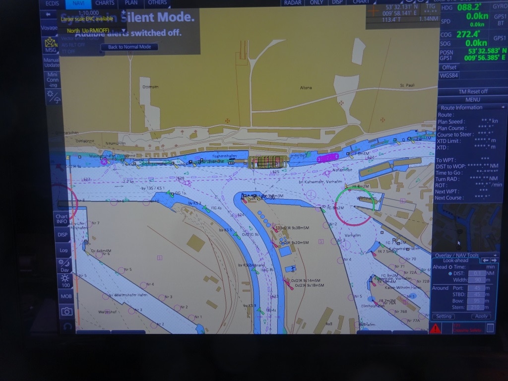
Around midnight we will change course to starboard and sail into the Gulf of Finland with the aim to be docked in Tallinn by 07.00 in the morning. Tallinn is on a different time and thus the whole ship will go forward one hour tonight. The port now has two large dedicated cruise piers and the cruise ships do not dock in the old port anymore. That is now reserved for the ferries of which a greater number call in every day. For the guests it does not make much of a difference. The length of the walk into town is the same length and with the modern pavement it might even be easier than the cobble stones near the old docks.

The weather for tomorrow is supposed to be sunny with temperatures in the high sixties. There is talk about a breezy day but I hope it is not too much as I am examining the sailors tomorrow to extend their competency certificate as Tender Drivers so we going to mess around with boats so to speak.

05 June 2018; Kieler Kanal, North Germany.

We left Hamburg in the early morning and turned the ship around as I explained yesterday. Such a maneuver is not done “ off the cuff” but carefully planned so all the officers know exactly what the captain, or his designate who carries out the maneuver is going to do and when. If the officers fore and aft have the exact maneuver also in their mind then they can report in what they see fore and aft while retaining the same mental picture.

Departure Hamburg during the ebbing tide. As usual we try to use the current as our friend. Put the bow in the current and have it pushed down stream while keeping the stern in position with the main propellers.

Then we sailed down river and just after 9 am. made the sharp turn to starboard and into the Brunsbuttel locks of the Kieler Kanal. Although the official name is the Nord- Ost See Kanal, the name Kaiser Wilhelm II Kanal is also used after the Emperor who opened the canal.  It was opened in 1895 but was between 1907 and 1914 already widened due to amount of traffic and larger ships. Holland America has a claim to fame here as the Rotterdam III was the first commercial ship (Commodore F.H Bonjer) that sailed through the Canal following the imperial yacht Hohenzollern with the emperor on board. A Dutch flagged ship was chosen to avoid international bickering about who was more important. The Kingdom of the Netherlands was neutral in European matters so it was the best way out for Germany to keep France, Russia and Great Britain from complaining. The Canal was officially built to reduce the time for ships traveling from the Baltic to the ports in lower Europe and vice versa.  Otherwise you have to go all the way around Denmark. The un-official reason is that the Canal was very handy for the German War Fleet to get from the Baltic to the North Sea and vice versa without giving Denmark or Sweden the chance to make things difficult by closing the narrow through fare off between Helinsingor and Helsingborg.

Entering the locks at Brunsbuttel at the Elbe River side. There is a second set of locks to the far right, which is at the moment under re-construction.

There is ample space for the Prinsendam and also larger / read longer and wider ships / to fit in the locks and go through the canal. That is not the problem. The challenge is the height of the ship above the water. There are a number of fixed bridges over the canal and we have to go under them. The Prinsendam is prepared for it as she can lower the top of the radar mast. Some ships also have to lower the funnel (they do that by tipping the top over) but the Prinsendam funnel is low enough. When we book a transit for the canal, one of the things we have to do is to send in a certificate which is approved by Lloyds and which clearly states how high the ship is above water including the draft variations. In the past it has happened a few times that the measurements forwarded to the canal authority where not exactly correct and a bump was the result. Since then a Lloyds Certificate is required.

Folding down the top of the Radar Mast to avoid bumping into the bridges.

The Kanal has a length of 98 kilometers and the average speed going through is about 10 knots, with stretches where the ship can do 12 and there are some – inhabited areas where the speed has to go down to 7 or 6 knots. Then there are moments that big ships have to pass each other and then one ship will go against pillars at the side of the canal and lean against it. The 2nd part of the canal is the smallest, the part towards the Baltic, and there no traffic can pass each other, so ships wait at moorings until the North bound convoy has passed. In similar style as in the Panama Canal where ships wait in the Gatun Lake. While going through the Canal we have a pilot, who changes half way through the canal, but the pilot also brings helmsmen to steer the ship. They know exactly how to stay in the middle of the canal or to slow or to veer off the center track when there is opposing traffic.

Entering the narrow part of the Canal. There are only a few bridges and the only other way to cross is by small ferries which can be found along the Canal at regular intervals.

By 1830 we were at the end of the Canal at the Holtenau Locks which give access to the Ost See or in English the entrance to the Baltic. This area is called the Kieler “Bucht” or Bight and when we exit the canal it has served the purpose for normal ships of not having to sail around Denmark and for us to have had a very nice scenic day. And we did have a very nice day. With the combined experience of Captain Dag and I we can say that this day was one for the record books. Sunny but not too hot, a gentle breeze but not windy, and a transit all the way on schedule. It is not often that we have all those elements coming together in one day.

This evening we will sail past Kiel and in the lower Baltic and then follow the German coast by going North West towards Tallinn, were we are spend the day, the day after tomorrow.

Expected weather for tomorrow: Sunny, low sixties or around 16.17oC and a gentle breeze. And that gentle breeze should (hopefully) just be enough to keep those low hanging white clouds away.

A view of the Prinsendam from one of the bridges. Taken in 2009 while going through the smallest part of the Canal.


04 June 2018; Hamburg day 2.

Today was day 2 of our visit to Hamburg after a quiet overnight alongside the Altona Landing Stage. This is the major cruise ship dock in Hamburg which is normally used by all the cruise ships. The small Prinsendam can dock further up the river when there is space. That dock is almost in the center of the city but it is only available when there are no festivities or activities going on, on the river front. And in Hamburg there is nearly always something going on and thus we are at the large cruise terminal.

The Hamburg Cruise Terminal. As you can see the river flows straight down along the dock making it very easy for the current to get between the ship and the pier. One of the swinging areas for ships turning around is just south of the floating black dry dock to starboard of the ship.

We docked nose in yesterday afternoon, for two reasons: the captain wanted to reduce the delayed arrival to the absolute minimum and the current had only just turned so we could still do so. Swinging around takes at least 10 minutes but if the current is very strong than that has to be done. Unless you use brute force with a few strong tugboats. Normally you always respect the force of the river current and use it as your friend.   So you keep the bow into the current and towards the dock, and the current will push the whole ship towards the dock. Then when you have your forward mooring ropes ashore and ready to bring tight, you use the propellers and stern thruster to bring the stern in. That normally pushes the bow out, something we do not want as then the current can get in between the ship and the dock again and to avoid this we need the forward mooring lines ashore to be able to heave them tight and prevent the current from pushing the ship away again.

The electronic chart for the area. the Prinsendam is docked in the black lined area and all to the south, to starboard are the various cargo docks of Hamburg. As soon as the tide becomes favorable, there will be a lot of traffic going downstream.

When we leave early tomorrow morning, we will use the current as our friend again. It will be low tide at 03.58 tomorrow morning. We have all on board at midnight so the Prinsendam can leave when it is best for the traffic on the river and for the time needed to get down river to Brunsbuttel at the entrance of the Kieler Kanal. When we leave it will still be ebbing and that means a down flow of the river. We will use the river as our friend by bringing the bow off the dock and the current will push us away to the middle of the river, it will almost go by itself. Then it will depend on the pilot to decide what is the best place to swing around. Most of the time we travel a little bit up river, to just under the floating dry – docks and swing there, which gives a bit more room as during the swing the river will also push the ship downstream. But the river is so wide here that the Prinsendam has plenty of room to play with.

It might raise a question about why we can only leave when it works with the traffic but that has to do with the size of the port of Hamburg. After Rotterdam and Antwerp, the port of Hamburg is the largest in Europe. That means a lot of traffic. Traffic that likes to leave and sail down river with the ebb; with following tide. The Elbe River is tidal for 148 km. and if you can use the current as your friend you save a lot of fuel. When we came up the river yesterday, we had the current against us and thus we had to use more power to maintain the same speed while traveling. It is not allowed to go full speed everywhere on the river  to catch up with the delay that one might have and that can then result in later arrivals. In the Hamburg area the maximum current can be as high as 2.5. knots and that means if you are only allowed to travel with a maximum speed of 10 knots through the water, then you only make progress of 7.5. miles distance. Going with the flow, you get those 2.5 knots as a bonus while still going at 10 knots through the water and complying with all the speed regulations. And these vary while traveling along the river. So I expect to see early tomorrow morning a lot of eager captains trying to get their ship on the way to take advantage of the most favorable current and the ms Prinsendam will have to find its place in the parade.


We will put the brakes on after we have traveled about 4 hrs. down river and then make a sharp turn to starboard to enter the locks of the Kieler Kanal at Brunsbuttel. Contrary to the Panama Canal, cruise ships here cannot book a transit time, it is first come, first served but in all the years I have been going here, we were always slotted in around 07.00 for the locks so the guests could see it all in day light. In the past we had an Umpa–Umpa brass band on board to play during the Bier Fest but that is this time done tonight while we are in port. A good thing as well I think, as during my last transit, one of the musicians fell down the gangway as he had also been participating in the Bier Fest while performing. If it happens tonight we can always roll them ashore in a wheel chair.

The weather looks perfect for tomorrow. 71oF / 220C partly cloudy skies and very gentle breeze. No very low hanging white clouds expected.

03 June 2018; Hamburg Day 1.

We have two overnight stays in Hamburg as it is impossible to get to Hamburg early from Rotterdam. It is simply too far up river. Staying overnight also ties in with the company policy of trying to offer at least one evening’s long stay in a port which in this case translates into an overnight stay, with a bonus for a 2nd one, as the Kieler Kanal is only 4 hours downstream. Those with a taste for German nightlife will be very pleased. For the sort of cruises that the Prinsendam makes – Explorer cruises – this is quite normal. You cannot see Hamburg in one day, even two days is not really long enough. So an overnight with a full afternoon and a full day is as best as one can do.

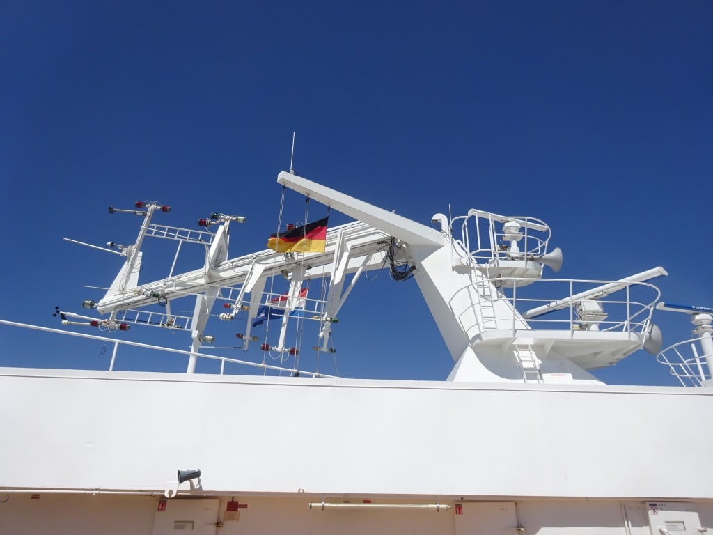
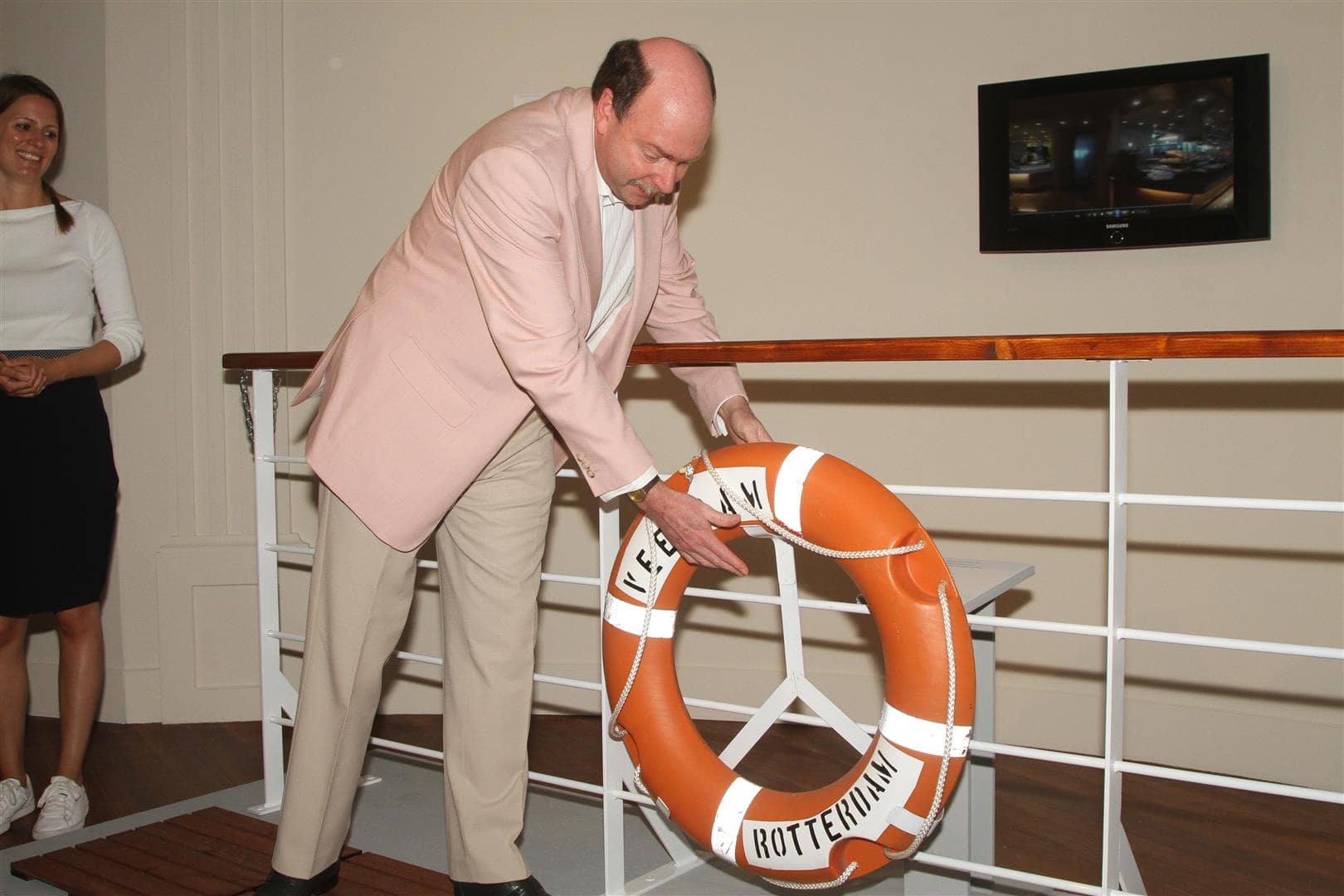
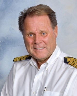
The good ship ms Prinsendam is in the capable hands of Captain Dag Dvergastein who has been commanding cruise ships for the last 30 years and came to us via Seabourn. The company is slowly starting to mix the officer teams from both company’s and we now have two HAL captains with Seabourn and a Seabourn Captain with HAL.  Late last evening the white curtain lifted and the Captain could switch off the fog horn much to the delight of the guests who occupied the suites right under the Radar Mast. You get the best cabins on the ship with the suites and also the best view from your balcony but you then also have to accept that you live close to the navigation part of the ship and that includes a lot of honking on the horn if weather or traffic so demands.

Traveling to Hamburg means a 7 hour journey up the river and that makes it impossible to reach Hamburg any earlier. That journey started this morning at 07.00 hrs. with the boarding of the Sea pilot. This pilot takes the ship as far as Brunsbuttel which is also the entrance to the Kieler Kanal where we will be the day after tomorrow. Then at Brunsbuttel, where we were at 09.30 hrs. we embarked the River Elbe Pilot which took the ship up to the entrance of the port. Then shortly after 13.00 hrs. this pilot was relieved by the port pilot who took the ship all the way to the dock. Because the schedule just works on average speeds, you never know if you will arrive exactly on time, as traffic and especially the current can affect things greatly. If you go upriver with the flood behind you, you can save easily an hour on a six hour journey but the other way around is also possible. Today we were unlucky as we had the ebb tide against us for most of the journey and only the beginning of the flood later on as high tide is at 20.11 hrs. And it is a HIGH as water level will rise by 12 feet. So we ran 20 minutes behind the brochure time, with complaints to Mother Nature please. But we had good visibility and so we had excellent sightseeing.

The exact locations where we change pilots. (Courtesy Elbe River pilot site)

Hamburg is a city with a long seafaring tradition. It was once home port to the largest shipping company in the world, the Hamburg Amerika Linie or HAPAG, until the wars put an end to that. Now that distinction is split into the largest container company, or the largest cruise ship company or the largest tanker company. But the citizens of Hamburg have retained a deep affection for the sea and the ships and the Hamburg port days are the biggest spectacle in relation to ports and the sea that you can think of. Also when a cruise ship gets christened in Hamburg, it is not just the company who creates a lot of hype, the whole city joins in. It also means that a lot of traditions are retained here which have fallen by the way side in other countries.

The location with Restaurant is called: Schiffsbegrüßungsanlage Willkomm-Höft, or Ships welcome point. It has been in operation since 1952 and receives sponsor money to keep it going. The pontoon in front is the docking location for the local river ferry,

Once of those traditions is to welcome the ship by flag dipping and playing the National Anthem. I know only one other place in the world where this still happens and that is when going up the St. Lawrence river to Montreal, about 50 miles north of Quebec.  Here in Hamburg there is a restaurant which continues the tradition and with a big loudspeaker they bid us welcome in the German and Dutch Language and then played the Dutch National Anthem. It costs money, it does not give any direct value, but it brings style and character and I always compliment those who take the time to keep such things going. People love and hence also the fascination with the pomp and circumstance of Royal Weddings and National Pageantry in the United Kingdom I suppose.

We will remain here until the early morning of the 5th.  and then sail down river again to Brunsbuttel to spend a scenic day sailing through the Kieler Kanal.

Tomorrow more about Hamburg.

02 June 2018; Amsterdam, The Netherlands.

And thus real life started again and I returned to sea by means of the ms Prinsendam. I was supposed to join the Koningsdam first, but the Prinsendam will be celebrating her 30th. birthday on June 11 and I was asked by the ship to do a few lectures in relation to HAL and our Elegant Explorer. Thus we juggled the schedule around and here we are combining work and hobby-pleasure.  Before we dive back in the real world; a small side step with something that happened while I was at home. Also in relation to the history of the company and in relation to the original reason we have a Veendam sailing in the fleet.

Explaining who W.A Scholten was. This is the ship from 1874 with it’s first Master, Captain Hus Top right and its last Master Captain Taat Lower Left. (Photo courtesy Mr. Ruud van Deventer, son of ex HAL Captain Van Deventer)

Back in the grey mists of time, 145 years ago, Holland America was founded and went public with having a listing on the Dutch Stock Exchange. Out of nowhere a rich industrialist from the Northern part of the Netherlands popped up and bought so many shares that the company was able to finance a complete ship from it. Thus the company named this ship after him. Mr. W.A Scholten was inspired to invest in HAL because he only saw German shipping posters at the various railway stations he used while traveling between his various factories in the Netherlands and as far as Poland. The ss W.A Scholten sank in 1887 but the company replaced it very quickly. By that time the DAM naming system had come in vogue and thus they could not repeat the personal name.  But no problems here, Mr. Scholten had factories nearby and lived in the town of Groningen and Veendam was the nearest “DAM” town in area. And thus in 1888 the ss Veendam (I) started sailing for the company.  And for most of our history we have had a Veendam in the fleet. The current Veendam being nbr IV.

There are big collectors and there are small collectors. I am a small collector but the museum found a gentleman who had managed to salvage the magnetic compass of the Veendam II when it was scrapped in New York. He is a big collector as this compass was only a very small part of his private collection. (Photo courtesy Mr. Ruud van Deventer, son of ex HAL Captain Van Deventer)

In this home town, Veendam in the province of Groningen, there is a museum which is dedicated to the rich shipping history the town once had and also its relation with W.A Scholten. And thus with Holland America being 145 years young and W.A Scholten and the four Veendam’s  it was decided to create an exhibition about it all. But then you need material to exhibit. In this case this museum asked the collectors and historians in the country if they could help.  And of course they were willing. Every collector likes it when his/her things go on display and most collectors are much easier to work with than the red tape of official museums.  And that brought the organizers to me and recognized a sort of unique situation: A Holland America Line historian and collector who also had been the Captain of a Veendam.  Some of my collection went on display (and that was not much compared to what some others were able to bring in) and I was quite happy.

Normally when a sailor has a life buoy in his/her hand it is because somebody has fallen overboard. It is quite unusual to use a lifebuoy to open an exhibition. (Photo courtesy Mr. Ruud van Deventer, son of ex HAL Captain Van Deventer)

Then there was the un-expected next step. As the Dutch King, nor Queen, nor the Prime Minister or any other highbrow official was available (the opening being on a Sunday afternoon…………….), it was decided that I should do the opening. A cruise ship captain’s life is never dull but I do not think that this happens very often. So in the last week of my leave I drove to the far north of the Netherlands, to Veendam to open the exhibition. No ribbon cutting with golden scissors but sailor style with hanging a lifebuoy on a fake railing.  For those who read this and have the option to visit, it is well worth to do so, not only because of this exhibition but also for the rest of the museum and for Veendam which is a delightful little town to spend an afternoon in.  (https://www.veenkoloniaalmuseum.nl/nl/in-het-museum/tentoonstellingen/veendam-in-de-vaart-1)

Our current cruise 02 June to 14 June 2018

The ms Prinsendam started today a 14 day round trip to the Baltic and will also call at Turku, where 30 years ago the Royal Viking Sun, now Prinsendam was built. Apart from Hamburg and the Kieler Kanal it is doing a regular Baltic cruise with calls at Tallin, St.Petersburg and Helsinki. The ms Prinsendam is the only HAL ship which fits in the locks of the Kieler Kanal and we have guests on board who have booked this cruise especially for that purpose. I am keeping my fingers crossed that we will have good visibility. Today on departure it was hazy and a white curtain came down the moment we left the locks at Ijmuiden. But tomorrow we are supposed to get a bit of wind and that should change the balance between air and sea temperature somewhat and hopefully that will result in being able to see the whole world again.

29 April 2018; Zeebrugge, Belgium.

Zeebrugge is an entry port for Belgium, same as Antwerp but on a much smaller scale. Although with Antwerp you dock in the middle of the city (as long as your ship fits in the turning basin) and in Zeebrugge you are in the middle of nowhere but it is much less time consuming than the run up and down the river Scheldt and the whole long stretch over the Westerschelde through Holland. Zeebrugge is the Gateway City for Bruges and Bruxelles but is not so bad itself. The port runs a shuttle bus service to downtown Zeebrugge which is a small but homely town with a nice shopping street. But it also has a boulevard with a beach and that is very nice in the summer time. Especially if you like Mussels and Frites (= the Belgium version of French Fries). Today the weather was not that great for a beach day, with a light but cold wind and occasional rain but it was still good enough to be able to enjoy the tours to the hinterland.

The light blue is the relative deep water of the North Sea (150 feet or more) and then where the light blue continues among the red and green buoys is where dredging keeps the wandering banks at bay. The big circles indicate various sorts of  lighthouses. The blue line straight down is the canal to Bruges for the smaller ships. We do not fit in.

Getting into Antwerp might take a long time compared to getting into Zeebrugge but also this port has its challenges. And that has to do with all the sand banks in front of the Belgium coast and the amount of traffic that goes up and down the North Sea, in and out of the Scheldt, and in and out of Zeebrugge port. The challenge with the sand banks is that they move. One of them, after which the pilot station is called, is called De Wandelaar, or The Wanderer, and that indicates already that it is moving all over the place. To avoid this there is constant dredging going on. In the approaches, but also inside the port itself.  For a while the main cruise ship dock was not accessible for ships with a draft over 8 meters. They had to go to the container terminal opposite. Not much of a problem as the port is big enough but challenging on a busy cruise ship day.  Today that cruise dock was occupied by one of those dredgers so we also went to the container terminal but one that is used for overflow and no containers were present. It did give plenty of space for our shuttle and tour buses.

You do not dock at a container terminal for the view. But it does offer a lot of space for coaches and long gangways.  In the top right of the photo the church spire of Zeebrugge, about 10 minutes away with the shuttle bus.

Because of the sand banks, the pilot boards far out at sea and they even have an accommodation ship out there so pilots can sleep while waiting for their turn. Once they have completed their shift there is a fast boat that brings them back to solid land or more comfortable they can step off the ship that they brought in. That was the case today with our pilot; he was going home and the captain could not even tempt him with breakfast on board. Either he was in a hurry or he had had too many cruise ship breakfasts already in his life.

Although the pilot only has an advisory duty, most of the time he/she sails the ship in and gives direct orders (which are then acknowledged by the captain as being correct) to the bridge team. In a port like this where wind, tide and sandbanks can change by the hour that is the best way forward. Once it then comes to docking the Captain takes over again and parks the ship where pilot, harbor master and agent thinks it should go. If you go in and out of a port on a very regular basis, you can get a pilots exemption, so your ship can sail when it needs to, without delay. Most ferry captains have such an exemption as they are going in and going out as often as the regular pilots do. But you still need the local knowledge due to the moving sands, moving buoys and other things that Mother Nature can throw at you in these dangerous North Sea areas.

We will sail from here to Rotterdam and the weather is again going to be very windy. There is another weather front coming over which will bring a lot of rain and wind to the Netherlands. On one side I can live with it as I am going home tomorrow, on the other hand I hope that it will not affect the flights from Schiphol as my wife wants me home before cocktail time.

The Captain and his navigation team produced this North Atlantic Chart for the Guests. Marking the noon time position for everyday of the cruise. This was voyage 549 for the ms Rotterdam.

It is also the end of cruise 549, the ms Rotterdam’s Trans-Atlantic Cruise which has turned out to be quite a good one. We did have to cancel a port because of bad weather, the crossing was nice and quiet and we were just a bit unlucky with the rain during the last few days. But can be expected during a spring crossing. Now the ship will make a number of European Cruises, then make three Atlantic crossings between Rotterdam and Boston; and then start on August 25 a series of Canadian Maritime cruises to Montreal.

This is my last daily blog until 02 June. Then I will join the ms Prinsendam for three weeks and the first week is rather special as the ship will be celebrating its 30th. Birthday and we will visit her place of birth in Turku.

While I am on leave I am involved in something that seldom happens to a ship’s captain: opening an exhibition. As the Dutch King was not available, neither the Queen, nor President Trump, it was decided that I was the next best choice to do so. The exhibition is about the four Veendam’s the company operated and the predecessor of the first Veendam, the W.A Scholten. I was captain for four years on the Veendam IV (from 2004 to 2009) and thus I am somewhat qualified to be involved.

https://www.veenkoloniaalmuseum.nl/nl/in-het-museum/tentoonstellingen/veendam-in-de-vaart-1

I will post something on the blog once the exhibition has been opened.

Thus is it time again to say goodbye to all my regular readers and those who tune in on occasion. I hope that you found my daily ramblings, interesting and on occasion diverting and maybe even educational. I thank you for your support and interest.

And I promised a Dutch “Art Deco” on the HAL ships.

This is the Grand Hall of the ss Nieuw Amsterdam of 1938.  The decoration is much more subdued than on the Normandie but the coloring is not that much different.


Again the Grand Hall of the ss Nieuw Amsterdam of 1938. Now in Black and White and seen from the other side. It is a mixture of styles. Some Art Deco, some Bauhaus and something what they called the “Dutch Style”. Still trying to find out what that is. Most famous is the ceiling with a number of nude sculptures, which gave quite a shock when the ship entered service. The ceiling still exists and is now owned by the Rotterdam Maritime Museum.

28 April 2018; Cherbourg, France.

On departure from Brest the Captain announced that we could expect some wobbly weather and some ships movement. And indeed 45 minutes after departure, when the ms Rotterdam pushed her nose into the North Atlantic Ocean, we took a few waves full on the bow and then moved about for a while. Then it became less and less until it was almost gone by 9 pm.  During a walk through the ship I had to go to great pains to explain to a few guests, why it the ship was moving in the first place and why it stopped moving in the course of the evening.  Well it all had to do with sailing around Brittany.

Our route from Brest to Cherbourg.

It all has to do with the way the swells are hitting the ship. When we left the port (see A) the swells generated by the storm (12 – 14 feet) were hitting the bow. That makes the bow go up and down and that is what we call pitching. The worst form is when the bow is lifted completely out of the water and then slams with an almighty bang back on the waves. That costs a lot of speed and thus ships often slow down to make it more comfortable and also as by on average they do not gain any extra mileage by keeping the slamming going. We were lucky because we were going to the North. So by 18.30 the ship had already made a nice course change to the North West and the ships motion was now between pitching and rolling. The stabilizers were doing their best and apart from the occasional lurch or sway, the ships movement greatly subsided. (See A to B)

We had even more luck because of the direction of the swells. By the time we turned to the North East (See B to C) we had the swell on the side and the stabilizers could take care. Why were we lucky? If the swell had been on the port quarter (half between the stern and the port side) then we would have experienced a cork screw motion. Then the ship not just rolls, or just pitches but does something in between which looks the way your laundry acts in the washing machine when the spin cycle changes. (If you have a front loader you will understand what I mean) This movement is very un-pleasant as it is hard to predict. We have that on all cruise ships that sail towards the Panama Canal when they are above Columbia. Here the swell generated by Trade Winds catch all the ships on the Starboard quarter and then they “corkscrew” all the way to Panama. Once we were above the top of Brittany (See C) we got the swell in the back but as the ship was sailing faster than the swell was running, the swell could not lift the stern up and the ship sort of surf boarded from there to the pilot station.

The Gare Maritime Trans Atlantique. The grey contraption to the right is the old gangway system on a rail track which would provide a direct connection to the terminal. Now we use shore gangways on platforms. Long gangways as the tide is considerable here in Cherbourg.

Cherbourg was still there; so were we happily docked shortly after 06.30 am., at the Cruise Terminal formerly the Gare Maritime Trans Atlantique.  It is now called the La Cite de la Mer with its Titanic (*) exhibition, its nuclear submarine and deep sea exploration Museum with a plethora of submarines and other submersibles.  It was a miserable rainy day and although the port had laid on a shuttle bus system to down town, a lot of guests opted for visiting the Musea in the terminal. A sort of disappointment was that the guests could not walk across the original shore gangways anymore and straight into the luggage hall of the 1930’s. The shore gangways have been condemned and need a lot of repairs and it looks like the luggage hall has not been morphed into the museum part.

A book to dream about the good old days. And that for Euros 39.95.

I visited the bookshop which has expanded its book collection quite a bit (and that in the age of the internet) and they made my day. They had four books that I was looking for and had not been able to obtain via that same internet. (And they were cheaper than expected so that made by Dutch heart sing………) One book is really IT by normal book standards as it describes the great interiors of the Art Deco ocean liners of the 1930’s, such as the Normandie and others. Art Deco is my favorite art style and this book is a picture book. But one of those coffee table books you sit down with, with a good glass of wine in the hand, and just enjoy what those craftsmen and artists created in those days. I am enormously proud about Holland America Line but we never went over the top with the interiors the way the French did. I suppose we were “too Dutch for that”.

Tomorrow we are in Zeebrugge, gateway port to Flemish Belgium and cities such as Bruges and Brussel. Weather: Overcast with a chance of rain and temperatures around 52o F /12oC and a bit of wind in the afternoon.

(*) After leaving Southampton on 10 April 1912, Titanic called at Cherbourg in France and Queenstown (now Cobh) in Ireland before heading west to New York.

This is what we call Grand Art Deco; opulent and over the top. Tomorrow a photo of what Holland America Line did in the 1930’s.

27 April 2018; Brest, France.

Once the captain had made up his mind that he could make it to Brest before the storm would arrive, all engines were put on line and the ms Rotterdam raced over the ocean with a speed of over 23 knots. The Rotterdam is the fastest ship in our fleet and also one of the fastest cruise ships or ocean liners out there. We made it well ahead of the storm and we were tucked away timely in the old shipyard of Brest. It was nice to see the Dutch name “Damen” on a large shed on the dockside. Once the new building yard disappeared from Brest, the Dutch shipyard consortium Damen took part of the yard over for ship repairs and related as it has a 420 meter long pier (that is where we are) and a dry dock of the same length with a width of 70 meters. This means it can handle the largest ships. In the past it did so, having on occasion the largest oil tankers in the world coming. The French oil company ELF built three of those between 1976 and 1979, each over 500.000 tons and they had to dry dock on occasion as well. Brest with its deep water port was ideal for handling them.  All the larger cruise ships are parked at this dock as downtown can only take smaller ships with little draft.

To give an idea about the scale. this shows the Norwegian Epic in dock and that is one of the big cruise ships out there. And she is not in the biggest graving dock. We were alongside where the black hulled cargo ship is.

The storm came over right on schedule. The wind breezed up to 26 knots around 6 am. (our planned docking time) and that would have made it very dubious whether we still would had been able to dock. In the course of the morning the rain clouds came followed by winds of over 50 knots. That is called a violent storm and those speeds are edging close to hurricane winds or force 12. The sort of winds you can lean into without falling over.  So the decision to go for an early arrival was a very good one, otherwise we would have had to spend a (bumpy) day at sea. The nearest sheltered alternative port is Cherbourg, where we are going tomorrow, It is also that 14 hrs. away and that means that we would have arrived in the late afternoon.  Thus this was much better. The town had laid on a very efficient shuttle bus system with bendy buses which stopped at 3 drop off points in town. Still a lot of guests stayed on board, not willing to brave the inclement weather. For those there were four little stands on the dockside selling local specialties and several Ladies sent out their Knights in Shining Armor to get the cookies and some other local things, while remaining themselves safely out of the wind.

At the west side of Brittany is Isle Ouessant. Ships have always tried to cut the corner here, but no more. Now you follow the “highway at Sea” further out.

The distance to Cherbourg is about 245 Nautical miles and the ms Rotterdam has to fly again tonight to make that schedule. Because of some oil spill and other shipping disasters in the past the ships cannot hug the shore line any more, unless you are really local traffic, and thus we have to go further out and follow the Vessel Traffic Separation Schemes (VTSS) which keeps everybody at a safe distance from the rocks. There is even a special VTSS for tankers, which keeps them even further away from the rocks. Understandable and well appreciated but it does make the journey quite a bit longer.

Cherbourg has a safe and deep water harbor and is very much sheltered from the westerly winds, such as the one we had today. That makes the port a favorite port for a plan B. And they do get a lot of extra business from that plan B. Especially from the ships that have to cancel Guernsey and/or Jersey. If you arrive at Guernsey at 7 am. and observe that there is too much swell at the anchorage (the anchorage is only well protected from winds from the west and south west) then with full ahead you can be docked at Cherbourg around 10 am. The locals are completely geared up for this, and they get tour buses, shuttle buses and authorities all lined up in that 4 hour time window. I have not experienced many other ports who can do that.

The Ocean Liner Terminal in Cherbourg. In the 1930’s the large ocean liners used to leave from here.

Tomorrow we will arrive at 07.00 hrs. but I wonder how many people I will see when I go for breakfast at 06.30, as we will have a wobbly night while sailing along the coast of Britany. The storm today has whipped up the waves considerably. I am looking forward to Cherbourg as we are docking at the old North Atlantic passenger terminal which the French in a very nice way have converted into a Museum with a Titanic exhibition and a nuclear submarine. But it also has (at least last time it was still there) a nautical bookshop.  For one who lives in England it is very hard to get French books (even via amazon) so if the books do not want to come to me then I will have to go to the books.

Weather: chilly and overcast with a good chance of rain. Temperatures 120C / 54oF but very little wind.

26 April 2018; Bay of Biscay, Enroute to Brest, Day 2.

Today we had the silence before the storm. We are expecting a lot of wind tomorrow and the captain has decided to go pedal to the metal to Brest and dock as early as possible. If not then there would be a good chance that we would arrive together with the storm and then we would have had to cancel the port call. In agreement with the local authorities the current” read” on the weather is that if we are safely docked before 04.00 hrs. we should be ok. So the ms Rotterdam is aiming for the Brest pilot just after 2 am and to be all fast before 3 am. And then it can blow as much as it wants.

The wind is increasing while the system is slowly moving into the English Channel.

At this moment (1600 hrs. GMT) the depression is slowly approaching and is about 450 miles away from the French coast. The first strong winds are expecting to hit Brest around 04.00 hrs. and then the worst is expected between 10.00 hrs. – 15.00 hrs. with 40 knots wind gusts from the West. After that is should diminish very fast. 40 knots of wind is not a big deal for a ship to be in while at sea or while safely tied up in port but it is too much to have it blowing that hard when you want to dock. Hence our early arrival. And by the time we leave around 17.00 hrs. the wind should be manageable again.  Then we sail to Cherbourg and there we should have a nearly wind free visit. The “silence after the storm”.

Stabilizer diagram. Thank you Wikipedia.

Same as today; the Bay of Biscay is nearly wind free. Just a slight ripple lies over the waves and the under laying swell. The ship is moving a little bit and the stabilizers are getting a very good workout. There is a long rolling swell coming in from the North West. From the part of the North Atlantic Ocean where depression after depression is still moving from Cape Hatteras to Northern Europe.  We have about 3 meters running and it is a long running swell, nearly full on the beam and the stabilizers are not always able to cope with every movement. That has nothing to do with the quality of the stabilizers which we have here on board the Rotterdam but the principles of the system.

Stabilizers are controlled by a gyroscopic system. A gyroscopic (basically a fast turning ball) works on the principle that a fast spinning ball is always trying to settle on a flat horizon. Because of this you can use it to measure the difference between that artificial horizon and the angle that the ship has in relation to it. Once measured you can send a signal to two stabilizers or four, (The Queen Mary 2 has two sets due to the weight of the ship, the ms Rotterdam has one set) and they then counter act the rolling motion.

They create lift in same way an airplane extends its wings for taking off or landing. Apply that lift opposite to the way the ship is rolling and you can reduce the roll. But as the gyroscope has to sense the angle and then send a signal to the stabilizers it is always slightly running behind the facts. Also if there is suddenly an extra high or low wave hitting the ship, it will react to it after it has measured the angle and then let the stabilizers go to work. They are hydraulic and that takes time as well.

The stabilizer of the ms Rotterdam. Seen here in drydock in 2015 before it was painted,

Based on this concept the stabilizers establish a sort of average working mode against the regular movement = rolling of the ship =. Hence it is considered to do good work if the dampens out 90% of the roll caused by the waves. If the ship would roll 5 degrees without, then the movement will be reduced by 90% to about 0.5 degrees. An unexpected higher wave will throw the system off a little bit until that movement is taken into account for the averaging.

The first stabilizers were proposed in the 1930’s but they showed up on the first passengers ships in 1951. The Media and the Parthia of Cunard, passenger – cargo liners were the first to have them installed, more as a test than anything else. But it worked very well. Then it very quickly became a standard feature of all the new ocean liners and cruise ships built.

The ss Media of Cunard Line. A passenger Cargo Combi liner for the intermediate service. (Photo Courtesy: Mrs. Robina Herrington)

I do not think we had a single ill guest on board because of the movement as all the activities going today were choc-a –bloc with people. Even Rummi-Cub was standing room only and that is considered a minor event among all that is going on.

In the meantime the good ship ms Rotterdam is racing through a quiet Bay of Biscay with an average speed of 23 knots. It is doing so on a more or less straight course and the more or less is caused by whales who are getting in the way. Luckily they are not in large groups and thus the navigators can easily dodge them.

Tomorrow we are in Brest and it will be a windy day with quite a bit of rain in the planning as well.

25 April 2018: Enroute to Brest, France, Day 1.

Departing Ponta Delgada is always a sort of non-event. Give the ship a kick ahead, make sure the pilot gets off as soon as possible and then sail straight out. Because the island of Sao Miguel makes a sort of nick in the middle we have to sail for a little while on the slight south easterly course and then we can turn to the North East once clearing the island. We followed the Royal Princess out and then left her to starboard. She is going to Lisbon and that is more to the south than Brest and thus we are heading on a steep North Easterly course directly for our next port. That keeps us well clear from our next weather hot-spot, the Bay of Biscay. For those who think that the weather is only bad in the Bay; that is not correct, it can be bad on the whole ocean, it is just then a little bit worse in the Bay itself. Why is that?

Really it is much more than a bay. It covers more or less the whole west coast of France. The bad bit is the South East corner starting at Cabo de Penas. (Courtesy map Worldatlas.com)

Because the storm rolling in from the north Atlantic gets in stuck in this corner called the Bay of Biscay. The wind can continue overland but not the waves. They are forced to run ashore, have nowhere to go, bounce back and build up in height. So the ripple that wants to continue “rippling” through the ocean cannot do so and some of its energy ripples back again, and hits the ripple coming in next. This gives a sort washing machine motion with very high waves which are not all of the same length and same height and that can make for a very unpleasant ships movement if you get into a storm here.

Not the entire bay is deep and over shallow area’s the waves can build up even more, sometimes resulting in a port being closed. Then even during good weather, the swell of a past storm can still remain and create a very unpleasant situation when you leave the port of La Coruna (or A Coruna in Spanish).  I have included below one of the very famous photos of the Fred Olsen cruise ship Balmoral who left La Coruna and met these high and irregular waves.  There is not much you can do about it except either stay in port and wait for the swells to subside or sail against the waves very slowly so you ride them but not hit them. I have done that in the past with the ms Prinsendam a few times where we just sailed out of port with 3 knot speed until we came in deeper water where the swells were less steep. Once in a bit of deeper water you can start edging up the speed and try to find the right balance between the ship not moving too much and still getting some mileage made to get to the next port.

Very nasty if you get into something like this. Important to sit down, hold onto your drink and wait for deeper water. (Photo courtesy via www.captaingreybeard.com)

As a result of this nasty weather we see it often for the French port of Bordeaux that the pilot will arrive by helicopter because the seas are too rough for the pilot boat to come safely alongside. Sailing to Bordeaux you need to enter the river Gironde and there where the sea and the river meet, things can also be extremely nasty at times. Only smaller cruise ships go up river to Bordeaux as they have to fit under a bridge and be able to turn upstream for the downward journey again. Somewhere in the year 2009 in the blog archives you will find my exploits about going to Bordeaux with the Prinsendam. You go up the river with the rising tide and you can only come down again when the flood brings enough water to the port and the ebb has not taken too much water away yet. And then you have to go over the bar at the estuary back into the Gulf of Biscay.  Luckily it is not all bad and in the summer months and into early autumn it is normally quite peaceful here.

This is the weather forecast for 27 April which shows a small but intense pressure system laying at the edge of the English Channel. It will cause some windy weather in Brest. Unless it clears up or fills in tomorrow.

Our course keeps us will in the open area of the Bay of Biscay and even when we approach Brest we are not in the really “exciting” area of the Bay. Our course keeps West of Cape Finisterre on the North West point of Portugal and then we will approach Brest in open waters, directly heading for the pilot station. At the moment it is extremely calm in the Bay and will remain so for the next two days. But the weather gods are not doing the same off the coast of Brittany. The day we are in Brest a small depression is scheduled to pass over bringing a very windy day to Brest and then a calm day the next day for Cherbourg.

Older posts Newer posts