- Captain Albert's Website and Blog -

Ocean Liner History and Stories from the Sea, Past and Present. With an In Depth focus on Holland America Line

Author: Captain Albert (page 32 of 228)

Ponta Delgada; Sao Miguel, Azores.

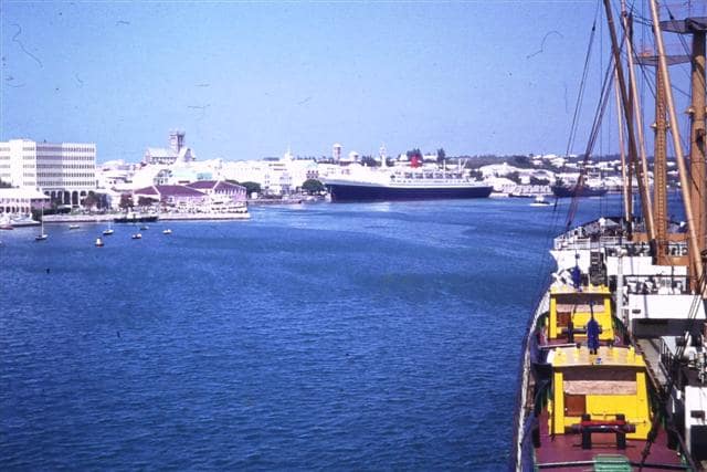
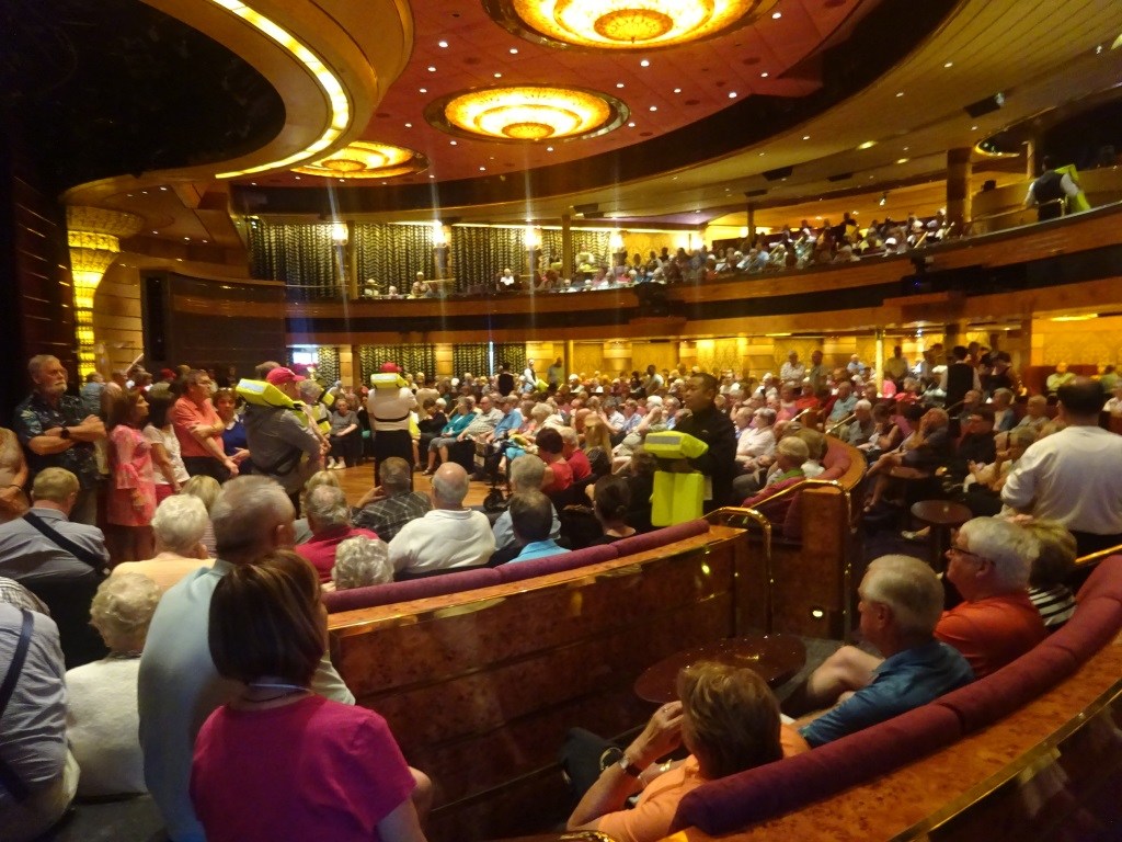
It was any early morning arrival and we had to wait a little bit as apart from the Zenith we also had the Celebrity Silhouette in port and that brought the total of cruise ships up to 4 and the total of ships up to five as there was also a small cargo ship present. But we were still docked by 07.00 hrs. exactly on the schedule as envisaged by those who made the cruise brochures.  As all the guests on the various ships were looking at a near perfect cruise day, there was a steady flow coming from all the gangways and moving into coaches or walking into town. It was a sunny day but it was not too warm and it was not too windy, it was near perfect. (It would have been perfect if I had had time to go ashore as well, but we had a General Emergency Drill today).

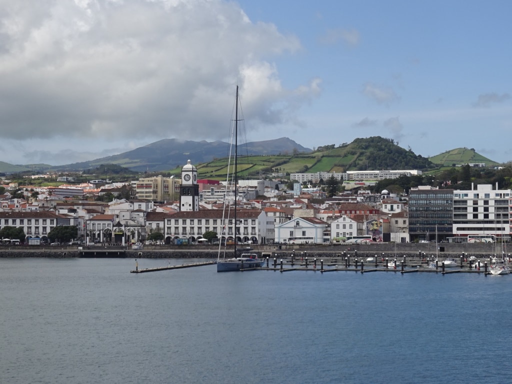
Ponta Delgada as seen from the ship. Wonderful place to be; friendly people and you can pay in euro’s.

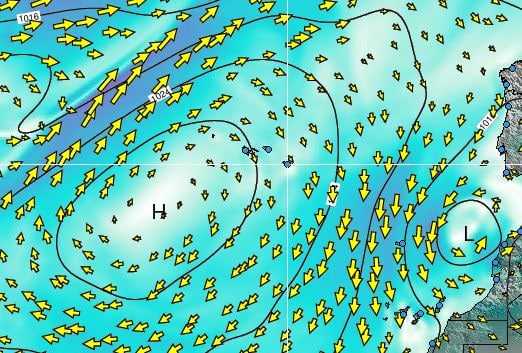
Today the weather was running ahead of its own schedule and the increased wind that was supposed to come through in the afternoon, came through in the morning and died down again by early afternoon. At the same time it veered to the North East from the South West and with the North Easterly wind came very low clouds which collided with the island at the east side and brought rain there. Not that it bothered us we just saw it after departure when our route turned into scenic cruising with a green and lush island on the port side and whales and dolphins on the starboard side. No wonder that the Azores are so popular with the cruise guests.

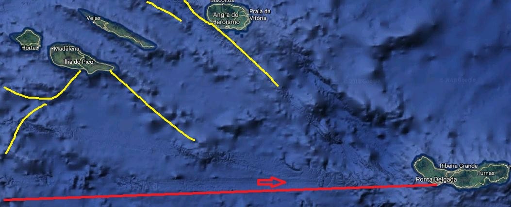
The Azores have been a popular place for cruise ships for a long time. And the constant battle has always been between Funchal on Madeira and Ponta Delgada on Sao Miguel; about who was the most wanted and enticing island for cruise guests. Both islands are part of Portugal so it is not about international rivalry.  That could be the case between the Portuguese Islands together and the Spanish Islands such as Canaries which are not that far way. Before cruising became really popular, there was already a steady trickle of ocean liners and passenger ships which filled their winter downtime with an excursion to the warm weather islands. In most ports a breakwater/ dock had been built shortly after the turn of the century as running tenders in these ports was nearly impossible even during perfect weather due to the long ocean swell rolling in. Even today, with very good weather conditions, we could still see the waves crashing ashore just outside the port.

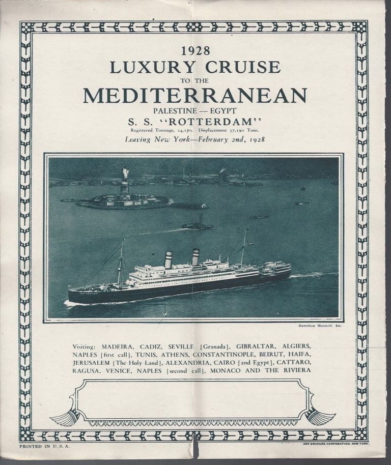
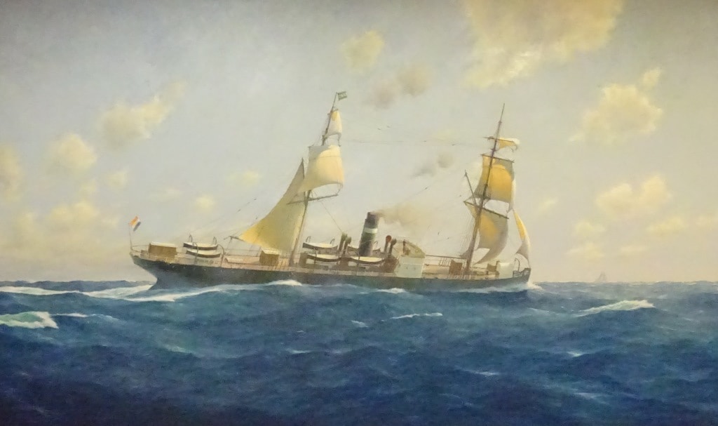
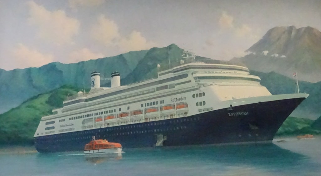
A cruise of the ss Rotterdam in 1928 calling at Madeira (Funchal) as its first port after leaving New York.

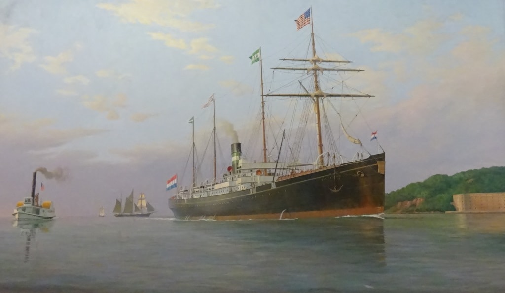
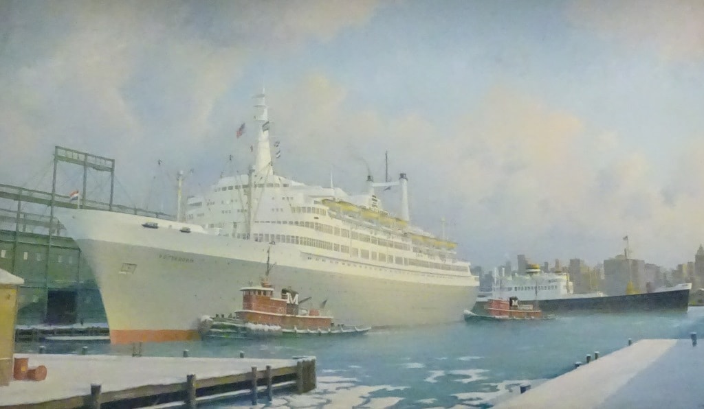
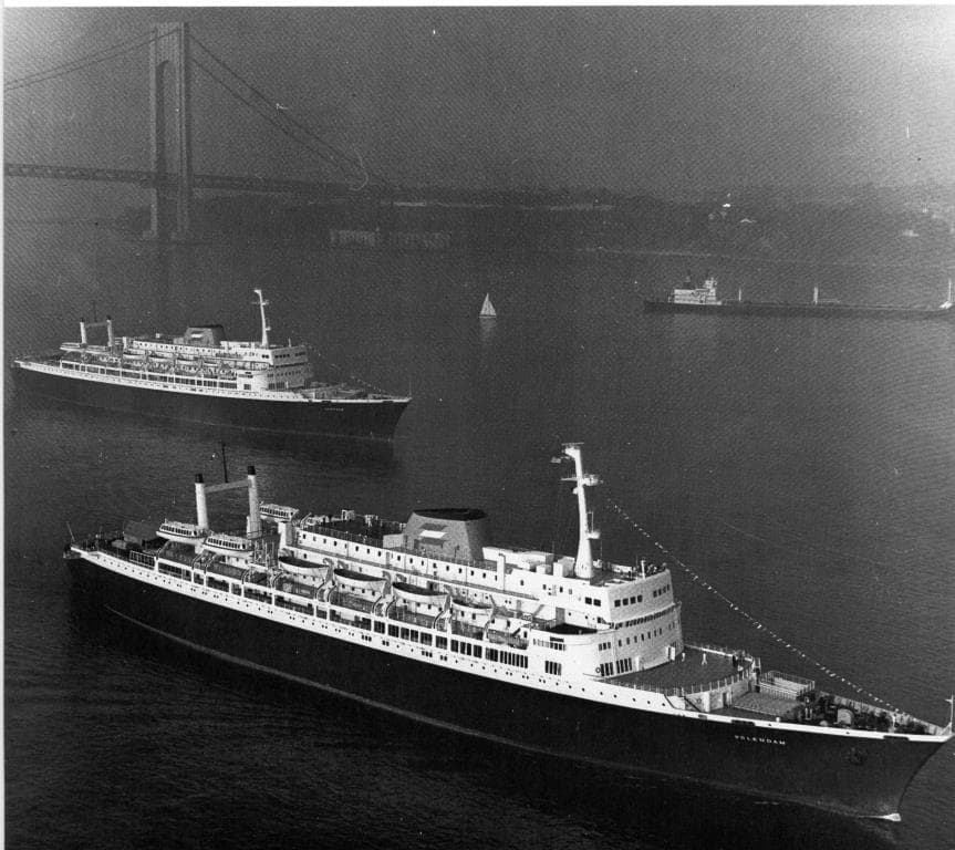
The Germans and the English were the most eager to visit these ports, no doubt due to the fact that they could reach a bit of sunshine without having to sail too far and with a climate which was /is very temperate due to the regulating North Atlantic sea temperature (Never too warm and never too cold). So you could make these cruises with ships that were not really designed for cruising and definitely did not have any air conditioning. Holland America showed up on occasion; when one their ships made the annual spring cruise to the Holy Land before the First World War when they then called at Funchal. Not because of the difference in port quality, as both ports are nearly identical, but Funchal had better coaling arrangements and that was for the old coal fired ships of extreme importance. The Holland America Line cargo ships called for coaling mostly at Las Palmas on Gran Canaria and although I do not know the real reason for it, it looks like that it had to do with reaching their limit of coal supplies on board and then to be able to load as much as possible for the remainder of the journey.

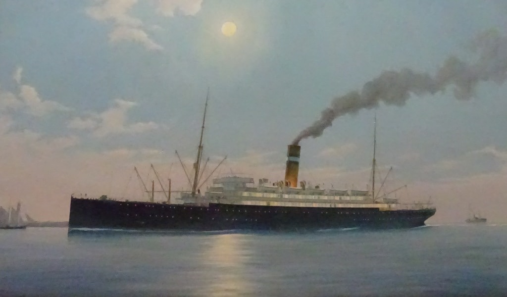
After the 2nd world war, when cruising picked up again, and the ships were now oil fired, they called at the ports depending on how the cruise was setup. Same as we still do today. Next time when the ms Rotterdam is on its crossing, it might as well call at Funchal or Las Palmas instead of Ponta Delgada.

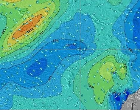
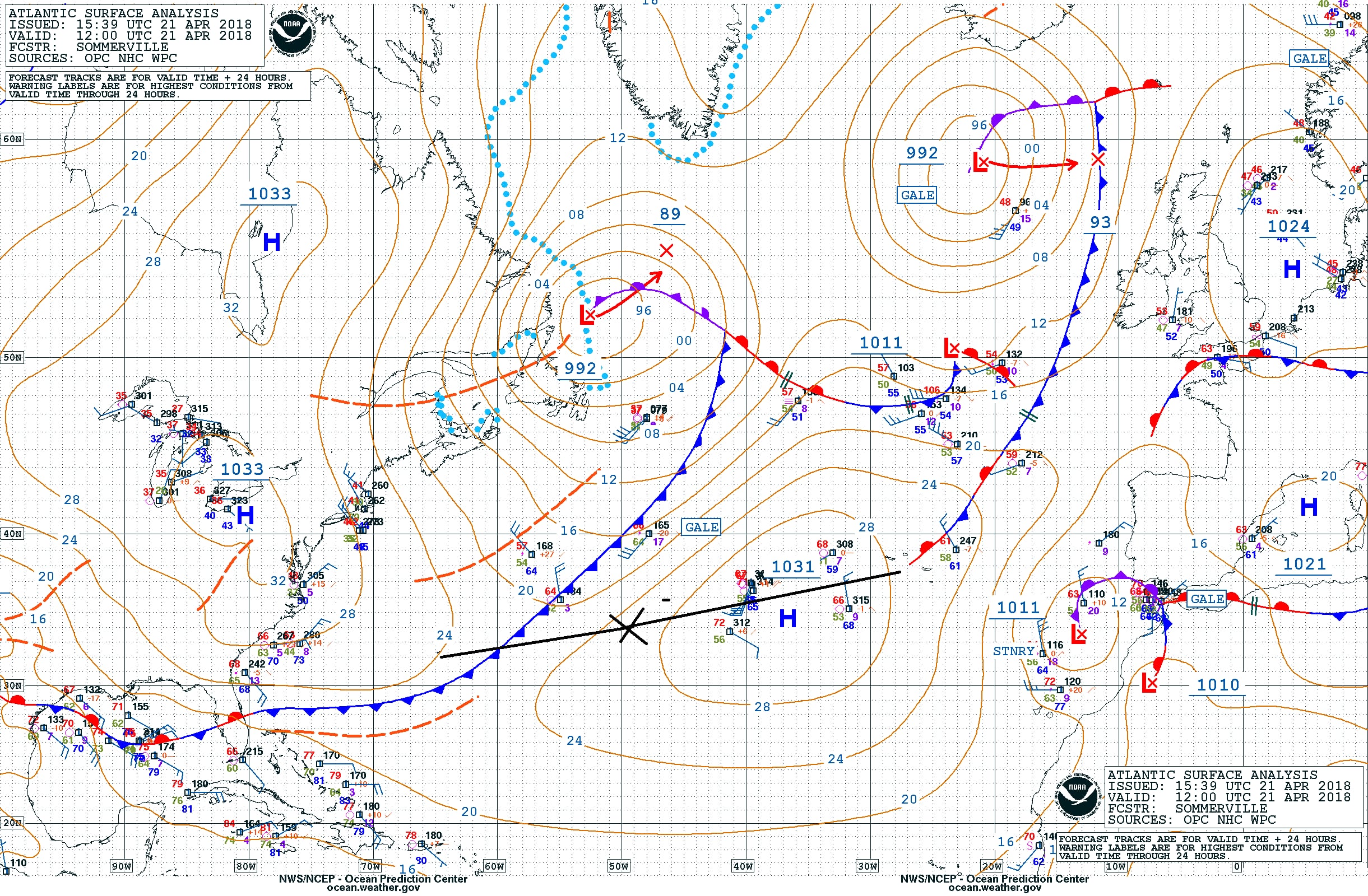
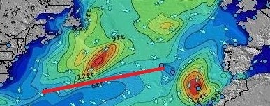
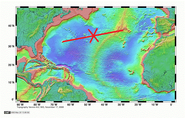
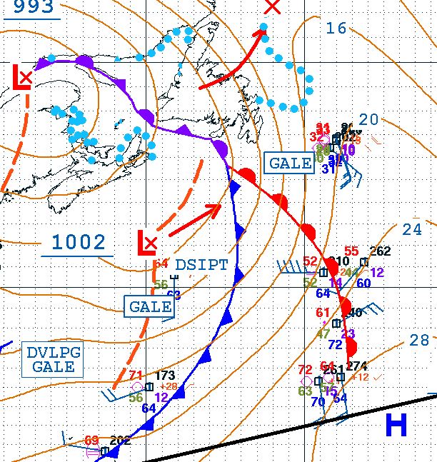
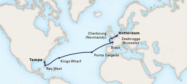
We will now have two days at sea to cover the distance between Ponta Delgada and Brest in France. Weather still looks good we just have to see what the air circulation off the African coast is going to do.  For the moment it is perfect. The high pressure system we were sailing though yesterday is on the move north and exactly following our course line. So we will keep nice weather and it might also keep a nasty swell away from us. Otherwise it will get a bit wobbly on Wednesday.


23 April 2018; Enroute to the Azores, Day 4.

The weather worked out as predicted and this morning we woke up to a windless surrounding, courtesy of sitting in between all the various wind directions generated by the High pressure system which we are sailing through at the moment. That also had an effect on the sea and swell. This time the word confused seas was completely appropriate. As the winds around is all from different directions (see the wind chart of yesterday), those winds also generated waves and swells for all different directions. When looking outside around noon time, I recognized a long running semi high swell (6 feet) from the North West, a long running lower swell (4 feet), from the South West and a bit of wind from the North East which did its best to flatten off the tops of the waves even more. Sometimes these swells enhanced each other and we saw 10 feet and sometimes they cancelled each other out and the sea was flat between two subsequent waves. It will remain confused until we come very close to the Azores  when we near the North East side of the current High pressure system and then the winds will become Westerly. But not much more than a very gentle breeze and we might not notice anything at all in port as we will be docking deep in the port of Punta Delgada which is protected against westerly winds by a mountain ridge.

We are now at the black cross. The water is a lot more shallow as we are nearing the Azores plateau.

For our under water happenings we are now sailing right on top of the midatlantic ridge. And as there are three plates meeting here there are numerous cracks as part of and next to the main Atlantic ridge. That created and is still creating the plateau on which the Azores are located. Off the plateau the ridge is about 10000 feet below water; at Pico (one of the islands of the Azores) it has created a mountain peak = Pico, which goes 7700 feet up into the air.


The mid atlantic ridge off the Azores.

The mid atlantic ridge creating Pico mountain.

The Ridge Walk as is possible in Iceland. Every year the path is supposed to get 2.5 cm. wider.


So the ridge is not always under water. In Iceland you can walk through it, in some places you can swim just above it, in some places it is far under water but here at Pico it goes up in the air and has created the highest mountain in the Azores and the highest mountain of the ridge itself.

The Azores, the northern islands. The underwater mountains, hills, valleys and ravines under water show a very fractured landscape.

We stayed about a 100 miles away from the island of Pico and thus we could not see it. Our straight course line only converges with the Azores by the time we put on the brakes at the pilot station. That is now all arranged. The Royal Princes will be 30 minutes behind us and we are aiming for a 05.30 pilot station. Ahead of us is the Zenith which should be there earlier but we have been advised that we might have to wait a little bit. Still she should not be much of a challenge as she is going to the downtown berth (courtesy of making regular calls against our one off) and both us and the Royal Princess are docking at the inside of the Breakwater. We will swing around on arrival and then back all the way in to the end of the break water. Which is nice as it reduces the walking distance to downtown considerably. The Royal Princess will then come in after us and will use the remainder of the pier.

Weather for tomorrow: Temperatures, 17oC / 72oF sunny and a very gentle breeze from the west.  Should be a perfect day for the guests going ashore and to go sightseeing. Although Punta Delgada is also a perfect port to do nothing and just sit on the boulevard to watch the world go by.

22 April 2018; Enroute to the Azores, Day 3.

The ship awoke today to a beautiful sunrise at 07.00 hrs. Right in front of the ship and in the round sun we could see a single black spot and that was the Regal Princess. She was still some miles ahead of us but we expect her to stop an engine sometime this morning to adjust for her correct ETA. And then we will overtake her as the plan is still to dock first.   The wind has reduced somewhat and instead of a relative wind wind force 8, we now have a relative wind, wind force 5 on the starboard side.  Life is never perfect of course, as we are now moving away from the Gulf Stream we have a different balance between the seawater and the air temperature. Both are now almost 19oC. or 66oF and just far enough apart that the moisture in the air can condensate somewhat. As a result it became quite hazy later in the day and the haze blocked out a strong sun from shining onto the deck. But the swell has mostly disappeared and the ms Rotterdam is steady as a rock again.

These are weather maps we like. All the nasty red stuff is disappearing. (Courtesy www.stormsurf.com)

Early tomorrow morning we should arrive in the area which is dominated by the Mid-Atlantic Ridge; although we will not see very much of it. At the moment we have almost 11000 feet under keel, just less than 4 kilometers, and that also reduces the chance of running aground considerably. As the new land ridge is formed constantly it would need an awful big disruption to build up enough lava to create a pinnacle that would go up 10,000 ft. Where is this lava coming from? From cracks in the earth’s crust. Everywhere were there are volcano’s, the earth’s crust is either very thin or there is a wide crack which lets the lava escape.  In the old days people took one or more volcanos just for granted without really knowing why they were there. That all changed when a gentleman called Mr. Wegener popped up. He is now mainly remembered for his theories about these cracks and related earth’s movement although his main focus through life was meteorology and geophysics. Focusing on Greenland where he also died 50 years old while on a very cold expedition.

The way the world looks like if we would only look at the natural – volcanic- boundaries. We and the Azores are in the black circle. (Diagram courtesy: Wikipedia)

In simple terms he figured out that there was a correlation between all these volcano’s and the way they were patterned around the world. He tried his whole life to get his theory accepted but as is not un-usual, when something truly revolutionary is proposed, not many people and scientists believed him. It took well into the 1950’s before others had accumulated enough much evidence for him to be recognized as the father of the Tectonic Plate Theory (and reality)

What is it; basically the whole outer crust of the earth is made up of several plates and they move. (About 2.5 cm a year) They do move because they are pushed by the lava coming out of the depths of the earth and this is helped by one plate moving over the other and the other one then being pushed down into the earth again. Becoming fluid and then starting the cycle again somewhere else, depending on the magna flow deep in the earth.

The mid Atlantic ridge is the location where the North American Plate surfaces and is going westwards and the Eurasian plate which is going eastwards. Where we are now, near the Azores, the situation is even more complicated as it is the region where those two plates are also meeting the African Plate. This is called a Triple Junction. Hence there is good reason to expect volcanic outbursts on the Azores and on any other islands in the area. (Madeira or the Cape Verdes) The Volcanos on the Azoric Islands have been exploding on a regular basis through the centuries and if there is no sign of a volcanic eruption then there is always the danger of earth quakes. The plates which are sliding with 2.5 cm. a year do not experience this in a friction less way. It is more a “hop” and a “stop”. The hop is then the earthquake when the earth really moves. The last major Volcano outburst in the Azores was in 1958 but (light) earthquakes happen with great frequency every year. Most earthquakes happen under water and that means we do not realize it and feel it while on the ship. Those earthquakes can create a Tsunami but even when a ship would be sitting on top of it, you would not feel it as a Tsunami is a pressure wave which only “bundles” its energy when it comes in shallow water and it has nowhere to go but up. There is no Tsunami or Earthquake alert out for the moment so I assume we will be ok for our coming visit. No reason to be alarmed, the people in San Francisco have also not run away since 1906.

Weather for tomorrow: We are now sailing into the Centre of the High Pressure system, so the wind should shift from the South, to the North and then fall away. If the system does not move there should be a period of hardly any wind and only confused seas to observe. Temperatures should remain the same. They are too close it might remain hazy but if the sea water temperature fluctuates a little bit we could have a nice, clear and sunny day.

The way the wind looks like around us. We are almost in the H of the weather system and thus we should see the wind changing. (Courtesy: www.stormsurf.com)

21 April 2018; Enroute to the Azores, Day 2.

Well, we did not go faster than the weather and we did not go slower than the weather. And thus we woke up to a rainy morning. But there was change in the air with the following wind slowly moving at bit to the South resulting in strong winds on the starboard side of the ship (a relative wind force 8: 20 knots from the ship and 12 knots from Mother Nature). We have some avid walkers on board who are either doing 1,2,3 or umpteen miles a day and each time they came around the stern they got the full southerly wind in the face until they had made the corner. Not pleasant you would think but as one Lady said, leaning against the wind also burn calories. I suppose that is true, I just do not have any idea how many calories that might be.

The weather chart for today. We were at the X at 1600 hrs. ships team and the frontal system is being pushed north by the High pressure system. That should mean that it will remain sunny and that the wind will diminish in the near future. (Courtesy NOAA)

I mentioned yesterday that there would be at least 3 cruise ships in port and that the Regal Princess was going to arrive shortly after us. Although it being Saturday, the local authorities had been thinking and have asked the captain to arrive at least 15 minutes earlier to spread the congestion a little bit. Of course he was willing to do that but it meant bringing an extra engine on line, while the following wind had just made it possible to switch one off as we were making good speed. Now we have to catch up 15 minutes first and then we can stop the engine again. A sort of driving faster to get there before the traffic jam. I try to do that on the motorway as well, you know that a certain junction will clog up at a certain time, so you try to make sure you are past that point before it happens. Whether it was speeding up of the ship or not but shortly after the sun came out and the rain clouds faded away.

The wave and swell chart of today. I have cropped out only the significant part for us as these charts cover most of the North and South Atlantic. As you can see we are just skirting the 12 feet wave edge and are in the 6 to 8 feet. Depending on how fast this wave field moves, we will get less swell or it will remain the same. (Courtesy: www.stormsurf.com)

To the north of us is a nasty weather system and some of its swell rippled down to the south and we picked up a bit of it increasing the average height from 6 to 8 feet. It merged on our course line with the swell generated by the Southerly wind and that gave on occasion a confused sea and a strange wobble of the ship. But we are still doing extremely well with the weather as the ship only moves on occasion. If the swell goes over 10 feet then we could get some regular rolling or pitching but that has not happened yet. It is always hard to predict what will happen in the Mid Atlantic but for the coming days we might be able to keep the swells low and the ships movement very small.

As far as Wild Life is concerned it is very quiet. The wind and the rain do not help I suppose but all day I have not seen any birds or other animals what so ever. While normally this is a good area for “catching” exhausted small birds that land on the ship and who then happily hitch hike with us to the next port. Thus at the moment below water things are more interesting than above. Yesterday morning we left the Bermuda shelf behind and the water went very deep. Contrary to popular belief the ocean bottom is not flat even if certain areas look flat on the chart. It is just relative; if you have depths of 6000 meters or 18000 feet, then a height variation of 500 feet is not much. Still 500 feet is a nice size hill on dry land. If we could drain away the water around Bermuda then Bermuda would be a very big mountain with very steep curved sides ending in a sort of pancake top with a few hills sticking out and those hills being the dry land of Bermuda. Once we fell of that shelf, that pancake, the water went deep, very deep.

A chart of the bottom of the North Atlantic. We are roughly at the cross and that green spot behind us north of the red line is Bermuda. It will take another day before we are close to the center of the North Atlantic Ridge. (Courtesy: Unknown Maker on the Internet)

We will keep sailing over very deep water until we come to the Azores. Before that we will cross the Mid Atlantic Ridge, there were the European side meets the American side with a huge crack in the middle. More about that tomorrow. The Azores are located on a sort of side platform which is attached to the Mid Atlantic Ridge. All caused by extensive volcanic activity. The Azores itself are quiet at the moment but all along the Mid Atlantic Ridge here is a lot of volcanic activity deep under water.  The minerals and other nutrients which are released here form the environment for lots of wild life and many new species are discovered. Which is now possible because unmanned submarines give the scientists finally the option to explore the great depths without having to be there in person. They say we know more about Mars than we know about our own ocean and I would not be amazed if that was correct. By the way for those guests who are interested in Mars and other planets one of the lecturers on board is explaining mankind’s exploration which goes up instead of down.

Tomorrow is another day at sea, and then one more and then we are in the Azores. Weather for tomorrow: again it is a wait and see game. How fast is the outside weather going? If we keep up then the gale to the north of us will not cause too much of an issue. If we go slower, we might feel more of the waves that it is sending down to the south, towards us.

20 April 2018; Enroute to the Azores, Day 1.

When a weather system comes over, it normally follows a standard pattern. Wind is from a certain direction which then shifts the moment the front passes. Normally that front looks a bit like an R. As you can see from the cut out of the weather chart from yesterday, that weather front laid over Nova Scotia but its tail came halfway down the North Atlantic. Red indicates a warm front and blue a cold front and they form the boundary between two separate regions of weather. The difference between cold and warm does not need to be that great. 10oF or so if often enough, especially in regions where there is the influence from the Gulf Stream.

The black line at the bottom is our course line so we are at the end of the tail of this weather front. Along the rim higher up there are developing gales and dissipating gales but we are far enough south. The frontal system can be seen again at end of the blog on the Sat. Photo.

When we left the shelter of the Bahamas a cold front had just passed by and then the wind changes as the High pressure – low pressure locations are different on each side of the front itself. Thus for us the wind shifted to the South West while we sailed north east towards Bermuda. And because we had a high pressure system in the back and a low pressure system ahead of us the wind blew the clouds away and smoothed the waves and thus we had beautiful day at sea and later in Bermuda. There the wind started to increase, indicating a new front coming over, which did so during the night. Now we are in that frontal system, right between the two legs and so we get a lot of rain as the warmer air condensates all the moisture once it gets hit by colder air. If this weather front keeps doing what it is doing at the moment, it will start to pass by late afternoon and then we will have a nice sunny day tomorrow. Because the winds keep opposing each other with each frontal system, the wind does not get the chance very much to push up the waves and thus we are having a steady ride.

We are not the only ship here, the Regal Princess has followed us from Bermuda as she is also going to Ponta Delgada in the Azores. At the moment she is scheduled to arrive 45 minutes behind us but the captain could always change his mind. The strange thing for everybody on board is that although the ship is supposed to arrive after us, she is overtaking us. This has to do with different engine configurations. The ss Rotterdam has five Sulzer 16 cylinder engines which can produce 25 knots if needed. For 16 knots we only need two engines and for 19 knots only three engines. As power versus speed is not linear we need a fourth and fifth engine just to deliver those last 6 knots going from 19 to 25 knots. While one engine could take us from 0 to 6 knots in the low speed range.   At the moment we are making surplus speed, because we have current and wind behind us. We started out on 4 engines and we will stop an engine as soon as the remaining engines can maintain the average speed needed.

The Regal Princess has four engines (2 x 12 cylinder Wärtsilä 12V46F and two 14 cylinder Wärtsilä 14V46F) This means that when they will stop an engine it will be at a different average speed to maintain. Their four engines deliver a maximum speed of 22 knots, and will reach the “3rd engine stage” at a different time. Then we will overtake her again to be first at the pilot station, unless they change their ETA. (Estimated Time of Arrival)

We will also meet the Zenith of Pullmantur in Ponta Delgada and then the Regal Princess so will sail together with the Zenith to Lisbon while we head north towards Brest in France.

For us at the moment the question is, will the band of rain that came by this afternoon rain out, or ep a higher speed than the ship, or go slower than the ship and will we will have a nice sunny day. The weather forecast says yes; so we also hope for yes.

The same frontal system now the rain can be seen laying along the front. The 2nd band passed over us late this morning. Thank you Weather Channel.

19 April 2018; Kings wharf, Bermuda.

The Island of Bermuda. It almost looks as it consists out of two volcanos that blew up and left craters full of water.

Bermuda has the form of a sort of a figure 8 shape, caused by two large areas of water, surrounded by land. In the south there is the Great Sound, to the north Castle Harbor and then in the middle a small lake called Harrington Sound. The main settlements on these pieces of land are all built in the lee of a little bit of elevated land. St. Georges to the North and Hamilton to the south. Kings wharf and Elizabeth wharf face the Great Sound and are the most exposed. There is a good reason for the docks to be located here; as Navy –battle-ships normally have a considerable draft and it made the area around Hamilton, the capital, not suitable for those ships, hence the navy port was built in a deep water area.  As explained in previous blog, the local authorities have now banned any ship over 740 feet in length from going to downtown and thus most cruise ships now dock at this old navy yard. From there taxis, a local ferry and shuttle buses will take everybody to downtown or anywhere else people want to go.

The old Statendam IV docked in Hamilton Front Street. (Photo Courtesy Cees Schuller)

Although the North west side of the island looks as if it is just sea, it is not as there is a large reef extending far into the deep sea area. That means that every ship visiting Bermuda has to enter through the East Side pilot station and then go for a long distance through the reefs, either to Kings Wharf or to Hamilton. When the British Royal Navy was still there, ships with too much draft, such as our ss Rotterdam V, had to anchor in the Great Sound and then use local tenders to bring the guests ashore. Smaller ships such as the Statendam IV, and the Veendam  could proceed to the docks at Hamilton.

Only the chart can reveal how nasty this area is with reefs and only a small deep channel.

Thus we picked up the pilot at 06.00 hrs. sailed the long route through Bermuda and were then docked a few minutes after 8 AM. as the captain had wisely decided to swing on arrival in case there would be a lot of wind picking up later in the day.  The strong winds are officially forecasted for tomorrow but with a flat island such as Bermuda you can never tell how fast an approaching weather front will travel if there is no geographical hindrance at all. So we were all set in case this would happen but although the wind breezed up, it did not go above a wind force 5 (19 – 20 knots) and the sun was brightly shining. Providing the guests with a beautiful day in a port where a lot of customs and tradition out of the days of the British are still in place. Bermuda is part of the British Commonwealth and the British Queen is the head of state and is represented by a governor. But that is more a ceremonial function as the island has its own government.

I did not see much of the island as I had a full day going with drills and assessments. This location is an excellent place to lower lifeboats and the ship combines all drills in one big scenario so the crew only has to show up once. Starting with a fire drill, followed by an assembly drill followed by the general emergency drill. In the same way as the guests are trained and advised when they join the ship. So I put the Bo ‘sun store on fire with a (fake) sailor inside who had slipped over a drum with chemicals and was thus out of action. Fighting a fire is a standard routine and does not cause our crew much of a challenge. What we are training on are the details and that invariably means communication. Because I operate outside the ships teams, they never know what I will cook up for them and what will be sprung upon them and then a good drill only works if the communication perfect. And that is not easy as the Bo ‘sun store is a dead zone. Not transmission signals get in or out due to the strong steel bulkhead separating this potentially dangerous area from the rest of the ship.

With the “chemical sailor” the challenge is for the rescue team, those who get the sailor out of the fire area, to deliver a comprehensive report to the medical department so they can treat accordingly. In the heat of the battle that is not always so simple.

The weather chart for the coming 24 hrs. In orange B = Bermuda , P = Ponta Delgada then the course goes up to Brest, France. To the north of us all sorts of things are happening, but on our course line it is quiet. At least for the time being.

Tomorrow and the 3 days after that we will be at sea; sailing eastwards towards Ponta Delgada on the Azores. We are expecting numerous weather fronts to come over but as we are on a southerly crossing it remains to be seen how much those weather fronts might affect us. For the first day it looks that we will be nicely in between.


18 April 2018; At Sea.

Today we have our 2nd day at sea as tomorrow we will arrive in Bermuda. And a beautiful day it was, a perfect sea day. The sun was shining all day and a low North Atlantic swell was running but it was so low that it hardly affected the ship.  A perfect day and thus a perfect birthday. As today our Holland America Line is 145 years young. What started out as an emigrant carrier back in 1873 (although our roots go back to 1871) has grown into one of the foremost cruise ship company’s in the world. And from all those old company’s which were founded in the later part of the 19th. century only three of the bigger ones have survived.

The ss Rotterdam I. The first ship of the company entered service in 1871. With her 1500 tons she would have fitted 40 times in the current Rotterdam VI

And they have all ended up under the same Carnival umbrella.  The other two Companies, Cunard and P&O were never really our competitors and thus we can be very friendly with them. P&O was mainly focused on the Far East and even in their cruising days they did not really get involved in our focus market. Same for Cunard, their home base was mainly in England and East coast of the USA. While Holland America’s heartland is in middle North America.  (Although we also have a lot of guests from everywhere else)

The ss Rotterdam II. This ship made the first cruise for Holland America in 1895 to the opening of the Kieler Kanal in Germany.

145 years is an important milestone but not as impressive as 125 years was and 150 years will be. Thus the company is keeping the celebrations on the ships low key but active planning is already going on for the 150 years, in 2023. But 145 years is something special as well, as the big boys such as Carnival and Royal Caribbean were founded around the time that Holland America was celebrating its 100 birthday.

The ss Rotterdam III. This ship did not sail very long for Holland America as she was sold and made way for a newer Rotterdam.

What fascinates a lot of our guests the most is our naming policy and the recycling of names. They love it and at the time they can be confused by it. Sometimes because they do not realize that we handed over the name to the next ship, sometimes because they come back on the same ship and do not realize that the company keeps updating the interiors and that can make it look like a different ship. I came across guests who had made the Eastbound crossing of the Westerdam last year and then came back this year and when they walked on board they thought they were on a different ship as the whole atrium had completely changed.  (The staircase was gone and replaced by the Rijksmuseum Enrichment center) But they were glad that their favorite cabin was still in the same location.

The ss Rotterdam IV. Here seen painted white during cruising in the 1930’s. She sailed for us from 1908 to 1939.

Today I gave my Holland America lecture……………. Something I could not resist……………… a HAL history lecture on the birthday of the company onboard the Flagship of the company………… and I had something similar. At the end a lady came over who had sailed in the 60’s on board the Nieuw Amsterdam and could not work out which Nieuw Amsterdam it was as several editions had appeared on the screen. (We had a N.A in 1906, one in 1938, one in 1983 and our latest one in 2010) She never realized when she was on board as a small child that she was sailing on a ship that had been built before the 2nd world war, had been a troopship during that war, and then went back to being a luxury liner for the North Atlantic service. Now she saw the photos on the screen but still needed confirmation that THAT was her ship.

The ss Rotterdam V. She was called the Grand Dame of the Seas as she survived all her contemporaries, well into the modern cruise age.

But the repeating names do dictate the history, even my own career. I joined Holland America in 1981 as 4th. officer on the Statendam IV. I was captain on the Statendam V and I will probably retire as Fleet Support Master sometime after the (Nieuw) Statendam VI has come into service. Three Statendam’s in one 40 year career. There are not many other companies out there who can create history in such a way.

The ms Rotterdam VI. She joined our company the day after the Rotterdam V retired on 30 September 1997.

Tomorrow we are in Bermuda and we are going to Kings Wharf; the old navy dockyard which has been completely re-developed through the years. If nothing has changed we will be in port together with the Royal Princess, docked somewhere next to us.

Weather: Sunny with temperatures at noon around 73oF / 23 oC with a light to moderate breeze blowing through the port.

Note: All the paintings shown here were painted by Captain Stephen Card who after sailing as a Deep Sea captain turned his hobby and talent into a full time occupation. His ships paintings can be found on all the Holland America Line ships. All of the above are hanging in the forward guests staircase of the ms Rotterdam VI.

Happy Birthday Holland America Line.

17 April 2018; At Sea.

The cold front came over during the night and caused the seas in the Strait of Florida to go really choppy and with the ship taking the occasional hit on the bow causing that banging sound which is not pitching but when an augmented wave hits the hull under the wrong angle. Because the passing of this cold front was exactly on schedule, e.g. the weather followed the weather forecast, the captain made the decision to give the guests a quiet remainder of the night and a quiet morning by deviating slightly from our intended track. So the good ship ms Rotterdam turned to starboard and sailed into North West Providence Channel. That way we kept the choppy seas away from us by using Grand Bahama Island as a buffer. It adds a few miles to the journey but those are the miles we have already gained by the extra push of the Gulf stream since we left Key West. The Gulf Stream peaked this time at nearly three knots where we were sailing and so in one night we gained almost a free hour of sailing time. Had the weather been good than we would have followed the Gulf Stream all the way up to Bermuda. Now we will pick it up later again but in the open North Atlantic Ocean when it is not so strong.

Black was the original plan, green was today’s deviation.

The guests had as a result a wonderful, calm and sunny morning and did not even notice the passing of this Cold front as it came over us at 08.00 hrs. As the rain was not coming down where we were nobody really saw it and the sun remained shining. By noon time we cleared the island and then we finally felt the motion of the ocean a little bit. But as the cold front is now well to the east of us, the changing wind should smoothen down the waves to about 6 to 8 feet and that will guarantee a quiet transit with maybe just a gentle movement of the ship. I have no problems with that, the guests on this cruise want sea days and thus they should feel a little bit of swell, telling them that they are at sea. It comes free of charge anyway.

Returning to Bermuda is something for me as if going down memory lane. Holland America has cruised to Bermuda since the 1920’s but it really became a summer season destination in the 1970’s when both the ss Rotterdam and the ss Statendam where visiting all the time. Then we moved the Veendam and Volendam in, both sailing from New York. The Veendam went straight to Hamilton and lay as a hotel for 3 days in Front Street and the Volendam split her 3 day period in Bermuda by first going to St Georges and then joining her sister in Hamilton.  I did a season on that ship. Those cruises were not great money spinners but did bring in steady earnings. For the crew it was pure heaven as we sailed for 1.5 days between New York and the Island and later back again, and then where basically a hotel for 3 days. Almost always good weather so maintenance work was easy to accomplished and as the watches were reduced to one officer there was plenty of time to go to the beach, to go sightseeing or to party.

The Veendam and Volendam seen here on a rare occasion together in New York. Originally built as the Brasil and Argentina for the American company MooreMcCormack, they came to Holland America after 1971.

When we built the N-ships from 1983, they were especially designed to fit alongside the Front Street terminal with their length and water, oil and sewage connections but with Alaska getting very big, Holland America could do much better business there and so we left. In the last few years we have returned, with the Veendam making summer cruises here, although not a full summer.

This time we are not going to downtown Hamilton but to the new cruise terminal area of King’s Wharf, the old navy port. For the larger cruise ships it was already much harder to get to the downtown cruise dock in the 80’s and if they could then it resulted often in the overcrowding of the main street. Thus now the guests have to travel around the island to get to Hamilton but the largest ships can now visit. The government now let only ships with a maximum length of 720 feet still go to downtown Hamilton, which automatically means only smaller ships. So our Prinsendam would qualify but our S- Class would already be over the limit.

But we are not there yet. Tomorrow is another sea day and it is a special day as it April the 18th. And that is the Birthday of Holland America Line. On 18th of April 1873, a small private company went public and the Holland America Line was born. Together with P&O and Cunard we are the oldest still surviving Ocean Liner company in the world. More about that tomorrow.

The weather front that passed over us today, this is midnight English time or 21.00 hrs. ships time and already far away from us. (Diagram courtesy Myfutureradar.com

Weather for tomorrow, it looks good. Sunshine, steady winds and low swells. If the weather forecast is correct then the next weather front is coming through on the 20th. and then we are well away from Bermuda.

16 April 2018: Key West, Florida.

This is one of those pedal to the metal runs for every ship going from Tampa to Key West and who wants to arrive mid-morning. Due to the 3 hour transit time through Tampa Bay, it takes much longer to get from Tampa to Key West then from Ft. Lauderdale where departure takes only 30 minutes. (Plus Tampa is higher up the Florida coast as well, which also adds more miles). So if a ship has an early departure say 17.00 hrs. and manages to pull out by 16.30, then you can make Key West Pilot Station around 08.30 – 08.45. Now the Rotterdam left shortly after 18.00 hrs. and that means you are looking at a pilot station time of 11.00 hrs. at the earliest. In the old days we could do a short cut through the Dry Tortugas but that is now a National Park and thus we have to sail around it. Hence this morning the ms Rotterdam was at the pilot station just before 11.00 and docked well before noon.

Basically we were the hour late, that we lost waiting in Tampa. Unfortunately for our Royal Caribbean friends, they had to follow us out in Tampa Bay and arrived even later than we did. But they had the better dock, being on the B pier, and we had to content ourselves with the Navy dock. And that meant that we had to use the little shuttle trains again around the dock all the way to the port entrance. This was a new one for me; Grave yard and Ghosts tours in Key West. Never seen that one before.


USNS Spearhead bow view.

I had already seen the ship being docked there last cruise but now we were next to it. The navy ship Spearhead was docked on the inside of the Navy pier. For a navy vessel it is of a very unusual design, being a sort of Catamaran with water jet propulsion pushing out water with 12000 hp. Rumor has it that the navy was inspired by the Stena Line Fast Ferry’s who were sailing between Hook of Holland and Harwich and they could carry a lot of guests, cars and lorry’s between the ports in a very short time. And if boys see toys……………..  So a navy version was designed and they called it an Expeditionary Fast Transport ship. Because it has no fighting capabilities by itself it is commanded by civilian officers under the Military Sealift Command structure and has a crew between 22 and 41. The thought behind it is to have very a very fast transport capability if needed.  And fast it is, having a maximum speed of 43 knots. It can carry all sorts of things as the inside is basically a box (modular design they call that) and so they can just stick inside whatever is needed. Even humans as it can carry 312 troops and they can be landed very fast by means of Inflatable speed boats. Accordingly Wikipedia, there are more of them but this is the first one of the class and it has already been everywhere. Key West is a sort of home port for them when they are not on missions and thus we saw them today in port.

And another view from the side. As it is basically made out of aluminum, they decided not the paint the hull but to keep it as built.

Although we did not have much of an issue in the end with the weather in Tampa, except sailing late, we are still not off the hook. We just managed to get into Key West with a beautiful sun shining but with a lot of wind blowing. That wind is supposed to increase, so the captain is trying to get out as quickly as possible, as sitting between the Key West reefs with a lot of wind is not the best place to be. Tonight and tomorrow we will follow the Coast of Florida taking maximum advantage of the Gulf Stream and eventually we will enter into the North Atlantic Ocean. This we will certainly feel as the Ocean Swell will meet the ship as soon as we clear the Bahama Banks. We have about 900 miles to cover and will do that by maintaining an average speed of 19 knots.  Once clear of the Bahamas it will be one straight North Easterly course running straight towards Hamilton Bermuda.

For those on board who are scared about the Bermuda Triangle; courtesy of Holland America we will sail just outside it. At least we are sailing just outside the area which the experts say where the triangle is located. I do not believe anything about this triangle business, as thus far never a passenger ship has disappeared and cruise ships sail through it all the time. Maybe too many witnesses???

Our course line is just skirting the North West boundary, the line that most “experts” seem to agree upon where the triangle stops.

The weather for tomorrow: we have this cold front coming through and the wind should move from North West to the East and thus it is hard to say what the effect on the ship will be. I am expecting rain, tonight and tomorrow, but how much is anybody’s guess.


15 April 2018; Tampa, Florida.

The weather remained good during the night and the ms Rotterdam was nicely able to follow the Rhapsody of the Seas to the dock and both ships were parked on time to start discharging luggage followed by disembarking about 90% of the guests. The remainder were the CVG or Collector Voyagers Guests who are staying board for this coming cruise and a few even beyond. These guests also have to go through Immigration inspection but that is arranged by marching the whole group ashore when the last guests have left. Once they have been seen by CBP, and the so-called zero count has been achieved, the whole group is marched back on board again. These are of course those who decided not to go ashore and explore Tampa and surroundings. As we were all warned to expect very inclement weather, most did stay on board. I normally tag on with this group as I am neither guest nor crew but something ephemeral called a non –revenue passenger. Basically somebody who CBP cannot classify in any other way. I am normally joined by the Port Shopping Ambassador who is sailing as an outside representative, although working for Holland America, but not as a crew based entity, so today we waved our passports together at CBP. And the gentleman was much more interested in her as she is much prettier than I am or ever was.

While the CVG guests stayed on board I went ashore and tried to be back before the arrival of the rain, while trying to buy a large TV for the Bo ‘sun store. With a smaller ship we always lack venues to conduct training and although the Bo ‘sun store is not the most posh of surroundings it is a larger space and to my utter amazement the ms Rotterdam did not have a TV in the Bo ‘sun store. The Bo ‘sun really felt left out. We have funds for these sorts of things but the challenge with larger organizations is always to find the right piggy bank to get it out of. And here I can help the ship and I do have time in a change-over port to go shopping. Tomorrow the Deck Machinist will weld supports and then we have a 55 inch TV in place for training of the sailors and others begging for a space.

Our Transatlantic Cruise.

Today we started our transatlantic crossing which eventually will bring us to Rotterdam on April 30th. First we go the Key West and then we head in the direction of Bermuda followed by the crossing.  We started our journey an hour later than planned due to the inclement weather. The Harbor Master of Tampa kept the cruise ships wisely at the berth until the wind had really died down so it was safe to go through Sparkman Channel and then into Tampa Bay. As explained yesterday, Sparkman is very narrow and you have to go through with slow speed to avoid wash and damage to the fuel barges docked at the side. The slower you go, the more you drift, and here there is no room to drift.

This is what scares sailors. A sharp edge in a cloud line as it indicates a sharp border between little wind and a lot of wind. Today the edge was not as sharply defined as it can be and the clouds not so dark, hence the passing weather front was not as severe as originally predicted.

So what the Captain and his team do today. First figure out when the frontal passage with the expected rain, wind and thunderstorms, were coming through. That turned out to be between 13.45 hrs. and 14.30 hrs. After that time the wind would slowly die down again and only the rain remain. On arrival extra mooring lines were given out and at 13.30, the bow and stern thrusters came on line. Then the tugboat arrived which had been ordered to push against the side of the ship if needed to keep the gangway (on the other side of the ship) in place as we had embarkation going on. The Radar was set on 24 miles to see the nasty rains approaching. (We cannot see clouds on the radar but we can see rain). 60+ knots of wind gusts were predicted but luckily some of it was dispersed before it reached the ship and the wind meter peaked at 42 knots. Still not nice but better than Hurricane Force. By 15.30 the wind had peaked and then the rain started.


The tugboat arriving before the wind picked up. Only this is not called a tugboat but a Docking Module as it can go with the same speed in any direction, instead of what a normal tugboat does, pull in one direction.

So we went to plan B, conducting the Guest Boat drill inside the ship. The portside boats were directed to the Show lounge and the Starboard boats to the Dining room. When we do this, we always have some confusion as on the first day most guests have not yet figured out what port and starboard is, or odd and even, let alone where the bow and the stern is. So for about 15 minutes I was a very popular person helping the Stairway Guides by directing guests in Dutch, French, English and German to the correct mustering location. The Stairway Guide I was with came from South Africa, spoke good English but as 2nd languages, Swahili and Sud-Afrikaans and those two languages are not so much in demand on a Holland America Line Ship.

Lifeboat drill inside the ship. Normally this is only done on large ships where the deck space is too small for all the guests to stand, such as on our Koningsdam. The Rotterdam musters under the lifeboats except when it rains, and it DID rain today in Tampa.

The Harbor Master gave permission to sail at 18.00 hrs. and the good ship Rotterdam pulled out of Tampa for the last time this season just after 18.00 hrs. Tomorrow we will be in Key West. The weather should be nice sunny with 24oC / 76oF but breezy after lunch time.


Older posts Newer posts