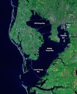
- Captain Albert's Website and Blog -

Ocean Liner History and Stories from the Sea, Past and Present. With an In Depth focus on Holland America Line

Author: Captain Albert (page 33 of 228)

14 April 2018; At Sea.

Overview Tampa Bay.

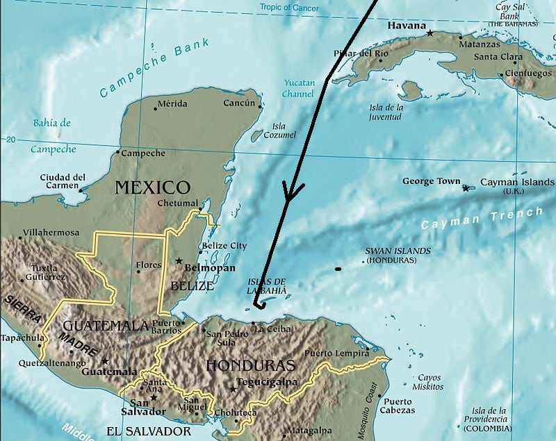
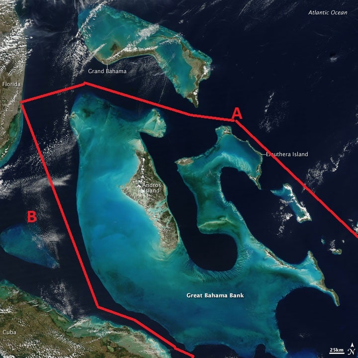
After leaving Costa Maya we set a rather straight course for Tampa Sea buoy. Rather straight because it is an almost straight line. We can sail straight from the Caribbean into the Western edge of the Straits of Florida and then into the Gulf of Mexico. Arriving in the early morning hours at the sea buoy and then sail towards the pilot station.  What time that exactly will be is a little bit up in the air, as we have to follow the Rhapsody of the Seas. She was with us in Costa Maya, has been sailing next to us all day, but will be docking behind us in Tampa and thus has to go to the berth first. Once she is in, the Rotterdam will dock in the terminal in front of her and there is no space to go around the Rotterdam once she is docked. The channels in inner Tampa Bay are not very wide.

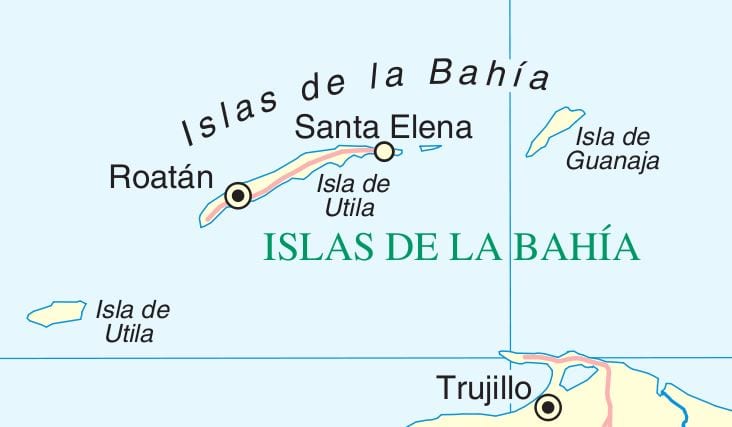
Although we have been on only a 7 day cruise, we have been quite busy with time changes. As the USA went to summer time and most of Middle America does not, we had to adjust the clocks twice back, and twice forward. The USA – Florida is now on GMT – 4 hours and Roatan and Santo Tomas are on GMT – 6 hrs. so the clocks went back twice between Key West and Roatan. Nobody complained about that one and everybody stayed out later in the ship, making the Bar Manager a happy man and everybody still gets a good night sleep.  But then we have to go the other way. East Mexico, which includes Costa Maya is on GMT – 5 hrs. and thus we go an hour forward. Not nice and the guests still have to get up early to go ashore. Then from Costa Maya to Tampa we have to get back on Florida time and thus we go another hour forward.  Today is a sea day and guests did not feel the need to get up and that gave an extremely quiet Lido this morning at 06.30 hrs. when I go for breakfast. On sea day’s breakfast starts at 07.00 hrs. but as most experienced cruisers know, continental breakfast is already available much earlier. I try to stay away from a full breakfast and its related temptations as the middle age weight battle has become a daily focus.

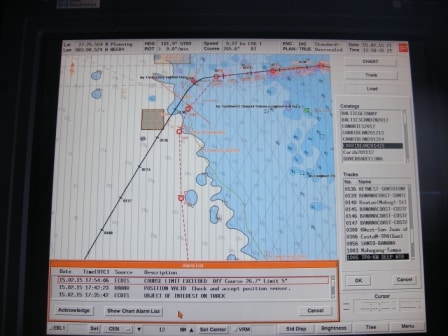
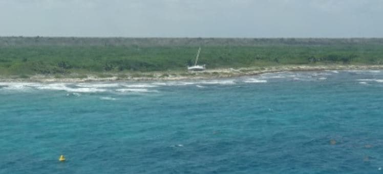
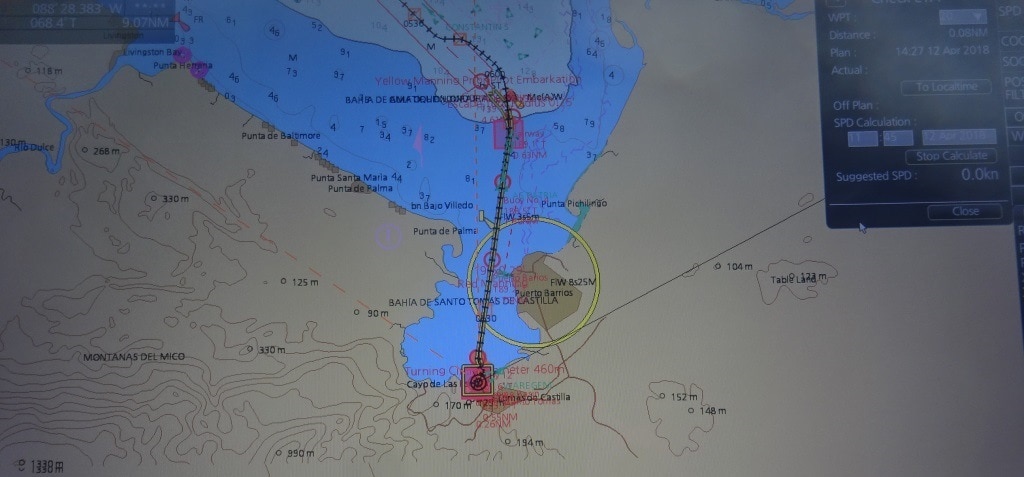
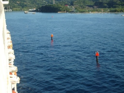
The Tampa Seabuoy is far out to open sea and marks the channel entrance, that gives the ships safe passage through the Tampa Bay shallows.

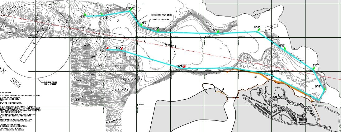
Our route takes us all the way to the top of Tampa Bay. But of course as we are humans (see my blog about names of part of the Caribbean Sea some time ago) we have to make things difficult by giving different names to the same bit of water. If you want to be docked at 07.00 hrs. for work, you aim from 06.00 hrs. alongside. The transit is anywhere between 3 or 4 hrs. and thus you have to be at the pilot station between 02.00 and 02.30. Thus most ships aim for the sea buoy for 02.00 hrs. and if there are more ships they normally follow each other two miles apart. The pilots board about halfway up the outer channel at buoys 9 and 10. Then with speeds of anything between 6 and 12 knots the ship follows the winding channels through shallow and muddy Tampa Bay.

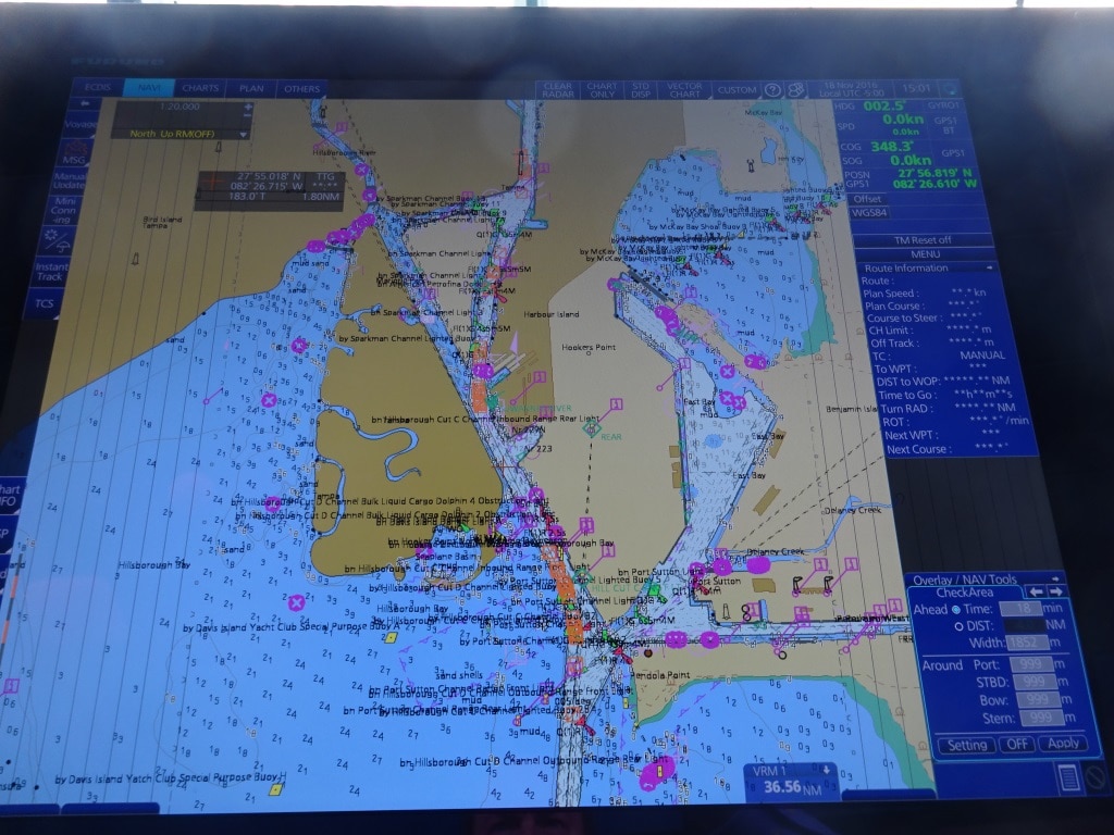
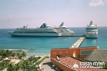
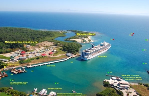
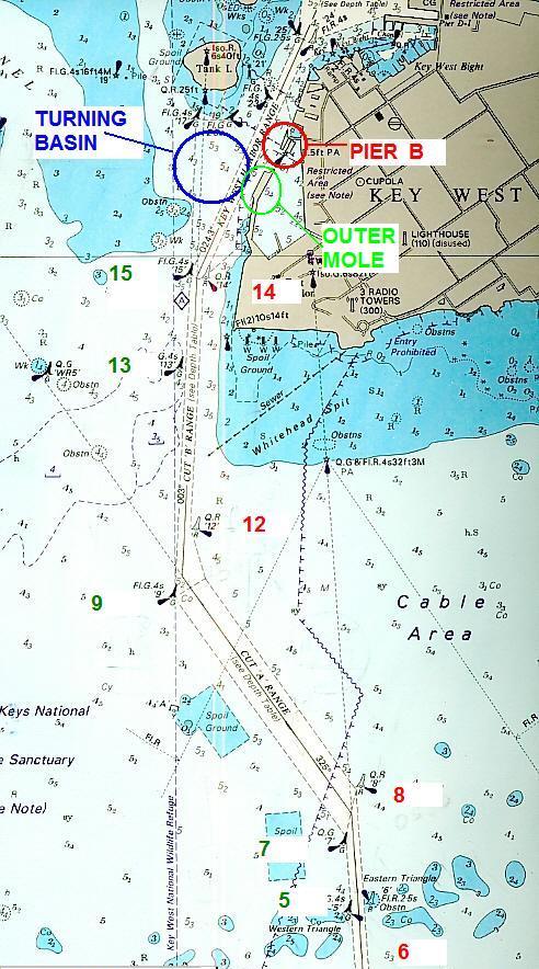
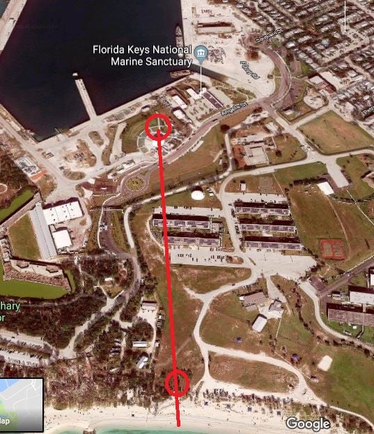
The narrow entrance to the cruise terminal called Sparkman Channel. To the right is a larger area and in the 80’s we had the cruise terminal there, appropriately called “Holland Terminal”. But for political/development reasons the cruise ships moved to down town and the area to the right is now cargo ship only.

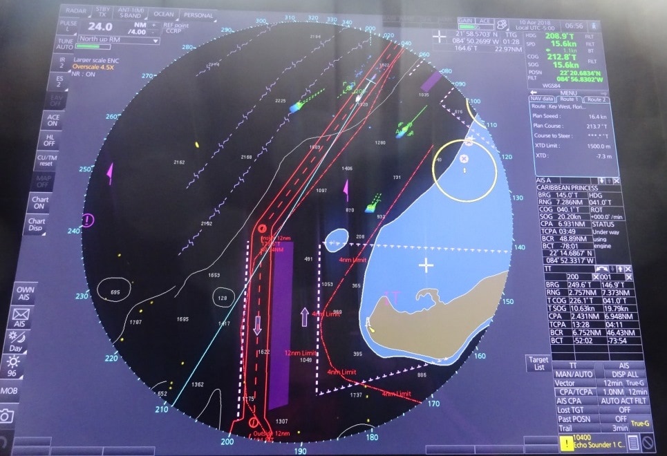
First the Lower Tampa Bay, which starts after the Sunshine Skyway Bridge and there we are normally 45 minutes after the pilot is on board. Then we reach middle Tampa Bay. This is where the Channel splits at the T junction. The West channel goes to St. Petersburg and the East channel goes to Tampa. Then about 90 minutes before docking we enter Hillsborough Bay, the upper right side of the Bay. The upper left side is called Old Tampa Bay. Here we pass the famous buoy Hillsborough 9, which holds the distinction of being the most hit buoy of Tampa Bay, by ships coming by. Mostly with windy weather as the channel makes a tight turn here. From this moment the ships speed has to come down to 10 knots and later to 8 knots to avoid erosion on the banks to the east. Then 1 hr before docking we enter Sparkman channel, which is really too narrow for the cruise ships but they cannot dredge very much as there are houses on one side and oil tanks and related at the other side. 30 minutes before docking we are then in the turning basin opposite the Aquarium and then the ship backs up to the cruise terminal assigned. 10 minutes past docking the captain is back in bed after having kept for a 4 hrs. period a close eye on the approach sailing in, pilots activities and the docking the ship.

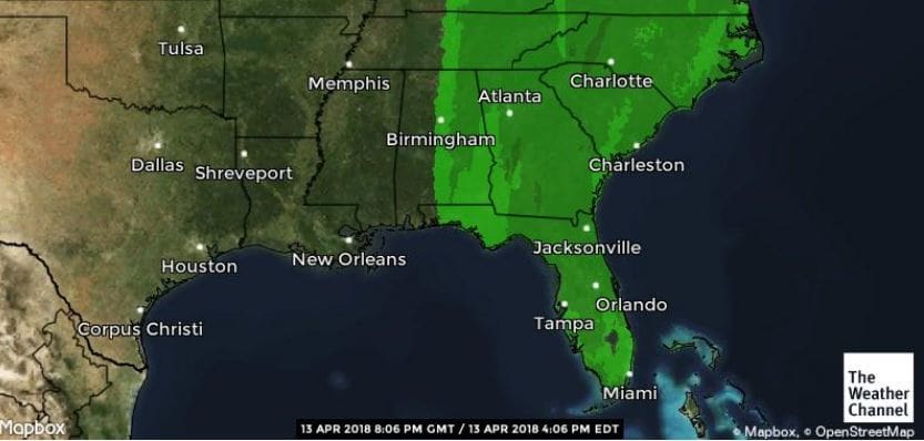
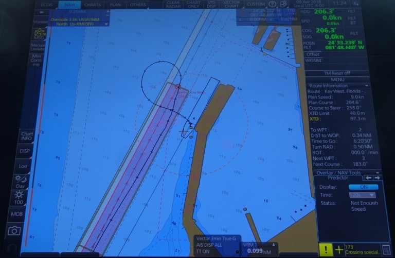
Weather: Dry with a moderate breeze on arrival. Strong winds with rain and thunder storms around noon time and early afternoon. It is supposed to get calm wind again just before departure. We might just be lucky and we need it to get to Key West on time.

13 April 2018; Costa Maya, Mexico.

Costa Maya is a port where we never know if it will work out or not. And that has to do with the fact that the pier is just built into the open sea with no protection whatsoever. And thus it gets damaged at regular intervals. To reduce damage and the wear and tear, it is an open pier and that means that the waves can roll freely under the pier and onward to the beach. It reduces damages as the pier does not have to absorb the energy of the waves when it hits the concrete. For us it is less pleasant as the ship, while alongside, can still roll on those waves coming in under the pier. And we never exactly now what we will find until we get there.  The local pilot is a larger than life optimist and even has nice weather when the waves are rolling over the dock and thus we wait until we are there to have a good look.

The good old days. The way it looked when opened in 2004. Not much has changed apart from the fact that the piers have been extended.  We were docked today where the ship with the X in the funnel is docked.

There are three berths and sometimes there are three ships in port but today only 2 were scheduled as the 3rd berth is under repair. It sustained damage during one of the hurricanes last year and is also being strengthened with extra pillars at the end where it takes most of the force of the sea. I tried to find out what they were doing exactly (not much today as the swell was not good for much work) and I was proudly advised by the local security that they were making the pier so “bigga” that it would never be damaged again.  Well if they manage to do that then they can sell and export that construction to a lot of places in the world.

Rebuilding berth 3 which sticks out the furthest into the sea. Work is a slow process as the swells do not always allow for work to take place. Today was an average day with low swells.

Today things were nicely in our favor, there was wind but the in rolling swell was low and we had nice protection by means of a RCI ship which was on the east berth. For docking that is the easier berth as you simply stop near the pier and let the wind push you alongside while controlling that movement with the ships power. Going on the west side is more complicated as the dredged width of the underwater area is only about 2x the width of the ship and thus we have not more than 40 meter room to play with. The advantage is that you have a ship next to you which act as a breakwater for wind and waves. We do not like competition when we are in port but sometimes other ships do have their uses. So today we were quite content to have a bit more of a challenge to get in, but once there, it was nice and quiet.

This yacht was carried a considerable distance inland during last years hurricane season. We have a saying in the Dutch language: A ship on the beach is a beacon for those at sea.

Costa Maya is an artificial port, hence the location of this T pier which is just sticking out of the coast. As mentioned yesterday the prime focus is going on tour or enjoying the resort. Option for those who do not mind to walk a few miles, there is a small fishing town just to the south of the resort. The resort is dominated by a fake Mayan Pyramid and surrounded by everything the Tourist might like. Also here there are still repairs in progress. There is also an amphitheater where at regular times, a sort of Mayan show is given to offer the resort guests a bit of culture.  I find those shows always fascinating and also always wonder how that they know that all those dances and rituals are authentic. The Mayan culture did not have the written word, nor photo camera’s and the stone inscriptions reveal a lot but not every detail of dress or cultural routines.  But that does not mean it is not enjoyable and at least it gives mom and pop from another country some sort of insight into the cultures of Middle America.

The ship is now returning to Tampa and tomorrow we will be at sea. The captain is a little bit concerned about the weather as there is a cold front with thunder storms expected on Sunday around noon time. His concern is “around noon time”. So a close look will have to be kept on its progress. I think that we will be ok, as we normally dock around 06.00 hrs. and the weather gurus are normally not six hours off schedule when we have less than 48 hrs. to go. Still stranger things have happened and thus we are vigilant.

This what s expected over Florida by Sunday lunchtime. Rain with wind.  On early Sunday morning the cold front is still laying between New Orleans and Jacksonville and if it does not speed up, we should be happily docked before the wind reaches Tampa. (Thank you Weather Channel)

That means that tomorrow we still have a nice day at sea, at bit cooler because of the sea breeze, but it should be dry and sunny.

12 April 2018: Santo Tomas de Castilla, Guatemala.

The nice thing about this port is that it is very well sheltered from the open sea; the not so nice thing is that you have to travel a long distance through shallow water to get there. Santo Tomas is located in a sort of inlet or bay that is almost closed off at all sides by land. Most of it is the mainland but at the entrance side there is a peninsula and some islands. Because the inlet is very shallow a long and straight canal has been dug to the port. Once you come outside the buoys you are immediately aground. This morning when we came in, we saw a container ship that had just done that. It has been there for a while and might be there for a while longer until they have figured out how to pull it off the mud flats. I do not know what caused it to go aground but most of the time it is a steering gear failure. A cargo ship seldom has the option B that we have of keeping the ship under control with the thrusters. With a cargo ship it either works or you go aground and there is not much you can do about it.

Our Approach. White color is water with depths from 10 to 20 meter. Blue color is less then 10 meters and we need 9 meters at the minimum. We have 8 meters draft and then we need about a meter more to be able to sail through the channel.

To be on time for 07.00 hrs. docking we had to be at the pilot station at 06.00 hrs. and then sail through the channel for 30 minutes and then swing to port to dock starboard side alongside. It does not make much difference here which side you go alongside. I personally prefer portside, so the noise is aimed at the shallows but some captains prefer the nose (& bridge) towards the rest of the port so you can see all the traffic coming and going and any mayhem that might ensue. If there is only one cruise ship then it is always docked in the west corner, to shorten the distance for the guests to the gate, the water taxis and the souvenir shops. When there are two cruise ships then one cargo ship has to go to anchor to make room. Today we did not have to make any cargo ship captain unhappy as we were the only one.

………..You will park exactly at the flag and nowhere else………, otherwise the harbormaster will be upset. This photo was taken this morning on arrival when I was observing / reviewing the docking routines of the sailors and officer at the aft mooring station.

Guatemala and Costa Rica had a large influx of German immigrants around 1900 and that is still very visible in the way the ports here operate. Everything is organized and everybody in the port sticks to the rules. While in other Middle and South American ports there is sometimes a certain amount of “creativity” present as far as adhering to times, safe working practices, planning and efficiency. Here everything is (pre) organized, everybody is on standby and it all rolls as we expect it to be when dealing with a cruise ship on a tight schedule. But at the same time the locals do not give the impression that they are really stressed by it. Maybe they should start a training school, I know quite a few port authorities who would benefit from it.

Something to report from yesterday. The Holland America ships try to do charity work in the various ports of call. For those of you who have been reading my blog for a longer period might recall that the ms Veendam was always quite active in this port and the ms Statendam in Corinto, Nicaragua. Well the ms Rotterdam was active yesterday in Mahogany Bay. When you build a new port, you alter the water flow in the natural bay that forms the basis of the new port. The water flow can then produce silting, sediment and more land but also coastal erosion. A very effective way to stop coastal erosion is the planting of Mangrove trees. The only challenge here is that you get wet.  But that did not stop our crew yesterday and under the leadership of our environmental officer Juliana Coffey, there was a lot of splashing going on just around the corner of the ship.  A new line of mangrove trees was planted and their roots will help to anchor the soil against the banks for Mahogany Bay and protect the land but also create a new habitat for several sorts of birds and water animals.

A compilation of photos taken during the Mangrove Planting yesterday in Mahogany Bay. (Photo courtesy: Ships environmental Officer Juliana Coffey = the lady top right with the fancy sunglasses)

Apart from that we also try to recycle as much as we can and in the past few weeks we have offloaded in various ports 550 extinguishers as the time came that they had to be replaced. All our extinguishers are kept in perfect condition but the law says that after 20 years you have to replace them. Basically we are replacing brand new extinguishers that have just been hanging there for 20 years, with new ones, which will (hopefully) also just hang there for a very long time to come. 550 extinguishers are expensive and for local schools, hospitals and other organizations, this is a great help.

Another batch of Extinguishers going off in one of the ports. (Photo Courtesy: Rotterdam Environmental Officer Peter Tukker)

Tomorrow we will be in Costa Maya, Mexico. This is also a specially built cruise port and here the guests have either the option to go into the resort to enjoy a beach day, to the little fishing village of Mahahual, or go on an excursion to the various historical Mayan Sites in the area. According to the schedule we should be together with one of the “Apartment of the Seas” so we will see who will show up.

Weather: More of the same. Partly Cloudy going to full Sunshine later and very warm temperatures.

11 April 2018; Mahogany Bay, Roatan.

During the night the wind did not die down but whipped the waves up to a short and nasty chop on top of the longer swell that is always there due to the forever blowing Trade Winds. This 2nd swell was sort of from the same direction but on a slightly different angle and that meant that it mostly increased the wave height but sometimes leveled the other wave height out.  (Filled the hole so to speak) The effect on the ship is that on occasion you hear a bang, when the bow hits an unusual pattern in the combined wave/swell, and sometimes the ship only moves a little bit. Because it is not consistent it is not so easy to get used to.  The Front Desk has decreed that I should have a guest cabin all the way in the bow this time and so I had the nightly enjoyment of the occasional bang, the occasional wobble, or the occasional bow movement that just did not turn into a pitching motion. Better me than a paying guest of course and so I did my good deed for yesterday and only had to stay in bed during the night to achieve it.

Over view of Roatan. The Resort is located on the top of the hill, with a cable car running to the beach. This is a overview from when the port had just been opened. There is a lot more vegetation now between the dock and the resort.

The ship was on time, the pilot was on time, and we could sail into the bay without any hindrance. Although the wind was a hindrance. The wind blows here on a 90o angle across the entrance channel and that means that we can drift considerably while going in… and the channel is not that wide. We always want to dock nose out, to be able to race out of the port in case we get really inclement weather and that makes the docking maneuver: going in sternway with the wind full on the beam not as easy as it sounds. Once you are halfway in the approach channel, the mountain ridge will catch the wind and all is well. You just have to get there first.

The layout of the port with the approach maneuver. Swing outside. Go in sternway while staying the middle of the channel with the buoys indication the 10 meter boundaries. As you can see in the beginning, when we have the wind, the ship has about one ships width on either side before it comes close to the buoys. That is only a 100 feet or so on either side.

Because of this situation, the port normally sends two pilots, one for each bridge wing. Not to maneuver the ship as they know that all Captains know this port very well (It is one of the standard training sessions on the companies simulator) but to warn the captain in case the ship drifts too far one way or the other. As this is an artificial port, the depth is also artificial and sometimes sand accumulates at locations in the channel that only the pilot knows. Hence an alert eye is dispatched by the local port authority.

The problem here is also that there are not many options to choose from in case you drift too much. They entrance channel is narrow and the banks on either side quite steep. So if you are being blown off track then you will touch ground. And that ground is coral with sand on the top. Thus if you drift against the bank you will not sustain much damage as the sand will be take the impact of the contact. But if you would drift over fast or make the turn the wrong way and hit the bank with speed then the hard coral can result in a nice crunching sound with dented plating. Not nice. Hence we like to go stern in first. If we would drift too much then with one good kick ahead on the engines we can get away again.

Sailing about 10 meters from the buoys, which are not real buoys but sticks, so we have room to drift over to the other side if needed.

So we sailed very close to the red buoys, on the high side of the channel, giving us some leeway in case the ship would start to drift. Which is always possible if the wind would suddenly start to blow much stronger than the force 5 to 6 which we had today. But the wind remained its steady self and the ship was safely docked 45 minutes later alongside the pier. We went in all the way to the back to have as much shelter from the wind as possible and we could do so as we were the only ship in port. The forward dock remained empty and that gave the guests a lot of space in the resort.  Always nice if you do not have to wait for the cable car that takes you to the other side of the Resort area.

A nice empty dock and that gives our guests the whole resort to themselves.

This was a full day call and we could stay until 17.00 hrs. as our next port of call is Santo Tomas de Castilla in Guatemala. That is only across the bay and we need the fast speed of 11 knots to make it tomorrow morning at 06.00 hrs. to the pilot station. This port is a tour call, so the guests can go on Eco tours although there is the little town, which is quite cute but limited. Then around the corner is the port of Barrios and we always advise the Ladies not to let the gentlemen go there by themselves.

How tomorrow will work out remains to be seen as there is a fair chance of showers and for the rest an overcast day which will make it warm and humid with the tropical rain forest right on top of the port. Temperature 30oC / 87oF and no wind in the port expected.

10 April 2018: At Sea.

Today we are hurtling with the low flying speed of 16 knots towards the Island of Roatan off the coast of Honduras. Although we are calling at that country, we will not notice much of it, as we are calling at an island with a custom made Resort, built by our parent company Carnival Corporation. Before Mahogany Bay was opened, there was one cruise dock which could take one ship. That dock is still in use when the two berths at Mahogany Bay are full. Quite often we then see a ship belonging to the competition going there. They can also use our berths but only if we are not there.

In the years B.C. (Before Carnival) Holland America used to go there on occasion; mostly during the Christmas cruise when marketing had glued two 7 day cruises together into one 14 day Holiday cruise. I cannot remember what the guests thought about it in those days but we were not impressed. The dock was always occupied by another ship and thus we had to anchor. The East Bay is quite deep and then becomes shallow very quickly and thus we had to drop almost 300 feet of chain before we even touched the bottom. That was not very pleasant when there were squalls coming over and you wanted to raise the anchor quickly. And with the old Nieuw Amsterdam, Noordam and Westerdam you never knew how fast and how much the anchor winch could pull. Tomorrow we dock and now have no more worries.

Approaching the VTS, ships highway at sea off the coast of Cabo San Antonio. We are in the top right corner at the end of the white (course) line. There are a few ships around indicated by the yellow dots and the green speed arrows but in general it was a very quiet day today. The green/yellow dot next to us is the Caribbean Princess and on the right hand side of the radar screen you can read her navigation particulars. Most important it says CPA 6.93 miles = Closest Point of Approach.

This morning at 09.30 hrs. we passed the west coast of Cuba, Cabo San Antonio, and then sailed into the Caribbean Sea. The moment we did so, the wind started to breeze up as the Trade Wind is quite strong at the moment due to an extra pressure system laying somewhere in the North Atlantic. But it should calm down again somewhat during the night.

This area of the Caribbean Sea is called the Yucatan Channel as it is located between the Yucatan Peninsula to the West and Cuba to the right. The border between the real Caribbean Sea and the Straits of Florida are a little bit fuzzy as it is all wide open water. For me it roughly starts North of Cozumel and then it stops once past Cabo San Antonio but that is more art than science.  Explorers in the old days, on their slow moving sailing ships, had not much to do so they named everything they could think of. Sometimes after areas at home, sometimes after King/Queen and country and sometimes after themselves.  And thus they were not happy with just naming the whole area Caribbean Sea but gave a different name to the area under Cozumel Island and that has the name of the Gulf of Honduras and stretches from Belize down to the Honduran coast.  That area we entered late this afternoon.

Our course down to Roatan, sailing through the Bay of Honduras.

From Cabo San Antonia it is one straight course down to Roatan. Which is not an island by itself but belongs to a group called Islas de la Bahia or: the Bay Islands. We call it Roatan Island but that is not correct either. Roatan is a town/settlement on the west side of a long and narrow island with the main town of Santa Elena at the East side. The island is called Isla de Utila and is flanked by either side by a very small island. The one on the left is also called Isla de Utila and the one on the right is Isla de Guanaja.


The Islas de La Bahia with Roatan in the middle. (Thank you Wikipedia) Trujillo is an important port on the North Coast of Honduras.

Mahogany Bay is located on the south side of the main island and is in general very well sheltered, except if there are squalls coming through, which can change the predominant Easterly wind to S.E., South or S.W. and then the ships have to be ready with their thrusters so they do not get blown off the dock. We will approach Roatan from the west side and sail between the two Islas de Utila towards the pilot station. We are expected at 07.00 hrs. and as we are supposed to be the only ship, we will dock as deep as possible in the Bay, getting as much shelter as possible from the strong Trade Winds. Weather, overcast skies with a chance of a squall are expected but it will be warm and humid with temperatures up to 27oC / 81oF. I hope the guests will be careful as you can get a sun burn here even if it is overcast.

09 April 2018: Key West, Florida.

Tampa to Key West is a “Pedal to the Metal” run and with going full out the ship can just dock comfortably before 11 am. If you have a fast transit down Tampa Bay then you have a bit of leeway in the schedule but if you have to wait for opposing traffic or you have slow tanker ahead of you, then it is a tight stretch to remain within in the schedule. Luckily Tampa transit was fast last night and the weather good and thus the ms Rotterdam was at the pilot station at the arranged time of 10.00 hrs.

Navy dock mole, swinging on arrival. If you compare the size of the ship with the size of the channel you can see it is not very wide and with a lot of wind there can be problems in the approaches but you cannot go outside the channel as you can do here.

Because everything here is as flat as can be, I think Key West Mountain is 60 feet high at the maximum; we can talk with Key West pilot station while we are still a long distance away. That gives the pilot the sufficient time needed to get ready and we know that he will be out on time as we could give sufficient notice. It also gives the local police or harbor master the chance to carry out their pre arrival security inspections. This includes look for suspicious objects, damage to the pier, flotsam and jetsam, or boating people (canoe’s etc.) hiding under the dock.

A number of years ago when I arrived here with the Statendam we had the VHF on the right channel and we followed a rather bizarre discussion on the VHF. It turned out later that they were doing an exercise and the boat had to find a suspicious package. Because that was not happening, the man shore side was getting a bit restless as we were coming closer and closer:

Shoreside: Have you found anything yet”

Boat: yea we found a broom.

Shoreside: Are you sure it is a broom?

Boat: yea, it has a stick on one side and red hairs on the other side.

Shoreside: Never seen a broom with red hairs.

Boat: that is because it a Cuban broom, they have red hairs, it must have drifted in.

Shoreside: Cuban brooms are not allowed in the USA.

Boat: Shall I tell it to go back or shall I arrest it?

Shoreside: Hold on, let me call the supervisor……………………

Until this day, I have never found out, if this was serious, or a VHF channel 6 staged Abbott and Costello imitation performance. But I have to think about it each time now when the ship calls the pilot and we can see the pilot boat coming out and a second boat going around the dock.

Getting into port in Key West is easy because it is a straight channel with only two course changes. Getting into port can be difficult as the channel is narrow and the wind is nearly always perpendicular over the fairway. To stay exactly in the middle, the have installed leading lights, which makes it easier to see quickly if you are drifting or not. Today we did not have that much wind and we sailed in nicely according to plan.

The leading lights in the pre electronic paper days. At nbr 8 we change course to the next leading lights and then at nbr 12, and then one more time at nbr. 14. all the time there are leading lights to keep us in the middle.

The leading lights for the first course into the channel are just poles standing in the middle of a park and at the beach edge. In the chart to the left, they are located close to nbr. 14.

We were assigned at the Navy Pier. The Carnival Glory was at the B pier and the downtown pier was empty, so no ship would interfere with the sunset over Mallory Square. Today there was hardly a cloud in the sky and thus sunset should be quite sensational tonight. We swung on arrival, courtesy of being nicely on time, and thus we will not bother anybody with sunset while we head for our next port of call; Mahogany Bay in Roatan.


So tomorrow will be a day at sea as Honduras is quite a way down south into the Caribbean.

08 April 2018; Tampa, Florida.

Captain Bas van Dreumel, Master of the ms Rotterdam (VI)

And here we are on board the ms Rotterdam (VI) of the company docked in Tampa, Florida. The ship is starting a final seven day cruise to Key West, Roatan, Santo Tomas de Castillo, and Costa Maya and back to Tampa. Then she will commence a transatlantic crossing and if we have smooth seas and following winds we should arrive in Rotterdam on the 30th. of April.  I will start today my 127th. cruise from Tampa today and so I can rightfully say about this port, been here, seen it and have bought the T-shirt.  I will be here on board until 30 April for training, reviews, inspections and audit on behalf of the captain and anything else that might be useful for the ship and its operation.

The Master of the vessel is Captain Bas van Dreumel who I last met on the Maasdam last year and who took command of the ms Rotterdam today taking over from Captain Eric van der Wal. Captain van Dreumel is a homegrown captain which means he started his career with the company as a cadet some 20 years ago. His biography can be found on the blog site here under Captains and their current schedules.

The ms Rotterdam (VI)) was the first of the R-class ships and entered service in 1997 shortly after we retired the Rotterdam (V). And as she had the name Rotterdam and was at that time the largest ship in the fleet she automatically became the flagship of the company. Then it became a bit more complicated as Holland America created the Flagship Class with the arrival of the ms Amsterdam (III) in 2000. Now the meaning of Flagship is hardly a statement anymore; as a flagship, is the ship that flies the flag of the Fleet Commodore and Holland America retired that rank in 1968 when the end came of the Trans-Atlantic Era. The Commodore always used to be the most senior captain who sailed on the largest ship in the fleet and brought each new ship into service. Most company’s now, including Holland America, work on a team focus instead of rotation and it is possible that a very senior captain is on one of the smaller ships and a relatively young captain is on one of the very big ones.  Plus we have the situation that some of the most senior captains are now Instructors on the simulator or looking after our schools in the Far East, or like me rotate over the fleet. Times have changed and the fleet changes with it.

A scenic view of the ms Rotterdam at anchor at the island of Gozo, nr Malta during an overnight stay.

But I still like the title Flagship and it has always been a Rotterdam that was the flagship, except between 1938 and 1959 when there was no Rotterdam in the fleet and the commodore sailed on the Nieuw Amsterdam. No doubt when in the far future the company decides to retire this Rotterdam (VI) it will not be very long before there will be a new Rotterdam (VII) joining the fleet as we like to keep re-using the traditional names. We are not unique in that as our sister company Princess is doing the same with having now a 2nd Regal Princess in service and some others as well.

Today we had 3 ships in port, belonging to NCL, RCI and HAL. The Norwegian Dawn is having her last departure today and the Rotterdam will do so next Sunday. When happens then is that the Carnival Miracle, which is now a Saturday ship, will move to Sunday departures. With other cruise ships it will be fairly quiet in Tampa during the summer until the winter season starts again in October. For years Holland America was the only company sailing from Tampa (with the little Vera Cruz sailing from Manatee), then came Royal Caribbean with one ship and then Carnival and then NCL showed up. And that will stay the same as the catchment area for locals is growing and growing. My Taxi driver told me this morning that Tampa was the fastest growing city in the USA at the moment and that can only be good for business.

This evening the Rotterdam will sail for 3 hrs. down Tampa Bay and once past the sea buoy go south towards the Straits of Florida. The weather tomorrow for Key West, a warm and sunny day: 83oF or o 28C.

04 April 2018; San Juan, Puerto Rico.

Today the good weather held and it was a nice and sunny arrival. And it remained sunny until around 5 pm. when dark clouds started to gather above the Tropical Rain Forest on the south side of the Harbor. It was again a quiet day in port with only the Carnival Glory and Silversea Muse to keep us company. The Glory was docked at the east side of Pier 4 and we were at the west side. 14 days ago we had the same situation but then for reasons unknown we were split up and docked at two different docks.

The ms Eurodam docked at Pier 4 together with the Carnival Glory, as seen from the ships tender. The white spot on the hull in the middle of the ship is the tender platform used for the assessments.

My last day here on the Eurodam was taken up with Tender assessments. This is a yearly test for all the deck ratings (Bo ‘sun, Asst. Bo ‘sun, Quartermasters, Able Bodied Sailors, etc.) who hold a tender driver certificate. In the archives of this blog you find some stories from me about giving these training’s if the numbers on board were getting low. Since this year we do not have to do that anymore as the company has now added two real ships tenders to the training center in Manilla where a week long course is given.

So now on the ships we are limiting ourselves to the yearly assessment of the skills. You might say, is this needed, and the answer is yes. Not every ship calls at anchor ports on a regular basis and thus a sailor might not drive a tender for his whole period on board. Coming summer the Eurodam will dock everywhere in Alaska and will only need the ships tenders when it returns to Half Moon Cay and only then when the shore tender capacity is not sufficient. Thus we do an assessment to see if all the basic skills are still there and if they can still dig up all the other knowledge from past learning when the question comes up. …………………………….What do you do when…………….

We like to use ports such as San Juan and Charlotte Amalie for these activities as there is no passing traffic that pulls large wakes. We see that in some other ports where local traffic seems to be totally oblivious of how dangerous it is to have a tender riding up and down along the dock while Grand Mother is trying to embark. Not to mention Mr. Jones who is not willing to hand over the sombrero and camera he is holding in his hand while entering the lurching tender.

For this assessment we rig up the tender platform and the tender driver has to dock portside alongside, starboard side alongside, dock with one engine, dock with one engine on fire etc. At the same time the tender driver should not forget to play the right arrival or departure announcement and also should keep an eye on the Tender helper who has to take care of the guests in the tender while the driver sails the tender. Then they have to be proficient in using Checklists; for preparing the tender, for collisions, for grounding, for a Person over Board and for sinking. If such an emergency occurs they should be able to take all the appropriate actions at once and then verify it with these checklists to see if nothing has been forgotten.

This afternoon we had the extra challenge of a strong wind gusting around the bow of the Eurodam which meant that the tender drivers had to remember: “Use the wind as your friend and not as your enemy) With other words, if you can use the wind to help you dock, do so, and if you can’t then overshoot a little bit and then let the wind help you drift back to the dock. That is quite a challenge for sailors who are often better with their hands than their minds. But as every time happens, the moment you put them in front of a challenge, all the wise training lessons from the past drifts up again to the “operations center” and they know what to do. Today everybody was capable enough to get my seal of approval and they are all good again for a year.

This evening the Eurodam will sail at 8 pm. and then head for St.Maarten where we will arrive around 08.00 hrs. There will be quite a few ships in port so it will be busy in downtown. I will be leaving the ms Eurodam here and fly to Tampa, to pick up the ms Rotterdam on Sunday. So for the coming days there will be no blog as I feel somewhat limited in telling stories about planes and hotel rooms. Although I am scheduled to visit a Chinese Biergarten in Tampa and I have no idea what that is supposed to be.  Sauerkraut with Chopsticks??? That might be a good story for the blog.

A last look at the Eurodam from the Radar mast, while in port today. In the front are the private Cabana’s and above the magrodome of the pool, and the Tamarind Restaurant, which makes the Signature Class (Eurodam / Nieuw Amsterdam) different from the Vista Class. (Zuiderdam etc.)

03 April 2018; Amber Cove, Dominican Republic.

With dark clouds gathering above the hills around Amber Cove it did not look as if it was going to be a good day. This weather was not in the weather forecast for today but in the forecast for the day after tomorrow. However there is always hope that these are only “Caribbean Clouds” as we call them. They gather during the night and often release some rain when the temperature goes down and the outside air reaches its saturation point due to that drop in temperature. Then when the sun rises, the temperature goes up and the rain clouds dissipate and the moisture it contains is just added to the high humidity again. That does not always work, if the local weather is disturbed by a cold front coming down from the North Atlantic, but if the weather is stable then you can more or less count on it.

The dock at Amber Cove which can handle two ships. Here an Aida ship as Aida is also part of Carnival Corp. Note the little bike taxi’s available for those who are not as agile as they used to be.

And today we could count on it. An hour after arrival, the dark clouds had moved away and it turned in to a perfect Caribbean Beach day. Although technically we are not in the Caribbean but in the North Atlantic. I mentioned last week that Amber Cove is an artificial port, constructed with the help of Carnival Corporation, and thus it is used by all the Brands under the carnival umbrella. So you see Carnival ships there, Princess ships, Cunard ships and Holland America by means of the Eurodam and the Koningsdam. Because cruising is becoming more and more popular and there seems to be no end to the demand, the cruise company’s deal with it in two ways. A. bigger ships B. more ports. Building bigger ships is not so difficult as a shipyard will build anything as long as you pay for it. More ports is not so easy as you have to find locations that are sheltered, are deep and safe enough for the ships to get in and out, and fit in the average cruise voyage plans of 7 to 10 days.

Aerial view when construction was not yet completely finished. But it gives a good idea of why it is so popular with families. (Photo Courtesy Carnival Corp)

Thus the companies are looking for options in the 7 day “maximum travel distance”. Somewhere out there must be a Cruise Destination Explorer, who peddles from bay to bay around all the Caribbean Islands and then thinks ”can I park a cruise ship here”. With the very modern ships, that might look like apartment buildings but are very powerful sea ships, they have those options.  If you would look at the cruise ships from the 1980’s, then these ports would be hardly worthwhile to build as quite often the wind would be too strong to let them dock without tugboats. And in these ports there are no tugboats of course. But now the ships have bow thrusters and Azipods which are so strong that they can visit when the wind blows up to 25 to 30 knots or even more. As an example the ships of the Allure of the Seas class, have over 30,000 horse power of bow thruster capacity; that is more power in the bow than our Prinsendam has in its whole engine room.

For those who do not sun bathe, there is also shopping and related options to enjoy.

This means that areas can be developed that would have been a complete no-go in the past. When constructed the understanding is there that once in a while a ship will have to cancel because the weather is simply too inclement. That happened to the Eurodam four weeks ago when heavy storms on the North Atlantic caused mayhem on the US Eastern Seaboard and the swells they generated caused mayhem in the bay of Amber Cove. The bay is sheltered on three sides but not to the North side and that can cause in the winter time the occasional problem. But with spring coming, I think that cancelling Amber Cove will be not happen anymore until December of this year at the earliest, if then, as it all depends on the angle of the Wind in those winter storms.

The approach course is the same as the prevailing storm wind direction in the winter and then sometimes we have to swap Amber Cove for something else. (Photo courtesy Carnival Corp and picture taking during construction)

Today we did not have any care in the world, and the ship was mostly empty for the day, with only those staying behind who had been there and bought the T shirt already. Tonight we will cross the Mona Passage and then make land fall in the early morning. The Approach will start around 08.30 and then we should be parked in the port by 10 am. Weather for the day, same as today 83oF / 28oC but with a good chance of a shower.

02 April 2018; At Sea.

Today we are at sea and cover the distance between Ft. Lauderdale and Amber Cove in the Dominican Republic. As explained last time, we have two ways of getting there, either sailing north of the Grand Bahama Bank or to the south of the Bank. What we do depends on the weather. If the weather looks good then we go north as that is the shortest distance and if the weather is not so good (heavy swells and wind rolling in from the North Atlantic) then we go south. The Southern route protects the ship and the guests on board from the North Atlantic Ocean until about midnight of the sea day. And in that way we do not spoil the first day of the cruise which is one of the only 7 days of this cruise and for quite a few guests the only vacation of the year.

A is the short but exposed route and B is the longer but more sheltered route.

But at the moment the weather is very nice and thus we went around the north, which saves fuel and in the long term also saves on the ticket price, because “the petrol” has to be paid for one way or the other. That money that we save might not be that much but if 14 HAL ships try to do that every day, then it soon mounts up and that works itself through in the prices for the cruises.

The major cost that makes up a cruise ticket price is fuel and labor. Fuel we try to get a cheap as possible by buying in bulk and that saves considerably. Imagine Carnival Corp buying fuel for one ship or for 120 ships, somewhere there will be somebody who will give a good discount to all the 120 ships. The purchase sequence is quite complicated and we do not phone Aruba and say, do you have some cheap fuel left? The fuel they have there is for sale on the international Market and Carnival Corp will buy some for a negotiated or contract price and then a company in Aruba will deliver. Same in Florida, same in Vancouver, same nearly everywhere else. The last time I remember that we dealt with local oil sellers was in St. Petersburg a number of years ago but there things happened in a different way anyway.

A bunker barge pushed by a tug boat. The round contraption on the bow is the oil boom which is laid around the ship and barge to prevent oil to get into the harbor if there was a spill.

Once it comes to loading the fuel, the procedure varies from port to port. Port Everglades has an extensive pipe system running through the port and the oil is pumped directly from a holding tank to the ship. If you are the only ship loading fuel, then they can do this with speeds up to 400 tons per hour. (1 ton is a 1000 cub. Feet) If more ships are hooked up, then speed can go down considerably. Therefore none of the engineers really likes bunkering in Port Everglades on a busy port day. In ports such as Willemstad they also have manifolds at the dock bringing fuel directly from the holding tank. In many other ports, there is a bunker barge coming alongside. Sometimes it is a real barge, put in place with a tugboat. This is standard practice in most American and Canadian ports. But in some other parts of the world, a complete ship, small coaster, comes alongside to deliver the fuel. That gives for the officers on our bridge the strange phenomena to look straight down into the bridge of another ship and see a colleague doing the same work as they are doing.

This is a example of a bunker-boat. A self propelled oil delivery system as seen here in a far eastern port. The ship is the Queen Elizabeth of Cunard which is a near sister to the Vista Class of Holland America and thus also similar to the Eurodam.

The fuel is always ordered by the Chief Engineer and on regular loop cruises as the Eurodam is doing it means we load fuel every 14 days. On longer cruises the Chief Engineer makes a calculation of what he needs and will order for a certain port. Normally that is approved but sometimes he gets the request to load the minimum possible for one port and then a bit more in the next port if there is a lot of difference in the fuel price. If that can be done safely for the stability of the ship (Fuel provides part of the weight in the bottom of the ship so we do not tip over) then that will be done. Therefore the Chief engineer will always have his fuel calculations verified by the 2nd. Officer in charge of stability to see if it is safely possible.

Tomorrow we are at Amber Cove, arriving around 07.00 hrs. at the pilot station and then docked before 08.00 hrs.   The weather calls for another sunny and warm day with 84oF or 29oC. We have this cruise a large number of children on board and I think that they really are going to enjoy the resort.


Older posts Newer posts