- Captain Albert's Website and Blog -

Ocean Liner History and Stories from the Sea, Past and Present. With an In Depth focus on Holland America Line

Author: Captain Albert (page 35 of 228)

22 March 2018; Philipsburg, St Maarten.

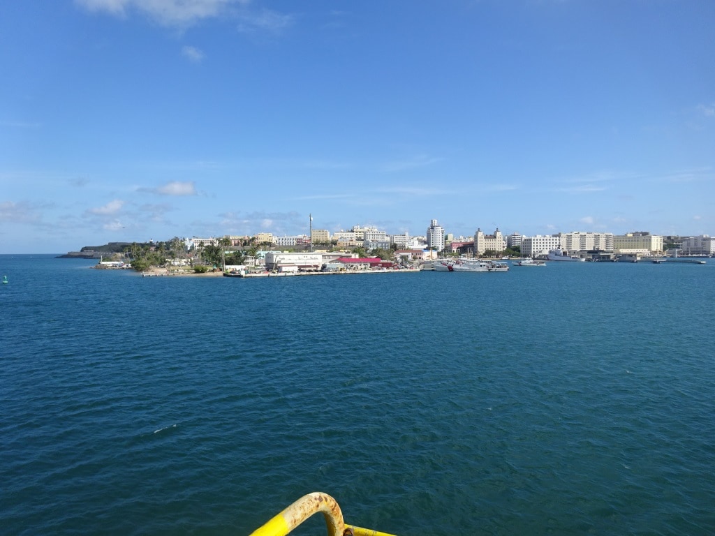
Today we were back in Philipsburg on St.Maarten, which is located on the Southside of the island. The island is split in half. The northern side that belongs to France, is called St.Maarten and the main town there is Marigot.

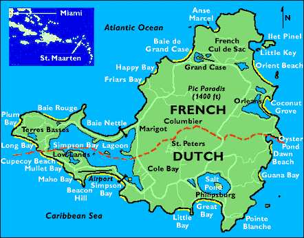
The map of St. Maarten. If it had been a cartographer or a Civil Servant then it both have been a straight line.

The story goes when it was decided between the two nations to split the island that a Dutch man (fortified by Dutch Genever) and a French man (fortified by French wine) set off from opposite sides of the island with the order to meet in the middle. If this is true, I doubt very much, but if you look at the way they border line moves off the island, then they were both drunk if it did happen. The Dutch got the South with the nice harbor and the French got the North with the better scenery. People say you go south for shopping and north for food and that is also in line with the ingrained outlook on life of the two countries. There was never a real border and now of course it does not matter at all as both countries are part of the European Union and there are no borders.  I think somewhere, somehow, some civil servants are very happy that the other half of the inland did not belong to the British (they live next door on Tortola) otherwise everybody would now be busy building borders & gates due to the Brexit decision.

The Dutch main town is called Philipsburg and dates back to 1763 when John Philips a Scottish captain in the Dutch Merchant Navy (The Dutch had very few real navy ships, they preferred heavily armed merchant ships that could pay their own way) took control of the island and decided to name it after himself. Those were the days, you could name a whole town after yourself and nobody blinked an eye. Now you run into problems if you even try to name a sidewalk after yourself. I once tried to have a rock named after myself in Alaska. Just with the request to rename it from Api rock (In Redwood Bay) to Appi rock (my nickname from long time ago) I almost succeeded but then somebody had a bright moment and Regulators and Chart Surveyors where less than impressed.

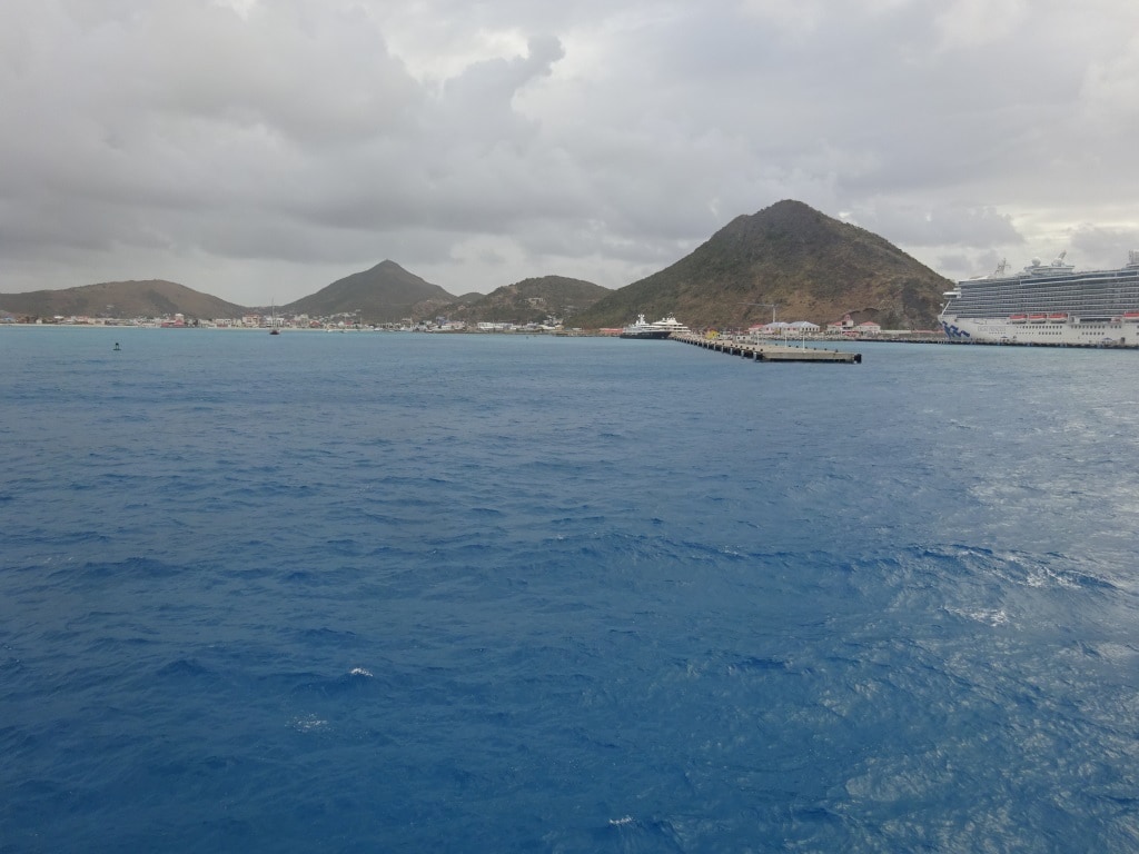
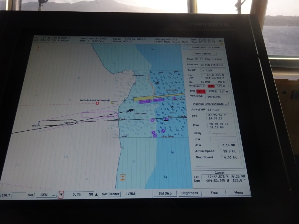
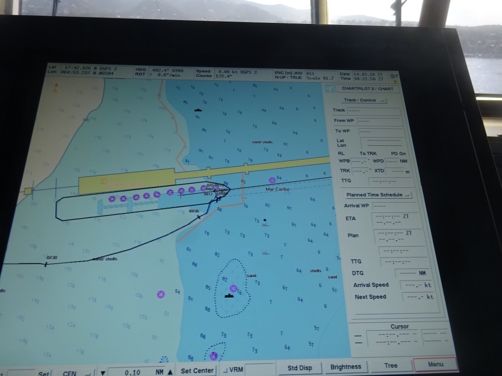
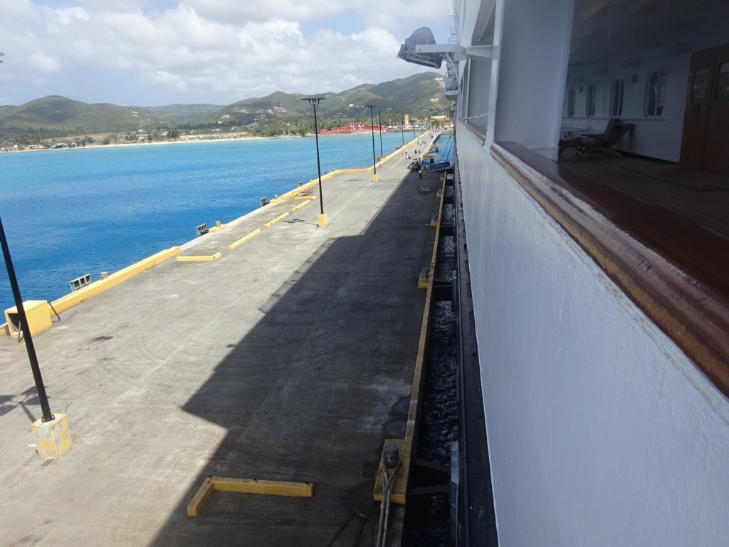
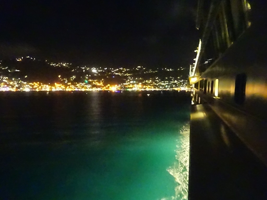
The two mega cruise piers. The one on the right where we docked this time, can handle four large cruise ships, the one on the left two.We docked next to the Regal Princess, as far inside as possible.  This photo was taken on arrival from the aft mooring deck where I was observing the safe work routines of the Officer in charge and his sailors.

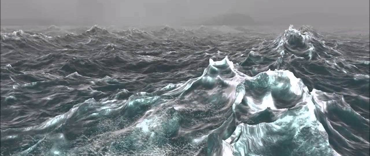
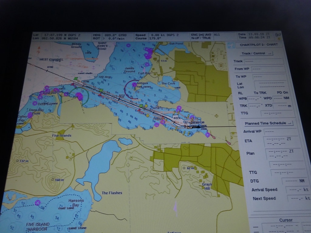
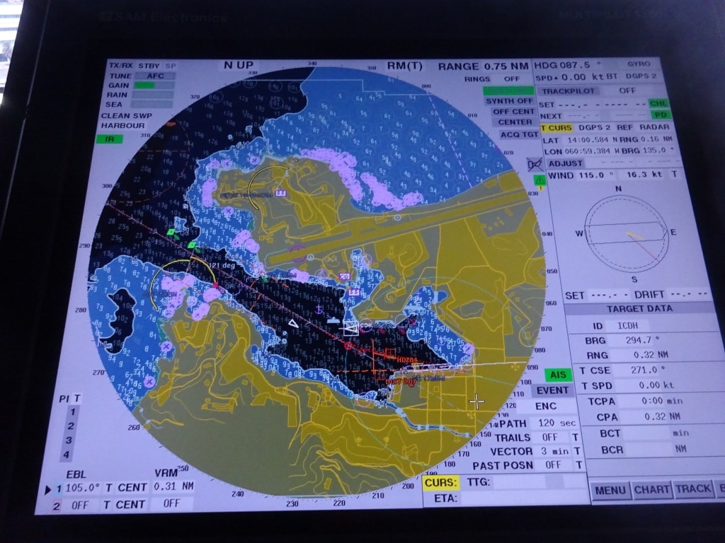
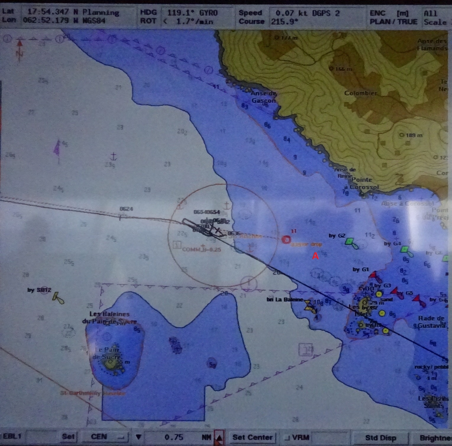
But the good ship Eurodam arrived on time at the pilot station and found that both the Regal Princess (already docked) and the Eurodam were going to the East dock instead of the West dock. The considerable swell was curving around the eastern shore line under an angle just a bit more to the south and that meant that the east dock had less swell than the west dock. As the Regal was already in position, we have even less swell than otherwise would have been the case, and that free gift was most appreciated. We will come in 2nd, anytime if needed here.

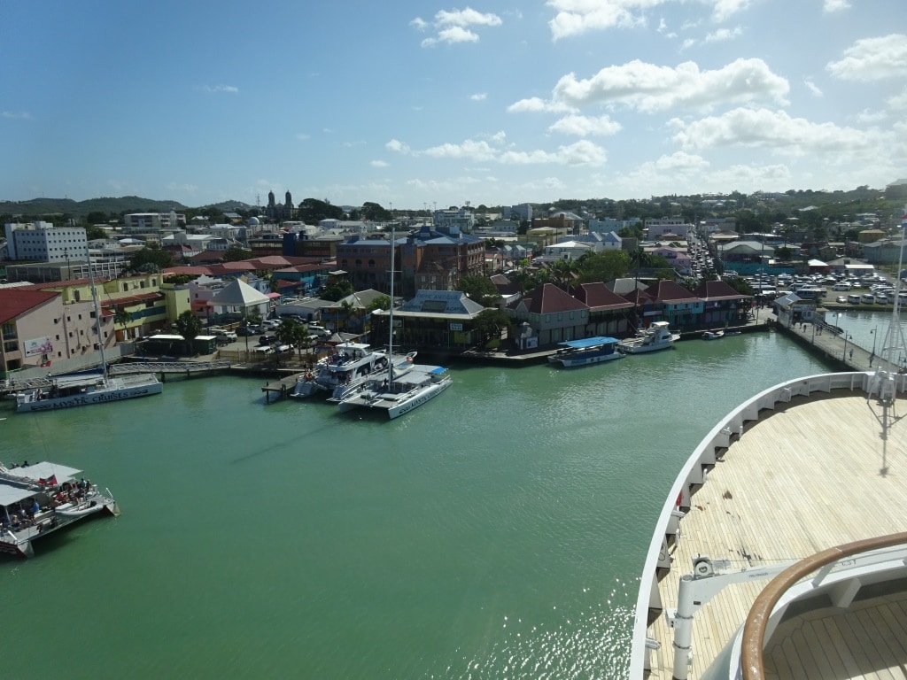
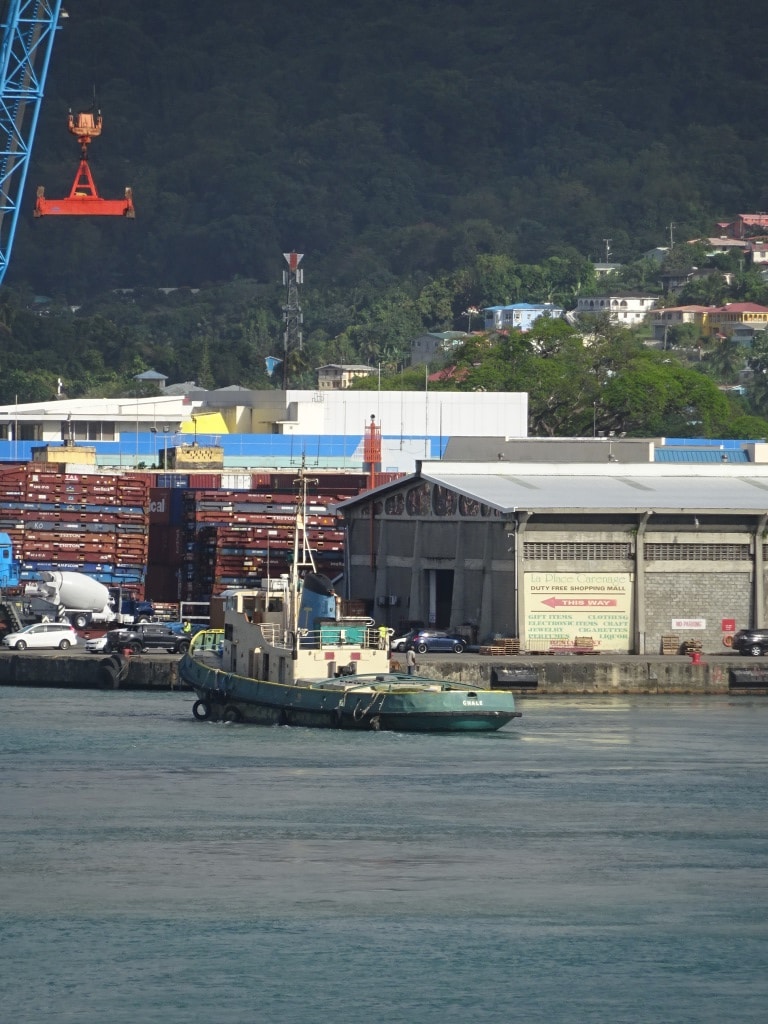
St.Maarten has been restored for a greater part since hurricane Irma with most shops open again. There is still a lot of repair work going on with the airport having a new constructed lounge in use until the main building has been repaired. Approx. 1200 of the 4000 hotel beds are back in use and the estimate is to have 2000 beds back in use by 2020. (As per local government figures). So they still have a long way to go but both the French and the Dutch Government have made relief funds available but it just takes time to get supplies to the islands.

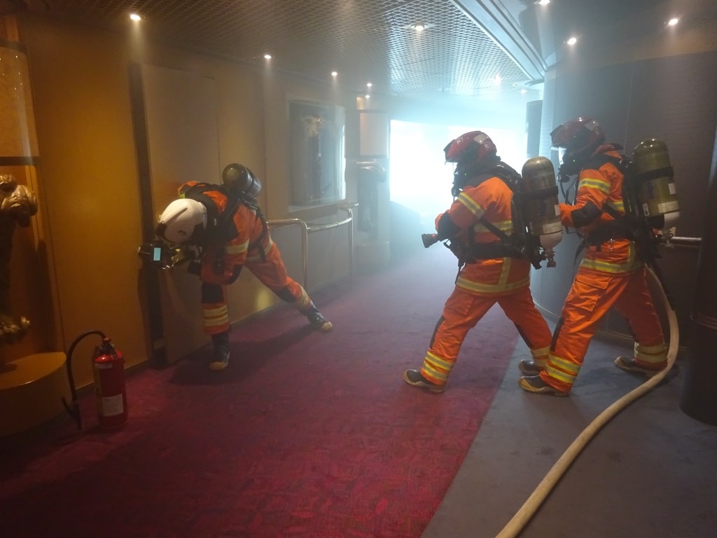
Making an entry. The team leader is using an thermal imaging camera (cost $ 10,000) to try to find out where the fire is inside, before the team goes in with the hose. Behind the wooden panel door is another steel door closing off a large area where Housekeeping stores their equipment.

My day was spent with creating mayhem on board by means of fire and boat drills. This time I had the inspiration to simulate a burn down of the center section of deck 2 public room areas and see how the crew would react if they have to search and protect a large area of the ship instead of a small space or locker. Port days such as today are ideal to do this as 90% of the guests are off the ship and will not be inconvenienced when we close Fire screen doors and run fire hoses all over the place. As expected all went very well and we now have a very proud Housekeeping Lady walking around as she reported “the fire” and because of her call the fire alarm went off and suddenly 80 fire fighters and support teams showed up.

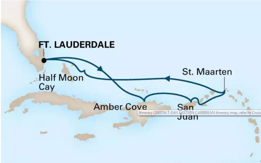
Tomorrow we will have a sea day and then we will be in Half Moon Cay. Our route back will be across the North Atlantic as there is no other option in this case. There are cold fronts playing around near Cuba but it looks like that we will just have a window of lesser wind (so lesser waves) tomorrow and during Half Moon Cay day.


21 March 2018; San Juan, Puerto Rico.

At 09.00 hrs. entry into a port such as San Juan is not a bad thing. Everybody is up and about and can see the scenery while having breakfast or coffee or while being out on the open decks. We are sailing quite close by Morro Castle which dominates the entrance on the East or portside of the ship and then while turning towards the dock, the whole old town opens up in front of you. As we had perfect arrival weather, sunshine with a breeze to keep things cool, it was nice to be out there.  We were in port today with one other cruise ship, the Carnival Glory, which was sitting at berth 4 east while we were given berth 3 west. Then there is Pier 1 so in total 6 docks available for cruise ships. Pier 2 is the ferry pier which has a shuttle service across the bay that makes up the big port of San Juan.  When there are more ships in all the berths are filled up but with two ships, it makes sense to give each other a complete own pier as it keeps the crowds down a little bit.

San Juan old port. To the far left Morro Castle; in the middle the USCG Station, to the right Pier 1 with a big USCG cutter alongside.

All three Cruise piers are right across from the old town so it does not matter that much at which berth you are. If it is a very busy day, then cargo docks, further to the East are also pressed in service and then it becomes a long walk to the old town and the Castle. It makes the Taxi drivers happy I suppose but not the guests and the crew. Adding more berths to the West is not possible as the corner of the downtown port is taking up by the USCG station and they are not going anywhere. I wouldn’t either if you can walk straight off the boat into the pub across the street. Often USCG stations are a bit more remotely located but this one has a Class A+ location.

I have blogged about this before in the past but San Juan has the peculiar approach that you charge into the port, then go full into the brakes, the put the rudder full over and stop shortly after. All to do with the fact that the port is so close to the sea, it is just separated by a strip of land on which the Castle and the old town stands.

We sail into the harbor entrance with quite a bit of speed to prevent the ship from drifting. The Easterly (90o) Trade winds are fully perpendicular on the entrance course (181o) and the more you slow down, the more effect they have on the ship, especially on a ship with a lot of balconies. Wind likes balconies as it gives a good grip while a smooth steel surface can deflect quite a bit of wind. So we enter the harbor entrance with about 12 knots and as soon as we are behind Morro Castle and in the lee of the town, we take speed back quite quickly. Also quite quickly a turn to the South East (132o) comes up and by that time we want to be down to about six knots. The there is a course change to 090o and then, especially for Pier 1 and Pier 3 you have to make a quick 90o turn to a northerly heading. All captains like to be down to thruster speed by that time (3 knots or so) so they can control the bow in case it falls off, as now the ship comes under the influence of the Trade Wind again which blows freely through the port. Nicely helped by the City airport which is located in the middle of the port and which makes the surrounding area even flatter than it already is.

San Juan as on the Electronic chart. you can see the track of the ship while coming into the port. The area further to the right is part of the cargo port but is used for cruise ships as well during congested days. The airport is located where the two little lighthouses are in the lower right hand part of the screen shot.

The trick with docking here is, is to stay as close to the pier as possible so the ropes can be given ashore. While that is going on, there might be moments of reduced maneuverability as the ropes are near the propellers and if you start out close then you can allow for some drift when the wind gets hold of the ship.

We were docked by 10 am., our official arrival time and we had the gangways out even before that time as we do not need all the ropes ashore to be safely alongside. A number of ropes go out as insurance in case the wind suddenly increases. So while the guests were already streaming into town, we were still adding ropes to the bollards for the “in case off” situation.

Tomorrow we are in Philipsburg, St.Maarten and we will be there with one other ship, the Regal Princess. Philipsburg has two cruise docks and as there seems to be some swell running, both ships are at the West dock which is the one furthest away from the corner. The captain is also going to dock nose out so that the –sharp- bow will ride the swell, instead of the –blunt- stern and that should help a lot.

Weather for tomorrow: More of the same. Sunny, warm and breezy.

Note: For those of you who are interested, I have uploaded the Biography of Captain Eric Barhorst under  the section Current Captains.

20 March 2018; Amber Cove, Dominican Republic.

Amber Cove from the Bridge.

With beautiful weather and hardly any wind or swell we arrived at Amber Cove, located on the north side of the Dominican Republic. Yours truly was on the forward mooring deck mentoring a young 3rd officer and from the diving board we had a very nice view coming into the port. (The diving board is that little walk way that opens up from the bow so the officer and Bo ‘sun can stand outside the ship to direct the ropes and or observe the anchor)

Amber Cove is a man-made harbor, constructed with the help of Carnival Corporation. So it is similar to Grand Turk Island, Roatan in Honduras and Costa Maya in Mexico. A nice long pier with sufficient bollards for the mooring lines. At the end of the Pier a nice Resort for those guests to spend the day ashore who are not going on tour. Next to it is a small resort with some hotels which also takes advantage of the bay and the surrounding area. For the rest there is only jungle and forest.

The Radar/chart picture. Open sea is to the North. The ship sails in, turns in the turning basin and then goes astern to an L shaped pier. We docked portside alongside on the inside of the pier.

Amber Cove had a natural bay and thus it needed only a bit of dredging to make an approach channel and a turning basin and then a new dock, large enough for two mega liners. Thus the resort should be able to accommodate approx. 7000 guests. We were only there with 2000 and a large number on various tours, so nice and quiet, but the shopping square can take a lot of people if needed. There is a very nice pool area and sufficient things to do to keep children and young adults active and away from boredom.

For us as sailors there is only one but, (And being a sailor, you are always cynical and look at the negative side, as that saves lives) and the but is, that it is fully exposed to the ocean. Wind and Swell from the NNW, the North and the NNE can freely blow and roll in. The Eurodam had this problem 14 days ago when there was this nasty storm blowing off the US Eastern Seaboard and a high and very long swell was rolling down all the way to the Dominican Republic. There it hit land; it built up and then crashed ashore. As a result the Eurodam could not get in and dock because the swells running in were too high. Breaking ropes and maybe even touching bottom were the obvious dangers. Then the next port of the ship was San Juan and there was 30 feet of swell in the harbor entrance and thus the Harbor Master had wisely closed the port. That left them only with St.Maarten and although the port there is on the south side, the high swell came around the rocks at the South East side and the Captain had to keep the engines going to press the ship against the dock to minimize the swell. It is not fun for the guests to navigate a gangway which moves one to two feet every 30 seconds. If it is not the wind, then swell can still make your life miserable if it comes in under the wrong angle.

Today was a glorious although very hot day and there were no issues what so ever. The Eurodam sailed in, spinned around in position and then backed up to the dock. As wise captains do when possible, always dock with the nose to open water. In case something happens then it is a matter of letting go the ropes and charge to open sea. Having a plan B always make you feel a lot better than only having a plan A.

For those who are concerned to walk the long distance from gangway to the Resort, Holland America has a very nice and environmentally friendly solution: The Bike Taxi

From here we continue tonight to San Juan which is located more to the east on the next island. The Dominican Republic is located on the east part of the island of Hispaniola and the west side is taken up by the country we know as Haiti. San Juan is located on Puerto Rico which is a much smaller island but not split up. To get there we have sail to the east and cross the Mona Passage. This passage is not as well-known with cruise guests as the Windward Passage, as not many cruise ships sail through it. But it is the gateway for all ships leaving the Panama Canal and going to Europe. So it can be quite busy there. The passage is named after the Island of Mona which is located right in the middle of it.

We are scheduled to be docked in San Juan at 10.00 hrs. and to stay there until 20.00 hrs. Our place at Amber Cove will be taken by the ms Koningsdam which is coming from Grand Turk Island just to the north. We will be together with the Carnival Glory in San Juan which will arrive ahead of us but also leave earlier.

Weather for tomorrow: sunny with 87oF / 31 oC. and very little wind in the port. It is going to be a very warm day again.

19 March 2018; At Sea, on ms Eurodam.

And so I made the transition from Veendam to Eurodam. The Eurodam is a Sunday ship and thus I had to spend a night in a hotel in Ft. Lauderdale and then return to the port to find the Eurodam and the Koningsdam waiting. (…………….and two Celebrity ships and two Princess ships and the Allure of the Seas = busy day in port)

The route for this cruise. As the weather is so nice, the captain is taking advantage of the shorter route North of the Bahamas, instead of going against the current via the Old Bahama Channel, just north of Cuba.

The ms Eurodam is currently on 7 day cruises and alternating between two different routes. This week we are doing Ft. Lauderdale – Amber Cove – San Juan – Philipsburg – Half Moon Cay – Ft. Lauderdale. Then next cruise we make a grand circle around Cuba, calling at ports North, East, South and West of the Island. It will be interesting to see how San Juan has recovered from the Hurricane devastation of last year as I have not been there since.

The good ship Eurodam is in the capable hands of Captain Eric Barhorst who is one of our newer captains but who has been with Holland America for a long time already. As a matter of fact he has never sailed for another company ever since he was a cadet. In the 90’s Holland America had a period where we had to get captains in from outside as we did not have enough Captain’s licenses among the senior officers. Pilotage in both England and Holland was pulling greatly and any officers with plans to start a family, might not be eager to leave Holland America but were certainly eager to spend more time at home. And thus we had a number of captains and staff captains who came in sideways and as they liked the company, they stayed. Now my generation is slowly leaving the fleet, the next wave is coming up, and now all the senior officers are coming up through the ranks again.

The Eurodam is one of the two ships of the Signature Class, the Nieuw Amsterdam being the other one. They are both an evolution of the Vista Class ships, sharing the same hull but with a slightly different layout and an extra restaurant, the Tamarind, on the top. That novelty was first explored with the Arcadia or the 5th. Vista Class which was handed over to P&O as it was decided that a 4 ship class worked better.  For that ship they had a bit more time to review its layout and when the guests kept asking for more food options (It is amazing that similar company’s get similar requests/demands/complaints) and they put their own specialty restaurant there the Sindhu. P&O is English and they have a very close historical connection with India, hence Indian food. As we have a very close historical connection with Indonesia, Holland America put an Indonesian, Thai, Japanese fusion restaurant there and we call it the Tamarind.

A tamarind Tree. At least that is what the internet says. If it is not, then I lie in ommission as I can barely differentiate between an Oak tree and a Fir tree.

A Tamarind is a tree, of African origin, which is kept as an ornamental tree but its fruits / nuts, can also deliver a brown paste which is used to season Indonesian and Thai cooking. When I grew up in the Netherlands my neighborhood was full of people who had worked in the Dutch East Indies and had left Indonesia when it became independent; the stories were always about gathering in the evening under the Tamarind tree of the village to exchange the latest news. The Tamarind tree is quite dense and provides a good shade.

To get to Amber Cove, we are sailing above the Bahamas Bank today and then this evening we pass the Turks and Caicos Islands and then cross the end of the Old Bahama Channel to arrive at Amber Cove tomorrow morning at 07.00 hrs. at the pilot station. Amber Cove is located on the north side of the Dominican Republic in a sort of sheltered bay. I say sort of as it depends a little bit on the angle of the North Atlantic waves coming in. At the moment, the ocean outside is a smooth as a mirror as there is hardly any wind and that ocean would have been flat if it was not for the ever present swell but even that is low.

Weather Forecast for tomorrow: warm to very warm. 88oF/31oC. The Trade Wind is blowing at its regular strength but there are hills in the way and that will reduce the breeze in the port considerably. A lot of guests were talking about going snorkeling and that might be  a good idea. The temperature of the water is expected to be 25oC or 77oF.

16 March 2018; Half Moon Cay, Bahamas.

It was a glorious day, whatever was happening further up North with the weather did not have any chance today to make our life miserable here further down to the south it was a great day. And so it will be tomorrow as the weather seems to be holding for the coming days. We were together with the ms Nieuw Amsterdam but the island is big enough to absorb over 7000 guests at the same time and our 1200 together with the 2200 from the Nieuw Amsterdam did not come even close to that 7000.

The island is on a permanent lease hold purchase from the Bahamian Government and this is our 22nd year of calling at HMC since its opening. There is the agreement that part of the island; the area around the lake will be treated as a permanent nature reserve. Guests are allowed to go there but just for a walk, not for anything else. Thus the company has concentrated its efforts for the guests around the crescent curved beach on the east side. There is not much beach on the North and East side and being there is not very pleasant as you are constantly buffeted by the Trade Winds or the occasional cold front.  There is some beach on the south west side but it is difficult to get there and we do no encourage guests to go scaling up and down a rock out cropping in order to find another beach.  The main beach is nice enough as it is and there is ample space. Either in the area where all the beach stretchers are or if you wish for a very quiet experience, you can make the hike, all the way to the North West end, where very few people go.

The sand of the beach is pure sea sand. It is built up by the sea and sometimes removed by the sea. Somewhere in the autumn of 2004 or 2005 I arrived here with this Veendam and we found the beach completely gone, apart from a small strip just beyond the vegetation perimeter. A few days before a hurricane had come through and wind and a change of current has washed all the sand away. As we were by ourselves we still had enough beach left for the 1200 guests but the water was murky and the skipper of the glass bottom boat had to keep himself busy with something else.  But the Island Manager explained that this was normal and said, Captain when you came back next week, half of the beach is back and in another week and everything will be back to normal. And he was right, in 14 days’ time all the sand was back. That sand gets there because there is a small current running to the North West through the bay. It curves with the beach and then under the influence of Ebb and Flood it deposits sand.  I do not know where that sand is coming from, maybe from an island or sand bank nearby.

The good ship ms Nieuw Amsterdam, just to the north of us, with a HMC tender under its bow.

We, as sailors, do not like that current very much as it means that the ship, when not at anchor, will drift slowly to the North West. With the Ebb, it goes North West to open sea, with the Flood; it goes North West towards the beach. With two ships in the bay that can be quite interesting as the current is not the same everywhere in the bay and thus one ship can drift faster than the other. Hence we keep a good distance.

The Rock at the entrance. If you anchor you have to go where you can just see the white was of another boat. If you stay on the engines you can sit right in front of the entrance.

Today both ships stayed on the engines, to be able to be as close to the harbor entrance as possible. The normal anchor spot is about 3 cables (1800 feet) from the entrance rock to the West and if one ship is there, the other one has to go another 1800 feet to the north and is then almost 4000 feet away from HMC port. Thus the captains had arranged to stay on the engines and then both could float close to the port because when staying in deep water you can sit right behind the rock. And that is what we did today. The Veendam floated right behind the rock, and the Nieuw Amsterdam hovered a little bit more to the North. Both had roughly the same distance to the port entrance and all was well in the world.

Tomorrow we will be back in Ft. Lauderdale; together with the Nieuw Amsterdam as she is nearing the end of her cruise as well. For me that is the wrong ship, as I will transfer to her sister the Eurodam. Thus there will be no blog tomorrow as I will be inspecting a Ft. Lauderdale hotel for one night and then join the Eurodam on Sunday. She is sort of alternating between the East Carib and West Carib on 7 day cruises with the Nieuw Amsterdam doing the opposite.

15 March 2018; At Sea.

Our route to Half Moon Cay.

Today we are at sea, covering the distance between St. Croix and Half Moon Cay. We are now in the North Atlantic on a North Westerly course towards the Bahama Bank. Sometime tonight, we will enter between the islands and then sail up to Half Moon Cay or Little San Salvador Island as it is officially called.  As we are now in the open ocean, we can feel “the motion of the ocean”. And we are looking at what we call confused seas. This means that there are swells and waves rolling in from various directions and they mix and match all around us.

Waves are modulated water masses which means they roll over the deeper ocean surface as a wave movement. Deeper down the water also flows but then it looks more like a pressure wave. Or if you would line up a number of bricks behind each other and then start pushing the last one. They all move forward but not up and down or sideways. Move like a train. Now if those bricks would be on the surface, they would go up and down as a wave. If now two of those “trains would meet, sometimes some bricks would push each other up and sometimes they would push each other down. That is what we call confused seas because there is sometimes an extra high (waves enhancing each other) or an extra low wave or an almost flat sea moment (waves cancelling each other out)  As the pattern is not standard it makes the sailor confused and thus Confused Seas, although we should really say confused Swell.  Then the wind that blows over it can also enhance the waves or makes them flatter. More confusion. Thus today the navigators were looking out of the window and they saw all sorts of confusion around them.

I have no idea who painted or posted this but it gives a very good impression of confused seas. A thank you to whoever you are.

The ship moves on the swell, whatever the stabilizers are trying to prevent. Stabilizers deal with regular motion and their fins move on the signal of a gyroscope which figures out the angle of the ship in comparison with a true horizontal. The more reliable and constant the ocean swell is, the easier the gyroscope can predict the angles needed and give a signal to the stabilizers to counter act it. With confused swell that is not so easy and as a result the gyroscope cannot keep up on the time. (Confused Gyroscope??) As a result the ship is sometimes as steady as a rock and sometimes it makes an un-expected movement, when the stabilizers cannot handle the “two bricks” on top of each other.

Another good rendering although a bit over the top. Main thing is you cannot see a regular wave pattern.

One of the two swells is the regular swell caused by the ever blowing Trade Wind from the South East. The other swell is caused by bad weather on the eastern USA seaboard and that weather sends out waves and swell all the way down to the islands which make up the Caribbean rim. As we are not yet in the shelter of the Bahama Bank we also get that swell. The more we come under the influence from the bad weather up north, the more dominant the swell from that area will become and eventually the confusion will be gone.  We will not see that as we will already be in the shelter of the Bahamanian Islands by then.

How much or how little we will be under the influence of the bad weather up north, I do not know. By lunch time it pushed the first weather front over us, so we had some rain on deck by noon time, and now we wait and see. Thus far the local weather forecast does not look that bad but it seldom takes heavy squalls into account and thus we wait and see until we have Half Moon Cay right in front of us without any nasty black clouds hanging above and around it.

14 March 2018; Frederiksted, St. Croix. US Virgin Islands.

Approaching the dock at Frederiksted is one of the simplest things there is in the world of cruise ports. It is basically putting the brakes on and not to overshoot. The pier is a long finger pier which can take mega liners and it sticks straight out into the open sea. Quite a long pier as the first part has to bridge the shallows before deep water is reached. We have a pilot here, simply because it is compulsory and he will bring some news about current, wind and also points out how far we can go. And that is all there is to it.

The initial approach. A bit to the south of the pier to compensate for the South Easterly Wind.

Still this over simplifies the whole thing and most cruise ship captains are a bit wary about St. Croix as the berth is not really sheltered. With a normal easterly wind, the island provides a lee but if the wind is a bit more to the South East or to the North East it might be different. Today we were the only ship in port so we could choose which side to dock to go alongside and thus used the wind as our friend. And that gave the chance to use the “blow to the dock maneuver”. We also have another one, the “blow away maneuver” if the wind is off the dock. That is even easier.  With the blow to the dock version, we approach from a safe distance, find the balance between the wind and the thrusters and then let the wind push us gently to the dock, while moving forward towards position, and stop the momentum with the thrusters just before we touch the dock.  The dock here has nice fenders so it can take a bump. But bumps do cause paint scratches and nobody wants the wraith of the Bo ‘sun. You never know if one day, suddenly paint is spilled from above at a location where you just happen to stand.

The blow to the dock maneuver, staying nicely away from the red lines and letj the wind do the work.

Cruise ships have been absent from St. Croix for a number of years, when things were not so safe here. For a while it was advised not to move beyond the first few blocks in the town and not to go ashore in the evenings if the ship made a late call. So the cruise ships dropped the port which was not good for the local economy and nearly everybody stayed away for a number of years. Now things are better and the ships are slowly returning as it is quite a nice island.

They suffered greatly here during the last hurricane and services are only now returning to normal. Blue Tarpaulin can still be seen on roofs and damage to private properties and shops has still not been repaired. One Guest reported today that a local grocery store had only one refrigerator in operation and could thus did not sell soda as the 2nd fridge was full with beer. You have to set priorities I suppose. I did not have time to go ashore but I saw that the Danish Fort near the pier was in a very dilapidated state and I do not think that there will be any repairs affected in the near future. The locals still have other things on their mind.  I say Danish Fort as St Croix also was Danish in the past, same as St Thomas and it was part of the sale between Denmark and the USA.

The long pier leading into town. The red structure is the Danish fort built to keep the pirates out. It controlled the best anchor area of St.Croix. Hence they built the cruise dock over here was well.

We had an early departure here, A  as the island only has a limited number of attractions and B  because we have to make it to Half Moon Cay on time. This is the last call of our cruise before we return to Fort Lauderdale.  HMC for short has been selected time and time again as the best destination of Holland America in the Caribbean and it has also won several travel awards saying that it is the best private cruise company in the Caribbean Sea.  So we have to be there on time. Luckily wind and current will give us a push in the back and that will help use to gain time and achieve some plus. Tomorrow will be a day at sea, to either relax, or partake in all the on board activities.

I was busy to day with a whole series of refresher courses for the crew and introducing some new things for the officers who do the trainings on board. Things keep changing and new ideas bubble to the surface. Since we are getting our trainings coordinated by Carnival Corporation between all the brands, a lot of ideas are bubbling up and then have to be passed on and absorbed. Although the various companies’ retain their own identity, their own brand as marketing says; there is only one way to lower a lifeboat and is timely and safely and thus the best practices are collected from each Brand and rolled out over all the ships.

Tomorrow we sail all day in the North Atlantic and we will have some wind and swell but it will be from behind. How the weather develops remains to be seen as there is a lot of bad weather up north and if it does what it is supposed to do according to the weather guru’s it will not affect us but if it dips down just a little bit then a cold front over Cuba might intensify and then everything will change.

13 March 2018; St. John’s, Antigua.

Sailing in the Carib is sometimes a bit confusing as there are more ports or islands with the same names. There are two Basseterre’s, there are two St. Johns, then there are the US Virgin Islands and the British Virgin Islands, etc. etc. Then some of the islands are Dutch or French or British, or independent or semi-independent so you have to keep a close eye on where you are going and what the status of each island exactly is.  Most islands have their own flag, even if they are considered an extended part of the mother country and they do get annoyed if we do not follow the flag protocol that they want.  Occasional we do get it wrong, if we do not pay close attention to what the quartermaster is doing, or we get the wrong flag sent to the ship. The British make it really complicated, as they have white, red and blue versions of their flag and occasionally we get the wrong ones on board. (White ensign = navy, Red Ensign = country, Red ensign = merchant fleet) Some of the British or British affiliated islands do the same and if we then get a Red Ensign for Grand Cayman instead of the Blue one, then we are in trouble.

What is even more complicated is the rule that the House flag should never be larger than the flag of the Nation that we visit and should also not be bigger than the national flag of the country of registration (in our case the Dutch flag) As we cannot always control what is sent to us, as a company flag, it is sometimes hard to comply with that rule. And when I looked at the flags of our neighbour today, I also saw that they were breaking the rules most likely because they did not have any other flags available. Procurement goes by computer and what goes in the computer comes out of it again, sometimes in quite a startling way…………………. And changing what is in the computer………………….

The flag of Antigua and Barbuda.

So today we were in St. John’s, Antigua. Or officially it is Antigua and Barbuda as the two largest islands together form the official name of the country. They used to be British but went independent in 1981. They had the wisdom to create a completely original flag so at least with this country we do not get confused. And I think it is a very nice one, I quote:   The 7 point golden sun of the Antigua & Barbuda flag represents the dawn of a new era. The colour red, the life blood of slave forefathers and the dynamism of the people. Blue represents hope, black, the soil and African heritage and gold blue & white Antigua’s and Barbuda’s tourist attractions sun, sea and sand.

Docking with the nose in downtown. If you are here in the evening then it takes exactly 3 minutes from the gangway to the nearest bar with draft beer. Can’t understand why we have to sail at 17.00 hrs.

St. John’s is a very nice place to visit; it has a good and long dock to park at, even today with 4 ships in port we all had a good dock and good access to the town. It is full of shopping malls and shops for those who want to invest in the local economy and the people are amazingly friendly, taking into account that they have to deal with these large invasions of tourists every day. (Today the four ships put about 10,000 passengers ashore not counting the crew) A major attraction are the very white and vast beaches on the west side of the island and a long time ago, I was educated in the local version of “Chicken in the Basket” with local herbs and spices and that tasted a lot better than in any other restaurant outside the islands.

The docks in St. John’s are far inside the island and a long dredged channel leads to it. That channel is a mixed blessing, the good part is, it brings you to a very nice and sheltered port where the ship docks almost in down town, the bad part can be, when the Trade Wind is very strong and a bit off angle. Then you drift sideways in the channel which is not so wide. Then it can be very difficult for the big boys to get in. The same as we had wind issues and drifting in Cienfuegos last cruise, the “Apartments of the Seas” would have it here, while the small Veendam would probably make it.

The long way in. The depths in the channel vary from 30 to 35 feet (very minimum depth) as we draw about 28 feet, there is normally about 7 to 8 feet under the keel.

From St. Johns we sail tonight back north towards the Virgin Islands and we will go to St. Croix, the 3rd island of the US Virgin Islands (St. Thomas, St Johns, St. Croix) Here we arrive at 08.00 hrs. and we are supposed to be all by ourselves.  The main town on the island is Frederiksted and that is also were we are going to. It will be a warm day with temperatures in the town reaching 82oF or 28oC. Hopefully the Trade Wind will bring some cool winds but not too much otherwise we will have issues docking at the pier.

12 March 2018; Castries, St. Lucia.

The nice of thing about Castries is that it has a very nice sheltered harbor from the predominant Easterly winds. So even if the Trade Winds reach their maximum velocity, Castries is normally a safe bet for a safe docking and a good day in port. As such it was this morning when we approached at 07.00 hrs. outside there was about 20 to 25 knots of wind but inside it hovered around 15 knots. No worries about not getting in.  As the wind was scheduled to reduce in velocity later in the day, the captain opted to dock nose in. That was a good idea anyway as the dock were we were going to, ends up in the rocks and that is not good for the propellers if you get to close.

Castries harbor. As you see it is a straight line all the way in. The small white triangle is the AIS from a small ship coming in. (AIS = Automatic Identification Signal)

Today we docked at the Elizabeth Pier, or berth 3 & 4 right with the nose in the middle of Castries. There are also two dedicated cruise berths, Seraphine 1 and 2, which are the normal docks for the cruise ships, but when there is no cargo ship in port they put one cruise ship in down town. Today we were the lucky one, while the Aida Vita went to the cruise terminal, Seraphine 1. The 3rd ship the Star Dream never showed up, unless it was a very futuristic looking private yacht in black and mocha colors that docked at the general cargo pier. But I could not read the name.

The leading lights towering over the warehouses. As you can see the beacons are not yet in line. The ship has just swung around and still has to line up for sailing out.

Sailing into Castries is fairly simple, it is a straight course until you pass the first cruise dock on the portside and then you adjust for your own way of approaching the dock. To make it easier to sail that straight course, there is a leading light system set up on the downtown dock and if you keep both lights or both day marks in line, then you are perfectly in the middle of the channel. The only thing we are concerned about here is the airport. It lies in a hidden corner behind a rock when coming in, and when going out. You can only see the landing strip once you start passing it. Why is it a concern, because we cannot see if a plane is arriving or departing. Can it cause a problem, yes, as time is flexible in St. Lucia. The pilot on the ship always confers with the control tower to find out if there is air traffic expected and most of the time the answer is correct. But not always. Either the Control tower does not care about the ships or the approach times given are not correct. Time is flexible, also in the air.

Overview of the port with the airport prominently visible. The rocks with the trees on it on either side are just high enough to obscure any plane approaching or leaving.

Most cruise ships captains eventually have the experience that an aircraft comes buzzing by, while the all clear was given with an ETA, well before or well passed our passing time. Most of the aircraft here are of smaller size as St. Lucia has a bigger airport to the South.  Is this a concern? If we could be sure that they would fly in at a good height, than it would not be.  But on occasion we have a sky-jock who wants to put their wheels down on the first inch of tarmac when he or she gets there and that means their fly path in the descent is at our bridge level. Although a steel ship will always win it from an aluminum tin can, the idea of a collision is not appealing. I had this experience once when a local 16 or 32 seater plane came in and went for the early touch down. It passed about 100 meters in front of our bow. I was outbound and then 100 meters is not much as you are in the process of speeding up from maneuvering speed to about 10 knots. I do not know how the pilot in the plane reacted when he saw 60,000 tons of momentum coming at him but I was not a happy camper. Explanation from the Control Tower was that this plane was supposed to come in 10 minutes later but arrived early. (Maybe the pilot found a short cut somewhere and wanted to be in before cocktail time)

The Pitons, as seen in 2014 from my own ship the Statendam. With volcanoes things do not change much in 4 years, so it all still looks the same.

We sailed at 15.00 hrs. which is on the early side but we also had sightseeing on the program. 15 miles to the south are the Pitons (= which means spike) at the south side of St. Lucia. These are over 700 meter high volcano cones. The outside of the volcano crater has eroded away, being lighter lava and the inside of being of much harder material has remained and is now a free standing pinnacle mountain. This is a UNSCO world heritage site due to its outstanding beauty. So we are going to have a look.

From there we put the pedal to the metal to get to St. Johns Antigua on time, where we are supposed to dock at 08.00 hrs. at one of the down town piers. It is going to be a full house if all the ships are showing up that are scheduled, with the Azure of P&O, the Adventure of the Seas of RCI and the Seabourn Odyssey, of our daughter company Seabourn. Everybody is coming in at the same time, so it will be an ocean liner parade.

11 March 2018; Gustavia, St. Barthelemy, France.

The challenge with French islands in the Caribbean is, that they are often more French than the home country itself. And as a company you cannot do very much about it. We were here today on a Sunday and most shops were closed. If I was a shopkeeper and knew there were 1200 eager shoppers coming ashore, I would be open. But no it is Sunday, so we go for Sunday lunch.  We had scheduled ourselves and had received confirmation that we could send the first tender ashore for the authorities to clear the ship at 07.00 hrs. We think that they suddenly realized that it was a Sunday and the agent advised to tender before 07.45 which is………….. very close to 08.00 hrs. The captain did not accept that, called, and reminded the agent ashore that we had confirmation for 07.00 hrs. Then it “c’est bon” again.

When we came to the anchorage there was a yacht on our preferred spot, luckily it was a small one and that gave us enough space to anchor behind it. But we could have been a lot closer to the port if that space had been empty, saving the guests a bit of a wobbly tender ride. But the anchorage is open to everybody, first come, first served; and thus the yacht had picked the best place sometime before.  It is a free for all to pick your spot, except of course if your name is Abramovich, then you get the best spot. But because we had to stay further out, so the ship could float clear of any danger, it became a long tender ride to the tender dock all the way inside. Because our guests are asking for more variation, the company is forced to mix these sorts of ports into the equation and thus to offer a mixture of new and old, known and unknown. The coming ports we will dock and that should solve all the going ashore issues.

From the Electronic chart. The yacht was in position A, and if she had not been there then we could have moved the anchor so much more forward, that we just would have been in the lee of the rocks (in yellow) and who have missed the swell of the ocean rolling in, what now affected our tender service.

When we go at anchor the main discussion is, apart from where we drop the hook, how much chain will have to go down to anchor safely. Safely means the anchor will not drag and the ship stays nicely in position. A lot of people think that it is the anchor which keeps the ship in place. This is not the case, it is the weight of the anchor chain and the friction it causes with the sea bottom that holds the ship. The ships anchor is only the anchoring point of the chain so it can lie on the bottom of the sea. If we would just use the anchor and no extra chain for weight, we would constantly drift away as the anchor would simply break out of the ground with every movement of the ship.

Normally the rule of thumb is the depth of the water in chain length and then two lengths extra. We speak about anchor lengths of chain. Each length is 15 Fathoms or 27 meters or 90 feet.  So if the water is 10 meters deep, we have to put at least 3 lengths of chain down. Then there is the distance from the sea bottom to the anchor winch which is normally also about a length with the end result of 3 lengths under the water and the 4th. length coming up out of the water to the anchor winch on deck. Now when the wind is blowing, we always add one extra length. If the holding ground is not good, then we add another one. If the holding ground is rock, then the chain will easily move over the rocky sea bottom and has not much grip. In Half Moon Cay (where we are on Friday) we have very dense sand with an enormous grip and there we could probably anchor with just three lengths of chain.

Today we went to six on deck, which meant the 5th length was just under water and in 20 meters of depth we had 4 lengths with the anchor on the sea bottom. 5 lengths would have sufficed here but we had a strong Trade Wind blowing so we added one length of chain for insurance. That meant we had a total weight of 35000 pounds (17000 kg.) of steel lying on the sea bottom to keep us there. I think nobody would be amazed to realize that the ship also stayed there.

We stayed until 15.00 hrs. and then set sail to Castries, St. Lucia where we will arrive at 08.00 hrs. Castries is located in a sheltered bay with two cruise ship docks and a downtown cargo dock where cruise ships also go when the port has a busy day. And it looks like a busy day as we are together with the Aida Diva, the Wind Surf and the Star Breeze.

Weather, mainly overcast 29oC / 85o F and a strong Trade Wind breeze.

In yesterdays blog I mentioned that departing St. Thomas in the evening, gives a very nice view. Here my amateuristic attempt to capture Charlotte Amalie sail-a-way.

Older posts Newer posts