The weather did what it was supposed to do, follow the Trade Wind rule and have the wind blow from the East. Thus the dark clouds that gathered during the night time (see my Caribbean cloud story from a few blogs ago) dissipated with the sun warming up the atmosphere and we had a glorious Caribbean day. Quite warm but the Trade Wind did blow through the port and that made it bearable. We were in port together with the Norwegian Bliss (4990 guests) and both ships docked at Havensight: that is the downtown cruise ship dock. Otherwise known as the pier of the West Indian Dock Company. So together with our 2500+ guests there were about 7500 guests ashore which is nothing compared to what St. Thomas can handle. Put a few RCI mega liners in and you go well over the 10000 for a regular day. So it was a nice and quiet day for St. Thomas. And no traffic jam to and from downtown around the bay Continue reading
Category: CaptAlExport (page 1 of 203)
Well the amount of wind amounted was less than the weather guru’s had predicted and the good ship Volendam arrived without any hassle at 05.30 at the pilot station. Some ships have a dedicated pilot break but on cruise ships there are always several breaks (that is what we call the shell doors in the hull side that can be used as they are on the lowest deck). For the Volendam that is A deck as B deck is below the water line and Main deck is passenger accommodation. There we have the Tender break, the Water break, the Bunker break, the Marshalling area (2 doors), the Provision break, and another Water break. So plenty of choice but we normally use the Marshalling area, there were we load the suitcases and store the spare parts coming on board, as this break has the most space. And it is exactly amidships, so it has a flat hull and no bow wave playing around it. Continue reading
This is the last day of Voyage 87; another 7 day cruise to Norway almost completed. The Koningsdam is making a varied pattern of 7 day and 14 cruises to Norway and then in between a cruise going another way. That is what she will do when she starts voyage 88, called the Northern Isles and includes calling at Scottish ports and visiting Iceland. The mixture of various lengths of cruises and destinations is a pattern which Holland America’s prefers to have so it can attract guests who stay for more than one cruise.
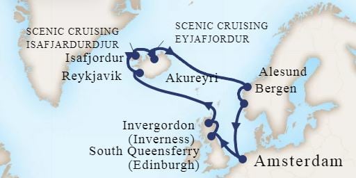
The next cruise of the Koningsdam which will offer a few more sea days to relax and enjoy.
Nice for the company but also nice from the focus of the guest. Especially those who come from far away. It does not make much sense to fly all the way from Vancouver to Amsterdam, do a 7 day cruise and fly all the way back again. Jet lag will cost you 2 days and the last day is half gone with packing. Thus on our ships we see a pattern of travelers coming from far way staying on board for multiple cruises or combing a cruise with overland activities. Because Holland America is offering that option we see a lot of Aussies and Kiwi’s on board who have made the 26 hrs. journey from down under and then embark on a month long (or longer) period of traveling through Europe. We often see them near the end of their overland travels so they can make a cruise and at the same time relax without packing and unpacking their bags, as we will park their hotel for them in a new place every day. The company even has a name for them. CVG guests. Collector Voyages Guest and, time permitting, we treat them to an extra lunch or cocktail party out of appreciation.
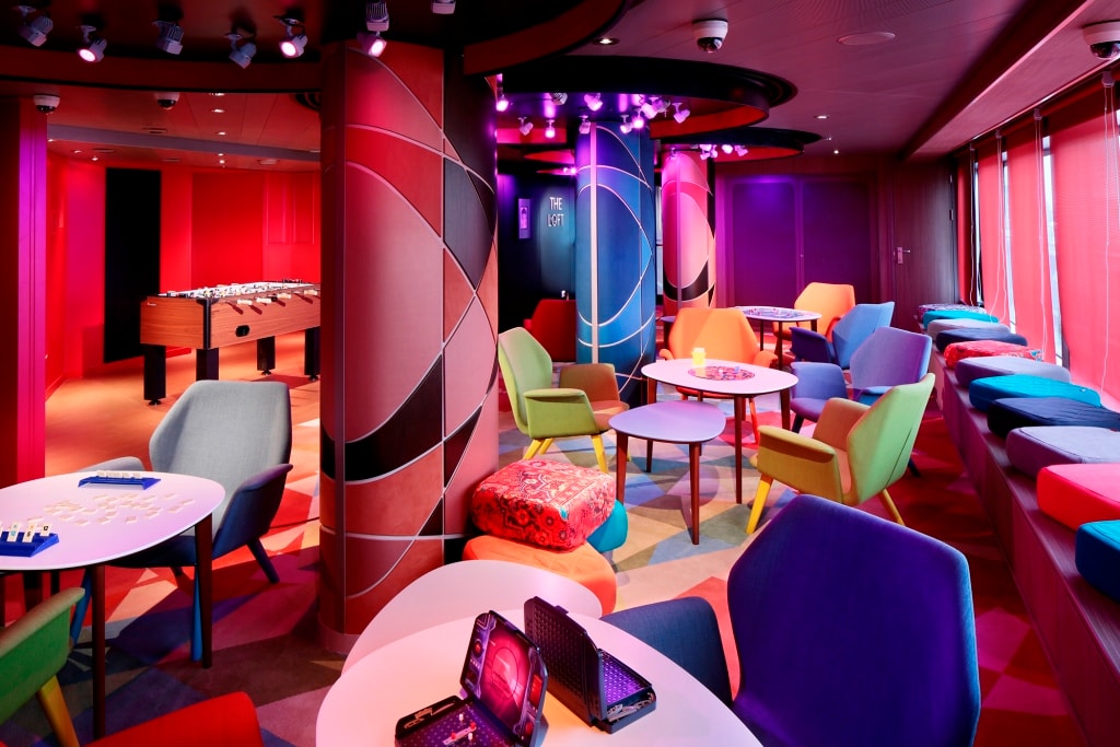
Club Hal is made up out of three sections. Toddlers, those in between ( a bit of a vague area) and teenagers up to 17. This the Loft, a place for teenagers to hang out and to be cool.
The Koningsdam is focusing on 7 day cruises as it expects that all the amenities this ship has will attract a younger crowd and families with children. We need to do this as otherwise there will be no HAL cruiser left in the future. With our 7 day cruises we do have a lot of families on board, at least during the school holidays. Not only Dutch but also from the USA, Canada, Russia, India and this cruise also from the East Mediterranean. It gives for a nice kaleidoscope of languages, sometimes clothing, but above all the various ways of families bonding and having a great time. For an interested observer the actions going on in Club HAL are even more interesting. We always have one or two child minders on board but when the bookings indicate that there are a lot of children expected, then those numbers go up pro rata to 6 or 8 club HAL staff. Kids do not do politics (except when it comes to hoarding toys) and it is interesting to see that all the nationalities just mix in without any reservation. Sometime I wonder if it would not work better if we put all the big political shots of the world on a HAL cruise (without advisers), make the drinks half price and let them sort it out. It is amazing what you can agree upon after five Heineken’s. I know from experience, I sold one of my bicycles once that way. Turned out the next morning that it was not my bike at all but nobody could remember who the real owner was and what had happened to him. But the evening before it all made sense. And I wondered ever since what happened to that person as we all came to that party on a bike. Maybe he got a date with a girl who had a tandem. This was in Holland and with bikes everything is possible, there is even a pub on wheels where you peddle with 10 people and drive the thing around the town while drinking.
On the last day of the cruise Holland America puts out scales in the staircases on every deck. The idea is that you can weigh your suitcase so it is not too heavy when going back on the plane. Some people use it for that purpose, but a lot of guests step on it to see how much weight they have put on during the cruise. Most of the time they are not very happy with the result. But then they have 358 days to deal with it before it is time for the next cruise.
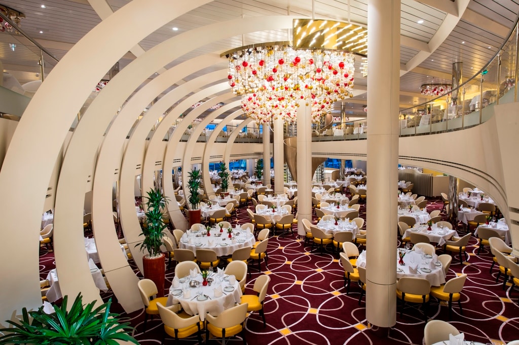
This is most of the time the main cause for frowning at scales. The Dining Room of the ms Koningsdam.
The good ship ms Koningsdam will dock at 07.00 hrs. tomorrow morning in the port of Amsterdam and that is also the end of my cruise. At 09.30 my private car (Holland America looks after its captains very well ) will be waiting at the gangway. Schiphol is only 30 minutes away and by 2 pm. I will be home in England, ready to face the Honey Do list from my Lord and Master and that of the Apartment building. My focus point for the coming period is designing and building new garbage sheds that offer enough space for the recycling requirements of the local council.
That brings me to the end of this period of blogging on board the various ships of the company and my blog will now stop until approx. 5 October. Then the plan is to go to the new building of the Nieuw Statendam in Marghera near Venice. As I did with the building of the Koningsdam I will take you again through the preparations of bringing our next new ship into service. I thank all my readers for their continued support and I hope I did not bore you too often.
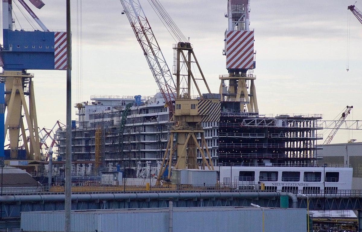
The ms Nieuw Statendam under construction at Marghera late last year. She is going on trials this month and by the time I see her the shipyard they will be hard at work to finish the inside for a delivery date of 01 December.
Bergen is part of Norway but somehow apart. People here say, there is Norway and then there is Bergen. They like to do things independently here and that means that routines are not always the same as in the rest of Norway. That also applies to the weather. One is not always certain what the weather is going to be like here as it really depends on the way the wind is blowing, or the lack of it. It worked out in our favor today; it did not rain. There was no wind at all so the moisture laden clouds that floated by above us did not hit the surrounding mountains hard enough that they started releasing all the water inside and so we had a very good day. It had rained before and during our arrival and then it nicely stopped.
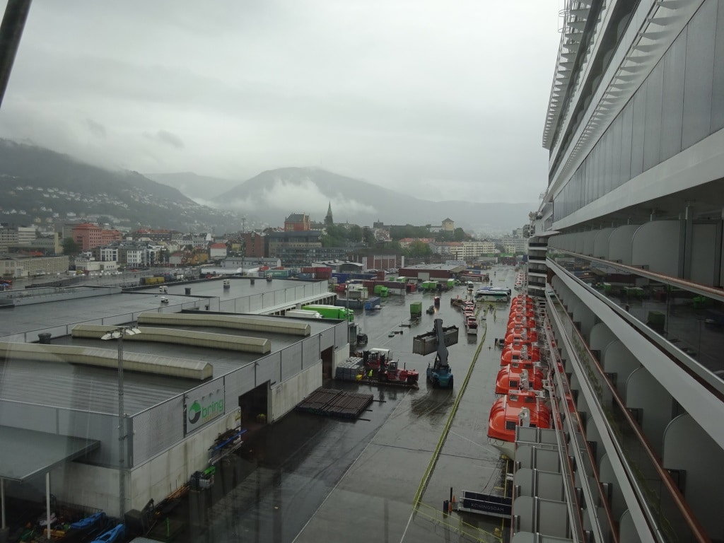
There is a funicular going to the top of that misty mountain but the clouds do not always stay out of the way.
We were not the only ones who were lucky today as it was a busy day with cruise ships. In port today Koningsdam, Ventura, MSC Magnifica and the Nordkapp (Hurtigruten), not to count the regular ferries, cargo ships and off shore vessels as Bergen is a big port. Together with Stavanger it is a major home port for the North Sea oil and gas industry and just outside Bergen is a large Gas complex which feeds a gas pipe line to the United Kingdom. So I better say nothing negative about Bergen as otherwise the gas to my apartment might be cut off.
The downtown port has not much expanded through the years as most ships visiting there are not that big and still fit in the downtown harbor. Large ships, cruise ships are only here in the summer and then things change. They can still handle one biggy in the downtown area but others have to go to the cargo port which is not far away but gives an extra hurdle to take as you are not allowed to walk on the dock. The port lays on an elaborate shuttle service to avoid accidents in the port area and we had to use buses today. Right under our starboard bridge wing was a ferry dock and behind us a container dock and you do not want pedestrians milling around when those ships are discharging and loading.
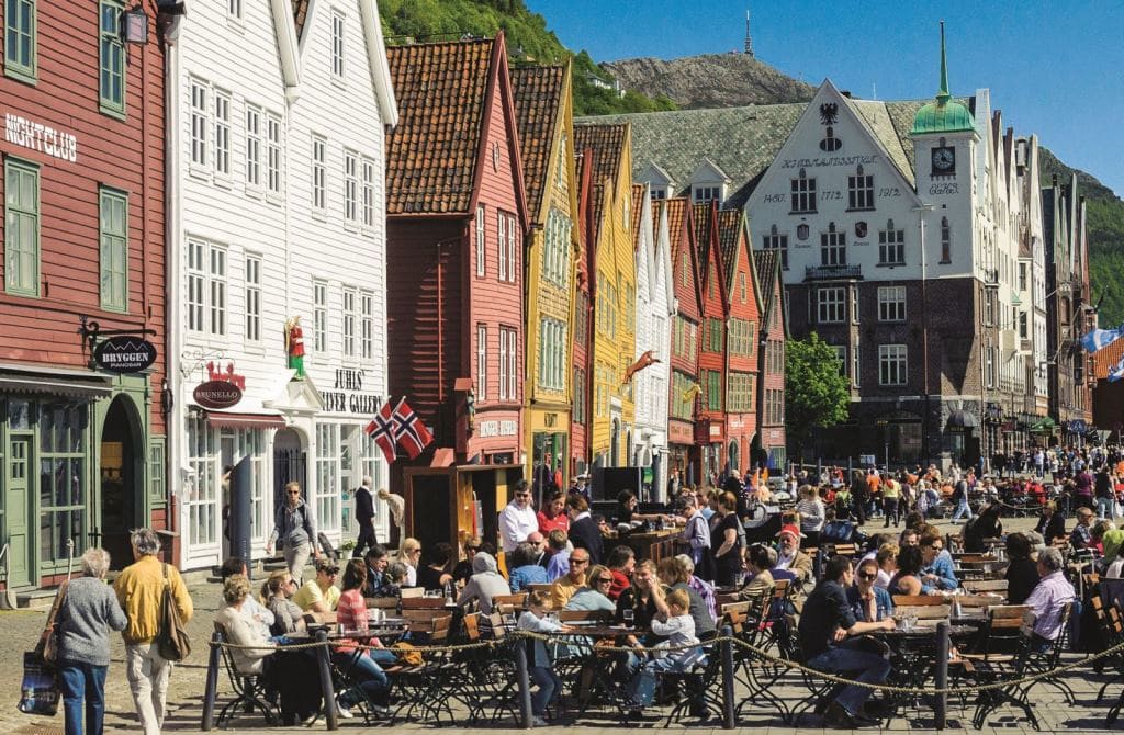
Bergen is a World Unesco port and the down town area considered important as an outstanding cultural inheritance site. This photo is courtesy of Bergen Travel and they must have waited for a sunny day to take it.
Bergen is our final port call of this cruise and planned so the guests have the option of a company tour, or take off by themselves for shopping and sightseeing. For those nautically inclined it has a very nice Maritime Museum with a lot of Viking Era items. Then the old port is made up of wooden buildings from the days of the Hanseatic Treaty in Europe (a sort of European Common market but then between cities) and the wooden houses and warehouses have survived quite nicely. Some of them are still in use for trading purposes but a lot have been taken over as tourist shops. Then further down is the regular main street with department stores, restaurants, bars and supermarkets. A glass of beer here is ultra-expensive and the deck officers had figured out that for less money they could take their girlfriends on the funicular up the mountain for a good look over Bergen with the mountains in the background all covered in rain clouds.
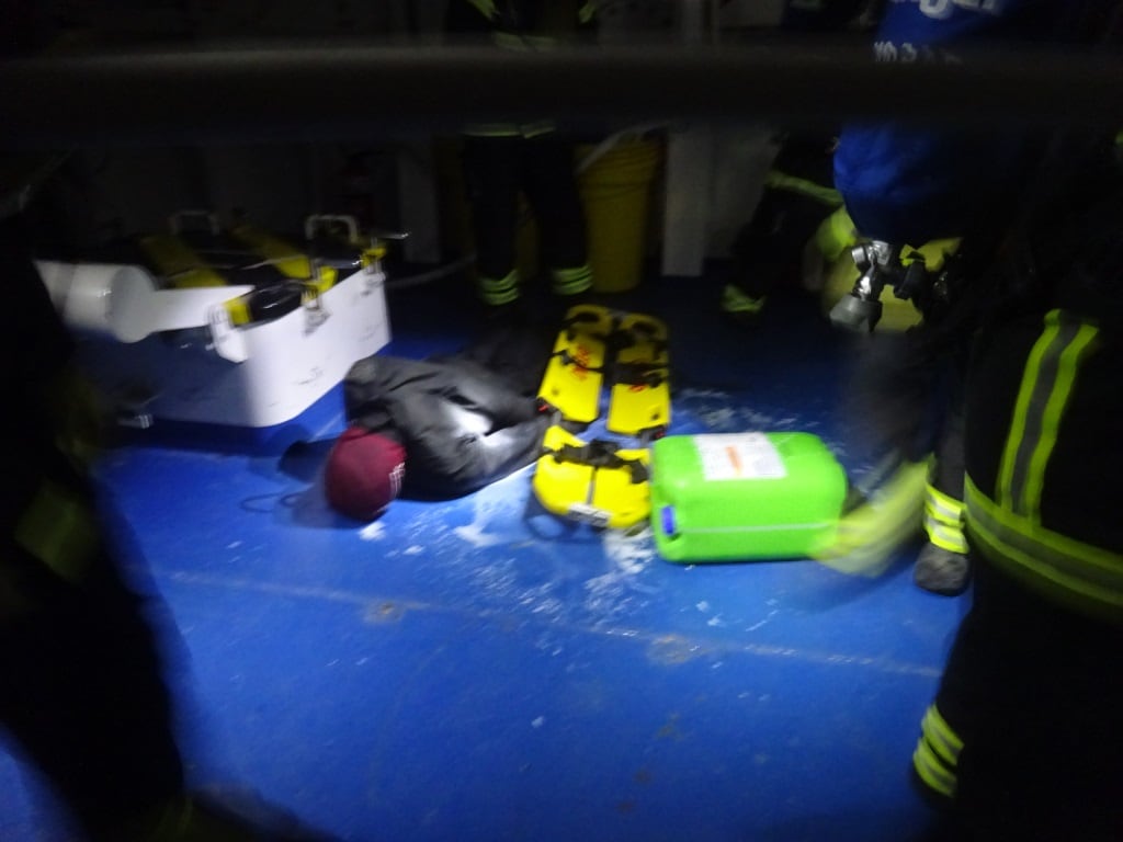
The ships dummy was a willing casualty laying in a chemical spill. He is about to be transferred to a stretcher. I use milk for this as it shows up very well in the dark.
The crew did not have much time to go ashore as it was time for General drill. (Fire drill, followed by General Assembly, followed by disembarkation in lifeboats and life rafts) I ran one of my specials to challenge the teams and had come up with a fire in the Bo ‘sun store combined with a chemical spill. This means that the teams have to combine their trained routines for the various evolution’s into one plan to achieve their objectives. Extinguish the fire, contain the spill and save the casualties.
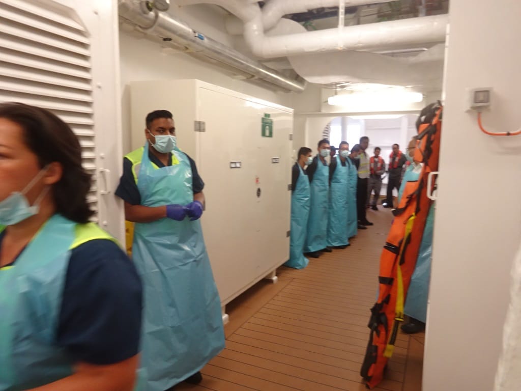
The medical team and helpers ready to receive the casualty covered in chemicals but also to deal with de-contaminating the fire teams coming out.
During the General Drill the focus is on achieving a 100% count of all guests and crew. During a regular passenger embarkation drill that is not so difficult to achieve. But our experience is that in a real emergency there are always a few guests who go in denial or get nervous or freak out. Still we want to save them so we also train for this. And for that we have a whole large team lined up who tracks all the search and evacuation teams on board and then coordinates what is needed to get EVERYBODY safely off the ship. The captain is the last one leaving so I suppose from him it is optional if he wants to go as there is nobody to push him into a life raft and off the ship.
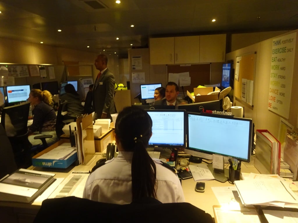
The Muster Control Support Team in action, coordinating the movement of 2500+ guests and 900+ crew.
Tomorrow we are at sea, going back to Amsterdam the summer home port of the Koningsdam. Weather should be good, 24oC / 76oF and a gentle breeze. That will be my last day on the Koningsdam which I will close off with a Holland America Line History lecture for the guests, followed by the handing out of certificates to the sailors and followed by the all-important exercise of packing my suitcase
It is always a bit confusing with this place as the fjord and the town (or hamlet) have the same name. Everybody is talking about going to Geiranger Fjord but we are not really doing that, we only sailing through it and then park ourselves off the town of Geiranger. We can also call it the port of Geiranger as it has a dock for the small local ferries, excellent tender facilities and 3 anchorages for the cruise ships. And then there is space for those ships that have to, or like to, stay on the engines and drift. As I had hoped for, the rain that was predicted must have fallen at the other side of the mountain so we had a dry day. The mountains here are at least useful for something. They cut off internet connection all day but they are nice to look at and they keep the rain away.
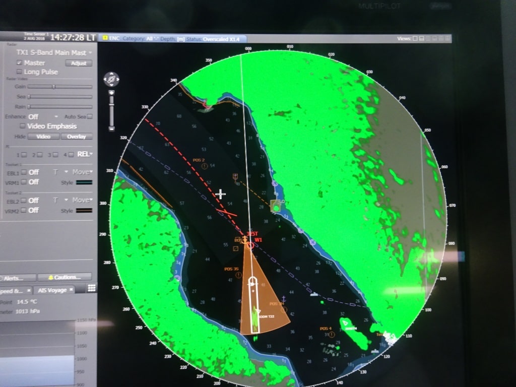
The ms Koningsdam at her anchorage. We are close to the shore but it looks closer than it is. The brown triangle is the safety zone of the ship. If the ship moves out of it an alarm goes off as the safety margin is then breached,
The cliffs of the mountain ranges come directly up from very deep and that makes is possible to anchor very close to the shore side; it also makes it very difficult to anchor as the water is very deep, very dark in color and you cannot see if the anchor is doing its job or not. On windless days that is not so important as the weight from the chain on the sea bed will keep the ship in place but on windy days it would nice if we would be 100% sure if the anchor had dug itself in and was preventing the anchor chain from slipping (dragging we call this) from its supposed location. But today was a windless day and thus one anchor down with a lot of chain and four mooring lines to a bollard ashore was enough. If it had been windy then the ship would have stayed in the middle of Geiranger fjord and would have just drifted on the engines.
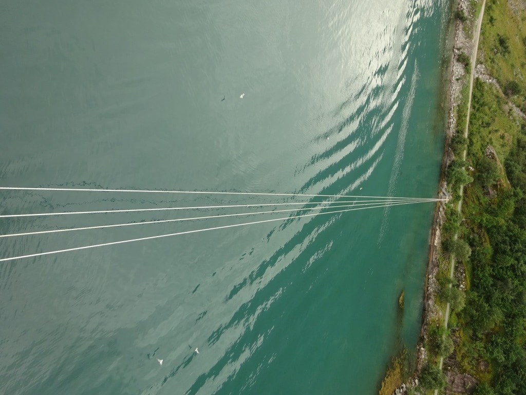
The stern of the ship is kept in position with mooring ropes. As you can see we are not THAT close to the rocks.
As mentioned yesterday with us in port was the Zenith, who was on a shorter stay call and was thus docked on the mooring buoys at the very end of Geiranger fjord. If you have that berth then you also have the option to use the Sea Walk which is a floating pontoon that zig/zags out to the ship and then provides a nice walkway to the shore. In that way at least one ship does not have to use the anchorage and run a tender service.
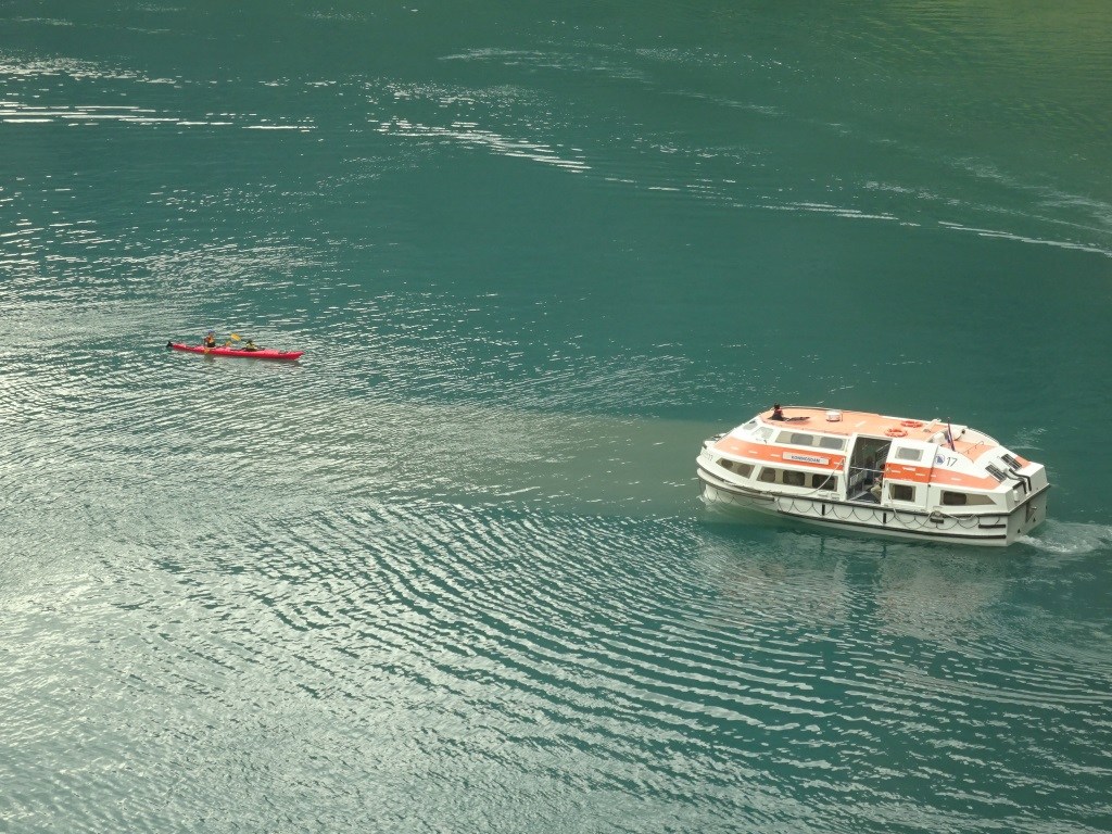
Our tenders are not that big but still dangerous to anything smaller. My question is why do they have to be exactly there? There is 200 miles of fjord around them and they have to drift 100 feet from the ship? The tender driver is standing in his cockpit now, half outside to makes sure he sees everything.
Our tender drivers who freshly obtained their new certificates, had their work cut out today. Normally their challenge is wind, swell and current, today it was traffic. Although it is here the very end of the fjord, there is a lot of traffic. The local ferry is in and out, we had the Midnatsol from the Hurtigruten mail service come in and go out, local speedboats and what we hate the most, kayakers. It is wonderful to kayak in Geirangerfjord as you really feel one with Mother Nature but with larger ships around it can be dangerous. And I sometimes doubt if the companies who rent out these kayaks, warn and train the peddlers to stay clear of all the other traffic. Because kayakers do not pay attention to anything. And even our small tenders have dead angles and could create a dangerous situation. We train our drivers and helpers to be on the look- out at all times as we do not know what the kayakers will do. Our rule for avoiding issues here is quite simple: slow down, stop and wait until you are completely sure of what that other craft is going to do. And today we saw that Golden Rule applied quite few times by the Tender drivers. Stop, Watch and then very slowly go one direction and hope that the kayaker either sits still or goes the other way. If not, then we repeat the process and try going the other way.
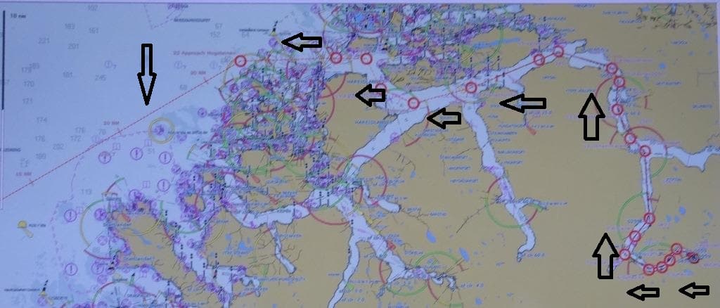
Our route out of Geiranger Fjord. Long evening again for the captain on the bridge.
By 18.00 hrs. we will start sailing out of the fjord again and sail for Bergen. We will disembark our pilots at the pilot station just outside Alesund and then sail south to the pilot station of Bergen. From there it is only 2 hours to the dock instead of a whole long night as is the case with Geiranger Fjord.
Tomorrow we dock, that is the good news, tomorrow it might rain, that is the not so good news. We can only but hope that the rain is delayed as Bergen has mountains on three sides but the rain comes in where there is not mountain range.
Welcome to sunny Alesund. After an overcast day in Eidfjord we saw the weather back from last cruise. Sunny and pleasantly warm. Unfortunately it is not going to last. While southern Europe continues to swelter in the heat (You have to be in Paris at the moment to quickly lose weight) Norway has arrived at the edge of the sunny weather system and in the coming days it is going to look more “Norwegian” again. For Geiranger we are expecting about a 40% probability of rain and for Bergen about 60%. For Geiranger this does not mean very much as it can be on one side of the mountain or on the other side or exactly in between and then we will get it. Bergen is the rainy capital of Norway as it catches most of the rain coming in from open sea and the incoming clouds then hit the mountains which surround Bergen. But savor the day in Alesund; and we are staying late so the guests can make the best of the weather.
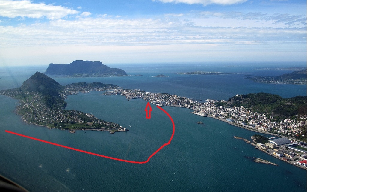
Beautiful Alesund and our approach to the dock. Two large ships can dock at this location and we had an “Apartment of the Seas” behind us today. Then at the other side of the town there is a another dock for one more big ship or several smaller ones.
For most of our journeys here in Norway we are under pilotage as most of the time we are in Norwegian Waters. When we sail deep into the Fjords we normally have two pilots on board so they can run shifts on the bridge. This does not mean that one is in bed and the other one on the bridge. Normally they are both there but relieve each other on a two hour cycle in order to stay fresh and focused. Most pilots come out of the Hurtigruten coastal mail system but some are from the Navy and a few come from deep sea. The Royal Norwegian Navy is mainly a coastal defense navy and thus they are in and out of the fjords all the time.
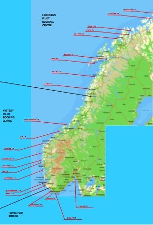
An overview of all the pilot stations of Norway. The black lines indicate where there is a Pilot dispatch center for the coordination of all services.
To serve the coast there are a large number of pilot stations dotted along the coast. Most of the time right in front of a fjord or sometimes north and south of a main city such as Bergen. To get our pilots scheduled we use our Agent in Norway and as this agency looks after most of the cruise companies it works out very well for the arrangements. The agent works closely with the pilot dispatcher to get pilots on board in the most economical way. Embarking two pilots and keep them on board for the whole coast does not really work as the coast is very long and the pilots are specialized in certain sections of the coast. As an example the Oslo pilot comes on and goes off at the beginning of the fjord and does not sail on with the ship to Kristiansand which is just around the corner.
When the pilot station and the sector is somewhat in between two locations then we can have the same pilots on board. Thus our friends from yesterday for Eidfjord stayed on to take us to Alesund as well. As we are staying a long time in Alesund, they went home after breakfast (very important for pilots) and tonight we will get two who will take us to the Geiranger anchorage. Most likely they will stay on for the return trip but they could be relieved in Geiranger as the access from the port the National road system is very good. The pilot system is based on the average usage of traffic and thus they are quite strapped for pilots on occasion during the summer time when all the cruise ships are coming in. And quite a few of those ships will be going deep into the fjords. Either to Eidfjord or to Geiranger or into the Sognefjord (the smaller ones which fit under the bridge) to look at the pulpit rock. Hence our agent has his hands full with getting the reservations confirmed on time and having the pilots lined up at the right time and in the right place.
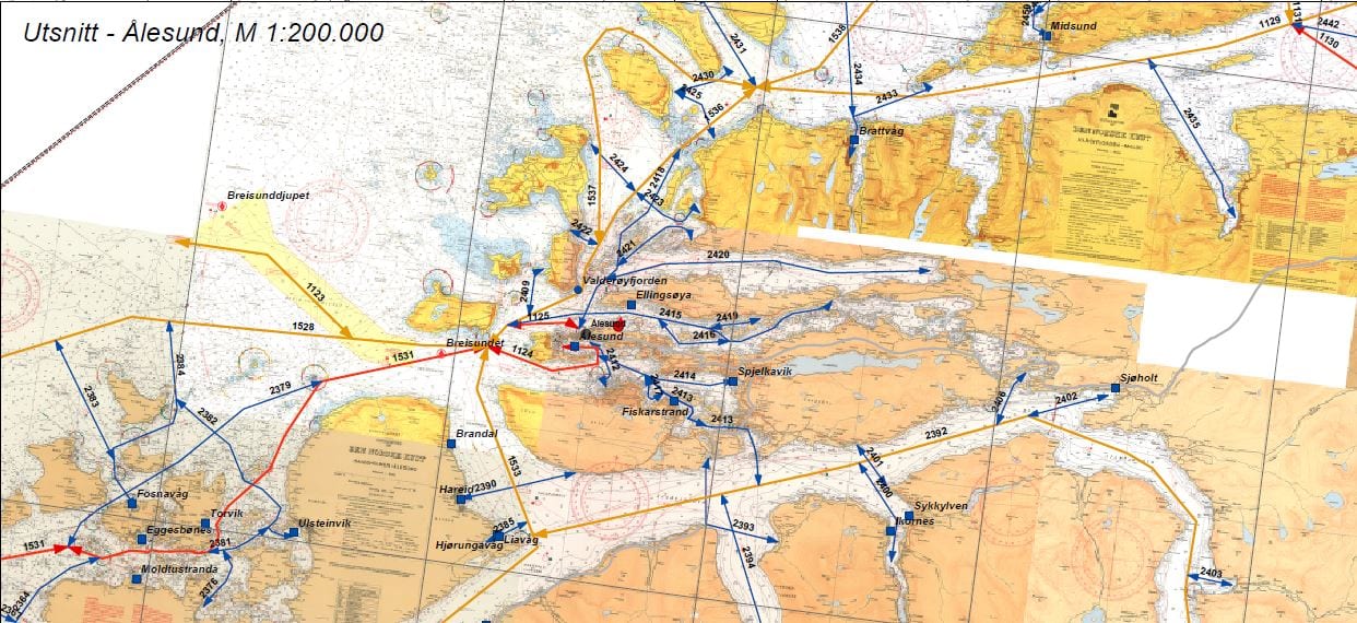
This is Alesund pilot station with an indication of all the routes the pilots are looking after. This evening we will follow the brown route going down and then going East into Geiranger fjord.
My right place was in the tender today as it was Sailor re-exam for tender driving. The company requires a yearly evaluation of their skills to ensure that they run a safe tender system for our guests. Something they have to do again tomorrow in Geiranger as there is no dock there.
We should be all set in Geiranger by 08.00 hrs. We will be together with the Zenith which is on a shorter stop and therefore it is expected that she will be scheduled closer to the tender dock than us. We have six tenders so for the distance it does not really matter that much. I just hope that the rain will decide to drift into another fjord and we will have a dry day.
It was a busy day in Eidfjord with two ships in. As there is only one dock, the Pacific Princess of Princess Cruises had to go to the anchorage. As there is not much of an anchorage, the fjord is very deep everywhere near the port, she stayed on the engines. For most guests an unusual sight because as she was drifting she did not stay in the exact same position all the time. Which made one of the guests wonder if the captain was drunk. In the old days we would have probably just said yes but as Princess Cruises is now our sister company, we are friends and do not stoke the fire anymore, and thus the guest received a truthful and detailed answer from one of the officers. We docked because we were the biggest one in port today, so it made sense to inconvenience as few guests as possible with a tender ride. The PP carries about 800 guests which is less that our total crew count.
When the ships are nearly the same size, when together in a port with limited docking space, then the pecking order changes. Preference is then given to the ships which call the most often. Which here in Norway is Aida Cruises. Also part of Carnival Corporation and thus also a sister company but from a different branch. In the same way as Princess and Holland America have been teamed up, Aida has as her partner company Costa Cruises. You would think that it would make more sense to team the Dutch up with the Germans but the decision to line up the various brands in groups was not done because the officer might have a link but because the products, the Brands, are close together. Both Aida and Costa have very large numbers of Europeans on board (Aida nearly 100% Germans) and that translates into similar ways of approaching the operations. Regardless whether it is with a German flavor or with an Italian flavor. (Bratwurst or Gelato??) As Holland America and Princess draw most of their clientele from North America, the logic is there as well.
Germany has a population of around 83 million people but has a very high percentage of cruise interested people, more than most other countries. And they are very interested in going to Scandinavia or the Nordland as they tend to call it. And they have been doing that for a very long time. When other company’s still had to discover that going to the fjords was interesting, the German shipping companies were already there. With the first ships calling as far back as the 1890’s. For more details have a look on this blog site under the drop down box Of Days Gone By. There is a story about the first REAL cruise ship ever built and one about the first real MASS market cruise ship. Both German, both going to the Fjords.
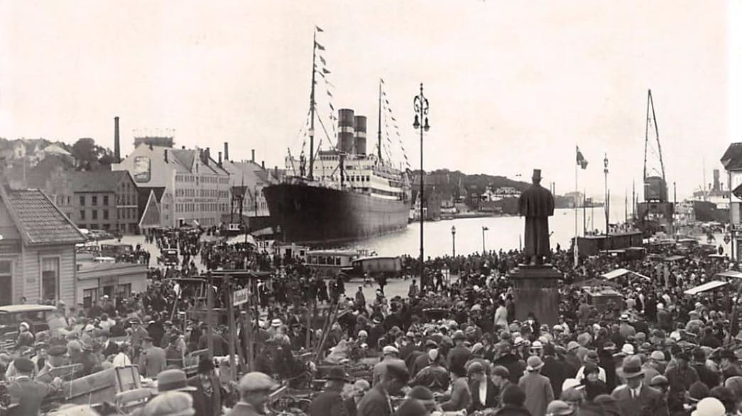
The ss Rotterdam in Stavanger Fjord. She is seen here docking in almost the same position as the Koningsdam last cruise. The KODM was a bit further back. The white buildings are still there and now house the Stavanger Maritime Museum. Those were the days that a cruise ship called and the whole town came out for a look.
Holland America went to the Fjords for the first time in 1933 with the ss Rotterdam (IV) and then popped up occasionally with the Veendam and the Volendam. But most of the “North land” trips were made by passenger ships from the company’s from Amsterdam as their ships were smaller and easier to fill. After the 2nd world war our ships returned but mainly on long cruises from the USA. It was not until the expansion from Holland America into the S Class that Scandinavian ports appeared regularly on the schedule.
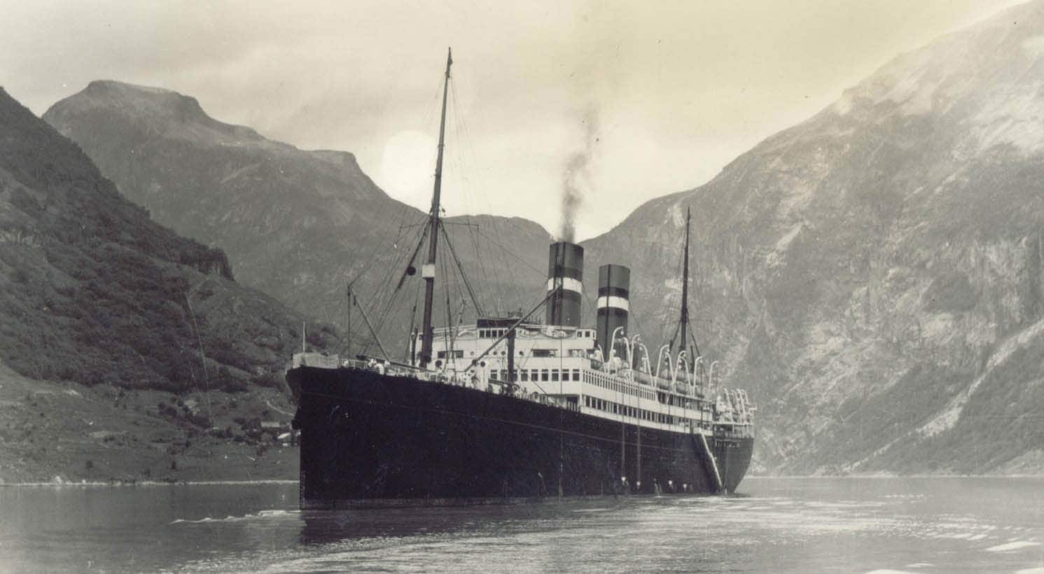
The ss Volendam at anchor in Geiranger Fjord. She is also just floating due to the deep anchor ground. We will be in the exact same position the day after tomorrow.
We stayed in Eidfjord from 0700 hrs. until 15.00 hrs. under an overcast sky with the occasional rain shower. Tonight it should really belt down (although maybe not where we are as there are everywhere mountains in the way) and then tomorrow is should be a sunny but a cool day.
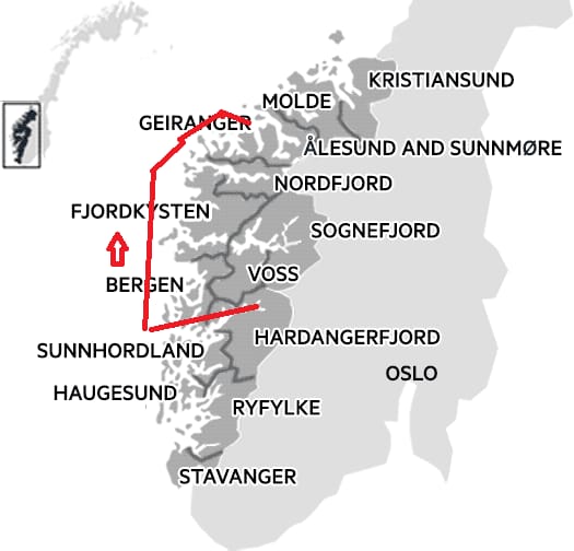
We will bypass Bergen as we will call there on the way back. Alesund is at the entrance of Geiranger fjord so we can make the call at Alesund a long one and we will be staying until 23.00 hrs.
Tomorrow we are in Alesund and to get there we have to race all the way out again, dip into the Norwegian Sea and then hop back in again. That going back is only 10 miles as Alesund is very close to the ocean. If all goes well we should be docked by 08.00 hrs. We will be together with one other ship, the Independence of the Seas but Alesund has some large docks with room for 3 or 4 ships so we all can dock.
Weather: dry 16oC / 61 of and with the sun coming out.
Thus we are on our way back to Norway and we are sailing under a cloudy sky. Courtesy of the British who from somewhere conjured up thunderstorms and rain. We got a bit of that rain dripping upon us in Amsterdam but it was only enough to settle the dust, not enough to make the farmers happy. The cloud cover now extends over part of England, the North Sea, the Skagerrak and the Norwegian Sea. That will result in a cloudy day in Eidfjord with some rain in the late evening.
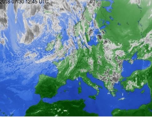
A band of cloud with rain and thunderstorms came over Europe yesterday, but should slowly move away in the coming days. For Norway it will depend on how it moves to get either sunny or rainy weather again. (Photo Courtesy www.WeatherOnLine.com)
Then this band of cloud should move by and sunshine should return. Although it is expected that the heat wave will also return to Scandinavia, but if it will, will depend on the way the Jet Stream will lay. Thus far it was instrumental in maintaining a large high pressure system over the whole of Europe and keeping the clouds away; but it only has to move up, or come down a little bit, and the whole thing can change. There is a chance that it all will settle on a slightly lower trajectory and if this happens than Scandinavia will get its rainy weather back and go to normal temperatures. Everything south of Edinburgh will remain in the hot zone.
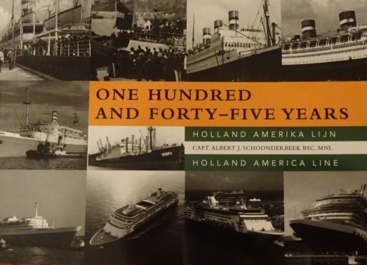
Published in soft back, size A 5 and 147 pages.
Whatever happens to the weather, I am a happy camper as yesterday I received the first copy of my new book: One Hundred and Forty-Five Years (of Holland America Line). As the last book with the complete history (400+) pages came out in 1998 and is only available 2nd hand anymore; I thought it was time to do something new. Instead of making yet another standard work, I went for a descriptive option, with one page devoted to each year of the company’s history.
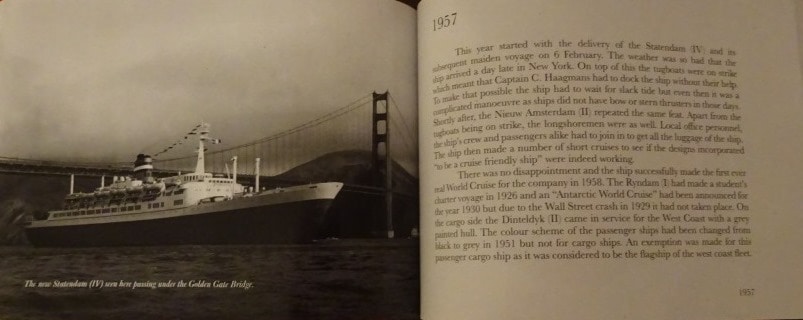
The photos from the older years are in black and white and then coming closer and closer to the current day they change to colour.
Thus 145 pages (but as we really started in 1871 with a small company which was transformed into Holland America, it is really 147 pages) with a text to the right and a fitting photo to the left. Although I think it is a wonderful book, we have to wait and see if the public agrees so the printer is going for low numbers at the moment. The shops on board have shown a tentative interest and hopefully that will work out. My publisher is working on revamping his website into English so –non Dutch speakers – can also get hold of a copy and that revamp should happen in the coming days. (ISBN 9-789492-368294 www.gunsathome.nl) Next project will be a similar book, but about the Cruise history of the company which started in 1895 and continues to the current day. Most authors have always focused on either the fleet itself or on the North Atlantic but Holland America organized some very fancy cruises in the past. Although some big dreams were cut short due to the depression or the world wars. (So now you know what I do during my time away from the sea)
As mentioned in my previous blogs, Holland America normally has one Tour focused port in its cruise while the rest of the ports are mixed options. (Those are for our cruise Alesund and Bergen) Eidfjord is our focused Tour port tomorrow as the town is very small but the hinterland extraordinary. From waterfalls, to Nature Centers & the Hardangervidda National Park, outdoors activities and taking a cruise on Hardanger fjord which gives access to Eidfjord. Most of the Holland America Tours offer a combination of visiting sights and lunch, drinks and nibbles, to offset the overpowering nature with a bit of social interaction. Everything here is close by and most tours do not need more than 30 minutes to get to a dedicated destination. You do not have to travel to get to see Mother Nature here, it will be around us 24 /7 and you also will be able to see it nearly for 24 hours a day as the Norwegian days are still very long.
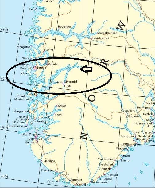
Hardanger fjord penetrates deep into the Norwegian land. Only Alesund and Bergen are fairly close to the sea. (Chart courtesy Lloyds World Atlas 2005)
For the captain and the navigation and engineering teams it will be again a long day as the pilot has been ordered for 02.15 in the morning and then we should be docked 07.00 in the morning. We are staying here until 15.00 hrs. and then we have to go the same way out.
Weather: Overcast with a chance of showers in the late morning and afternoon. 18oC / 65oF. Regular normal weather for Norway and as we will be tucked away deep into the fjord there should be hardly any wind.
I sometimes think that the guests do not always appreciate how many hours the officers on the bridge and in the engine room make while on these Norwegian Cruises. Hotel can normally continue their shift work day in day out but for upstairs and downstairs it all depends on where we are sailing. And with the Koningsdam on the 7 day run it is really hitting hard. This morning the captain was on the bridge by 02.15 and did not see his bed until 07.00 hrs. when the ship docked. Then by 10 am he is supposed to be around again to meet with people who are, or who think that they are, very important and then in the afternoon by 15.30 (Guest boatdrill) it starts all over again and then it will last until 22.00 hrs. before the Koningsdam is safely back in deep sea again. Tomorrow’s sea day sees all the social stuff and then it is back to early standby’s as the Koningsdam goes deep into the fjords. Wonderful cruises and great to do but after 2 months every Captain dreams about a Atlantic crossing with 6 or 7 peaceful sea days in a row. (Most captains also dream of sitting at home in the garden with a Heineken on the table………. but for that you do not have to be a captain).
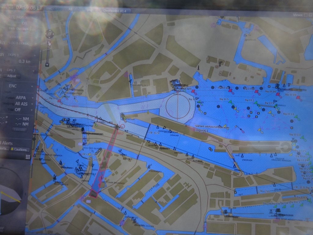
The port of Amsterdam as seen on the electronic chart. The cruise terminal is indicated by the purple beam and the large turning circle is to the right. All the black triangles indicate ships that have an AIS transponder. These are not compulsory for small ships but many skippers who sail around Amsterdam in the fog have them so at least the are seen on the radar, if not heard.
But we docked safely again this morning, joined a little bit later by the little Astor witch would fit 5 times inside the Koningsdam and sat as a small tugboat under our bow. But smaller means also visiting smaller ports and that is also good fun.
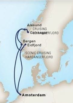
Our cruise plan for voyage 87 from 29 July to 05 August.
Today we said goodbye to nearly all our 2900 guests. The regular ships capacity is 2500 but it was school vacation time so there were about 400 younger people on board varying from 2 months to 17 years and the ship was heaving. Still with all the ports, the ship was never over crowded or in a chaos. This cruise we have a full house again but I do not know the total numbers yet. We will call at Eidfjord, Alesund, Geiranger in Geiranger fjord and Bergen. Four ports in seven days. With the long sail ins and outs and Amsterdam being a day sailing away this is as much as you can press into a seven day cruise.
We docked today starboard side alongside for propeller cleaning but also for hull cleaning. While sailing, algae sets itself onto the hull, turning the red under water ship into an emerald green one and that growth slows the ship down by about 10%. The Koningsdam will get a new sort of paint applied in December which will stop most of this growth but as December is still far away, the company has decided to clean the hull. We get the costs back in one or two cruises due to less fuel consumption, making a sound investment. For this purpose a large barge comes alongside and lowers a scrubber machine in the water which (with magnets) locks onto the hull and then travels from bow to stern scrubbing all the growth off. This machine is under water accompanied by one or two divers who steer it where it has to go. Removing this growth from the ship and then letting go into the water does not affect the local environment as the growth is already dead, so carries no toxics and will just decompose.
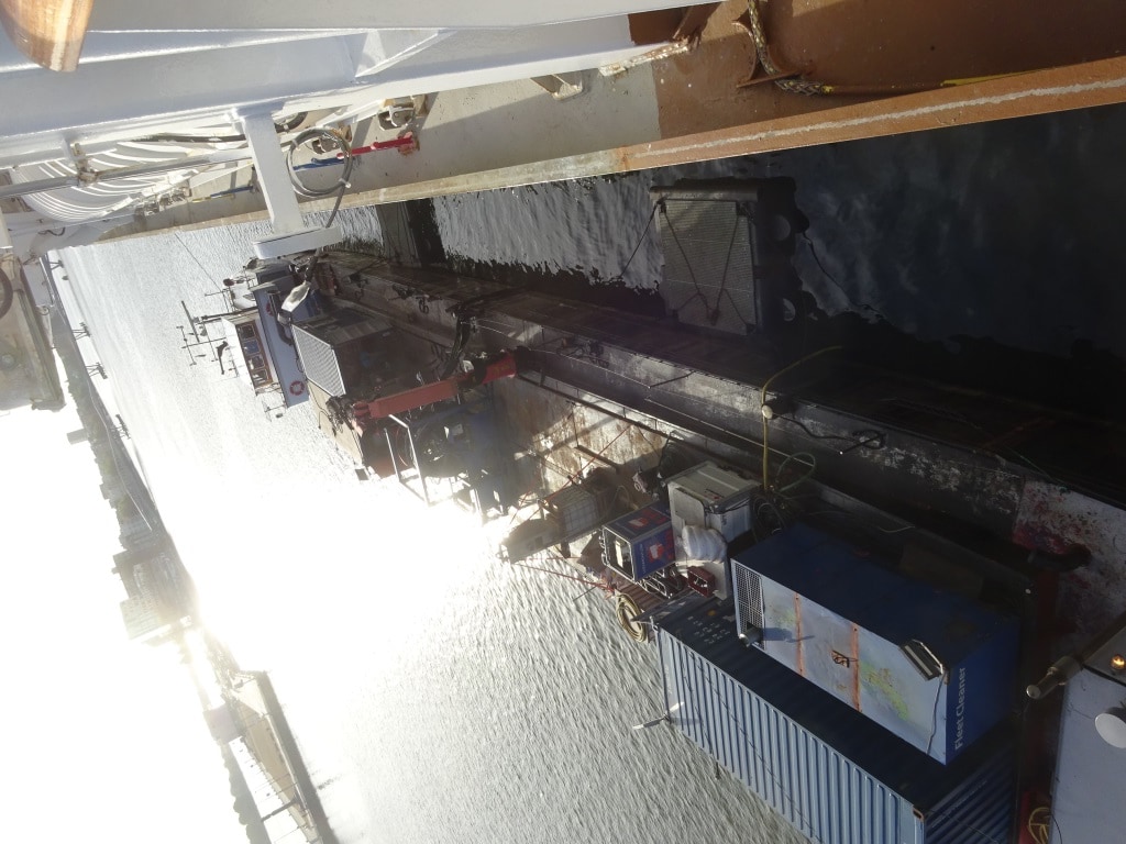
The river barge which is a diving headquarters. The cables for the scrubbing machine are kept on a large drum and pay in an out depending on where the scrubber is located.
They come by barge as most transport and service company’s use self propelled barges as it works a lot easier and you never have any parking problems. Hence we had apart from this barge, a fuel barge, a lub oil barge and also a water barge alongside. The latter was here to top the ship up as we make our own water but it is more cost effective to load from shore in port than to run our own onboard plants. Hotel supplies still come by truck as many of the distribution centers are not near water.
We will sail this evening around 17.00 hrs. and because we docked nose in, we have to sail first south in the Amsterdam – Rhine Canal to the large turning circle before we can head for open sea. The turning circle opposite the cruise terminal can handle ships up to 225 meters but then it gets tight, so they arranged for a bigger one a little further down.
Today the weather was considerably cooler due to a weather system with thunder storms coming over from South England. That is going north and we will follow it. So we might have one day with a bit of rain somewhere, depending on when the Koningsdam catches up with the system but then the Norwegian heatwave should return.
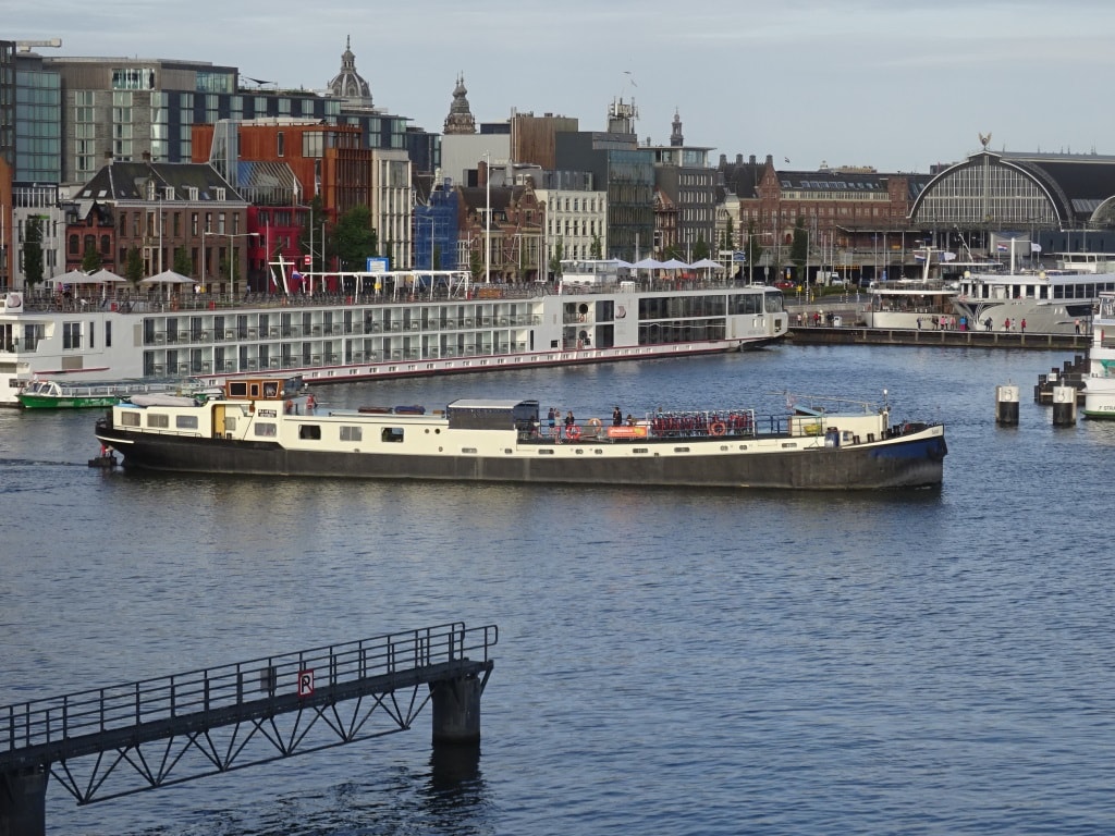
Amsterdam is an important cruise port. Not only deep sea cruise ships also river cruise ships, and we also have these Barge & Bike cruises. Probably the only cruise where you do not put on weight.
Today we have our final day of the cruise and are on our way back to Amsterdam. As we are still in the middle of this high pressure system, the weather stays unabatedly beautiful and the only thing I can say is that we moved from a Norwegian heatwave into a Danish heatwave as most of the day we were sailing in an area which is called the Skagerrak. This is still the North Sea but the piece along the Danish coast up to the Norwegian coast. There it becomes the Kattegat where the North Sea connects with the Baltic. It is a bit of a question where the Skagerrak exactly ends and the North Sea begins. Scandinavians are quite focused on using the name Skagerrak; sailors seem to keep calling it North Sea until their ship sails over the letters in the chart that gives it the other name.
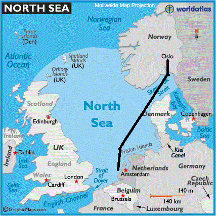
Our route from Oslo to Amsterdam. The water remains the same, the names change. (Thank you World Atlas via Wikipedia)
Whatever the preference, it is all the same water, water that comes from the North Atlantic Ocean flowing in north of Scotland or from the south through the Straits of Dover which the French call La Manche. The Dutch have adopted the English name: Straat van Dover while the Germans have gone for the French version: “Armel Kanal: which in both languages means sleeve or bent arm. And the bend in Dover Strait resembles something as a bent arm. The Dutch being the inventors of double Dutch have of course a second name for the strait: Het Nauw van Calais or the Calais Narrows, which makes sense as well as Calais is right on the edge of the narrowest part. Hence the fact that most ferries are sailing from Dover to Calais and back and also the Chunnel has its submerged pipes right here. So things are not so simple with the names in this area and the Skagerrak name is just one of them.
Unfortunately it is us the Dutch again who are also responsible for this name. Rak, in old Dutch means a straight Strait (so not a bent strait one as Dover Strait is) and thus we are speaking over here about the Strait of Skagen; the town on the east side of Denmark where the Skagerrak becomes the Kattegat. To make things worse the Dutch are also responsible for the name Kattegat. Kat = Cat and Gat = hole. The meaning is that this thoroughfare is a hole so tight that only a cat can get through. All these names are from the 17th. Century when the Dutch were the most powerful nation in the world and had the biggest fleet, produced the best charts which were then bought and used by the rest of the world. And so the names stuck.
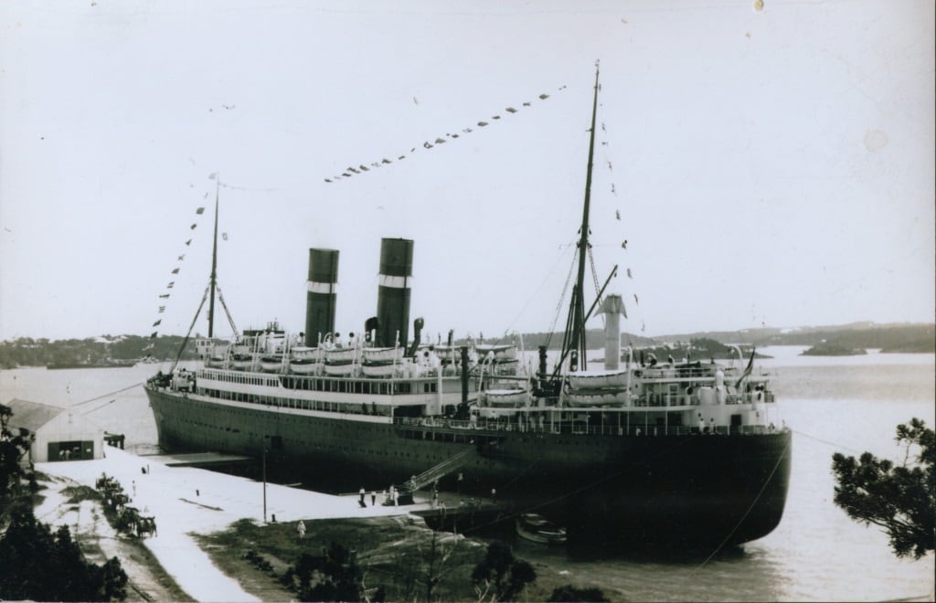
The ss Veendam (II) docked at what we think is Bermuda. Please note the wind catcher above the aft lifeboats. This was the only form of A.C the ships had in those days. Going on a cruise was not for the faint hearted. The ships also went to Norway so they might have also experienced a “Norwegian Heatwave”.
Until well into the 19th. Century the Dutch dominated the trade to the Baltic and Russia and Holland America has its own connection with this, with the town of Veendam in the North of the Netherlands. Our current Veendam is the 4th. ship which carried this name. Veendam was such an important town of ships registry that Lloyds Register (and Lloyd’s insurance) opened up their first foreign office here in this town in Holland.
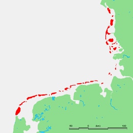
All the islands in the North Sea protecting the Frisian Hinterland since times immemorial. (Unknown Source on the Internet)
When sailing further down we come to the Frisian Islands. Also here enough room for confusion. As we have the west Frisian Islands (Dutch), the east Frisian Islands (German) and the north Frisian Islands (Danish). The Frisians are an ancient tribe, with their own language, who in the course of history got divided over what are now The Netherlands, Germany and to some extent Denmark. Thus the islands are split up as well between the three Nations. Normally when one speaks about the Frisian Islands the focus is on The East and West ones. The biggest ones belong to the Netherlands: Texel, Ameland, Terschelling, Vlieland, Schermonnikoog and then there are 9 more which are uninhabited. The Germans have more of them but on average smaller: Borkum, Juist, Norderney, Baltrum, Langeoog, Spiekeroog, Wangerooge, Neuwerk, Pellworn, Nordstrand (but now connected to the mainland) Halligen, Amrum, Fohr and Sylt. And they have 17 un-habited islands. On top of that the Germans have the island of Helgoland which is not part of the series but does belong. In the same way as Barbados is outside the Caribbean island ring but still considered to be part of the Caribbean. Then these Frisian Islands are part of a chain which runs from Texel all the way up to the Kattegat and those we call altogether the “Wadden Islands”.
So far the geography we are sailing past today. During the night we will come straight down the coast and then very early tomorrow morning we will be sailing into the North Sea Canal. In Amsterdam we will be docking Nose in, Starboard side alongside because we have a propeller / Azipod inspection. Last cruise we went portside, so they inspected the starboard pod and this time it will be the portside pod.
Weather, no change from expected. Warm but not so warm as in Norway. 28oC or 82oF.
© 2025 – Captain Albert's Website and Blog –
Theme by Anders Noren — Up ↑
