- Captain Albert's Website and Blog -

Ocean Liner History and Stories from the Sea, Past and Present. With an In Depth focus on Holland America Line

Category: CaptAlExport (page 24 of 203)

26 June 20117; Gulf of Alaska.

It was not the greatest weather we had today but it was quiet weather. Just a low swell was running and we had a following wind and thus we hardly noticed it on board. For all the new guests not a bad way to start a cruise, especially as we have a lot of new, new, guests on board who have never made a cruise before. Quite a few of them follow the logic: “if I do not like it, then at least I have not spoiled my complete holiday” as they will still have enjoyed the overland part of their Alaska trip. Most of them do enjoy the experience and we gain every cruise a lot of new Holland America Line passengers, who will then come back for our Caribbean or European cruises.

As mentioned yesterday, the crew were looking forward to the end of Ramadan and the special dinner that goes with it. Holland America is very focused on providing the food that the crew likes and that includes a lot of ethnic foods. With normal cruise operations the ship work’s on a 14 day menu cycle that repeats itself. The crew knows what is coming and also the company can fine tune the delivery and quality of each dish.
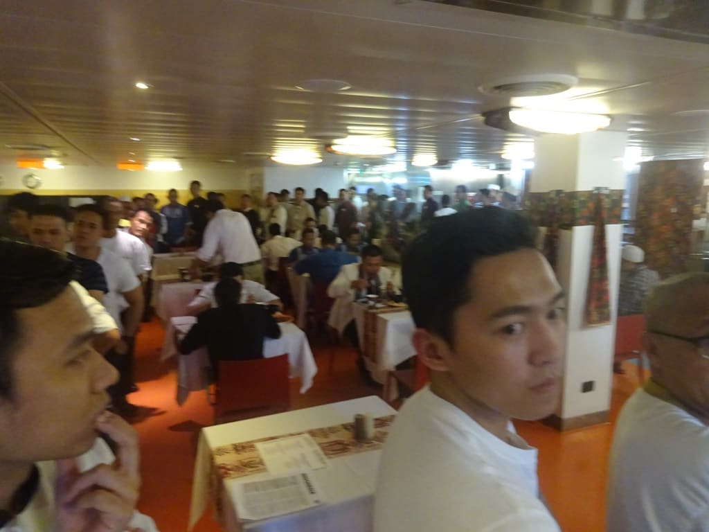
Normally the crew comes in, in staggered numbers. Not today; special food and the line was out into the crew corridor.

With high days and holidays there is always something extra and everybody joins in. It is amazing how many crew are Christians during the Christmas dinner and how many are Muslim during the Idul Fitri dinner. I think it would be beneficiary for the world’s peace if every religious leader would be required to have a cook’s license before being allowed to preach. I think it would make a difference.
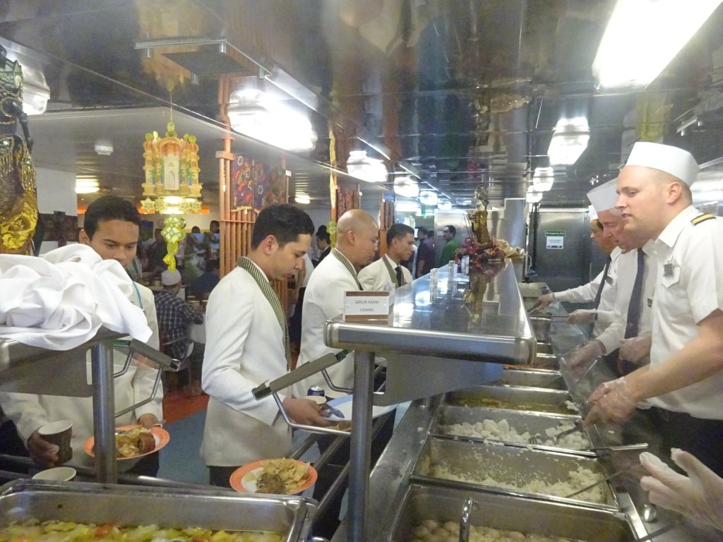
Part of the serving line. In front of the counter Diningroom Stewards who now get served instead of serving themselves.

Another tradition is that the Ships Staff serves the food during dinner. We cannot do table service as there are too many crew but we stand behind the serving line and dish out all the special foods for the celebration. The officers rotate on 30 minute slots through the dinner period and at each period there are about 5 or 6 behind the serving line dishing out. As there was a gap at the start of the dinner, my colleague Captain Bos asked me to help out and that gave the unique situation of having two captains in the serving line at the same time. I was doing the rice and he was doing the spiced liver.

A dinner like this takes a bit of planning and through the years the company has figured out a menu for this celebration which pleases everybody. We cannot simply decide to do something at the last minute as the ingredients have to be purchased ahead of time and then have to be brought on board. Our provisioning takes place in Vancouver and that means that the Culinary Operations Manager (budget), the Executive Chef (menu decision and amount calculation) and the Provision Master (inventory control) have to decide at least 3 weeks in advance how much they need from the more exotic foods which are normally not part of the menu cycle. And then we all hope it arrives on board on time.
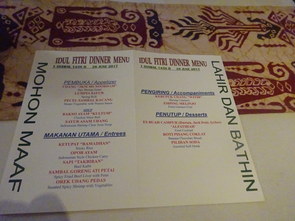
The special menu in the Indonesian language and English so the Philipinne community can also choose.

As usual itis the Cooks who suffer the brunt of all the work while the others feast on the results. The cooks in the crew kitchen under the leadership of Kokkie –Satoe, (Dutch/Indonesian for First Cook ) need to prepare it and that takes more than a few hours. Normally the marinating and other prep work starts a few days ahead of the official date. Then cooks seldom get to enjoy a good sit down to enjoy the fruits of their own labor. Still they must get the chance to eat as I seldom see a skinny cook on our ships, at least not after the first contract.

Tomorrow we are in Glacier Bay, picking up the Rangers at 07.00 hrs. and then sailing up and down the Bay until 17.00 hrs. The weather forecast is not that great, no sunny day is expected, but there are no plans for rain to occur. Still Glacier Bay has its own climate due to the high mountains on either side and the proximity of all that Glacier ice, so we really never know what we will get until we are sitting in the middle of it.
 

25 June 2017; Seward, Alaska.

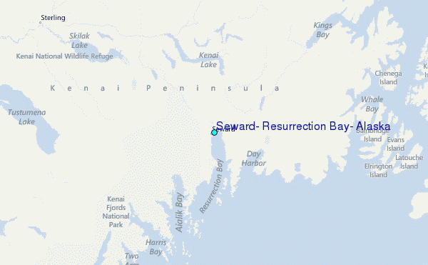
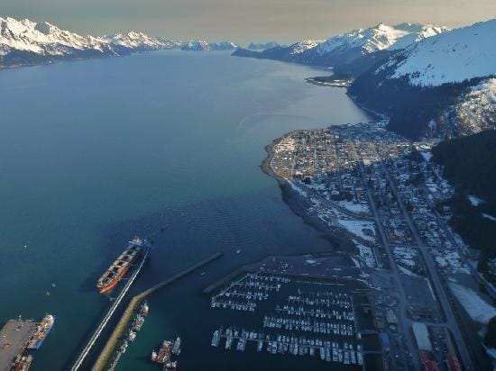
Seward is located at the end of Resurrection Bay and used to be the Ferry connection to the interior.

We had a glorious day today while the temperatures remained under the mid-sixties (18o Celsius) Just low enough not to cause restricted visibility and just low enough not to get hot and bothered while pulling suitcases. But high enough to enjoy a gentle summer morning while travelling. This is a very early morning arrival for everybody and certainly for the ship’s crew. The guests coming from the overland tours mostly arrive in Anchorage the night before, so do those who fly in for the cruise only experience do the same. They all converge on Anchorage, which is a 2.5 hours’ drive from Seward. How to get 2000 people down there and the same number back is logistical tour de force. And thus you have to start early.

The dock is to the left of the cargo ship which is docked at the Coal terminal. We do not like a ship at that location when we are in, as it makes it difficult for us to get in. But the Marina is nice for tender training. Wintery stock photo from somewhere on the internet.

The ship has to be docked by 05.30 and the first wave of disembarkation starts at 06.00 hrs. This means that the Bridge and Engine room go to battle stations around 03.30, when the ship approaches Resurrection Bay (*). The pilot comes on board at the entrance at 04.30 and then the ship will just be docked at 05.30 hrs. with the gangway out. Contrary to other disembarkation ports, most guests do not have to take their luggage with them on the coach. They either find it back at the airport or at their first hotel stop while going overland. So when the first wave leave at 06.00 hrs. to take the train to Anchorage, the luggage is still being offloaded and is following in a truck.  The system seems to work very well as I seldom hear about problems with a suitcase ending up somewhere else than where it was supposed to go.

(*) And I do not even mention the hotel department, as breakfast starts at 05.30. which means some of the cooks are already running around at 03.30 in the morning as well. If to boil an egg takes a lot of planning let alone to set up the complete lido buffet and be ready for 300+ guests who all show up at the same time.

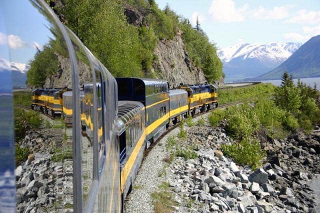
We use the local train service from Seward, but they do have Panoramic Cars, before the guests move to our own trains to Denali.

Then for the remainder of the morning, groups are being called out, they call them “waves” here in Seward, as soon as the busses are available. These busses or coaches take some groups to Anchorage where they change to our inland trains or to other buses which go up into the interior. These shuttle buses then bring back the new guests to the ship. The result is a very staggered and non-rushed operation with the last guests arriving around 18.00 hrs. at the ship and the last luggage being on board by 19.00 hrs. The follows boat drill and then we are on our way south again. While a whole port call in Ft. Lauderdale takes (pilot to pilot) from 05.30 to 18.30, here the whole evolution lasts from 04.30 to 21.00 hrs. Although the pace is less hectic.

Today we also had the end of the Ramadan for our Muslim community and that is normally celebrated with an Idul-Fitri meal. Because of change over day we had to postpone that until tomorrow as such a celebration should not be rushed and the special food for the feast meal needs more time to prepare. In the same way as we sometimes move Christmas dinner for the crew as well, if it is too close to embarkation day.

I took my school class down in the tender today, for their first practical lessons of tender driving and a lot of the conversation was about if the Cook would get the fried rice (Nasi Goreng) exactly right. That seems to have been an issue in the past. I always like it when they are nattering away in their local language as you pick up interesting tid-bits of information and sometimes they are quite shocked that I understand much more than they think. 37 years of being involved with Indonesians gives you a good insight in the language even when they speak a sort of sailor slang.

Teaching a novice how to drive a tender and make him understand what is better is not so easy, as most of the trainee’s think that speed solves all problems. Either full ahead or full astern. This is not the case as it only makes the tender harder to control so I try to explain that driving a tender is like dancing with a very big and tall lady. You cannot get your arms around her, she is much taller than you are, and if you push her, you cannot stop the momentum. So you have to nudge her gently to sway with her over the dance floor in the right direction. So we spent a whole morning dancing around the ship and in and out of the Marina.

Tomorrow we are at sea again, retracing our steps to Glacier Bay. The Gulf of Alaska is to remain quiet for the coming days with only a low swell running from the South West. It should be a nice ride with a gentle breeze pushing in the back.

24 June 2017; At Sea, Gulf of Alaska.

The weather forecast today did not run in tune with the actual weather. Where the expectation had been for a clear morning followed by increasing cloudiness and rain in the afternoon, the reality was the other way around. Most of the day turned out to be gloomy but then it cleared in the late afternoon. Not good for today but certainly good for tomorrow as we should now have a sunny day in Seward. For the guests who leave us, it will be a nice way to start the overland journey.

Outside there was little to be seen, which was a pity as it was wind still for most of the day. It would not have been very difficult to spot wildlife in the waves. But all was quiet. So guests had to find things to do inside the ship and I am happy to advice that about 400 decided to attend my Holland America Lecture and thus now they all know where the company came from and where it is going.

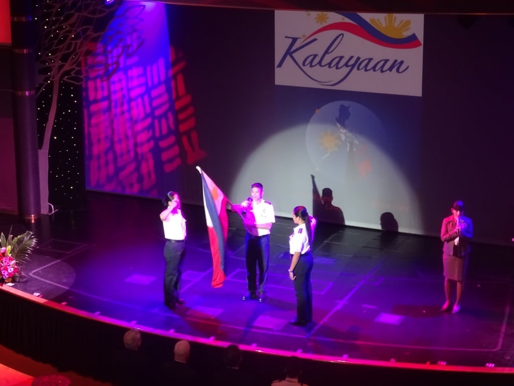
The ceremony always opens with the singing of the National Anthem. Flag raising is doing done by the Security Guards and the song sung by a Lady from the Front Office.

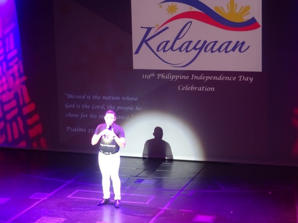
With such a quiet day, it gives me chance to publish something I did not get the chance to do before. Philipino Independence day. On June 12 the Philipino community on board celebrated the 119th. Philipine Independence day and because of the inclement weather it was done inside the show lounge.  While the Indonesian celebrations follow a very strict script which is the same all over the world, Philipinos are a more freewheeling country so it depends very much on the organizing committee on board to decide what shape and structure it will follow.

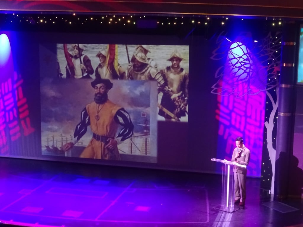
Historical narrative read by a Front Desk attendant.

The show lounge gave them the option to work with a power point setup and thus a short review of the turbulent history of the Philippines was narrated. The Philippines count the year that they went independent from Spain as the birth of their nation. It was not a real independence yet as for a long time after they were governed and supervised by the USA, who had moved in after the USA- Spain war over Cuba and the Philippines.  The longtime presence of American influence resulted in the fact that most Philippino’s speak a sort of combined language. Their native Tagalog is the base language which is then interspersed with American English.  Basically if there is not a good word to describe a situation in one language then you just borrow it from the other language.

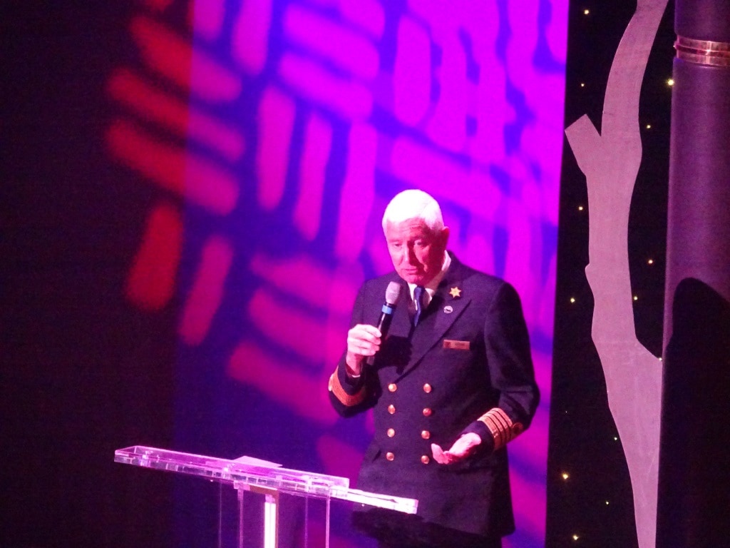
Wise words from Captain Pieter Bos, Master of the ms Noordam

Standard is always a short speech by the Chairman of the Philipino Communities and then there have to be a few wise words from the captain. What a captain says is entirely up to him as the important part is to sound genuine and you cannot do that with a scripted speech. So every captain does what he feels comfortable with and what feels natural to him. I normally insert a bit of philpino – Holland America history into the speech and captain Bos reflected more on the way we work together on board. As we say in the Dutch language: “there are many ways that lead to Rome” and so there also many ways to show your appreciation for a large group of hard working people on board.

You cannot celebrate anything in the Philippines without at least one song.

The celebration is always followed by a party in the evening and that is normally held on the evening that the clocks go an hour back so in our case the night before Ketchikan when we adjust for Alaska Time. Because we could not do anything outside, there were no independence games on the outside deck.  But as it was a sea day this time, there was hardly any time for that anyway as sea days are very busy days in Alaska with guest services, as we have so few sea days in the cruise.

Our next celebration will be the 4th of July for the Americans, then in August we have Indonesian Independence day, and the Dutch already had their Kings Day in April.  Then sometimes the Indian contingent on board (Cooks and Security), organize something as well when their day arrives but that does not always happen. Mainly because it is a much smaller group.

Tomorrow we are in Seward and we should have a glorious day.

23 June 2017; Glacier Bay, Alaska.

Between 18.00 hrs. and 21.00 hrs. the cruise ships left Skagway one by one and the ms Noordam was the one who closed the door behind them. Thus we had a steady parade sailing down the Lynn Canal with the highlight being the metropolis of Haines on our starboard side at 10 pm. We will be calling at Haines on our way back. As we had nice and sunny weather for most of the day in Skagway, we were all afraid that a white curtain would descend on the waters again but it did not happen. I think that the amount of warm air available was not yet enough to create a small world. We saw patches of wispy white smoke hanging over the valleys but there was not enough energy to solidify or extend to the open waters.

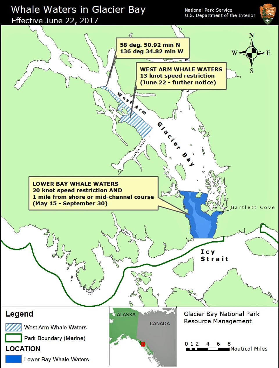
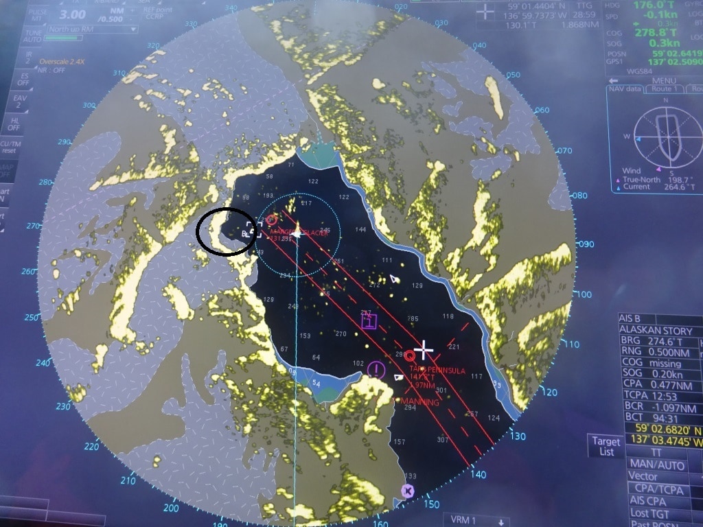
This diagram is send out regularly by the National Park Rangers to ensure safe traffic in Glacier Bay.

And so we sailed with glorious weather into Glacier Bay and boarded the Rangers at 07.00 hrs. I mentioned last week that if wildlife in the lower bay would increase then speed restrictions would be imposed so nobody was amazed when that announcement came in last night. We had to stay under 20 knots in the lower bay, the entrance of Glacier Bay, and there will be further speed restrictions in the future. On the West Arm side it has gone down to 15 knots but we always stay on the East side as there is more to see anyway. And we saw a lot, stellar sea lions, mountain goats and also a good number of Bears foraging around at the water’s edge. The bridge team has a sort of competition going about who spots the first Bear. A tray of soda drinks is provided by the captain as an incentive and thus everybody keeps a good look out. Not only at the navigation but also on the shore line. Bears are not easy to spot as they are black or brown, so what we normally do is not to look for a bear but look for a small rock that moves. In the same way as we look for ships. We do not search for ships; we scan the horizons for changes in the pattern and for anomalies and that normally turns out to be a ship or something else of interest.

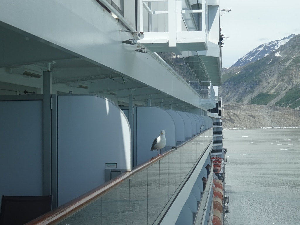
We always have unwanted hitch hikers on board while in the Bay, sometimes because the guests feed them. We try to educate everybody not to do so but there are always a few who do not listen. It does not stop the sea gulls from patiently waiting…. in case of.

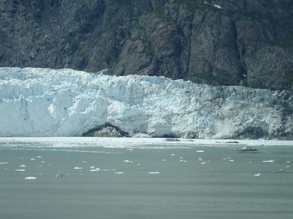
Glacier Bay is changing every year and as I have been coming here since 1982, I seen a fair number of changes. Marjorie and Grand Pacific Glacier moving forward and touching and then a few years later moving apart again. I have somewhere in the archives a photo of me touching with my right hand Marjorie Glacier and with the left hand Grand Pacific Glacier. That was in the days that we were still allowed to lower lifeboats and potter around taking photos and picking up a piece of glacier ice. Sweet memories.  Through the years I have seen more and more trees growing up and covering the lower slopes of the mountains that had been bare before. Global warming is definatelly having an impact. In the late 80’s the Glaciers started to retreat again and Marjorie has been doing that ever since albeit very slowly.

A big rock under Majorie Glacier now exposed. I wonder how long it will take until it will no longer be a Tide water glacier.

This year is seems to go a bit faster as we now have a rock exposed in the middle which I have never seen before. When looking at the Radar we can indeed see that the face of the glacier is further back than ever before. Also when we sailed passed Lamplugh Glacier near John Hopkins Inlet; we saw that had retreated now so far that you could walk in front of it. I will try for a photo next cruise. This time the ship had to alternate the route as the Crystal Serenity was also in the bay and during the time we passed Lamplugh I was somewhere in the dungeons of the ship. By 5 pm. we were saying good bye to the Rangers and then set course for the Gulf of Alaska and Seward.

I have never seen the gap this deep into the glacier.

Tomorrow we are at sea and then it is the end of the cruise for most guests in Seward. Weather: overcast with chance of showers and a low swell running from the south, so we might experience a gentle movement of the ship.

22 June 2017; Skagway, Alaska.

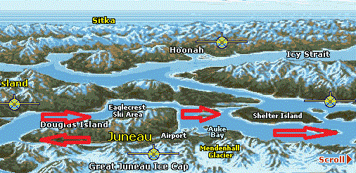
You have to sail around Admirality Island to get to Lynn Canal. (Map courtesy, Alaska E commerce on Line)

If there was a channel or fairway between Juneau and Skagway, we could cover the distance between the two ports in a few hours. However there is a big mountain range in between which means we have to sail in a big curve around it. First retracing our steps by sailing out of Gastineau channel again, the only way in to Juneau, and then sailing up and into Lynn Canal. We will have to repeat that sort of maneuver again when we leave Skagway as Glacier Bay is also “just on the side of the mountain” but we have to sail all the way south out of the Lynn Canal and then go north again.

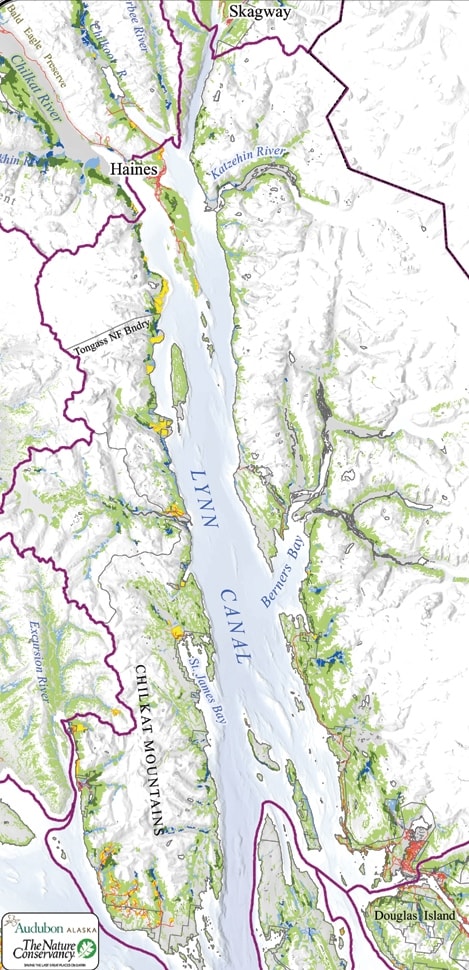
90 mile long and narrow Lynn Canal with Haines half way up. (Map courtesy see left corner)

The name is Lynn Canal but it is not a canal at all. There are no locks nor is there any landscaping on the side of the water way which would suggest any human influence. So the “canal” connection mainly comes from the fact that is looks almost like a canal as its width does not vary that much. It is basically very straight with only a small bump in the middle, just north of the borough of Haines, half way up. Thus the proper name would be Lynn Fjord. It is also the deepest fjord in North America, going down to more than 600 meters in depth at places.  In Norway there are fjords which are deeper but then the Norwegians invented them so that sort of makes sense.

Lynn Canal is named after King’s Lynn in Norfolk England. This is a nice old town and located about a 45 minute’s drive from where my apartment is. That is 45 minutes if there is no “Farmer John” on the road. Otherwise it might take two hours, as Norfolk roads are not very wide and also not very straight. The first – non native – man who explored and surveyed Lynn Canal was Joseph Whidbey, who served with George Vancouver, and who came from Kings Lynn. He would also still recognize the roads on which we drive to King’s Lynn.

At the very end of Lynn Canal the town of Skagway is located. Home to about 400 inhabitants in the winter and about 1200 in the summer; when an army of shop attendants descend on the town and occupy a sort of camping in the valley behind the town. Skagway is mainly the result of the Klondike Gold Rush and then its existence continued with ore export coming down from Canada. There is still an ore dock and on occasion a bulk carrier will call in, but now the main source of income is tourism. Skagway is handy as it fits nicely into almost any cruise schedule. You can reach Juneau, Sitka and Glacier Bay from here in one night sailing and even Ketchikan if you plan in a late morning arrival.

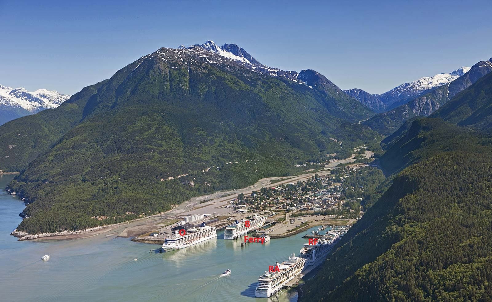
For that tourism, we are there to help. And the cruise industry does indeed help; to the extent that all the docks were full today. We had the Noordam on Rail Road dock fwd. The Emerald Princess on Rail Road dock aft, the Grand Princess on the Broadway dock, the Disney Wonder on the ore dock and the very tiny American Spirit (sister to the American Independence , see my blogs about Bar Harbor) at the right side of the ferry dock. In late afternoon the Alaskan Marine Highway Ferry called in as well and thus all docks were full. Roughly 11,000 guests were ambling about or going with the train up and down the White Pass. History galore as many a gold prospector died while trying to go through this pass on the way to the Yukon to strike it rich.   Now these prospectors have been replaced by shop keepers and they do seem to strike it rich.

Stock photo of Skagway Docks O = Ore dock, N = Broadway dock, Ferry = left side ferry side, right small cruise ship side, RF and RA = Railroad forward and aft.

The Noordam was docked at the Rail road dock, which is handy as the guests can walk straight off the ship and onto the train. Also the town is not so far from here although then it is a little bit easier to be at the Broadway dock for that purpose. We stayed here until 21.00 hrs. partly to give guests the options to enjoy the excursions or to walk around the town. Glacier Bay is just next door and the only thing we have to do for that is to sail back down Lynn Canal again. We will be there by tomorrow morning 07.00 hrs.  During the day the sun came out and the temperature at once jumped up to the low sixties. We are expecting a similar day tomorrow.

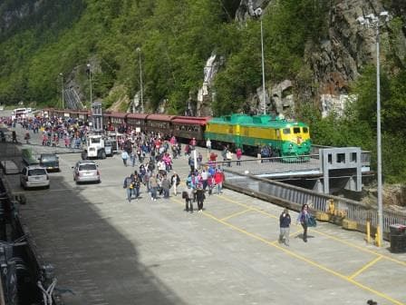
Guests disembarking from the returning White pass train excursion.

22 June 207; Juneau, Alaska.

Today we had “Princess Day” in Juneau. Your good old Noordam was sandwiched in between three Princess ships. The Grand Princess, Coral Princess who were there when we arrived and who were later on followed by the Emerald Princess. Which meant that the whole port was taken up by one company. Sort of. Holland America is part of Carnival Corporation which consists of a large number of companies such as Cunard, Costa, Carnival Cruise Lines, Aida, P&O,P&O Australia etc. etc. But we are also part of a sub-division inside this umbrella group called HAG or Holland America Group. This group consists of Holland America, Princess and Seabourn.  It does not mean that we are all the same. Far from that. The products, the Brands, are totally different with each having a distinct clientele and target group.

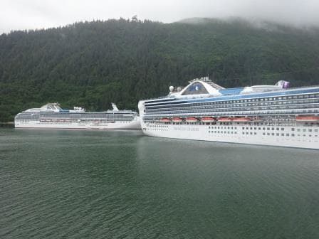
Two of the three Princess Ship in port today. To the right the Grand Princess to the left the Coral Princess.

Where we are coming together is on the operational side. Here we share the same “Marine Services” under the same Exe. Vice President and report to the same company structure which operates the ships. Everything in relation to Nautical, Technical, Ports, and other operational activities which support the product delivered to the guests falls under this Marine Services division.

And that is why I can say we are sort of the same company. When we go for our nautical training in the Netherlands, we do that at C-Smart which was originally developed within Princess. Classes are made up of officers from all the brands of the Carnival Corporate as the correct logic is that safe watch keeping principles and operation should not vary from company to company.  Operational maters are resolved in the same way at HAL and Seabourn as at Princess. We even have officers rotating through the three brands if needed. The other day we had a conference call to discuss certain procedures and it showed that everybody was on the same page and following the same routine.

The product we deliver to our guests makes the difference and both groups of officers are fiercely loyal to their own company in order to deliver that particular cruise experience to the guests. Also for the overland tours here in Alaska, the two company’s work closely together with good results as it is now much easier to share capacity in coaches, hotels and trains which in the past were kept completely separate. If the Holland America branch needs an extra coach then they can get it from Princess and vice versa. We are now in this process of close cooperation a few years now and my impression is, while only seeing small parts of the whole puzzle that it works quite swimmingly.

What has not changed is that we try to get the best spot for our ships and the best arrival times and that made that the Captain decide to arrive nice and early this morning to ensure that both gangways were out on time and everybody could stream ashore without any delays. Where possible we operate two gangways on arrival as in general all guests want to leave at the same time and then later we go down to one gangway as the return of the guests is normally a steady trickle.

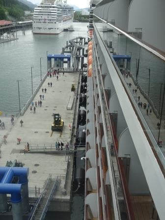
The pontoon and the ship go up and down with the tide. So the guests always have a almost flat gangway to walk over.

With the new dock in Juneau we have that two gangway option as the floating pontoon which makes up the center of the dock is just long enough to cover forward and midships stairway and exit. The rest of the dock is fixed and does not move and that is where the ropes go on the bollards. In an ideal world, we would like to moor completely on a pontoon, so the dock, the ropes and the ship would always move up and down with the tide in a status quo position but then you have to make the pontoon anchoring construction very strong. During windy weather, a cruise ship catches an enormous amount of wind and that force has to be absorbed then by mechanics which keeps the pontoon in position. Thus in Alaska they have opted for a pontoon / dolphin construction with the foundations hammered into the bed rock.

We will stay in Juneau until 22.00 hrs. and then sail for Skagway for an early morning arrival as there will be a whole parade of ships coming in at about 20 minutes intervals. Weather; more of the same, although we had hardly any rain to day,

20 June 2017; Ketchikan, Alaska.

We still had some good scenery while sailing through Grenville Channel but it was too misty to see any wildlife. Either they were obscured or the Bears, Moose and Goats decided to stay inside until it stopped raining. From The Triple Island Pilot Station it is only a short distance to reach the Twin Island pilot station in Alaska. We sail partly through Dixon Entrance and then hop over the border although nobody notices it. The only item of interest is that the clocks are going an hour back at 02.00 in the morning. We have been steadily moving west and Alaska is in a different time zone than Western North America. I suppose it makes a difference in the winter but with the long days here in the summer, you do not have to change the time to get more daylight here as we do in Europe.  It is daylight from 3 am in the morning until 10 pm. in the evening and then the night hours are not really dark either. More of a sort of prolonged period of dusk or dawn.

We follow the route of the dotted line in the chart. The west side route past the island is more used by smaller ships and tugs and tows.

We boarded our pilot at 04.30 in the morning to make sure that we would be docked before 07.00 in the morning. We only have a short stay here, sailing again a 15.00 hrs. Ahead of us was the Grand Princess who had to dock first as she was on number three northbound, while we were scheduled for nbr 2 northbound. That gave a bit of a strange picture today as on berth nbr 4, we had a Princess ship docked for southbound and behind us on berth 1 we had the Silver Shadow docked for southbound as well. The latter only makes a few cruises to Alaska and was thus lucky to have a berth as it could have been taken up by one of the regular customers but not all ships have arrived in Alaska yet.

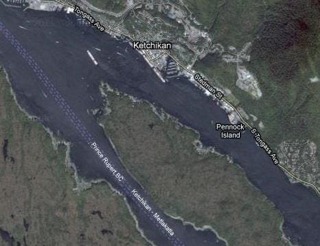
This is what it looks like from the air. courtesy google.

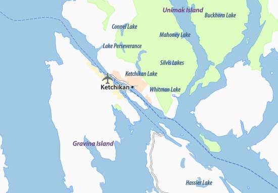
The approach to Ketchikan differs from all the other ports because it is such a long time of standby for everybody. This has to do with the fact that Ketchikan lays fairly well sheltered in the Tongass Narrows behind Pennock Island. I am saying fairly sheltered as the winter winds and rains can still blow fiercely through the area but it is more sheltered than other locations.  Thus for arrival the troops on the bridge and on the mooring decks have to be in position once the ship start sailing through the east arm of Tongass Narrows keeping the island to the portside. This area is called Saxman village and because of the houses at the water’s edge, the docks and the USCG station the maximum speed is 7 knots to avoid wake. Then you have to slow down for the final approach to the dock and all in all, it takes over 90 minutes to get there. I am currently supervising and training the forward mooring deck crew and even with safety shoes on it is a chilly affair with cold feet on the steel deck, due to the weather being much chillier than it should be.

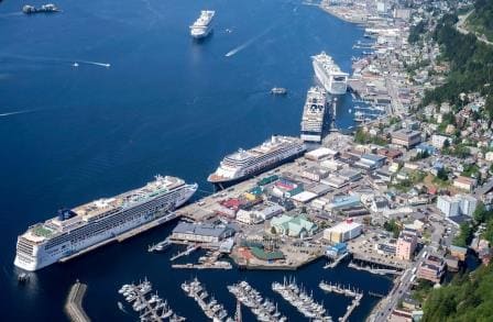
Stock photo Downtown Ketchikan, with cruise ships in port. We were at the spot of the blue hulled Holland America Line ship, only with the nose the other way around.

Because most weeks the ships docking are not the same, and thus not the same length, it means that when coming into position there is always an amount of “fiddling” going on to get the ship in the best spot. All focus is on the gangway location but we also have water breaks and sometimes a second gangway and they have to be clear of dock obstructions as well. Thus when we come in position and the Security Officer at the gangway has a final look, then quite often the call comes: “we have to go x feet or x inches forward or aft”. Long time ago I indeed heard the Security Officer demanding that the bow had to go 2 feet forward and the stern 3 feet aft.  He had to take stick for that for a long time.  We were docked fairly quickly today as we only needed to focus on the gangway location.

We sailed at 3 pm. and moved north. Due to the return of the tours we just made it on time as we had to leave on time, as it is a tight schedule to get on time to Juneau. We are scheduled to be docked at 10. am. but the captain would like to be a little bit earlier to help the tours get on the way.

Weather for tomorrow, more of the same, but maybe a bit more clear skies.

19 June 2017; Inside Passage, British Colombia Canada.

Seymour Narrows. The challenge is this big course change right in the area where the current creates eddies and does not follow the regular direction of the channel.

The weather is still not helping and this morning I really thought that I was walking around in a Tolkien book with Misty Mountains all around me. The captain did not have an easy night as by 22.30 visibility went down to zero and that lasted until 3 am in the morning after which it marginally improved. This was also the period when we went through Seymour Narrows and Race Passage; areas we prefer to go through when we can see something. Although we can do it safely on the radar, especially if you have been there before and know what is looks like in reality. You can super impose your own memory on top of the radar picture and build yourself a sort of 3D picture of what the situation is really like.

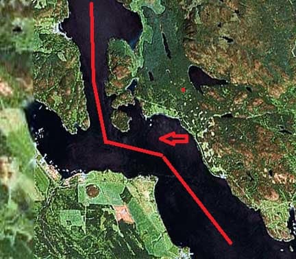
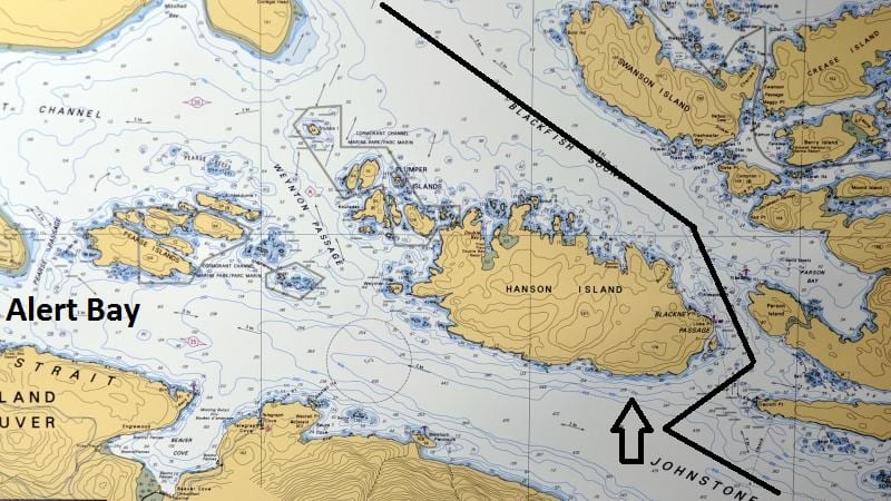
Blackney Passage. Again the challenge is the way the current will affect the ship due to the big course change. When the weather is nice and we have the time we sail past Alert Bay, but it is a much longer and slower route. So only worthwhile to do when we have guests on the outside decks.

From Race Passage the route took us through Blackney Passage. On the way back to Vancouver we pass this area in daylight and at a half decent time for the guests to be up and about. We then also have the option to sail past Alert Bay, but that takes more time due to the longer period of slow speed required. In the very early morning we might as well take the fast route as there is nobody around yet to enjoy the scenery, or the Orcas who show up here very frequently. Blackney Passage is also an area which requires a bit more focus and then we normally have the Staff Captain on the bridge as an extra pair of eyes, while the Pilot assisted by the Bridge Team keeps conning the vessel. The currents in Blackney seldom reach more than 4 knots but the challenge here is that it includes a more than 90o turn, going from a wide open area (Johnstone Strait) into a small hole (Blackney Passage) to reach Blackfish Sound. While doing that the current which is normally with you or against you, is pushing the ship all over the place if we are not careful.

After Blackney there are several ways to go up to Triple Island where the pilot station for the B.C pilots is located. We can go all the way outside, we can go all the way inside or we can do a combination. That depends mainly on how much time we have, what the captain prefers and what the weather is going to be like. Today the weather was lousy with nothing to see so the captain opted for sailing through Queen Charlotte Sound and then try for Grenville Channel. That is a very scenic route and often if the weather is miserable in the more open area’s the high mountains on either side of Grenville, tend to create a sort of Micro Climate.

When we got there is was marginally better, but still the weather remained damp and gloomy. However now the mountains are so close by that regardless of the rain you still get a very good impression of the awesomeness of the nature here. Grenville Channel has one challenge and that is traffic. There is not much of it, but if there is, then it normally affects you. Also this time; one southbound vessel which we would have exactly met in the most narrow part of the channel at Tom Island. Thus we had to slow down to wait until that ship cleared the narrow gap before we could go through. Tom Island is as far as I know named after a gentleman called tom who lived around the corner and operated a small Salmon Canning factory.

From Tom Island it was another three hours before we got to the Triple Island pilot station where we said goodbye to our two Canadian Pilots. From now on we are on our own until tomorrow morning at 04.30 when we will embark the Alaskan pilot at Twin Island which is about 20 miles to the East of Ketchikan. Only one pilot will come on board as it is only a short stretch to sail. The 2nd pilot will then simply walk on board in Ketchikan so we will have two pilots on board until after Glacier Bay.

Weather for tomorrow. More of the same 49of / 9oC overcast with a 55% chance of rain. I wonder what is happening to the summer here…………………

18 June 2017; Vancouver, Canada.

It was good that it was change over day today as the weather was not up to cruising standards, even for North West standards.  It was gloomy, chilly and rainy. Most guests transferred from the ship directly into a coach for Vancouver Airport or back to the USA; but a steady stream walked their own suitcases off the ship and around the corner to the big parking garage and some even further to the Sea Bus station so they were mostly likely people from North Vancouver who had made a cruise in their own back garden so to speak.

I had to run ashore briefly to comply with immigration requirements. Here in the port of Vancouver it is really confusing at least if you are not used to it. For the Canadian Government I am a regular crewmember as I work on board. If I want to be a passenger then that is fine as well, as long as I comply with the regulations. For the American Government I am a non – revenue passenger. Although I work on board I cannot be classified as a crewmember as that requires a different sort of visa; and I have one that allows me to hop on and off ships in USA ports.  To make things easy I was a passenger for both countries today………….. unfortunately that all stopped when I got back on board again and had to start working again.

I had to be off the ship by 10 am. and could not return until 11 am. after the CBP started their immigration process, so it gave me the chance to go to my favorite 2nd hand book store McLeod’s on West Pender.  They have so many books there, that they are off the shelves, piled up on the floor and in such density that there is a hardly any room left for clients to browse. Approx. 20,000 sq. feet of a book explosion. Although they do have a very large section on maritime subjects I could not find anything. Not amazing as my library is almost complete. Still there is always the chance…………….

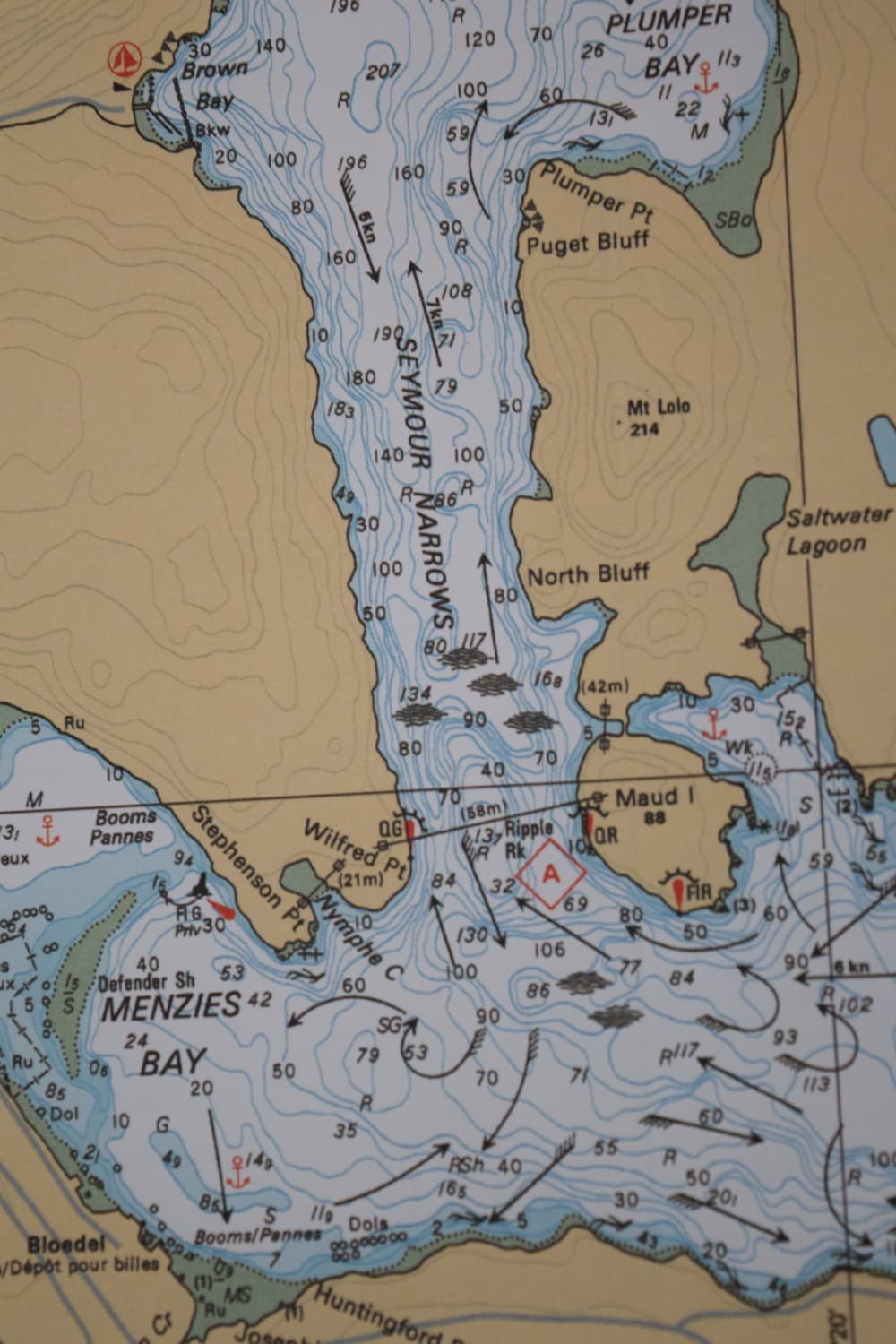
The chart of Seymour Narrows with current vanes. As you can see the current does not follow the mid channel direction but bounces around. Hence the danger to go through with high velocities.

Now back to my story of yesterday about Seymour Narrows. I might have explained once before but once I went through Seymour Narrows with more than 7 knots of following current. I was 3rd officer on the Noordam in 1984 and we were coming south towards Vancouver. The captain was adjusting the speed for a 3 knots current transfer and then the emergency call came in that the Sun Dancer was sinking. The Sundancer was a cruise ship / ferry boat sailing from Vancouver to Alaska and the idea was that guests could take their own car/camper to Alaska. Coming north, the ship had somehow missed the turn and hit the rocks before coming to the Narrows itself but it did not ground. However the ship was taking on water and as a ferry is a sort of tin can, once a hole is punched in the can, the water can go everywhere. As it was uncertain that she would make the dock, a Mayday went out and we were requested to get there as soon as possible as we had all those lifeboats available. So we went through and that night I learned that you can go through with currents above 4 knots but there is no room for error left. The pilot only gave two rudder orders, one to port and one to starboard and we were through the hole. In the meantime the SunDancer had limped towards the dock at Campbell River lumber mill and settled against the pier there. So we were not needed.

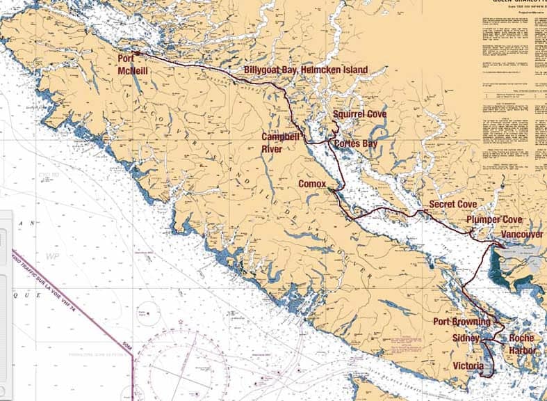
The narrow part north of Vancouver Island. You can clearly see why the currents are so strong. As it only widens up near Port Mc.Neil. (Chart courtesy, Katiekat.net)

There is another strong current area a bit further north called Race Passage. But because you do not have to make a big turn and because it is wider, the current seldom goes above 5 knots and thus we can go through at any time. In the middle is Helmcken Island and if there is traffic then it serves as a sort of traffic cone separating the east and west bound flow. If there is no opposing traffic then all ships use the south passage as it is straighter.

Tomorrow we are at sea, sailing Queen Charlotte Sound and then another part of the Inside passage but the weather is to remain gloomy, rainy and foggy. Amazing because the Southern USA States and most of Europe is sweltering in a heat wave.

17 June 2017; Sailing the B.C Inside Passage.

Sailing the Canadian Inside Passage through British Coloumbia is one of the highlights of the cruise but it is sometimes a little bit under appreciated as all the focus tends to be on the Alaskan part. A 2nd challenge is that the scenic cruising takes place either on the first day of the cruise Northbound, or the last day of cruise Southbound, and then there is so much else going on. So for the guests it can be a very busy day if they want to partake in everything that is happening. The amount of Inside Passage that you see really depends on one crucial factor: Seymour Narrows slack tide. The ship has to make Ketchikan on time when going Northbound and it has to make Vancouver on time when going Southbound. So for an ideal schedule Seymour Narrows slack tide has to take place between 23.00 and 01.00 the next morning. With that time frame you can plan for regular sightseeing while keeping the cruise schedule and not having to race through the Inside Passage to make it on time. Unfortunately the tides do not always act in accordance with the Holland America Line cruise brochure so sometimes the slack tide is as early as 20.00 in the evening before Vancouver or as late as 02.00 in the morning when Northbound. And those 3 to 4 hours difference will play havoc with the time available for sightseeing.

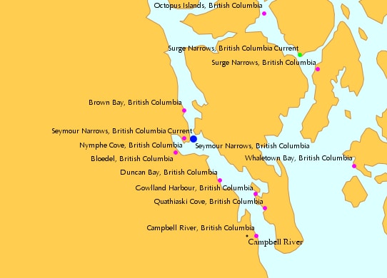
Seymour Narrows is the smallest part in the waterways which separate Vancouver Island from the Main Land. We have to go through there if we sail from Vancouver. Otherwise we have to sail south to Victoria and then out to open sea via Strait Juan de Fuca and then back north again in the Pacific Ocean. Ships sailing from Seattle have that option and quite a few do so when the Pacific Ocean is in a good mood and the weather is quiet. They then miss part or all of the Canadian Inside Passage but compensates that with calling at Tracy Arm before going to Juneau.

Overview Map of Seymour Narrows. As you can see it gets very narrow at this point.

However we have to go through the Seymour Narrows and the problem is the currents. From Pine Island in the North West and from Victoria in the South the water can flow freely all the way around Vancouver Island. Not a problem in principle, it is just that the opening for that water to flow through is getting very narrow at Seymour Narrows. Make an opening smaller with the same amount of water having to go through and the result is stronger and stronger currents. With a spring tide running, the current velocity can go up to 14 knots and then you do not want to be there.

Safe passage is possible as soon as the current runs 4 knots or less. It has been done at a higher velocity but when doing so the margin for mistakes goes down to zero. So sticking with our safe philosophy of “there always has to be a plan B” we follow the pilot’s advice and go through with currents under four knots. Thus all the ships who have to go through, cruise ships, tug and tows, fishing boats and whatever else that travels up and down the Inside Passage aims for slack tide. The moment the current goes from flooding to ebbing and vice versa. They all know that will not work out as not everybody can go through at the same time but you have to aim for something.

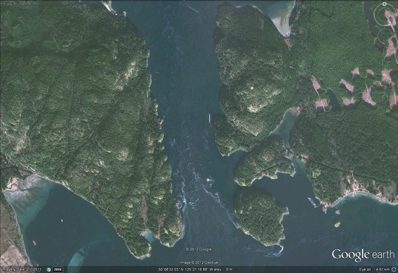
Even in this photo from Google Earth you can see the tide ripping through the Narrows.

Then the tinkering with the times start. All ships over 300 tons in size have to participate in the Vessel Traffic System which operates through the whole area from Victoria to Prince Rupert. They advise the times which the ships are aiming for and then the pilots start to adjust what will work best for each ship. That normally results in a nice parade coming down and/or going up. The Captains who have been on the coast already know how this works so often they aim for a time well before slack tide so they can be sure to get through before the other ships want to go through. Log tows often need the exact slack tide to get their floats around the corners and as they block the whole passage, the cruise ships want to be passed them. More tomorrow.

Tomorrow we are in Vancouver and scheduled to dock at Canada Place West side by 07.00 hrs. The weather is remaining chilly 12oC /54oF which is really too cold for the time of the year and there is even a chance of a shower. But no wind is predicted and thus it will feel no colder than the 12 oC.

Older posts Newer posts