- Captain Albert's Website and Blog -

Ocean Liner History and Stories from the Sea, Past and Present. With an In Depth focus on Holland America Line

Category: CaptAlExport (page 3 of 203)

16 July 2018; At Sea.

The route from Katakolon to Naples takes us straight to the West across the Ionian Sea, then south of Italy into Messina Strait, then into the Tyrrhenian Sea and from there up the coast past Capri. We were very fortunate with the weather today as it was very calm and the Oosterdam provided a smooth ride. Navigational high light of the day was the passage through the Strait of Messina. Last cruise at the early time of 0500 in the morning, today it was at the more decent time of 1600 hrs. in the afternoon. A good excuse for an early cocktail hour. The EXC team provided a commentary about what was there to be seen and the Oosterdam raced with the great speed of 14 knots through the strait.
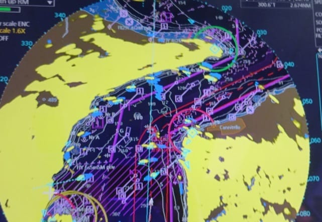
The Strait of Messina. Sicilia to the left and the Italian Mainland to the right. The purple lines are the safe boundary’s of the strait, and the red lines our intended path through the strait. As we are going north we try to hug the starboard side of the strait as much as possible; pending pilots agreement.

Pilotage here is compulsory, not so much for the sailing through as that is very straight forward, but to deal with the ferries which are constantly crossing from the Italian Mainland to Sicilia and back again. Then there are the fishing boats, the other deep sea ships and the six pack navigators and all together it is enough reason for pilotage to be compulsory here. The pilot knows exactly what the ferries are doing and the ferries are not worried as they know that the pilot will do the right thing. Rules of the road do not always work out of here to achieve the fastest crossing solution and so sometimes the ferries cross the bow of the ship and sometimes they go astern. And as long as the ship in question does not do something erratic then it is a safe operation. And the pilot ensures that.
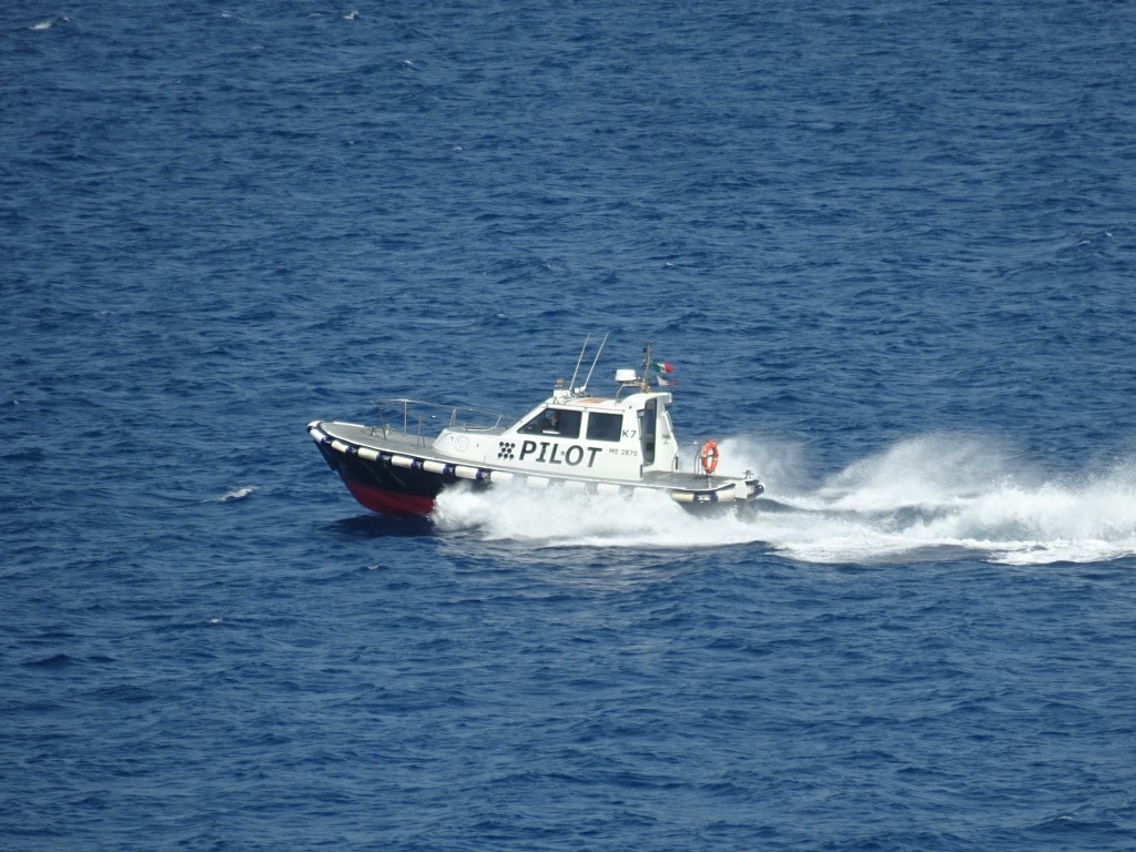
The Messina Strait pilot boat at full speed. This is also the speed they make when they come alongside the ship.

I have yet to meet one captain who is not very happy with the way the pilots come on board. In most ports there is always a fuss about slowing down, making a lee way and once done, the pilot boat skipper changes his/her mind again. Not here; just keep the speed steady and pilot hops on board whether we are sailing with 12 knots, 14 knots or 16 knots. I once did it even with 18 knots. I wish we could send all pilot boat operators for some lessons to Messina. The secret in them being able to it with such high speeds lays in the fact that once going fast the ship creates its own smooth water boundary around the hull. The water that flows away from the bulb is smoothed out and there are no waves, only a bit of swell.
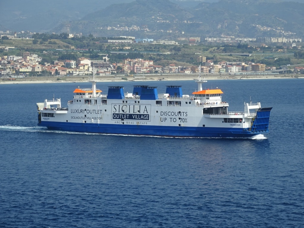
One of the car ferries. As you can see they also have an outlet village in Sicilia.

Also today the pilot raced on board; explained to the captain that the ferries were still going from one side to the other and back again………. and that this would not be a problem. And with that wise information we raced through the Strait. And yes the ferries crossed our bow and they crossed our stern. On the Sicilian side they all dock in Messina or just outside the City border and at the Calabrian side at the town of Villa San Giovanni. Different ferry companies provide nearly the same service. Some of the ferries carry cars and pedestrians and some of them are train ferries which connect the Sicilian railway system with the mainland. That is why the railroad ferries are our biggest worry as they are on a “railway timetable” and therefore do not change course or slow down. Hence the pilot anticipating the schedule and sailing around them. The car ferries have it a little bit easier and those we see slowing down once in all while. (Not too often……………….)
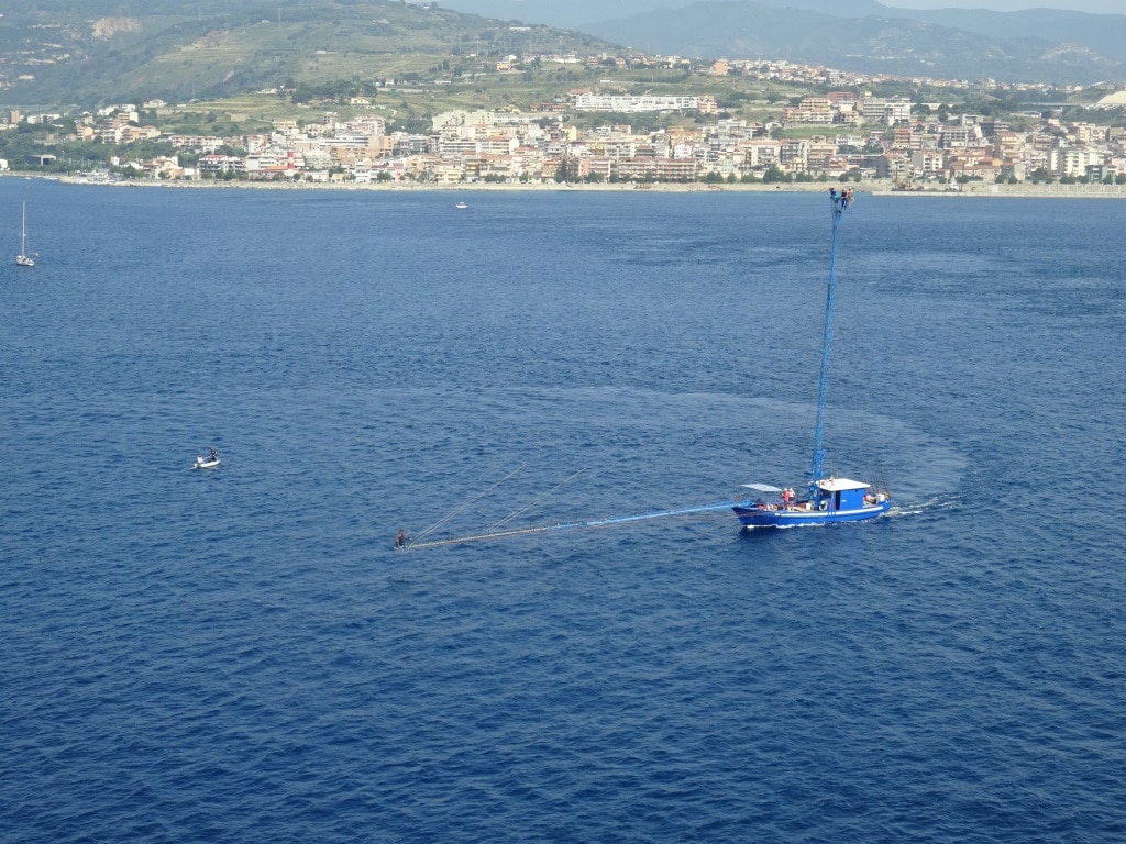
A Marlin hunt in full swing. The harpooner stands on the bow and the skipper and two spotters are high up in the lookout and steering cage.

We had a nice show today with a Marlin fisherman in full operation about 500 feet from the ship. The guests at the starboard side got a real crash course in Marlin fishing. Marlin or Sword fishing is done by a fishing boat called a passerelle and it is not really fishing but a sort of hunting. Therefore the boat has a spotter; he is standing on a 30 meter high pole and looks for the marlin. Now with the modern boats they also have moved the skipper upstairs with the controls of the boat. Sticking out from the bow is a 45 meter long bridge or “passerella”. Here is the harpooner standing. The spotter with the skipper brings the harpooner right above the marlin and that makes the catch easier. The harpooner is standing so far away from the boat to ensure that the marlin cannot hear the boats engine. The average price for one Marlin is between $400 and $500 and that can make you a good living if you are skilled enough to find them and to catch them.
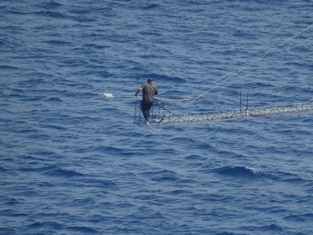
The harpooner with the harpoon ready to throw as soon as he is maneuvered above the marlin.

40 minutes after the pilot came on the bridge he left again and the ship continued to Naples. Around 18.30 we will do a quick sail by the Volcano Stromboli but although the Volcano is always active it is seldom active in a spectacular way. Hence we do not know if we will see something.

Tomorrow we are in Naples, together with the Norwegian Epic, that is that NCL cruise ship with the black shoe box on top of the bridge. We will follow her in and we should be docked just before 08.00 hrs.

Weather: sunny again 28oC / 82 oF and very little wind. There is supposed to be some rain during the coming night and that will help to freshen things up before we arrive.
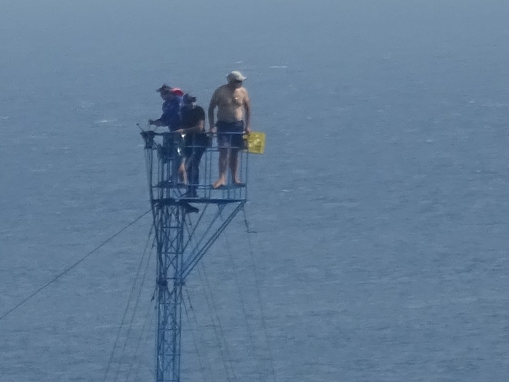
The spotters and the skipper on the boat controls. 30 meters above water so not good if you have high anxiety. I also wonder if you get sea sick from the pendulum motion as the skipper is cutting the corners as tight as possible to get lined up behind the fish. And I also wonder if that guy climbed that steel lattice tower with his bare feet as I do not see shoes anywhere.
 

15 July 2018; Katakolon, Greece.

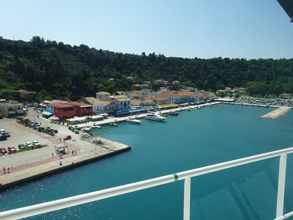
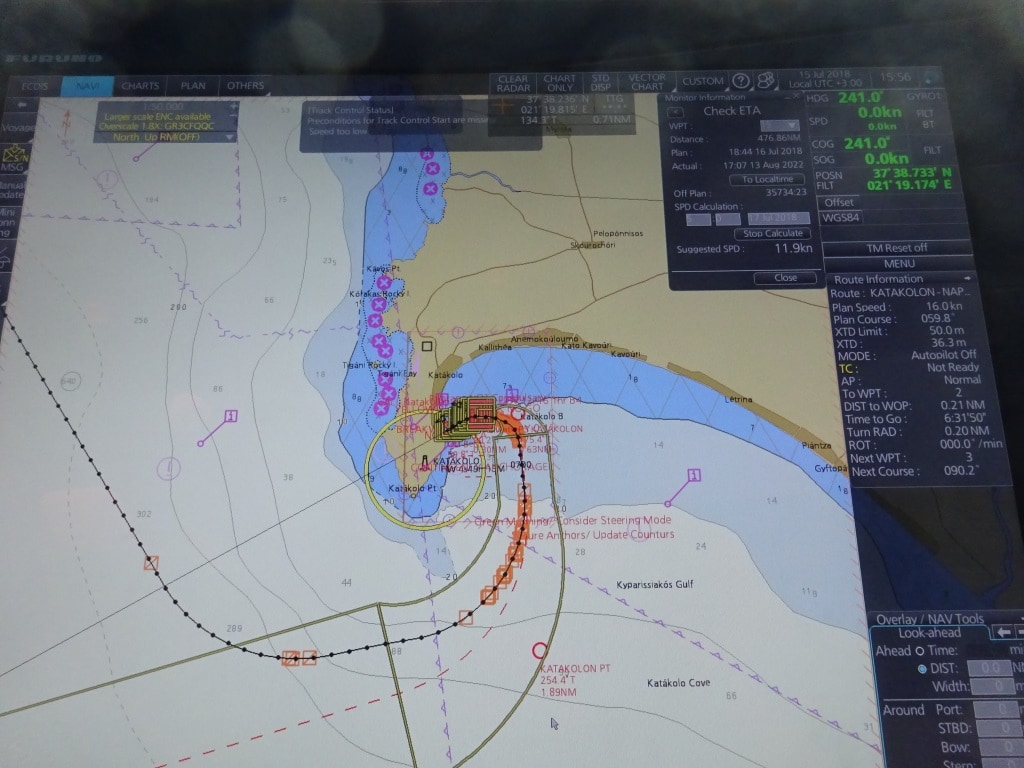
Katakolon, (The Greeks translated this into English as Katakolo) is located on the southwest side of the Peloponnesus and nicely tucked away on the inside of a mountain ridge; sort of in the same way as Sarande. Only here the natural bay it has created is much deeper and provides much more shelter. But because it is away from any major sea route it has never been a really important port. Only what was needed to reach Olympia from the sea would call here. And for a long long time it were only fishermen who used the harbor here while the town itself was focusing on tourism coming from the Athens and other larger cities. For Katakolon that resulted in being the end terminal of the first long distance railroad in Greece. Something they are very proud about and which has been running until the current day. The town itself is still small with no more than a 1000 real inhabitants but local tourism must provide work for many more. We were indeed the only cruise ship that came in this morning and thus we had the best spot in port, Berth 3, which causes us to in push our nose almost into the boulevard. With the port security that we have since 2001, there have to be fences and with that comes a large open area. If we would not have had that, then the restaurants would be been built up all the way to the gangway.

Sailing into Katakolon with the little port nicely tucked away behind a mountain ridge.

The port can take 3 ships alongside: Berth 1 is inside of the sea wall and a long way from downtown. The berth 2 is opposite of us, and the same pier but is slightly smaller than berth 3 where we are. Then you can have one or more large size ships at anchor. Which happens on occasion but as the town is so small and there are a lot of regular tourists as well, one ship is enough to keep all the shopkeepers happy.

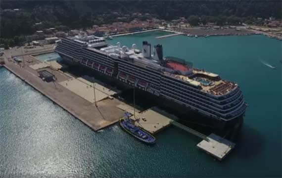
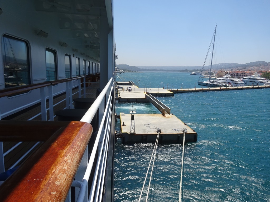
It is amazing what you can find in the internet. Your own ship alongside. Note the pier construction. To save money it is made up of 4  platforms sticking out from the earlier pier. The south side, pier 2, can take a long ship as well, but it will be overhanging past the piers end.

Yesterday the focus was on the beach but today most of the guests went tour. I counted about 30 coaches lined up outside the gate and 30 x 50 guests mean 1500 on a roll and going somewhere. Most of them to Olympia, Delos and the Corinth Canal. When the ship does the East Med cruise to Piraeus, then we run the same tours from Nafplion located on the east side of the Peloponnesus. Now we are running the west Med. cruise to Barcelona and then we use Katakolon. For those who stayed behind, Katakolon offers a nice and intimate Greek experience with all the small restaurants along a boulevard which starts at the cruise terminal and ends at the marina. In between small fishing boats tie up to the water’s edge in front of the restaurants. It is very touristy but somehow not spoiled. Fishing is still a “one man happening” here and this morning around 09.30 we saw a whole slew of them coming back. I do not know if they catch much in the area here but the boats looked well maintained so there must be money in it.
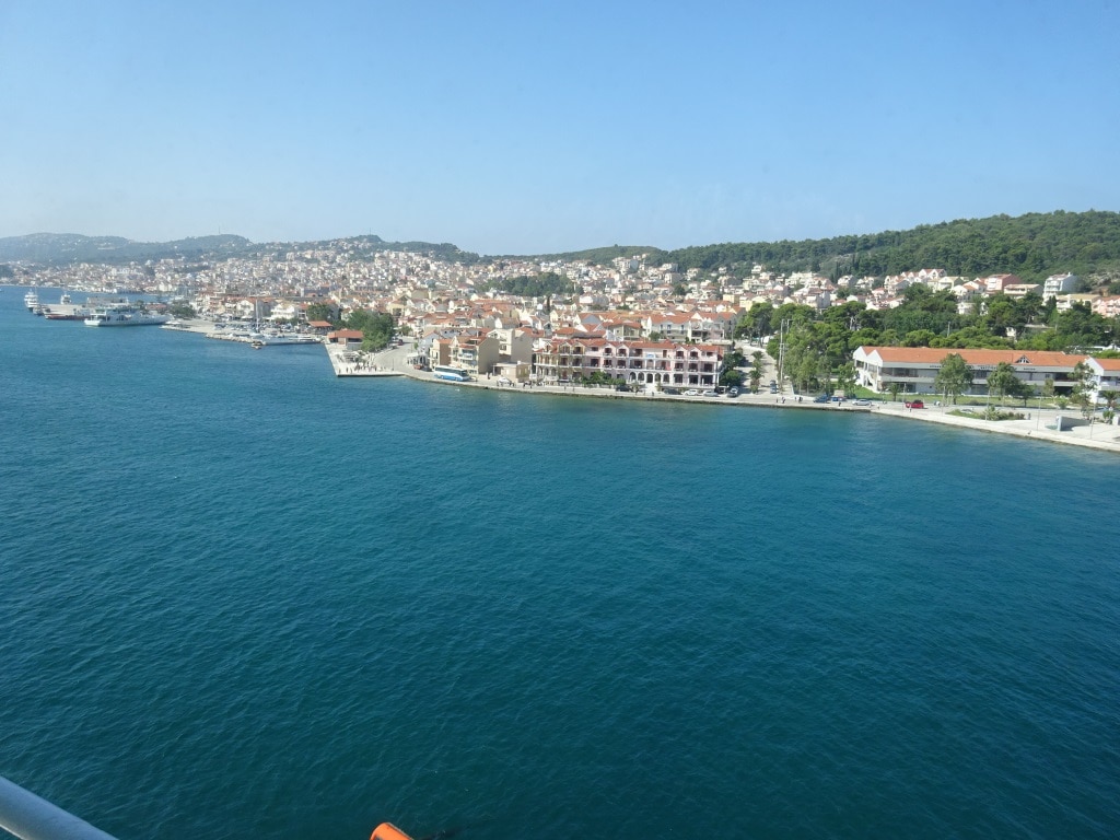
Katakolon is very small. Basically only three streets. The boulevard, a street with shops and then the last street with a museum and some regular houses. No big hotels or anything else. So once the day tourists are gone it returns to being itself.

I mentioned yesterday the sulpher smell and yes it was there this morning. Very distinct and very nasty to inhale. Luckily the Oosterdam has its main gangway amidships where it is less prominent as the earth fault lies close to the shore line, there were our bow was. Katakolon Mountain is an ancient volcano nearby and its old volcanic ash has ensured that this is a very fertile area for farming. But the cracks in the earth crust which once let the lava through are still there. Only now it lets water in, which gets warmed up and which then returns to the surface with a lot of nutrients only they are acid nutrients. Among them sulpher gas which once released by the water gives the port of Katakolon its characteristic smell. But that is as dangerous as it will get here. The local pilot (You will find him mentioned in previous blogs since 2007) told me once that they did not want volcanic action here as it was bad for business. So I suppose the local chamber of commerce has outlawed this from happening.
. On the bridge he still tells the captain the same thing; if you go here and if you go not too close to there, you will be in good shape. For the rest of the day he runs his restaurant on the seafront but I should say it is operated by the family. As mother is in the kitchen and daughter and son are serving at the tables.

Tomorrow we are at sea, sailing north towards Naples were we are on the 17th. It means sailing south of Italy and then going through the Strait of Messina. The marine weather forecast predicts with 90% accuracy that it will be another warm and sunny day, with temperatures in the high 80’s or high 20oC and a moderate breeze. As we are moving back to Central European time, we will have an hour back, which is appreciated as Today was a 13 hrs. day, spent on teaching the cadets to supervise sailors and mooring ropes on arrival and departure and a regular day in between.

14 July 2018; Sarande, Albania.

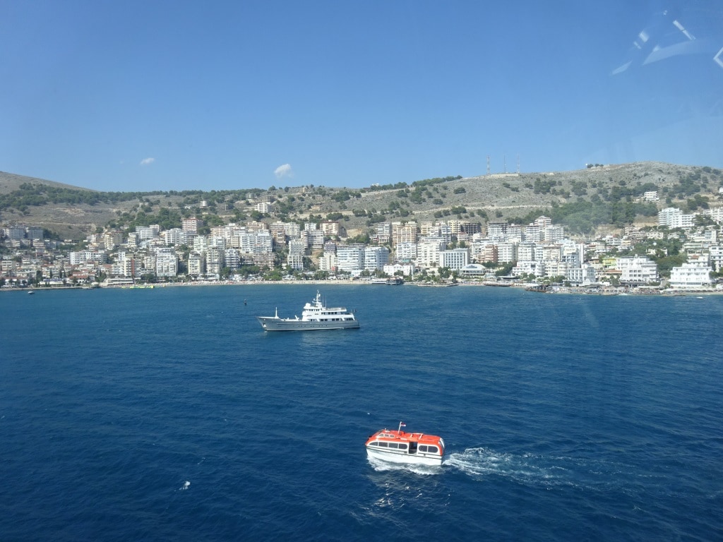
Sarande is a resort town in Albania just north of the Greek border. When are in the port you can see an island straight across the bay / channel and that is Kerkira / Corfu which we visited last cruise. The Albanian spelling of the name is more like Sarande with “.. on the top. As a lot of languages do not have letters with ” .. on the top it is often written as Sarande, Sarandes or Sarandee. The name in the navigational chart is spelled as Sarande and that is what we go by. The area has a long and troubled past and it was not until 1945 that a permanent own state was founded by communist freedom fighters of the 2nd world war.

The Resort -port of Sarande. At anchor the expedition yacht Axantha II. Available for a weekly charter of somewhere over 100,000 euros.  But is at least a yacht that can take some bad weather.

It remained communist and very much isolated until 1999 when it opened up more to the west. Since then going to Albania on a cruise has become more acceptable to travelers and now Sarande is considered the port that takes the overflow from other ports in the area. With the expansion of the cruise industry it will not be long before it is a full-fledged cruise call for many a company. Because of its ancient history and being a resort there is more than enough to do for every sort of cruise guest and that has been upping the guest ratings year by year, ever since we have been coming here.

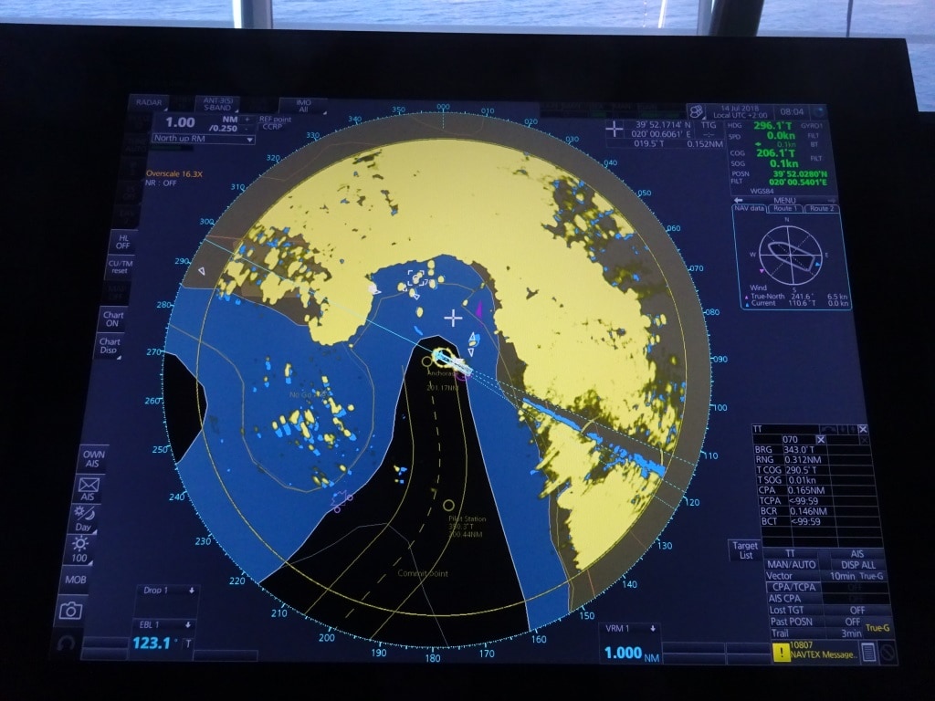
The deep water anchorage at Sarande. We anchored as close to the deep water edge as was safely possible. The first yellow blip upwards of the ship is the yacht Axantha II as seen in the previous photos.

But it is still an anchor port. The water is deep and becomes shallow very quickly once past the small cape which is the end of a mountain ridge that protects the Bay from winds from the South West, up to the South East. It is just a pity that the afternoon winds and swell comes in from the West, and can freely reach the anchorage. To mitigate this they could built a dock here but it would mean a considerable re-organization of the port as the current small dock area (in use for Hydrofoils to Greece / Corfu and small coastal cruise ships) would have to be extended and then a 2nd pier constructed in the shallower area further inside the bay, to help the now displaced ferries and cruise ships and I do not see that happening very quickly.

It leaves every larger cruise ship (with a draft of more than 5 meters) anchoring right on the edge of the land and thus out of the protection of the mountain ridge. We did as well, and anchored today in 40 meters of water, what is deeper than normal for cruise ports, but we could not go further in the bay. Every ship likes to be deep in the bay as in the afternoon the wind normally breezes up, only to die down again after sunset. Also today, it became quite choppy in the afternoon and the captain had to keep a good lee by having the port side anchor down and pushing the stern towards the wind to keep a lee for the tenders. So one Azipod was continuously pushing & holding the stern against the wind while the por tside anchor prevented the bow from moving. Ashore there was no issue as the mountain range kept all the wind away from the dock area but also from the town.

That made it “nice & toasty” in port and my initial resolve of exploring Sarande dissolved quickly and I made a quick U-turn when I walked between the first houses. I knew that white paint reflects the warmth of the sun but I can now confirm that yellow paint does the same.  My next “resolve” will have to wait until a spring or autumn visit. Many of the families we have on board opted for the beach but quite a few of them (often urged by their children) came back after a few hours as it was “too toasty”. The kids had already figured out that being on a cruise ship gave them all the same beach fun but with the option of running back into the A.C coverage when needed.

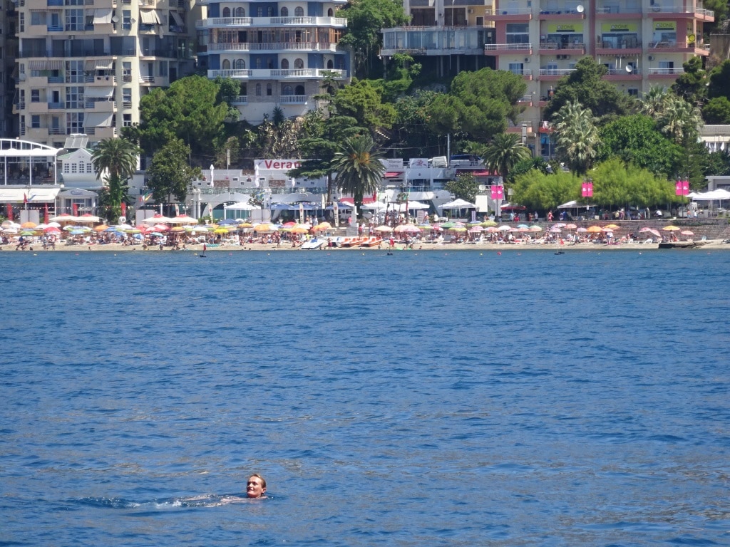
Our “swimmer” who thought it was a bright idea to swim between the tenders to the ship. This photo was taken from the tender platform alongside, so he came quite close. I could not get a tender in the photo to show you how dangerous it was, as our well trained tender operators kept a safe distance and waited until the swimmer had a bright moment and recognized the peril he was exposing himself to.

The local boats, large and small where not exactly in compliance with the Rules of the Road and we even had suddenly a swimmer near the ship, who had come from the beach to have a look. The lunatic did not understand how dangerous it was what he was doing as there was some swell so he bopped in and out of view all the time and the tender drivers cannot see everything around their tender. Thus the helper inside has to keep a good lookout as well. Which one helper did in the most admirable way; by climbing on top of the tender, keeping the person continuously in sight and at the same time made his feelings crystal clear. I do not know how much Indonesian the swimmer would have understood, but the guests in the tender were quite impressed. After we drew the attention of the swimmer to the fact that there were two propellers under each tender, he got the message and swam back to the beach.

Tomorrow we are in Katakolon, which is just a bit further to the south. Here we will dock and right through the port/docking area runs an earth fault line. Not a fault line which causes earthquakes or volcanoes, but water that comes welling up with a large sulpher content. So the first impression of the guests walking off the gangway is often the smell of rotten eggs. After that it gets better quite quickly.

According to the latest cruise schedule we should be by ourselves but things do change. The weather won’t. It will be Sunny with 32oC / 89oF, no wind in town and zero change of rain.


13 July 2018; Dubrovnik, Croatia.

Today we called at Dubrovnik although we are docking a far distance away from the city itself. This area is called Gruz and it is where most of the cruise ships go to. Here were originally only ferry docks but the pier has been extended and can now take three medium sized cruise ships. (If there is no ferry) There is also room for a small one on the river embankment. Then in front of this dock are three anchorages. Plus there is space at an anchorage just outside downtown. In the not so distant past, there were sometimes three cruise ships at anchor there and sometimes they were not very small. Now the downtown anchorage has been dedicated to small cruise ships only such as our Seabourn ships. Anything larger has to go the Gruz docks or to the anchorages in front of it.

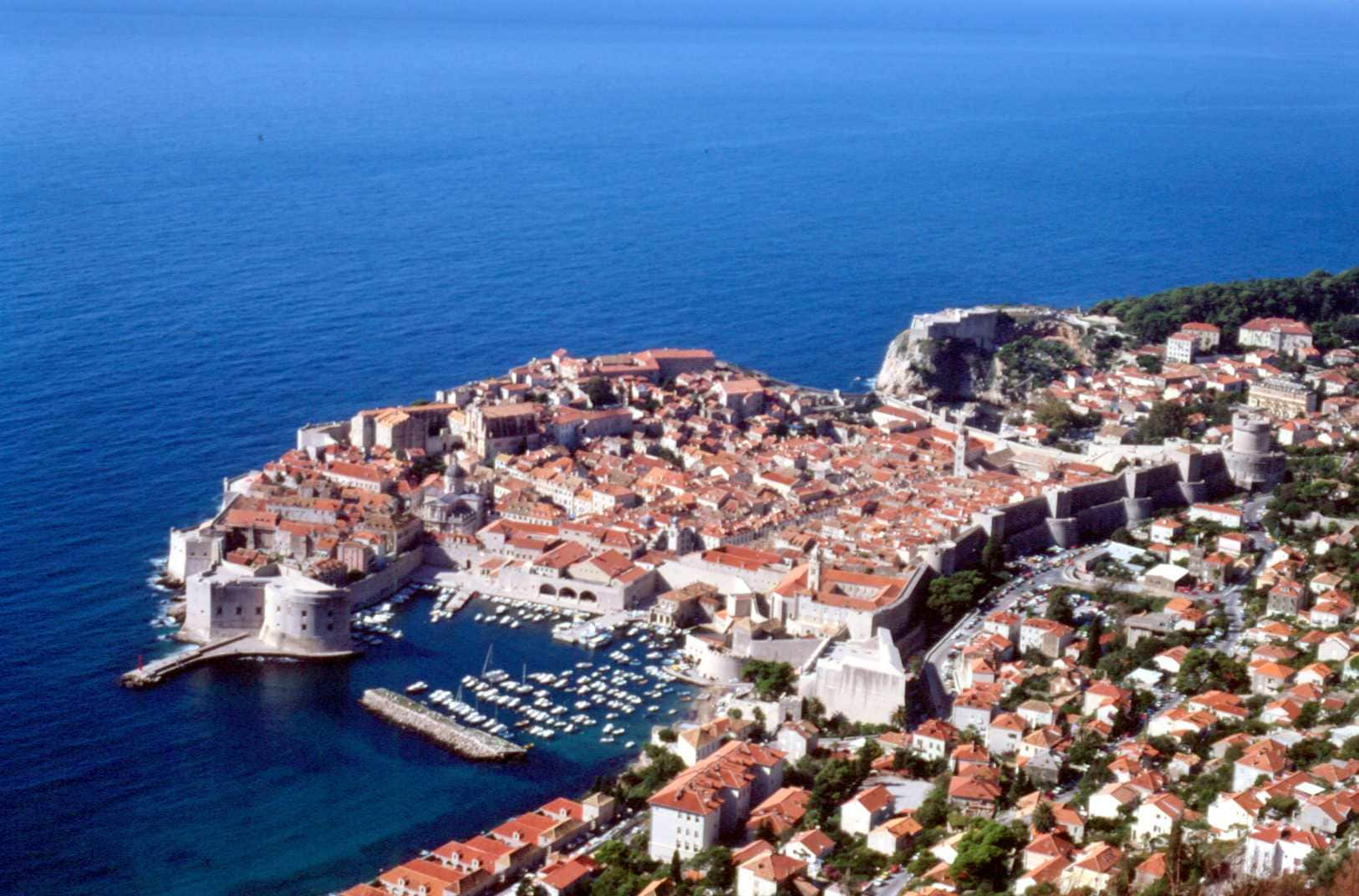
This is what is all about. The old town of Dubrovnik also called Stare Luka. the anchorage is to the left and the dock of Gruz about 20 minutes to the right. The ancient walled city is quite compact and thus has a limited capacity of visitors it can handle

Anchoring at downtown is nice but there is not much space, if you are a larger ship, and the anchorage is not sheltered at all times. So there have been fun and games in the past. Holland America has always followed the (safety) lead of the captains and had their ships docked at Gruz. That means that we have a shuttle service running today which departs and arrives every 30 minutes. Which works out well as a lot of our guests are on tour. To go into downtown Dubrovnik is wonderful (it is a UNESCO heritage site) but the surrounding area has so much to offer that many guests opt for tours that combine both things. Today there were only two cruise ships in; us and the MSC Poesia and that only brought about 4000 guests ashore. There were days in the past that there were seven or eight ships in port. Three alongside, three at anchor and one or two at the downtown anchorage. As mentioned in a previous blog, Dubrovnik is really suffering under its own popularity with the influx of ships, shore (by car) and air tourists (Those that come in on package holidays)

The Town leaders are trying to regulate all this traffic a little bit and thus far their emphasis has been on regulating the number of visitors by spreading the volume out and to try for the same numbers every day. If I look at the cruise schedule for this year; it looks as if they are succeeding as most days there are only two ships in and never more than three.

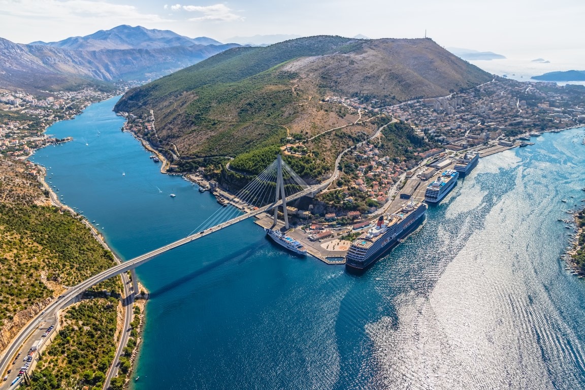
I pulled this photo from the internet as it shows the curving hills which cause the funnel effect. Three ships at the dock. Forward is a Holland America Line S class, 2nd one I can not recognize and the 3rd one is a Cunard Vista Class size. On the river berth the little cruise liner Dalmacija. (Thanks the unknown photographer who posted this)

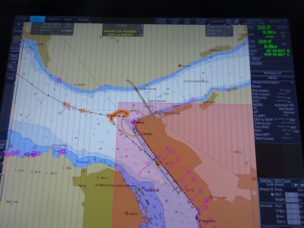
Docking at Gruz has one big challenge: The River. Right in front of the dock, there is the river Rijeka Dubrovačka. Although officially it is called a Ria. A water way carved through high mountains on either side. A sort of Canyon. It ends up in the sea here at Gruz. Because of its high sides, it can act as a real funnel and it does that on a regular basis. If a high pressure system is building up over Bulgaria and it is lying under the right angle towards Croatia then a strong wind will develop and once it reaches the Ria it gets compressed between the walls on either side. Then it really increases in velocity and strength. Most of the time the pilot receives advance warning and can tell the captain to wait near the anchorage or go at anchor and run a tender service.

This morning we swung the ship around while in the river /Ria mouth and then went astern to the dock. If the wind would have come down, we could simply have kept the nose in the drift, so there would be no drift, and waited until it all had “blown over”.

I had the experience twice. Once the pilot did receive advance warning and gave me the option; wait or anchor. I decided to wait for 2 hrs. as the Bora normally does not last long, then docked and simply stayed two hours longer to make up for the lost time. (If you have the luxury of that option in your cruise schedule) The 2nd time, the pilot did not know and there was also no general advance warning out. I think it was not expected that Bulgaria would “pressurize” itself that day. Thus I happily came in with the ship, wind still, and the moment we sailed past the west bank of the river, we saw the wind coming down. It looked like a sort of sand storm moving over the dessert only in this case it was water vapor pushed up by the wind. Then the only option is, to react quickly and the turn the bow into the river; meet the Bora head on and wait until the wind dies down again. And that is what I did. Apart from a number of caps and straw hats lost there were no issues. If you do not react quickly then the 50 or 60 knot impact full on the beam, pushes the ship very quickly to the other side, a side where is no sand but rocks. Very nasty.

But today all was fine, although the total lack of wind made for a very warm day. We will sail around 18.00 hrs. or as soon as all the guests are back and then tomorrow we are in Sarande, Albania. Here we have to anchor as there is no cruise dock. But same as in Nafplion last cruise, we will tender straight into town.

Weather tomorrow: Sunny all day 90oF / 32oC and no wind. Another very warm day. Luckily I will be sitting in the tender with the door open so I will create my own breeze while examining my 2nd group of Tender operators.

12 July 2018; At Sea.

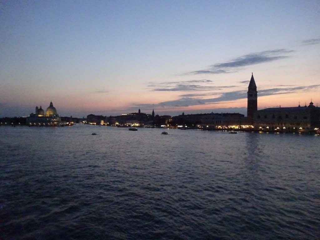
Today we cruised through the North Adriatic Sea. The name of the sea comes from the old word Adria which means water, so today we were sailing on the water sea. A water- sea which was as smooth as a mirror. It almost felt as if we were committing a sin because the ship was cutting through this mirror with its bulb and was causing the only rivulets on the water. Completely wind still weather is normally not so much of a problem as the ship creates its own wind. They only thing was, that today the ship was not creating much wind as we were only doing 10 knots. Dubrovnik is not that far away but to make it in one night you have to leave Venice early. On an embarkation day that does not work and who wants to leave Venice early if you can have the most romantic sail-away possible? And beautiful it was as the thunder storms had nicely departed and it was dry, cool but not chilly; a perfect temperature to stand outside and watch magnificent scenery.

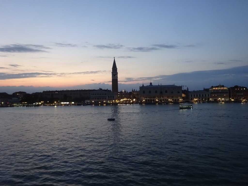
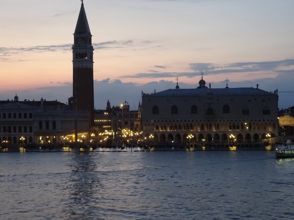
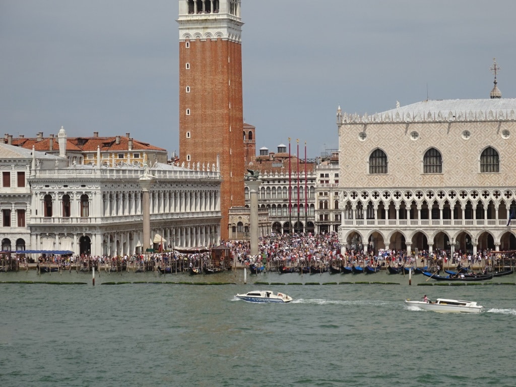
Approaching St Marks Square. Sunset was at 20.59 hrs. and thus the sun was still casting a red glow against the horizon.

And most guests were outside with a camera, cellphone or other recording equipment and most of them stayed until we came to the pilot station at 22.15 hrs. It was just too nice to leave. But all humans are different and the sailors who were handling the ropes on departure could not wait to get inside. For a very urgent reason to watch the semi finals of football with England against Croatia. Although Indonesia did not make it into the world cup, most Indonesians are football mad and do not want to miss any game. Their allegiance is mainly for English Clubs if there is no Dutch Club playing but tonight it was more “may the best one win”.

Diner and partying in St.Marks Square. A wonderful thing to do as long as you wish to pay the prices.

Most of the deck officers are Dutch but we have one from Belgium (very depressed at the moment, as losing is ok but not from the French) and we have two British and one from Romania.  The two English guys, as most of their country, were convincing themselves that England would win the World Cup and were thus fully focused on the game. As the whole game was played while were leaving port, the ship had a good connection and the whole game could be followed on a screen in the Bo ‘sun store. The best team won and today we had two more depressed officers, namely our English friends. A very quiet and reflective day on the bridge so to say.

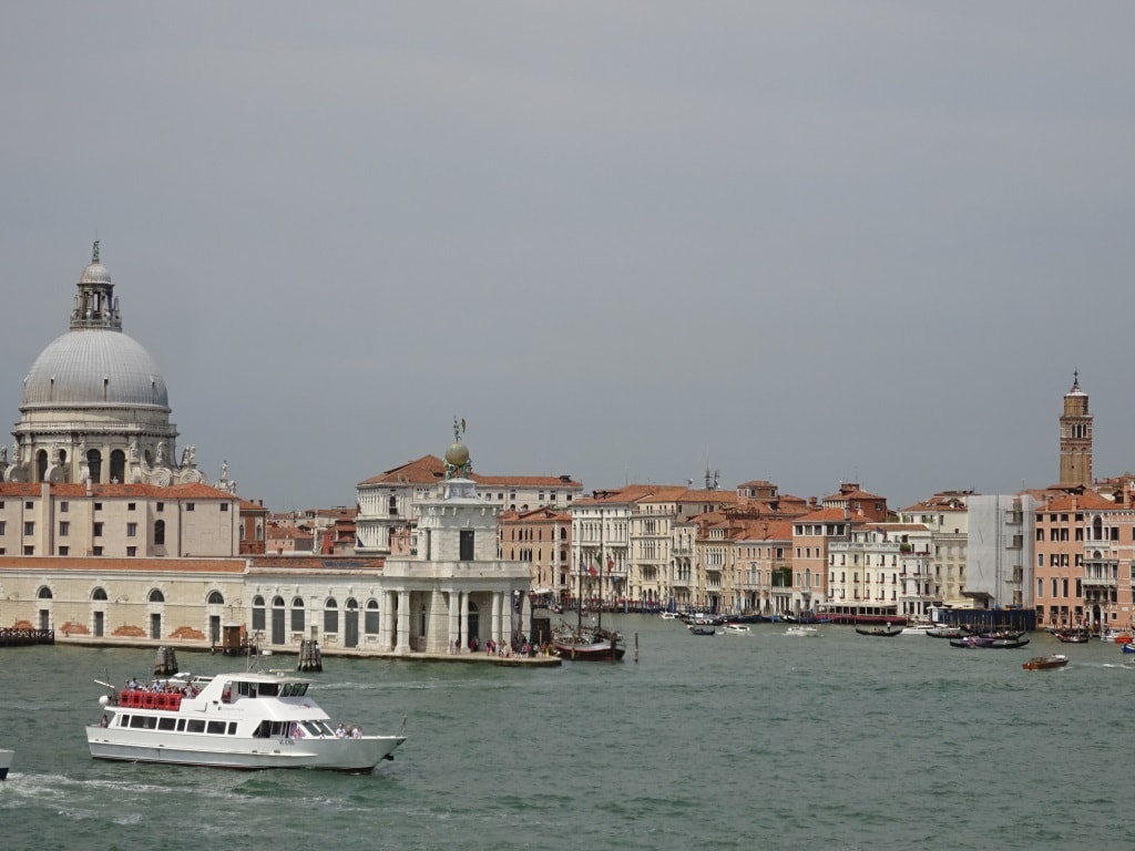
A quick look into the Grand Canal. Boats keep going day and night as it is the only means of transport for most of the city.

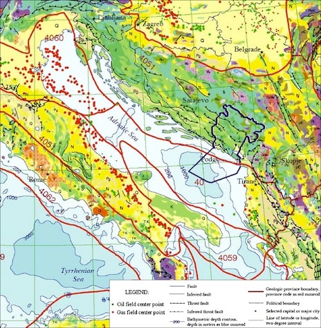
What is not widely known is that there is a considerable amount of oil and gas exploration going on in the Adriatic Sea. Not on the scale of the North Sea or the Gulf of Mexico but a large number of oil wells have been drilled and the tops of these wells are sticking out above water. We sailed by them for most of the day. Some of them were just the end of the well with inspection housing but some of them have a helicopter platform as well and are a little bit bigger. Most of the wells we saw today are in the Economic Zone of Italy but the former Yugoslavian countries such as Slovenia, Montenegro and Croatia are starting to explore as well. More oil is still being found and I have been given to understand that Croatia is handing out concessions further south of the country.

The red dots are the wells. Either Gas or oil.  We kept them all on our starboard side while sailing south towards Dubrovnik. (Thank you to the unknown website that posted this)

I hope the companies that will go for these concessions will have their house in order as all the countries surrounding the Adriatic Sea have very strict anti-pollution rules. Those apply to the cruise ships as well and thus the Oosterdam runs its cruises here on MGO instead off on bunker fuel. In a port such as Venice, the only thing we are allowed to do is a little bit of cleaning but no painting and no major hosing down of the decks. (This was fine with the sailors as the only thing they wanted to do was watch football) A number of years ago most countries around the Mediterranean realized that the Med. was nearly dead. Because it is basically an inland sea, there is not much circulation as the only flow through is from the Strait of Gibraltar to the entrance to the Suez Canal and the Black Sea. Thus what went into the sea stayed and could not break down by regular circulation. By taking draconian measures everybody was kicked into shape and now things are slowly improving again. (If you ever are in Italy or Croatia or Turkey do not wash your boat or paint it. The fines go up to $ 40,000 for each offense)

Tomorrow we are in Dubrovnik and we are docking in the outer port. The weather should be warm again with a full day of sunshine, temperatures of 85oF or 29oC and a gentle breeze blowing. Our only concern is, if the Bora would start to blow through the river valley near the dock. If so hopefully we are docked before the wind comes through as otherwise we have to wait until 11.00 hrs. or so before it dies down again. But we do not know and we cannot plan for it; we just have to wait and see until we get there.

11 July 2018: Venice 2nd Day.

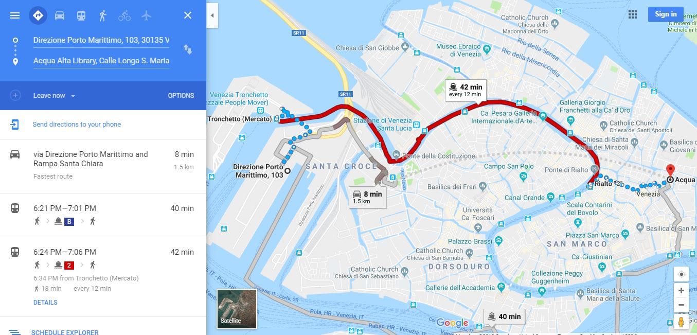
Overnights in port are always nice as they give most of the crew the chance to run ashore for a few hours before change over day starts the next day. There is a metro station right outside the door which takes you to the west corner of old Venice. From there you can walk further into town or take the Vaporetto which goes all the way –clockwise –around: “the Rialto route”. Next to the ship there is a Vaporetto stop as well (on land you call it a Bus- stop, so is this a Boat –stop?) and that takes you clockwise around: “the Lido route”.  Cost is about 8 euro’s and if you connect the two routes together you can make a full circuit of the outer canals of Venice in about 80 minutes.  I had this on my plans for today but I was wise, knowing my 2nd hand book sellers, and made a telephone call first to find out if the bookshop of my focus was open in the morning; it was not. So I stayed on board. Original plan had been to go ashore after having conducted my end of cruise ritual, moving cabin.

As you can not use a car in Venice and private water taxi’s are very expensive and difficult to book: You have to plan this as an expedition. Walk to the vaporetto station, hop on for 42 minutes and then zig zig through the narrow streets to the bookshop.  (Courtesy of Google Maps)

There is always a cabin reserved for me but it is up to the Guest Relation Manager to decide if I get that one or another one. So she makes the guests happy first and I get the cabin at the end of the pecking order. Through the years I must have made a lot of guests happy by giving up the initially reserved cabin and they never knew it.  Now I am in an outside cabin with an obstructed view and that normally indicates that a guest did not want an upgrade. People do not always realize this but a lot of guests do not like upgrades, either free or for a fee. They want their preferred cabin. Sometimes because it is close to an elevator or to the gangway; sometimes because they do not want a bath and sometimes because they simply like inside cabins. Whatever the reason, I have now a cabin with an excellent view of the bow of Tender 13.

Because we are staying until 21.00 hrs. embarkation was slow today as a lot of guests first went into Venice before boarding. So we had a lot of puzzled cabin stewards who were all geared up for delivering suitcases and those suitcases were very slow in arriving, at least during the first two hours. I do not know what those guests did with their suitcases while ashore but they did not arrive early. Luckily because we are sailing late, we have ample time to get them on board.

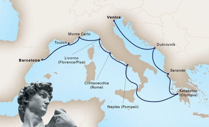
The coming cruise. voyage 657 of the ms Oosterdam. I will stay with her to Civitavecchia and then fly back north again. (Map, courtesy of HollandAmerica.com)

This cruise the ship will return to where it came from, Barcelona. When I joined her she was eastbound and now she is westbound. A westbound route with a large loop around Italy and calling at Croatia and Albania. The call at Albania is a destination in development. It is still not so long ago that it emerged from Stalinist autocratic rule and it is now slowly becoming part of main stream Europe. That means that all facilities that cruise guests are used to, are not yet fully developed but on the other hand, guests will visit a port which is still very authentic.

Another port which is more unusual for Holland America is Toulon. And with that I mean we are not calling here that often, often compared with visits to the ports nearby. Toulon is the French Navy port, located to the west of Monte Carlo. It is not a port name that stands out as a must see highlight but from there the company runs excellent tours which give a very good impression of southern France, especially the region between Marseilles, Nice, Toulon and Monte Carlo.

We will sail at 21.00 hrs. and hopefully we will have a nice sail away. Thunderstorms were gathering in the late afternoon and thunder and lightning was seen over Venice. But it might be all gone by sailing time. The sun will just have set by that time, so we are sailing out at dusk, followed by nautical twilight. The sun will not be in our eyes and the lights of Venice will just be starting to come out. Once out we will sail south into the Adriatic Sea and have a sea day before we reach Dubrovnik.

10 July 2018; Venice, Italy, First Day.

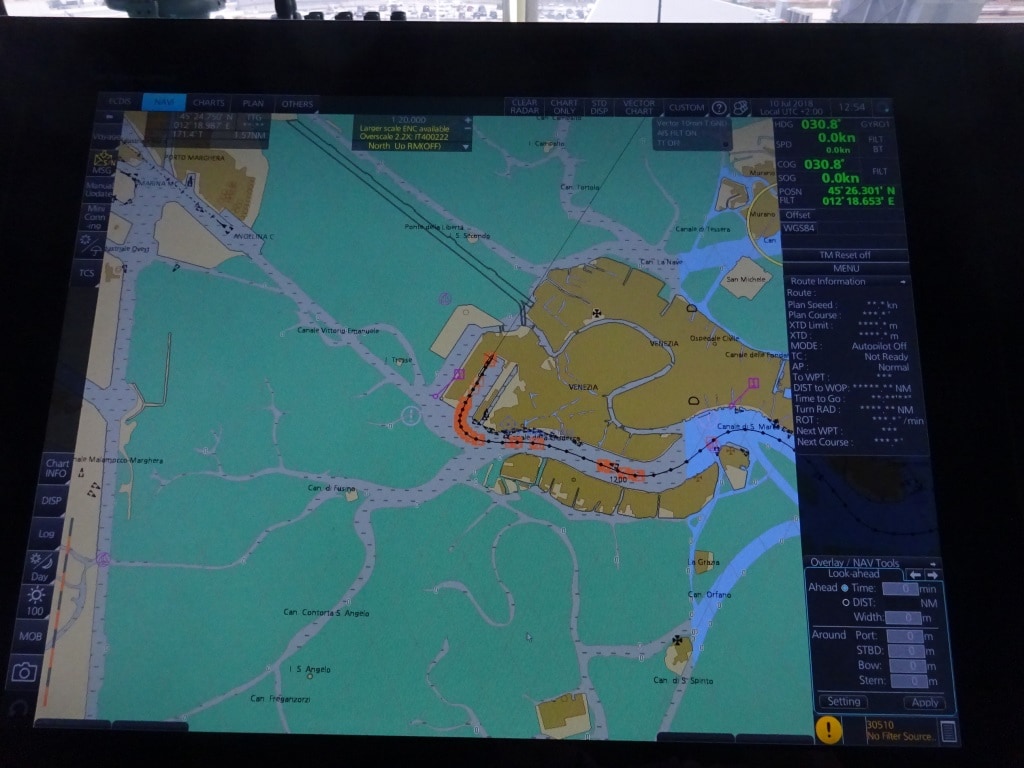
While sailing over an Adriatic Sea that was a flat as a mirror, we approached Venice pilot station. As we were entering the port at 11.30. it was a very decent time for all the guests to be up and about and to see Venice in all its glory. And I can only advise all the guests to do so while they still can.  Sometime in the future there will be a channel dug or enlarged (there is already a channel system coming to Venice via Maghera where the shipyard is) and all the cruise ships, at least the big ones, will go via this channel to the cruise terminals.

The Electronic chart overview of Venice. To the west is all shallows, interspersed with small rivers. One of rivers will be enlarged to guide large ships directly to the terminal without sailing through Venice as we did this morning.

Although it will be a pity that the guests will be deprived of one of the more spectacular sailings in and out of a port, I can understand the concern of the local authorities of having these ever larger ships coming through what is basically a fairly narrow fairway.  What size ship will still be allowed to come through, I do not know, there was talk about 90,000 tons and if so then the Vista Class ships will still go through. Wait and see, nothing has been decided yet.

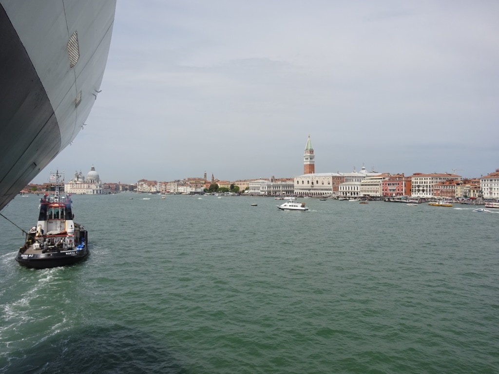
Approaching the centre of Venice. The tugboat has made fast to ensure we will change course to port on time and not go straight ahead into the Grand Canal.

To mitigate the danger of a large cruise ship missing the turn when curving past San Marco’s square it is now compulsory to have a tugboat forward and a tugboat aft. They both make fast with a towing line on deck and if something would happen, they would be able to stop the ship (the aft tug) or to keep it on the intended track (the forward tug). I was forward again with the cadet and I took the opportunity to refresh the sailors mind about how to receive a towing line and later on to safely let it slip through the Panama chock back to the tugboat again. As the Oosterdam has so much maneuvering power, we seldom use tugboats and the experience gets a bit rusty then. This evolution is not so simple to do and to do it safely needs some coordination.

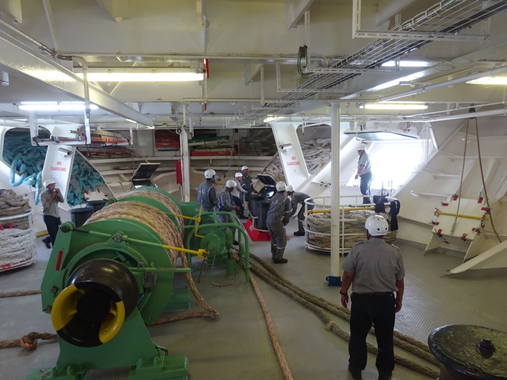
The sailors in action. They are just putting the tug rope onto the bollard.

The line is pulled on deck with the winch and then the eye has to be lifted over the bollard on deck so the tugboat can pull. This means: one sailor on the winch, one sailor guiding the messenger line over the capstan of the winch, two sailors holding the rope or wire when it comes on deck and two sailors for guiding the eye of the rope over the bollard. The dangerous moment is when two sailors have to keep the rope in position so the other two can lift it over. If the rope would slip out of their hands it might cause an accident to the two holding the eye. Thus the two holding the eye will handle the eye of the rope with “open grip”; e.g.  they lift the rope up but their fingers are not going around the  rope. So if the rope would “jump up” it slips out of their hands without damaging their fingers. So we did a little exercise first and then under the guidance of the Bo ‘sun it went perfect and very safe.

Although it still looks busy. This is a quiet day in high summer for Venice.

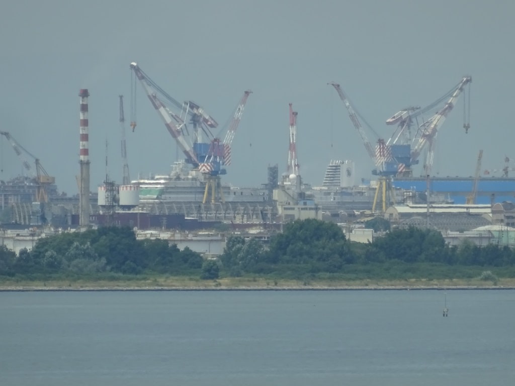
Today we had a wind less approach to the dock and the tugboats were not needed to guide the ms Oosterdam through the Lido or into the berth area. We were the only one at the cruise terminal which made everything a lot simpler. Once docked we could look to the South West and see the Nieuw Statendam taking shape in the distance.  More about her in the autumn when I will be on board to help starting her up.

The Nieuw Statendam at the Marghera Shipyard. When she comes to Venice, she will have to go to open sea and then come in through the regular entrance to the East of Venice. A direct channel will come, but is not there yet.

For the guests it should have been a good day, today, as it was not that busy in Venice. If there are more cruise ships in port then it gets busier of course but the city itself attracts so many visitors that one would almost expect that it would sink into the Laguna under all the weight, cruise ship guests or no cruise ship guests. Most of the visitors are all milling around San Marco square and do not venture that deep into the city itself. Which is a pity as the architecture and little piazza’s that you can find add a lot to a good understanding and enjoyment of being there. One advise, make sure the cell phone is on a map or navigation system so that you can find your way out again as all the islands (and there are more than a 100 which make up the cluster of Venice) are all densely built up. This makes it is hard to see the sun or any other landmark. To give you a good reason to go a few streets away from the main square and the area around the Grand Canal:  at San Marco’s square a pizza costs 50 euro’s. Two streets deep into the city behind it (where the locals live) it goes down to 9 euro’s and they taste as good, if not better.

The entrance to the Grand Canal. A wonderful area to get lost in. And if you have the time, then it does not matter as eventually you will come to a canal and then there is always a Vaporetto stop nearby to take you home.

We will remain here until tomorrow afternoon 17.00 hrs. and then start our next cruise which will bring us to the West side of Italy and beyond. The cruise will end in Barcelona but I will be leaving in Civitavecchia to join the Koningsdam so I will take you back to the Norwegian Fjords.

Weather for tomorrow: Sunny again but with 40% chance of a thunder storm. That will bring the temperatures down to about 28oC or 82oF and that is cool compared to the last few days.

09 July 2018: Kotor, Montenegro.

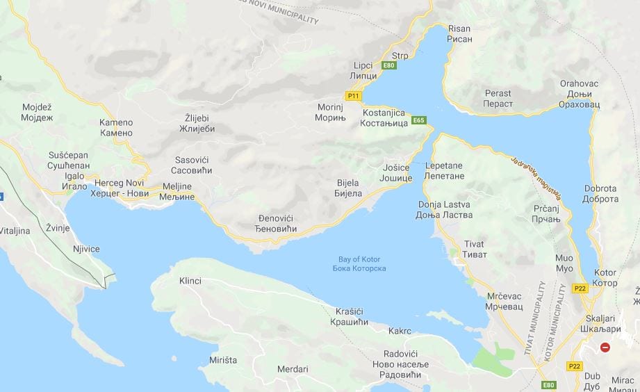
The bay stretches from the lower left – open sea, to the far right. At the end is the town of Kotor. (Thank you Google Maps)

Kotor has always been a sort of hidden gem in the cruise business, but was visited by small cruise ships and private yachts even before the 2nd world war. Then the troubles with the breaking up of Yugoslavia came and until that was settled there was no cruise ship traffic all. Now the industry is booming and every day in the summer there are one or more cruise ships present.  Today there was us and the Seabourn Odyssey and we had the dock. Guests do not always realize how lucky they are, that the company can secure a dock. We do so many different cruises that we are never the “senior” ship calling who can get preference because it comes in every week. So we need to have a bit of luck. Today it was easy, we were with Seabourn which is our sister company and things can then be arranged in house. The Oosterdam docked until the departure time of 14.00 hrs., then the Odyssey who was at anchor and ran a tender service  went alongside as soon as were gone.

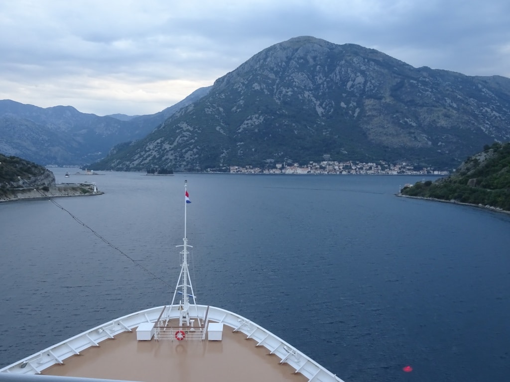
The narrow passage in the Gulf of Kotor. This was at 05.30 in the morning, I was already up and about as at the moment I am teaching the deck cadet how to do stations and how to lead the Bo’sun and his team with the mooring ropes on the bow.

Sailing into Kotor is one of the most scenic arrivals that there are. If you like ice and trees then Glacier Bay will win. But if you like to look at villages, old and new houses, fortresses and churches perched against the hill side, and then Kotor ticks all the boxes. Going in was early today as it takes nearly two hours from the pilot station to the dock but worthwhile to get up for. For those who did not want to do that, the same thing could be seen on departure but due to the lay out of the Gulf of Kotor sailing in gives a better look.

Most spectacular is the narrow sail through near Lepetane. The gap is just over a 1000 Feet wide and sits under and angel of 90o onto the rest of the Bay. In width is comparable to Seymour Narrows north of Vancouver. There they have the current, here they have the wind. Because of the lay out of the Bay, (according to experts it is not a bay but a Rija or submerged river canyon) even a gentle breeze can blow up to storm force as the steeps mountains on either side compress the wind into a narrow beam. Thus everybody on the bridge was completely focused and looked for the smallest white cap on the water to see if the wind could suddenly pick up; because if it hits the ship while coming out of the gap, the rocks on either side are very near. Today we were lucky, we had some wind, but once around the last corner it was a gentle sunny day. The predicted rain only arrived after we departed.

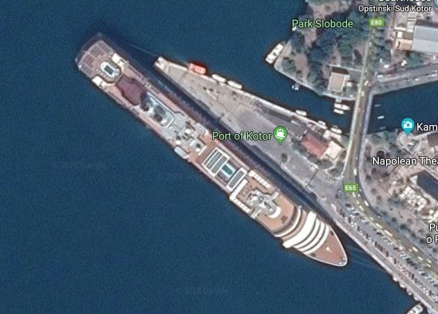
I found this on google earth. A Vista Class ship alongside.. See how far the stern overhangs the dock.

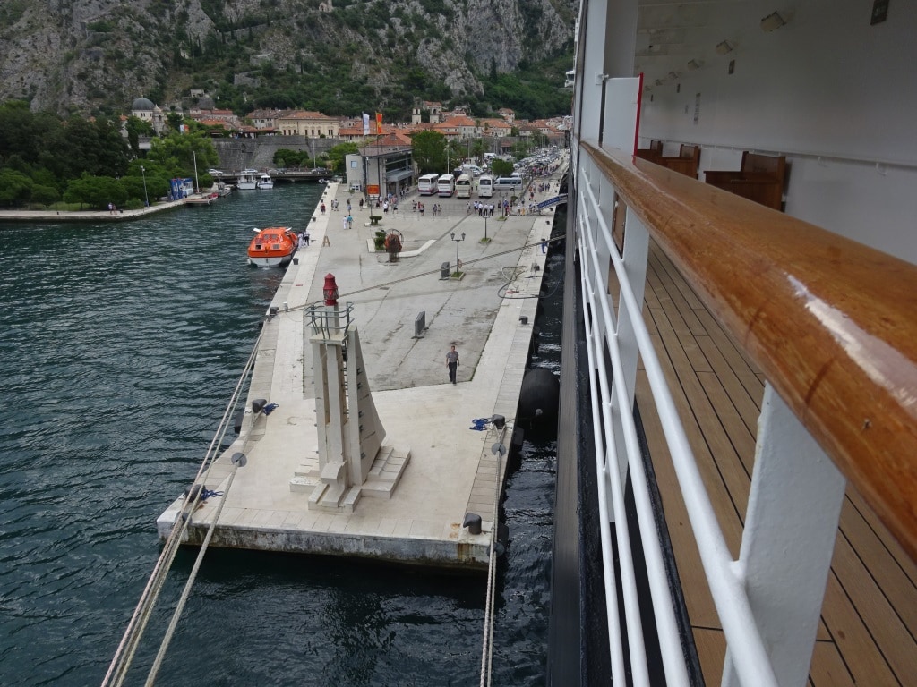
The guests did like the port as nearly all 2000 came back in the last hour. Reason for us on board to rejoice because if we had been tendering…… then we would have had very long lines as the tender service cannot process that number at the same time; even with four docking platforms going. So we were happy that we were docking. What the guests do not realize is that happiness on the bridge is tinged with concern as we do not fit alongside. The part of the pier that is deep enough is Prinsendam size not Oosterdam size. Thus we have to be creative with the ropes at the stern and the captain kept the Starboard Azipod going at all times, to keep the stern pressed against the dock.

Creativity by the officer on the aft mooring station. As we have only lines leading forward, two lines were led around a bollard on the opposite side and then tied up onto the ship itself. What we can do as we have “Dutch bollards” in recesses in the ships hull.

In the meantime, the guests crossed the street as the old city was less than 300 yards away. We cannot do much better than that.

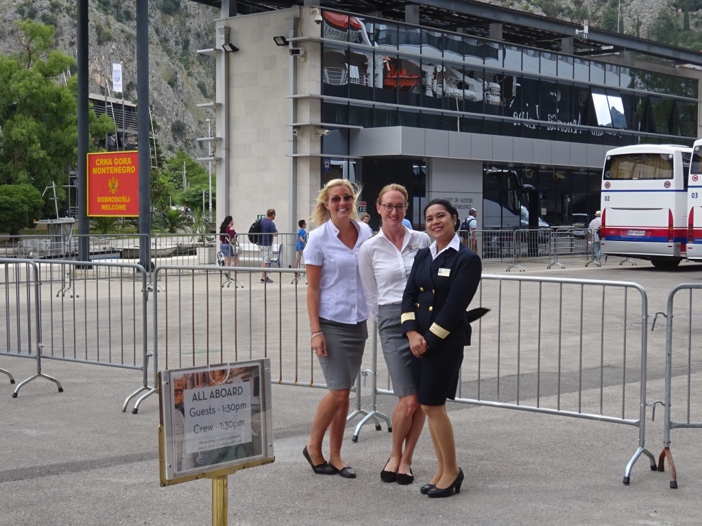
Friendly crew at the gangway. Another Holland America Line tradition. At the gangway we have officers wishing the guests a nice day ashore. This time Front Desk attendant, Cruise Director and Guest Relations manager.

Kotor has been there for a long long time, but the Fortress and the Walls, which are perched against the cliffs, are mostly from the Venetian times of the 1500’s when Venice was by far the most powerful entity in the Mediterranean. A pity we did not stay in the afternoon as the old town is a delight to walk through and sitting on the main square with a good glass of beer is an experience not to be missed. But we sailed early and in the morning my presence was required in the Main Galley. Not to teach the cooks how to cook but to teach them what to do when their cooking goes wrong.

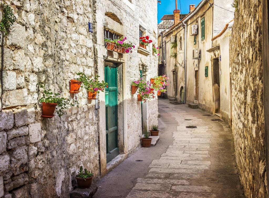
One of the old streets in Kotor. The whole downtown area looks like this and is a delight to walk around in and to get lost in.

We left Kotor at 14.00 hrs. as it is a tight schedule to make it to Venice on time. Here we stay overnight. Tomorrow afternoon and evening the guests of this cruise have the chance to see the place and then the day after tomorrow the new guests arrive; although we have quite a few CVG guests on board who are doing back to back cruises, or have strung 3,4, or 5 together.

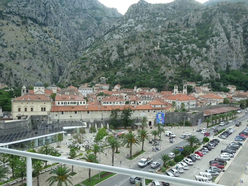
The old town of Kotor right across from the bow of the ship. Kotor is a UNESCO world heritage site; is very well preserved and since there is peace in ex- Yugoslavia, a a lot of restoration of the old buildings is taking place.

Weather for Venice. Partly cloudy with 28oC or 82oF. The 2nd day there will be a 50% chance of rain.

08 July 2018; Kerkira, Corfu, Greece.

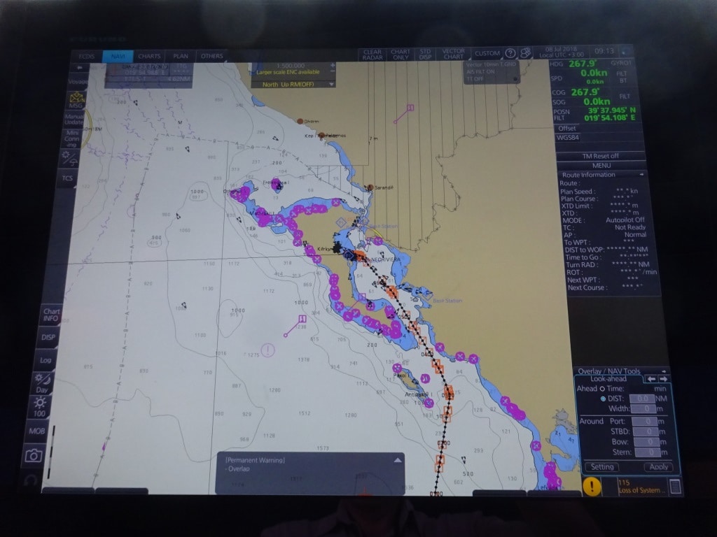
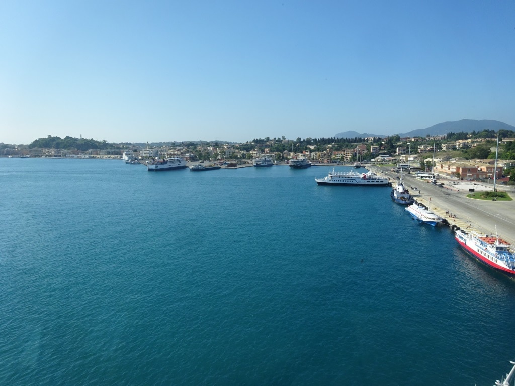
After a very windy departure the ship sailed north along the coast of the Peloponnesus towards the next island in the Ionian Sea, Kerkira. An island that is separated from the big island by a strait which is called the Steno Kerkiras. Kerkira lies on the east side of the island in the sort of curved bay. Thus a sheltered port except when the Etesian winds blow. Today they arrived late and they were not that strong at least when compared with yesterday. The port has a U shaped pier setup with the Left leg and the top part of the U being used by ferries and the outer leg by cruise ships. The docks were constructed sometime in the past and now most docks are either too short or “just fit” for the average size cruise ships of today. We were in port together with the Costa NeoReviera which was originally owned by the now defunct cruise company Festival Cruises.

The approach from the south. Corfu is also North to south located so the predominant wind blows straight down the Steno Kerkiras. the island acts as a funnel and things can become quite unhappy then. Today it was not too bad.

Because the U of the port is quite large there was a shuttle bus running from the port gate to both ships as we were docked all the way at the end of the U. although there is an airport, which sees over 2 ml. guests a year, mainly package holiday tourists, a large number of locals and visitors use the local ferry system to get to the other side or to the other islands. Hence the plethora of ferries, large and small, in the port. Transport with these ferries is fairly cheap and once you have figured out the Greek system of announcing/posting the various routes, and where on the dock the ferry is parked (which sometimes involves quite a lot of asking) you can travel all over Greece with their ferry system, including the islands far off the beaten track.

The ferry part of Kerkira. The 2nd boat on the right is one of the “fast cigars” or hydrofoils. This is a quiet moment as some ferries had already left for their day crossing to somewhere else.

Of all that floats as a ferry, what stands out most among them are the Russian Hydrofoils or “fast cigars” as I heard somebody calling them. For a while they were made in large numbers in Russia and were exported to countries close to the USSR. The Greeks seemed to have liked them a lot for the pure pedestrian traffic as there is no space for anything on board but hand bags and suitcases. They never came much further west than Greece but since some time we have had a few in the Netherlands where they run a Water Taxi system to Rotterdam Central for commuters. They are/were quite popular by those using them but not so much by those around as the wake produced would make the boats and yachts laid up along the route wobble considerably. The plan was to replace them with “less wobbly” options so they might be gone again. But there in Greece they are still everywhere to be seen.

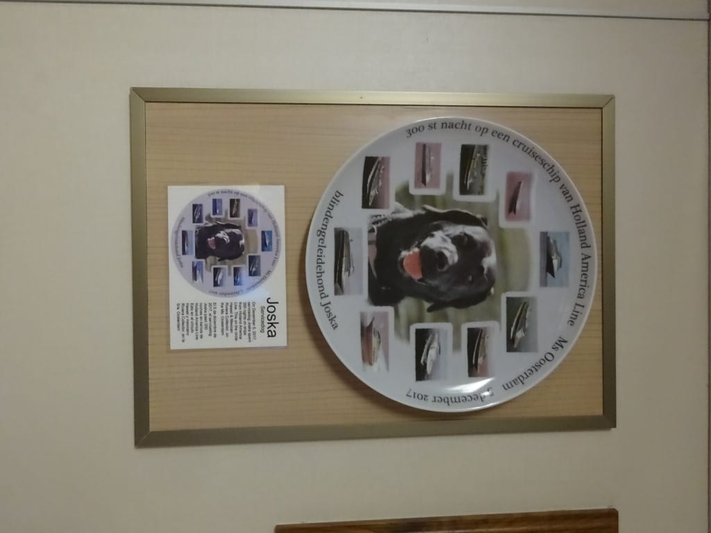
300 days at sea. Not bad for a dog. Many a regular cruiser does not get that high in the HAL Mariner Society.

For those who cruise, know that every ship has a “Wall of Fame” where First Port Call plaques are put on display. Some are a bit naff but some are almost pieces or art and very nice to look at. The Oosterdam has a very usual one; one to commemorate a blind dog who in 2017 reached  300 days with Holland America. And counting as I recently met dog Joska (and the owners attached to it) on the ms Rotterdam in April 2018. Guide and Service Dogs are held in high esteem by us and most Captains recognize them with also issuing a medal for the dog.

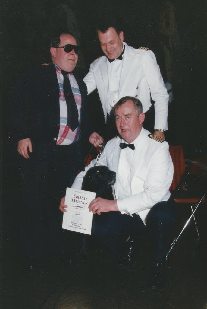
The good old days. Captain Leo van Lanschot Hubrecht, Hotel Manager J.J Scheringa, dog and owner, elevated to Grand Mariner. This was before we went to medals with 100, 300, 500 and 700 days.

My records show that (most likely) the first medal/certificate issued to a blind dog was in 1992 on board the ss Rotterdam by Captain Leo van Lanschot Hubrecht. I have kept that tradition going on my ships and as most current captains have sailed with me one time or the other in the past before they became captain, they are now also continuing that tradition. But it is the first time that a HAL ship was offered a Plate to commemorate this event.

We sail from here to Kotor in Montenegro and that brings us back to the Central European Time Zone and thus tonight we go one hour back. Good planning as the sailing into Kotor is very scenic with a very narrow passage before entering a fjord or lake and then nearing the old town of Kotor which lies at the end, partly on the flat, partly against the hill. So guests can have a good nights rest and be up and about early to see the scenery.

Weather for tomorrow: 27oC / 81oF mostly overcast with a chance of showers.

07 July 2018 Argostolion; Greece.

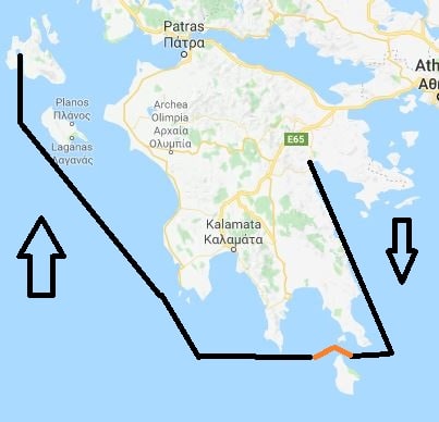
Argostolion or Argostoli is located on the island of Cephalonia or Kefalonia, one of the Ionian Sea islands, on the west side of the Peloponnesus. We arrived here by sailing around the south point and through the passage north of the island of Kithira. It is much easier to go around as then there is no traffic but it is 16 miles longer so all traffic goes through the passage. This passage is called Steno Elafosinou and Steno means strait or passage.  The passage is quite wide but the number of idiots going through is also quite extensive. Last evening it was fairly normal; every ship made the course changes on time and every ship gave each other a little bit of room. But that is not always the case as we come in this area of the Mediterranean on the routes to Turkey and Russia, across some very original thinkers as far as the rules of the road are concerned.

Our route around the Peloponnesus. The red part is the Strait where things can be very interesting as all ships have to make the same course change. NE to SE when going East and NW to SW when going west.

I still remember very vividly when I was captain on the Noordam in 2001 and we went through here that ahead of us was a very large tanker, close to 300 meters or so. While in the middle of the passage, where everybody makes the course change, it decided to make a full U turn. I assume that the captain had received orders to turn back at once and decided to do so; at once. But there was no announcement, nothing of the kind, just suddenly a large tanker making a turn to port and going around. Tankers need quite a bit of space to make a U turn and thus he was blocking the routes of everybody else. For me on the Noordam it was not much of a problem, we put the brakes on and stayed at a safe distance. But for other cargo ships, those who need a long time to slow down when their engine is on sea speed setting, it was not so nice. So we saw ships scattering hither and dither and one even drifting into the bay on the North side. In the meantime this tanker came very close to the shallows on the North side of the Steno Elafosinou; so close that the officer of the watch on the Noordam started to wonder if we should not get the tenders ready in case a rescue mission was needed. The tanker made it, but only just, and then sailed in the opposite direction. In the meantime the air was “blue” on the VHF by all ships who were questioning the heritage of the captain, wishing him a not so nice future, and promising him a very close personal “ conversation” if they would ever meet him somewhere.

The town of Argostolion. Completely rebuilt after the 1953 earthquake and as a result most of the houses have very similar roofs. The building on the right is the Maritime Academy.

Argostolion is located in an inlet which is quite sheltered except from the Northerly winds, the Etesian winds. And they started to blow today. There is a dock nowadays in the port, also in the north south direction, and that made docking possible. Had there been no dock, then we would have had to cancel as you cannot tender in swells caused by 40 knots of wind and more. But we were docked on time. But for the reminder of the day, the waves were slamming under the stern, sending shudder after shudder through the ship. The town is fairly new as it was partly destroyed by German bombing in the 2nd world war and then an earthquake in 1953 took care of the rest. Thus all the houses look fairly new and also fairly similar.

Building a dock the most frugal way possible. Three short platforms and the bow and the stern are held in place by mooring lines connected to two buoys.

It was a good day for the guests as the temperature had dropped significantly from yesterday while the sun remained shining, but with a lot of wind blowing. From here there are tours available to inland caves, ancient sides, wineries and botanical gardens; a great variation which made  our tours well booked.

I spent my day in “red tape”. As is required for each shipping company we have to have a Safety Management System. A set of books or a database which gives us regulations and guidance on how to run the ships and how to implement policies for every aspect of life on board. (Although the SMS is compulsory for safety, environmental, security and health only; we have a lot more in it). The challenge is that it is easy to put a regulation into the system but it is not always that easy to find it back. The search engine reacts to key words and the keywords that the policy maker had in mind are not always the same as the searcher will use. It is like doing a google; you do not always get what you were expecting. I was on my ship inspection again and then you have to check the database for every item as the world keeps changing. So I hovered between my computer to find the theoretical requirements and going into the ship to see what had been implemented in a practical way. …………… and it is amazing how complicated everything around a First Aid Kit can be………..

Tomorrow we are in Kerkira or Corfu as the rest of world calls it. It will be sunny again with temperatures of 85oF / 29oC. and it might be windy again. It is only a 106 miles north from here and that means a slow comfortable run further up the coast, and then we will be docked by 08.00 hrs. If the authorities do not change their mind, we should have the best dock in the port with the shortest walking possible distance to the town.

Older posts Newer posts