- Captain Albert's Website and Blog -

Ocean Liner History and Stories from the Sea, Past and Present. With an In Depth focus on Holland America Line

Category: CaptAlExport (page 32 of 203)

06 Dec. 2016; At Sea.

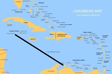
Today we are in Western part of the Caribbean Sea, heading for Grand Cayman. And the course line is basically one straight North Westerly heading until we arrive there.  Until we get there, there is not much excitement to be gleaned from the around the ship. Just sun, sea and wind. And numerous Starlings who are flying around the ship and who are not very happy with the ship. A bird is only really happy with a ship when it can hang on the wind generated by the bow plowing through the water. The airflow is pushed upwards and generates just sufficient up-lift for a bird to ride on it. On the Pacific side you see them hovering there for hours and hours. Here in the Caribe they have a problem, the Trade Wind. When going North West that is a following wind, which blows about 5 to 10 knots faster than the ship travels.

Birds hate a following wind as it plays havoc with the uplift needed under their wings. So today we saw a continuous performance of: bird getting into position, bird happy for a moment, wind increases for a moment, wind now upsets the balance, bird unhappy and flies away. Most of the time to the stern of the ship. Then either the birds has forgotten what has happened, or there is a new bird but shortly after the whole sequence starts again. It does give the officers and quartermasters on the bridge something to look at, because for the rest the sea is empty.

Can not be much simpler. Heading straight for Grand Cayman.

Can not be much simpler. Heading straight for Grand Cayman.

During last night we met a few ships who were on the line between from Panama and the Mona Passage (between Dominican Republic and Puerto Rico) or going even further east but by the early morning the ms Oosterdam had sailed in an area of nothingness.  Here the water is very deep up, to 9000 feet is the norm, and that makes it less interesting for fishing boats and there is very little commercial traffic as there are not many cruise or regular ships who sail from the east coast of Costa Rica and Guatemala over to Grand Cayman or Jamaica. When we do our 7 days cruise next week, same as last 12 days ago, the Oosterdam will hug the coast and hop from port to port there. It does not hop over to Grand Cayman as the distance is just too long to fit in a seven day cruise. Hence we visit Grand Cayman on our 14 day around the Caribbean cruise when the Island lays on our return course back to Tampa. More or less straight in the line from Oranjestad to the West Point of Cuba. (Cabo San Antonio)

Thus we will meet cruise ships tomorrow who are also on a sail by the island cruise. Quite a few of them have just started their cruise in Miami or Fort Lauderdale and now have a sea day; they will have sailed around Cuba early this morning and will then arrive at Grand Cayman tomorrow. Or they have been visiting a port to the East (Bahama Island, Dominican Republic or Jamaica)  and are now coming westward, either to go to the Yucatan (Cozumel, Progresso) to do the same we are doing, heading back to Florida after their stop at Grand Cayman.

Tomorrow there are supposed to be four ships in port and it will be interesting to see on what schedule they are, as how long they are staying totally depends on the time needed from where they were coming from or where they are going to. We will have a relative short stay with everybody back on board by 14.30. hrs. to ensure we will make Tampa on time. The Captain has already announced that he cannot wait for stragglers. For them there are very good flights back home but it is a fuss to come back and collect your luggage. So it is better to be on time and catch the tender home before it leaves without you.

Tomorrow we will be another warm and sunny day and ashore in Georgetown it will feel even warmer than in another port as the sand (which everywhere) reflects and absorbs the heat.   No clouds expected at all and 84oF. 29oC. The trade wind is keeping this temperature down from soaring into the 90’s. if the wind was not there.
05 Dec. 2016; Oranjestad, Aruba.

The A.B.C islands (Aruba, Bonaire, and Curacao) are located just above the South American North Coast. Hence the good reason why it became a Dutch territory in the 17th. Century. They were very strategic in controlling the area which is now Venezuela, Columbia and the approaches to Panama. The islands itself were useful as well, as sugar cane was cultivated with great success. As both Curacao and Aruba had a natural harbor these two islands were the foremost of the economic expansion when Royal Dutch Shell stated to explore the Venezuelan oilfields. Refineries were built and eventually Bonaire took part in the oil production as well but Curacao with its Schottegat and Aruba with the Paarden Baai had a great advantage. And this remains to until the current day. Bonaire is still the more laidback one of the three islands although it has two cruise piers.

Our overnight cruise has taken us from Curacao all the way to Aruba, about a 50 miles voyage to the west. Even with leaving at 23.00 hrs. in the evening the ship could still make Oranjestad by 06.00 the next morning by sailing backwards. Other ships were dealing with this “backwards sailing” as well. Two cruise ships were going from Aruba to Curacao and as they had left in the afternoon they were already off Curacao by 8 pm. floating for the remainder of the night until pilot/docking time. They could have docked either where the Zuiderdam was or at our dock as soon as we had left but then you have to pay more port fees and you loose on board revenue as a lot of the younger crowd on board those ships would have invaded Willemstad in the middle of the night.

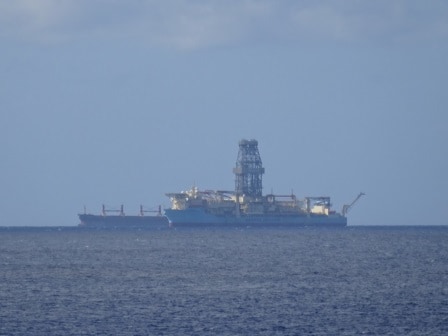
Unusual to see outside Aruba, and there were three of them, were the floating oil drill platforms from Maersk. Most likley waiting for orders.

Unusual to see outside Aruba, and there were three of them, were the floating oil drill platforms from Maersk. Most likely waiting for orders.

Our stay in Oranjestad was scheduled from 07.00 hrs. to 13.00 hrs. a short call needed otherwise it would be hard to make Grand Cayman on time. The port of Oranjestad is basically a heightened shore line turning it into a number of berths for ships and those berths are protected from the ocean swell by a natural reef. This all together is called the Paardenbaai or the Bay of Horses.  As luck would have it we were the only ship in port today making it possible to dock right in the middle of the cruise pier at Terminal B, which has the shortest walking distance to town.

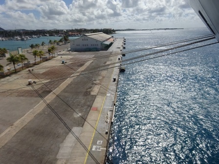
Most is different from other ports is that the bollards are much more island, giving a much better angle against the wind.

Most is different from other ports is that the bollards are much more island, giving a much better angle against the wind.

Also the Staff Captain was happy as the ship could put its mooring ropes anywhere it liked without having to share with any neighbors. Putting mooring ropes in the best possible position is of extreme importance in Oranjestad.   If the trade wind veers just a little bit to the North East it flows fully in the port beam.   The island is very low and thus offers very little protection. The ropes will have to hold the ship in position against the wind which on a bad day can easily climb up to 35 knots. So sometimes the help of the thrusters is needed to ease off the tension on the ropes. The port has a very large number of bollards installed, many more than in any other port and that makes it possible to put ropes ashore which are 90o to the ship and straight in line with the wind. With other ships at the A and C terminal you sometimes have to share bollards and that is never nice. So today was an ideal day for a perfect rope alignment even if the wind was not that strong.

For departure the strong wind is not a problem. You simply employ the “blow away” maneuver. Let go the lines and by the time they are out of the water the wind will have pushed the ship 10 meters or so from the pier and the only thing you have to do is to give full ahead and make one course change to starboard and you are back again in the open sea. Then sail around the west point of the island and from there a northerly course to Grand Cayman.

Here we will be the day after tomorrow. They are expecting five ships in port and if they all show up, the Oosterdam will have to drift. This means more work for the captain but for the guests it is not too bad as we can drift right outside the tender port reducing the tender distance to the port to the absolute minimum. The weather for tomorrow, more of the same with maybe a bit more swell as we will be out of the lee of the islands.

04 Dec. 2016; Willemstad, Curacao, the Netherlands.

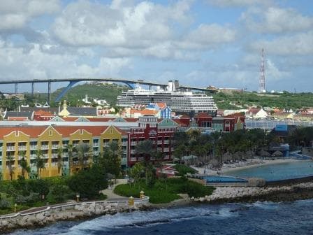
Sometimes I think that our weather guru’s just put a bit of rain in the weather forecast to make sure they always have it right. Again today a bit of rain was forecasted but we have not seen anything yet. It was a beautiful sunny day with a very occasional cloud coming over but that was about it. I do not know if anything will change during the dark hours as we are here until 23.00 hrs. tonight but for the time being it is very nice. We are docked at the mega pier which is located outside the port and was inaugurated a number of years ago when it became clear to the authorities of Curacao that the new large cruise ships would start to bypass the island as they did not fit in the port and/or under the bridge when coming into the port.

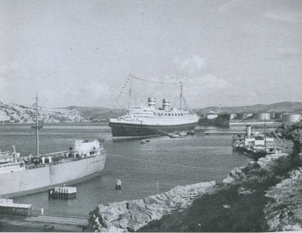
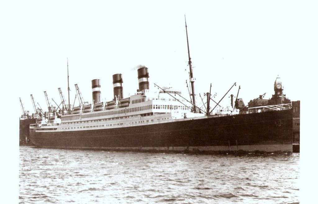
Not an inspiring area; Caracas Baai. Where dock now is much better. This is the ss Nieuw Amsterdam II, around 1950.

Not an inspiring area; Caracas Baai. Where dock now is much better. This is the ss Nieuw Amsterdam II, around 1950.

In the old days there was the option to dock at Caracas Bay just around the corner. This is a secondary port for Curacao and mainly used for oil tankers and cargo ships. It is much wider but it is a long way from port and bussing in 5000 cruise guests would be a nightmare. Hence the new pier. There is now talk about building a second one for the even larger ships. The Oosterdam with a length of just under 300 meters fits comfortably alongside this pier and can set good mooring ropes under the optimum angles. Our Koningsdam which is 12 meters longer would already have to deal with all the forward or stern ropes becoming breast lines and that is with the predominant , strong, Trade Wind not such a nice thing.

The ms Zuiderdam towering over Otrabanda the left bank of Willemstad. If needed the ship does fit under the Juliana Bridge seen in the distance.

The ms Zuiderdam towering over Otrabanda the left bank of Willemstad. If needed the ship does fit under the Juliana Bridge seen in the distance.

We caught up-to-day with the Zuiderdam who calls here before it goes westwards towards the Panama Canal. She docked in the port or better said just inside St. Anna Baai at the west side to the entrance channel to the inner bay. Which means her guests are closer to downtown than ours. So why would she be there and not us? Well, she leaves at 17.00 hrs. and that gives the guests less time. We stay until late in the evening and thus our guests have plenty of time to walk to town (it is only 5 minutes more) and to come back. There is a local bus service and taxi’s galore so it is not as if we are cut off from the world.

jkjkjkjkj

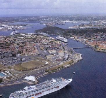
A busy day in Curacao, as it can be. Below at the mega pier a Princess ship,in port two R class ships and under the bridge a Celebrity ship. Today we only had Holland America in port.

Willemstad has been a cruise port since a very long. Already around 1900 there were the German cruise ships (The Hamburg Amerika Linie had the first dedicated cruise ship constructed called the Prinzessin Victoria Luise) who came here in the winter months before the first world war. I have a story about her on my blog. If you click Cruises from the past, and then click: the first real cruise ship.

Holland America showed up in the late 20’s and 1930’s when especially the ss Rotterdam came here on a regular basis while making cruises from New York. She docked at the same spot, the Mathey werf where the Zuiderdam is today.  Later on when the Nieuw Amsterdam came, she went to Caracas Bay as the available tugboat power was not deemed strong enough to bring her in. That problem has been longtime solved and the ss Rotterdam of 1958 which was bigger than the N.A just sailed in docked anywhere in the port.  Now they bring in very large tankers who are going to the repair shipyard located in the inner bay called the Schottegat.

Docking at the Mega Pier is a fairly easy gig. When coming from the East, as we did, you just make a wide turn, stop in front of the pier, make sure you keep the nose in the sometimes very strong current and go sideways.  Going into port, into St. Anna Baai, is a lot more complicated because you sail 90o on the current which can run up to 4 knots. The wind is from the same direction and that does not help either. When wind and current are strong together it is quite tricky to enter into the fairly small opening.   Thus it takes some planning and thus we saw the Zuiderdam stopping well outside the port, assessing the drift and then quickly moving forward to dock. Once you know the effect of wind and current on the ship you can figure out the drift, and then compensate for it. Which normally means steering a course which makes it look like as if the ship will hit the shore when it makes it approach but the current then pushes it back onto the course line at the moment you enter the Baai. While going in, the current will have less and less influence on the ship and then you have to reduce the drift angle until you are back on the normal course again.

We will sail tonight for Oranjestad Aruba at 23.00 and which is only a small hop to make as Aruba lies just west of Curacao. Here we will experience a Drive Inn, Drive Out harbor as the harbor is protected by a big sand bank with an opening to the NW. and a exit to the SE. (and vice versa) Weather for tomorrow, ……………………… more of the same.

03 December 2016; At Sea.

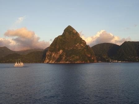
Today we have a Sunday at sea and for most guests an excellent chance to recover from 4 warm ports in a row. Tomorrow we are in Willemstad, followed by Oranjestad, and then we have a sea day again. So the next stretch is not that busy. Yesterday after departure from Castries we sailed by the Pitons and it was one of the better scenic stops here that I have seen in a long time. The sun was almost setting and bathed the Pitons in a golden glow and while doing so a sailing cruiser came by right in front of it. Giving a good perspective of how high the Pitons are but also bringing a romantic touch to it all, remembering the old days of slow sailing clippers sailing around the world. Now it was a sailing ship used as a cruise yacht but it is still sailing and was still going slow.

Sailing past the Pitons, we "sail by" on the engines, they are doing it for real

Sailing past the Pitons, we “sail by” on the engines, they are doing it for real.

The Oosterdam is going slow as well as the distance to Willemstad on Curacao is too long to make it one overnight. Thus we are trundling on with a sedate speed of 13 knots. The Trade winds are with us and have a velocity of 20 to 25 knots and the relative result is a gentle breeze over the decks of about 10 knots. Perfect weather to spend time on deck and thus all deck chairs were occupied with guests deeply immersed in books or “digesting all the information they had just absorbed from those books”.

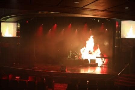
With a bit of stage haze you can make this look really life like.

With a bit of stage haze you can make this look really life like.

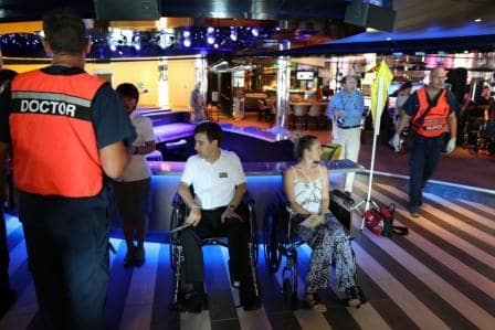
Yesterday in Castries I organized one of my special – controlled mayhem- drills. Multiple Casualty retrieval and treatment for the Medical Department. We have official procedures in the case this happens. Our medical team cannot deal with 40 to 50 injured people (always a possibility in case of a fire or collision) and then they have to proceed to Triage Routines in a similar way as the Military does on the battle field. For a lot of crew this is something unusual and this means a lot of pre organization to get all the noses pointing the same way. For such a drill you need a lot of volunteers, who will play dead, wounded, or mentally impaired because of an incident. The fun part for them is to play “Drama Queen” to their hearts content and some a very good at it. Sometimes almost too good.

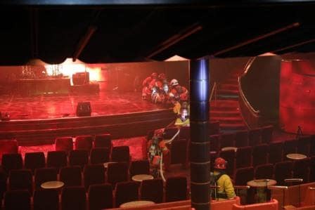
The Ships Fire Brigade to the Rescue.

The Ships Fire Brigade to the Rescue.

For this particular drill I set the show lounge on fire…….. sort of. With the modern techniques we can project fire on the screens with flames which look even more realistic than the real ones. After the Fire Teams have then secured the lounge (and the light technician lets the fire go out very slowly) the Medical Triage Team is sent in to assess/triage all casualties very quickly and then focus on those who still have a fair chance to survive.

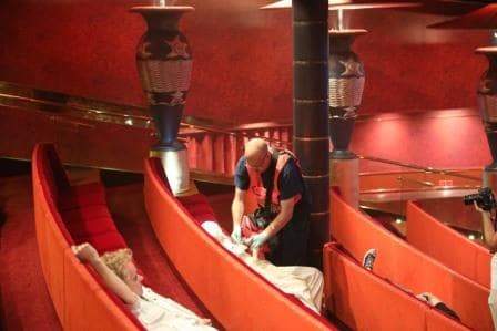
The ships Medical Officer assessing a casualty. They are stickered accordingly to urgency.

The ships Medical Officer assessing a casualty. They are stickered accordingly to urgency.

Their challenge is, as they want to focus on those who can still be saved, that they are always hampered by those with small wounds and minor issues who still demand instant attention. For that and for transport, the rest of the crew comes into action. Make shift hospitals are being setup and the casualties are transported there and separated accordingly to their triage color and grading of urgency. While the lesser cases wait until medical is available their details are noted by the Administrative Staff so it is exactly known who is affected and how many.

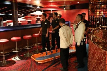
A combined group of Housekeeping and Diningroom waiting to be called in with a stretcher.

A combined group of Housekeeping and Diningroom waiting to be called in with a stretcher.

I use the show lounge as it is together with the dining room the area with the largest concentration of guests on the ship and also because on a port day it is always empty in the morning. This time I managed to get 29 volunteers and the exercise took 45 minutes before medical could say; we have those who will survive stabilized and now we can go over to secondary treatment routines. For that option we normally take over the Greenhouse Spa where there are 10 treatments rooms which are perfect as a small hospital.

The yellow area for those who need urgent treatment but can wait until the critical cases have been stabilized.

The yellow area for those who need urgent treatment but can wait until the critical cases have been stabilized.

Over a 100 crew is involved as there are extra stretchers teams, First Response teams but also support teams from the Bar Department who might be needed as extra security, providing drink and food. Apart from being useful, the crew really enjoys doing it as the Drama Queens provide a lot of entertainment and distraction and everybody is involved in doing something.

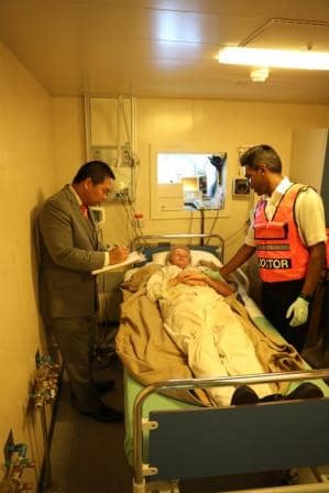
The critical cases end up under the direct supervision of the ships Sr.Doctor. Seen here dictating his assessment to a clerk or scribe supplied by the Front Office.

The critical cases end up under the direct supervision of the ships Sr.Doctor. Seen here dictating his assessment to a clerk or scribe supplied by the Front Office.

Tomorrow we are in Willemstad Curacao. At the moment we are scheduled for docking at the Mega Pier just outside the west side town of Willemstad. The weather will bring little change: It supposed to rain again, as it was supposed to do all week and it did not and it will be warm 85oF / 29oC and with the regular Trade Wind blowing.

02 Dec. 2016; Castries, St. Lucia.

Castries is most of the time a great port to be in. It is sheltered from most winds, it has fairly deep water and if you are not at the downtown dock, the larger cruise dock has a small shopping village which satisfies those who do not want to go very far. For the captains the most brilliant thing is the airport which is located right at the entrance. The airport – control – tower, which is manned by the time we arrive can give the exact wind strength in the port.  On the off chance there is too much wind in the port the ship can then decide to stay out and does not have to abort at the very last minute. It seldom happens but we always prepare for the worst scenarios.

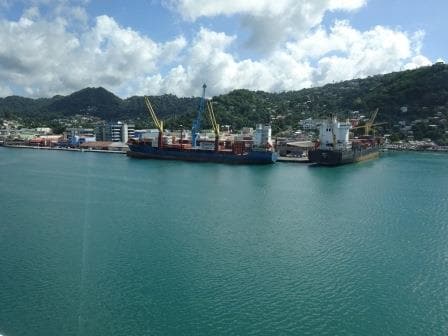
The Elizabeth dock in downtown Castries St. Lucia.

The Elizabeth dock in downtown Castries St. Lucia.

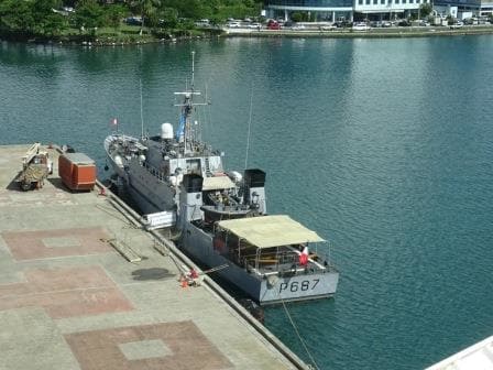
There are several docks in Castries but most cruise ships dock at the two cruise terminals which leaves the downtown pier open for the cargo ships. We were the only cruise ship in port today, the 2nd cruise Terminal was taken over by a French patrol boat and the Elizabeth dock at  the down town side was indeed occupied by cargo ships coming and leaving. Most of them are involved in a feeder service to Panama, Aruba or to Miami; where the long distance containers are transferred to the very large containerships on the worldwide routes.

The French Patrol Boat La Gracieuse.

The French Patrol Boat La Gracieuse.

France has 21 of these patrol boats and this one listens to the beautiful name La Gracieuse. The   French Patrol boat was not an un-expected appearance as this part of the Caribbean Sea is looked after by the French because their islands are just around the corner. Most islands in the Caribbean Sea are independent or only loosely attached to an old home country but Martinique and Guadeloupe is fully part of France. One of the reasons these islands are so much more expensive to visit as the prices are the same as in France itself. St. Lucia is part of the British Commonwealth which means it runs itself but the British Queen is still the official Head of State. When we come to Curacao and Aruba we will see Dutch patrol boats and helicopters as they guard that part of the Caribbean. Main job for all these patrol boats is to try to keep Drug runners from coming out of South America and making it to Puerto Rico or even the USA.

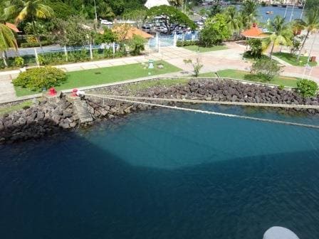
These are the forward breast lines which run over water to the shore. Note the silver circular shields on each rope.

These are the forward breast lines which run over water to the shore. Note the silver circular shields on each rope.

As you can see from the photo the dock is very small and so is the berth where the Oosterdam is docked. As a result we run long lines to bollards and mooring buoys far away. This makes the docking process on arrival quite a time consuming affair. Each line has to be brought ashore by boat and then pulled over the bollard.  Because these bollards are almost inland and the vegetation close by, we take extra care here to have Rat-Shields or Rat-Guards in place on the mooring ropes. These things come in a variety of designs and then they are normally painted by the sailors – just for the fun of it —- Hence there is no rhyme nor reason what is used by a ship but some ships just keep them as is with the Galvanized silver color. So as soon as the ship is docked a sailor with a trolley comes out of the ship and puts on each rope a shield. We prefer to do it from the shore where we can tie them up better than shipside as otherwise they might be blow off by the wind. If we cannot get at them because the ropes are on a dolphin or mooring buoy then we hang them from the ship.

There were times when they were compulsory in any port in the world, and there would be heavy fines if they were not in place. For the W.H.O organization they are not compulsory anymore as the ships do not really carry rats anymore. The poor rat that climbs onboard dies a certain death due to lack of food. Still most countries recommend it and also the American Navy health regulations still demand them. So we put them on as in that way, we will always be in compliance.

The route to Les Pitons about an hour down from Castries.

The route to Les Pitons about an hour down from Castries.

As long as I have been sailing here, St. Lucia always was a shorter stay. Invariably the ships sailed before 15.00 hrs. as they then went to Soufriere to pick up the Overland Tour and do a scenic sail bay of the Pitons, two Volcano cones which rise straight up out of the Jungle.  We will also do the sightseeing again and afterwards sail westwards towards Willemstad on Curacao. So tomorrow will be a restful sea day.


01 Dec. 2016; St. Johns, Antigua.

Sailing into St. Johns Antigua is bit more complicated than sailing into Charlotte Amalie where the water is deeper and there is more room to swing.  St. Johns lies deep in a natural bay but it is a very shallow bay. Almost so shallow that by the time you dock, there is hardly any water left under the keel.  Regular dredging is taking place and they were doing so today as well; using the soil for shoring up the shore.

Coming from deep sea the ship approaches the pilot station and at once the depth gets a lot less. But still good progress can be made with 10 to 15 feet under the keel. Still the speed into port is then regular between 10 and 12 knots. You can try to go faster but the ship simply will not do it as the displaced water needs the time to flow away from under the keel. Then when coming to the dock the water depth is reduced to 5 feet or less at some places and then the ship becomes really sluggish in handling. Again because the water which is pushed away by the ship needs time to flow under and around the hull. Increasing power on the bow thrusters and Azipods does not help very much because of this delay. If you give too much power and the water starts flowing then you might overshoot (or bump into the pier) and have to counter act again. The lecturer at my Maritime Academy always said; it is like a very small man dancing with a very big lady, you have to guide, you cannot force, as then you lose control when the lady starts to sway over the dance floor.

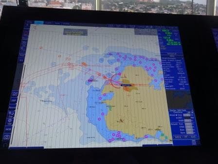
jhjhjhjh

White is deep water and the bluer it gets the more shallow it is. This shot of the electronic charts shows the departure route for this evening.

Thus the docking took some time today; the ship had to be inched forward slowly but steadily as the heritage pier where we docked ends up straight into the town center and thus you do not want to overshoot. Guests on deck could see the sand billowing in the water all around the ship indicating that there was not much clearance left under the keel. This evening when we sail out, we will have the same thing again, it will be a slow maneuver in the basin. First because the basin is not much longer than the length of the ship, and secondly during the 180 turn all that water on the port side that is being pushed away has to flow to the starboard side to fill the void.

St. Johns has two finger piers and can accommodate 4 mega ships if needed. Today we only had the Regal Princess in with us but together we brought just short of 6000 guests ashore so enough for the shopkeepers to be happy. The Regal Princess is much bigger than us but does not have that much more draft as the ship is wider. If you need stability for a box of a certain size, you need a certain amount of weight inside. Think about a tin can in your bath tub. No water inside and it can easily fall over. Fill it up and it sinks. Fill it so that it is level with the outside water level and it nicely bobs up and down in the tub. The same principle goes for the ships. They higher they go, the less weight there is in the lower part. So they can fall over. If you put more ballast in the bottom, they will become stable but the draft increases. If you make the ship wider, you can put the same amount of ballast in but divided over a larger area and the draft will not increase.  That is one of the reasons why large ships such as the Oasis of the Seas do not fall over while they are much higher than other big cruise ships.

Rat Island is to the far left. We used to dock there with the ss Rotterdam who with 32 feet draft could not get to downtown.

Rat Island is to the far left. We used to dock there with the ss Rotterdam who with 32 feet draft could not get to downtown.

If a ship has too much draft and you still want to go to St. Johns it can dock at Rat Island at the beginning of the bay but that is a long trek into town for the guests. This hardly happens anymore and now it is mainly a cargo terminal. Containerships dock here and today there was a Japanese Car Carrier, no doubt delivering new Japanese cars.

Tonight we will make the hop to St. Lucia and we will feel the same movement as last night. Nice and steady ship and then each time when it came out of the lee of one of the islands, the light swaying of the ship on the ocean waves until it came in the lee again of the next islands. We will pass Guadeloupe, Martinique and Montserrat so will gently roll several times. Tomorrow we will be in Castries St. Lucia where they are forecasting rain again, which we have hardly seen since San Juan and so we will just wait and see. Temperatures will be the same again 84oC / 29oC.

30 Nov. 2016; Charlotte Amalie, St. Thomas, U.S.V.I.

As we were going to dock nbr.1 (That is all the way in the corner) we were in position by 07.00 hrs. due to the other ships following us, well ahead of our scheduled docking time. In the old days there used to be the “Pink Hotel” and a nice open air Pub on the pier but it had all been taken over by new buildings with shops. But Shops bring in more money than yachtie’s who come for a drink, so progress has to be.  Also in the Good old days the pier could easily handle four cruise ships of the Statendam size but now it was a tight fit with three. Behind us was the Norwegian Epic and later on the Regal Princess showed up and thus the whole pier was full.

Somehow the phrase "Apartment of the Seas" comes to mind. This is the stern of the Norwegian Epic.

Somehow the phrase “Apartment of the Seas” comes to mind. This is the stern of the Norwegian Epic.

I went ashore for about 20 minutes as Havensight has a very nice bookshop with normally a good selection of shipping books. According to the internet the shop was still there but when I arrived the wooden doors were firmly shut and not a soul, let alone a librarian, was insight. Well at least it kept the world in balance. They did not sell anything and I did not buy anything. Normally I also try to buy the latest postcards, but there were issues from 10 years ago as nobody sends postcards anymore. The post office on the dock is gone because of it and instead the Pubs now advertise “Beer with free Wi-Fi”. I wonder if they also have that available in Tin Cans or in Bottles.

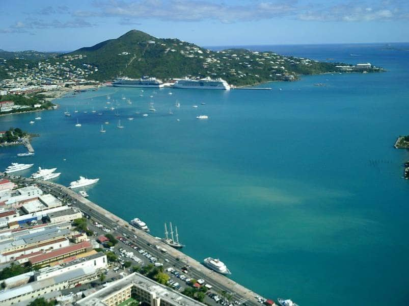
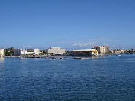
The sheltered harbor of Charlotte Amalie.

The sheltered harbor of Charlotte Amalie. This photo is from a few years ago before they extended the pier so it could take three much larger ships.

Charlotte Amalie has a beautiful natural and sheltered harbor and thus it has always been an important place in the Caribbean. First it was a shelter for pirates, we still have the name Bluebeards Castle as a result of it and when the Danish took it over it became an important trading post. They called the place Charlotte Amalie after their Queen, although it was originally called Taphus (house of draft) meaning there was a brewery there. So the Danish had their priorities right, you first built a pub and the town around it will grow by itself. In 1917 it was bought by the USA and since then it is American territory. The cruise boom here started very slowly to gather pace after tourists could not go to Cuba any longer. Before that time cruise ships called here as well but it was marginal. Holland America came here already in the 1930’s and one of the captains (Commodore Barendse) had a house here not far from where the Cable Car now runs. He had bought it together with a passenger of Dutch decent and each time the ss Statendam (III) would sail in, he had a house boy raise the Dutch flag.

the ss Statendam (III) used to cruise extensively to the West Indies during the winter months of the 1930's.

The ss Statendam (III) used to cruise extensively to the West Indies during the winter months of the 1930’s.

Slowly but steadily the tourist trade increased not in the least because Charlotte Amalie is a Freeport. No taxes. This was instigated by the Danish and the Americans left it as is. Thus in the 70’s when RCCI and Carnival start to bring mass tourism to the port, cheap booze was a big draw. When I went there in 1981 and 1982 and if we were at anchor, we had to make one or two tender runs to load all the booze for the guests. If we had 7000 guests then there were at least 300 boxes. Invariably there was then a freebie box for the Captain, the Hotel manager and the Cruise Director. As we, the deck department who had to do the work did not get anything, it was standard procedure that either the Hotel manager or the Cruise Director lost a box during transport. (It depended on who was the least popular………..)  Then in the 90’s the emphasis shifted more to quality shopping and we saw a large increase in Jewelry and Electronics shops. Now with the mega ships it has become a complete village which easily handles 5000 people on the Havensight dockside, let alone what downtown can take care of as well.

We will sail this evening for St. Johns Antigua. Today we were supposed to have quite a bit of rain but most of it bypassed the harbor and I hope for the same tomorrow as the weather will be similar. It cannot be much different as Antigua is not that far away. Again it will be warm to hot 82o F / 28oC with a fair chance of showers. Also here we will park right in downtown.

29 Nov. 2016; San Juan, Puerto Rico.

San Juan is a port which is often on the cruise schedules with an abnormal arrival time. Whereas in most ports we are docked by 08.00 in the morning and stay a full day, San Juan is the exception to the norm. They only time ships seem to arrive there early is when it is their last port of call or when they do a longer loop cruise. Today was not different. The Crystal Serenity was docked by 10.30; the Oosterdam was docked by 11.00 hrs. The Eurodam was docked by 13.00 hrs. and the Freedom of the Seas started docking at 14.00 hrs. Then at 14.30 the Celebrity Silhouette came in who was not even on the pilot’s schedule. All we are now waiting for (4 pm. in the afternoon, while I am writing this) is the arrival of the Regal Princess. We had much less wind than expected today as the wind suddenly changed from East South East to South West and then dropped down to almost zero. Very usual for San Juan. The South West winds, when blowing, can bring in quite a bit of rain but as the wind change came at 09.00 hrs. there is a fair chance it will remain dry until at least the early evening hours. It will all depend on when the wind gathers force again.

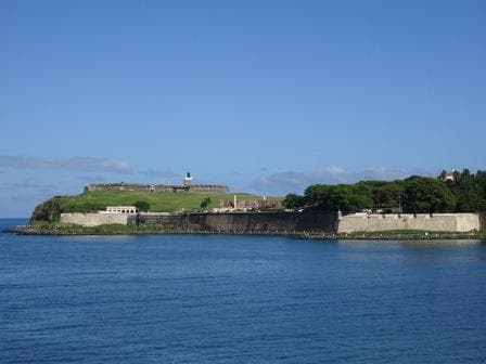
Sailing into San Juan harbour is always nice. This is Morro Castle seen when looking back to sea.

Sailing into San Juan harbour is always nice. This is Morro Castle seen when looking back to sea.

We arrived nicely in the way I had described yesterday, except the pilot came out early not doubt inspired by the nice weather and thus we were docked earlier and that meant the ship cleared well before our scheduled arrival time. San Juan is one of those ports where you are right on top of the town. Walk out of the gate and up the hill and then you only have to aim for the old city. Docking at 1 West is even better but the Oosterdam is really to long for the dock to be comfortable and thus the port authorities prefer the longer ships at berth 3 and 4. Berth 4 has a terminal constructed about 15 years ago but berth 3, of a more recent date, is just an open space. You wonder why but  my assumption is that if they would have made the dock wider to construct a terminal, then the distance between a ship at 3 East and 4 West would have become a little tight so to speak.

Berths 3 and 4. Berth 3 completely flat and berth 4 with a terminal on it.

Berths 3 and 4. Berth 3 completely flat and berth 4 with a terminal on it.

This means that ships that have San Juan as a home port will have to be assigned to berth 4 for luggage and clearance purposes. I do not know if there is currently a large ship home porting in San Juan but Holland America did so for a year with the ms Veendam, when the ship was new, and it turned out to be quite a challenge with flight arrangements and lots of moaning guests who were greatly affected by the heat when coming out of the airport and then having to lug their suitcase(s) to the taxi. The idea behind it was: if you start a cruise in the Caribbean then you can offer more ports as you do not have the sea time between Florida and Puerto Rico. Great Idea but our guests preferred embarking in a US port. Easier to get to and the sea days were to be appreciated as well.

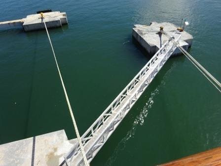
No doubt the Authorities will do something about this one. Ropes touching the catwalk is not good for anybody.

No doubt the Authorities will do something about this one. Ropes touching the catwalk is not good for anybody.

When we docked today, the officer on the aft mooring deck was not a happy camper. The port authority had decided to install a catwalk to the last stern bollard to make the handling of the mooring lines easier and saving the linesmen the hassle of having to climb onto the bollard, secure the rope, climb down again in their boat and then go and get the next mooring line. Great idea but when you put a catwalk there you have to take into consideration where the ropes need to go to and install it in such a way that it does not hamper the free running of those ropes. The catwalk had been installed yesterday and we were the first ship “to benefit” from it. By the time I took the photo, the Port Director was on the dock and already indicating that the catwalk had to be shifted so it did not block the ropes any longer. So we will see next time. Luckily with today’s weather it does not matter that much but when it is very windy and the stern ropes need to take a lot of strain it would have been unpleasant.

Tonight we sail at 23.00 hrs. and so will the Eurodam as we both go to St. Thomas.  Who goes first will depend on whose guests are back on board the earliest. For the distance and approach it does not matter. For the captain whose ship goes out first it has the benefit as he will be off the bridge first and can get to bed first as well. The Eurodam will dock at Crown Bay and the Oosterdam will go to downtown to Havensight. We would normally have gone to Crown Bay as well but the Oasis of the Seas is in port and then she goes to Crown Bay as it is a better fit there with the dock.

Weather for tomorrow in Charlotte Amalie, St. Thomas: Same as today, Warm but with more wind expected.

28 Nov. 2016; At sea, day 2.

Last evening we sailed out of the protection of the Bahamas and Cuba and came into the open waters of the North Atlantic. The area is fairly quiet, or better said the North Atlantic further North of us is fairly quiet as there is not much of a swell rolling in and thus the Oosterdam is sailing through the water in a nice and stable way. Good for everybody, as they could enjoy a carefree sunny day. For most of the day we sailed above the Dominican Republic and then during the night we will cross the Mona Passage located between the Dominican Republic and Puerto Rico, with the plan to arrive at the pilot station of San Juan at 09.45 in the morning.  We arrive at 09.45 at the pilot station because the Crystal Serenity is scheduled for 10.00 hrs. She is going to berth 1 west while we are going to 4 West. The docks are counted from the sea inwards and thus if we sail in just before the Crystal S. then we do not have to wait for them while they make the turn into the 1 dock as 4 dock is further inwards.

I mentioned yesterday that we were expecting two other ships but in the meantime the list has become much longer. We will now be joined by the Eurodam (docking next to us) the Freedom of the Seas , the Regal Princess, the Crystal Serenity, the Silver Wind and the Club Med.  Which means it is going to be busy in San Juan. Even when keeping the pax. count low, we are looking at 12,500 guests coming ashore from the ships, sometime during the day.  It will certainly mean that the T shirts will not be on discount tomorrow.

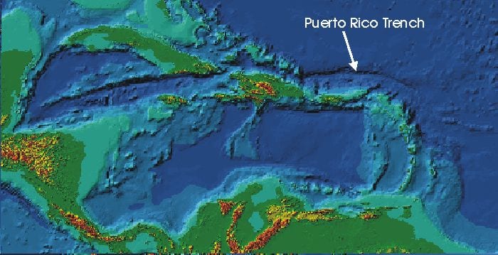
The Puerto Rican trench running from above the Dominican Republic to the East.

The Puerto Rico trench running from above the Dominican Republic to the East.

Sailing towards Puerto Rico, we come across a natural phenomenon which most guests will not notice as it located under water. It is the Puerto Rico Trench which is one of the deepest places in the world. Laying to the north of Puerto Rico it has a length of 800 kilometers (497 miles) long and a maximum depth of 8,648 meters (28,373 ft.) or 5.373 Miles. Not as deep as the Mariana trench near the Philippines but still deep, very deep. All the Caribbean islands are from volcanic origin (something you can see very well when we will pass the mountains near Soufriere on St. Lucia) but the whole area is dormant. The mountain range which tops are the islands were caused by a minor tectonic plate, the Caribbean plate, pushing over the much larger North American plate. The North part of this minor plate is now sitting on top of the large plate and has thus cut off the direct connection with the earth’s fluid inner core. Not completely as we still have a very active Volcano on Montserrat, more to the south east, which crated a lot of mayhem a few years ago.  The Puerto Rican trench is a crack on the North side of this plate and goes much deeper down than the ocean floor around it, which is not shallow either with depths of up to 5 or 6 thousand feet. Because of the tectonic plate movement and the depth, landsides are easily possible, creating tsunamis and also earth quakes can occur.

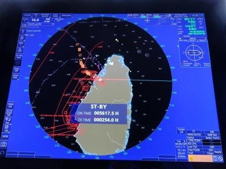
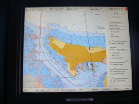
Our course (red) when going in, as seen on the Electronic chart.

Our course (red) when going in, as seen on the Electronic chart. The black line is the track the ship used last time and you can see with the bulge near the dock that the captain went “high” to compensate for the strong Trade Wind.

When we line up tomorrow morning for going in we will do that several miles from the entrance itself. The sail into port is nearly directly south (the leading lights are 181o, with south being 180o) and to get a feeling for the set of the current, the captain will try to get in the leading lights very early as the entrance is not very wide and the shallows are very close by. Then the pilot will board, outside if it is not too bouncy or otherwise when we are just inside. Once past Morro Castle on the portside, we will lose all the current and most of the wind. Then we have a 50 degree turn to port to head for the downtown docks. San Juan is a very large and natural harbor and there are a lot of docks much deeper into the Laguna than where we are going. Next step is to keep a lookout for small airplanes as they built the runway right in the line of the entrance channel. Then we come to the dock and we turn north again. This will bring the Trade wind full on the sb side of the ship and thus the captain has to ensure that he “stays high” otherwise the ship will drift against the cruise ship docked at pier 3 east.  Although we always enjoy visiting the neighbors, drifting against each other is not the way to do it.

We will stay in San Juan until 23.00 hrs. as it is only a short hop to St. Thomas, just around the corner. More about that tomorrow. Weather for tomorrow: Fair chance of showers and 29oC / 84oF with a gentle breeze in the city.


27 Nov. 2016; At Sea, day 1.

As usual we had to wait for the sun to set before we could leave the dock in Key West. Because it was nice weather with only a gentle breeze in the afternoon, everything that floated was up and about and thus it took some doing to get the ship into the turning basin and back to open sea. The pilot boat had to summon & remind several pleasure craft about the Rules of the Road and that if that did not work, explain ………..if big goes against small, then big normally wins.

As soon as we left the pilot station we made a sharp turn to the East and then we followed the Gulf Stream into Nicholas Channel and then the Old Bahama Channel. When we went the other way, coming from Europe we did our best to avoid the Gulf Stream now it was a challenge to find the best balance between staying in it for as long as possible and at the same time not adding too much length to the courses. Otherwise you lose again what you gained with that free push of current.  Unfortunately for the chief engineer and his fuel saving focus we will not catch much Gulf Stream before we enter Old Bahama Channel, where the current is against us.

We will be spending two days at sea and adjust for an arrival time at the pilot station of 09.45 in San Juan. From there it is roughly an hour to be completely alongside and if the local authorities are quick, then everybody will be able to go ashore at the scheduled arrival time of 11.00 hrs. There should not be an issue as Puerto Rico is considered to be a sort of USA as far as clearance activities by the CBP are concerned. And as we are coming from a USA port it should all be fair sailing. We should be in port with the Crystal Serenity and the Freedom of the Seas but we will only find out for sure when we are docked there as the cruise schedules are not always kept up-to-date.

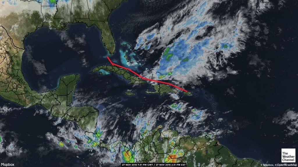
The route we are following takes us above Cuba and Hispaniola in one straight line to San Juan. From Key West you can also go under Cuba but that is considerably longer as you first have to go west and south, then sail under and then come up again through the passage between Hispaniola and Puerto Rico. But it is a viable option when there is a hurricane going to the Bahamas and taking the Northerly route along the Eastern Caribbean Islands. Then we use the mountain range on Cuba as a natural buffer and just sail around the bad weather.

Our route and weather to San Juan. We are just sailing through the lower part of a weather front and it remains to be seen how much water is in there.

Our route and weather to San Juan. We are just sailing through the lower part of a weather front and it remains to be seen how much water is in there.

At the moment there is not much chance of a hurricane or storm as everything is really scattered in dry and wet areas. There is a lot of wet weather hanging over the Puerto Rican basin and we will have to see if some of that water will be “downloaded” onto the ship. It will all depend on the length of the cloud system and the angle of the wind higher up in the atmosphere. Same for the waves. Currently we are nicely sheltered with Cuba to the South and the Bahamas to the North but late tomorrow we will leave that shelter behind when we enter the open sea area south of Great Inagua Island. But as there is no frontal system around to whip up the waves we will only have to deal with the regular trade winds. And that means for the waves to reach a height of not more than 9 to 12 feet. Up to 10 feet the ship does not move at all and when the waves get higher then it depends on the length of the waves on how it will affect the ship. For the moment my estimate would be that we will have a very smooth sail to San Juan.

For on deck it will make for windy weather. We are going against the wind with about 17 knots. The wind is coming at us with about 20 knots and the combined wind velocity is thus reaching Gale Force winds if you stand exposed at the bow. On the Oosterdam the decks in front of the radar mast are completely shielded by tinted windows and thus you do not notice it. But it can be a tricky area as the sun beats down with Caribbean strength, and then reflects from the waves, and all around is the white superstructure from the ship which reflects the sun as well. Altogether good enough to create a sort of microwave oven of sun rays. Sun block 35 or 50 is of the essence.

Tomorrow is our 2nd day at sea and then we will be sailing in the open North Atlantic Ocean. Weather for tomorrow: a chance of rain and sun, windy and temperatures in the mid to high 70’s. (Mid 20oC’s)

Older posts Newer posts