The weather forecast sort of came out but in stages. In the early morning it was miserable with rain and wind. By midmorning the clouds and rain were gone and a nice sun was shining. Still very windy and with the wind on the bow it blew a near hurricane force over the exposed bow area (and that without Otto helping) but in the sheltered areas it was nice to be outside. Then in the course of the afternoon, the wind started to die down and will continue to do so, to such an extent that it might be gone by midnight.
That will cause another challenge: low clouds descending: or restricted visibility. Tampa is notorious for the stuff and if Tampa Bay fogs in, then the ships are kept at anchor until it lifts. And that can be as late as mid afternoon. Very nasty for the guests who are disembarking. I have been sailing from Tampa since 1984 and from day I it was hammered into me by the pilots, try and get your ship to the pilot station by midnight. Then you are docked by 04.00 hrs. and most likely you will beat the fog. It always worked out for me and in all my years sailing from Tampa as a captain I adhered to that rule and I was only caught out once and that was because I could not make it to the pilot station by midnight due to engine issues. So I discussed this with the Captain of the Oosterdam and the wise man that he is, he is going for midnight. Restricted visibility has been forecast and thus he is taking no risks. Not good for the fuel consumption but a lot cheaper than rebooking so many guests onto other flights and as important: keeping the guests happy with a rosy” After Thanks Giving” feeling.
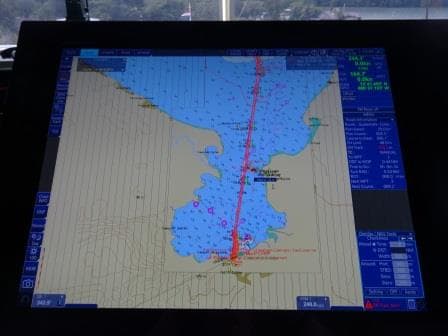
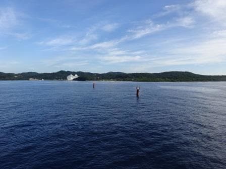
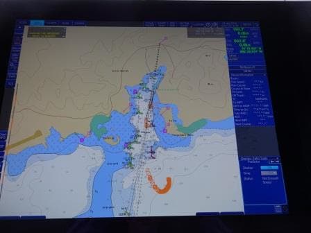
As soon as you are passed the Sunshine Skyway Bridge, there is no turning back and the pilots will have to continue guiding the ship through Tampa Bay. As long as there is no wind, thus no drift, that is not much of an issue. The buoy route is clearly visible on the Radar screen and if you give yourself a little bit more time than you normally do when going around the corners, all will be well. Instead of 04.00 hrs. in the morning, you arrive at 05.00 hrs. and that is still early enough as the CBP and others only start boarding at 06.00 hrs. for the pre-clearance.
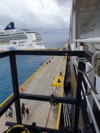
We will be docking again at Terminal 3 and this time we will go starboard side alongside. This is my favorite as well; I always prefer to dock with the nose out, so it is much easier to leave when there is wind on departure. The turning basin is not that wide to swing around in with a 300 meter ship and it is never a good idea to make your own life miserable if the weather forecast has given you fair warning.
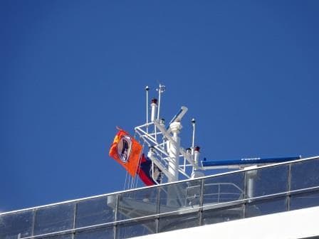
The 3rd version Company flag on the mast of the ms Oosterdam.
Occasionally we see a few unusual things on the ship. The first one was when I boarded on 7 November in Malaga. I was at once intrigued by the fact that our old company flag was in the top. The one we had from 1986 to 2000. It turned out that a guest had once been given such a flag and had brought it with him on the Trans – Atlantic crossing. Good fun of course to fly it a few times.
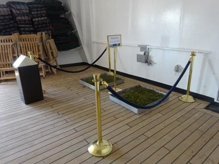
Doggy heaven for Kiki with his own reserved sign.
Second thing we have on this cruise. We are getting more seeing eye dogs and service animals on board as more and more owners are discovering that the cruise ships are a very friendly environment for their special needs, and that they can enjoy their cruise without anything to worry about. This cruise we have a gentleman on board with a small service dog, a white Pomeranian (………..or something like it and very small), who detects heart problems. The name is Kiki and Kiki also has to go to the toilet. For that we order real grass from ashore and then the carpenter builds a nice little boxed grass park. So for the whole cruise Kiki was the envy of the ship with an own roped off area, own grass, and an own name sign.
A number of years ago I gave a seeing eye dog his 300 day medal, so if the owner is still cruising the number of days a year that he used to, then his dog (I think the name was Sylvester) must be up to 500 days now. It is probably hard to achieve but I wonder what would happen if a dog would make the 1400 days, which is the Presidents level. Then the President sends flowers every time you go on a cruise. I wonder if he would then send a bone or something……………………….
Tomorrow we are in Tampa and we should be docked by 04.00 hrs. All the families who came for the Thanks giving cruise will be going home and the ship will prepare for the next cruise, a 14 day roundtrip of the Caribbean. Weather for tomorrow: Partly Cloudy 29oC / 84oF. and very little wind, it is going to be a very warm day.
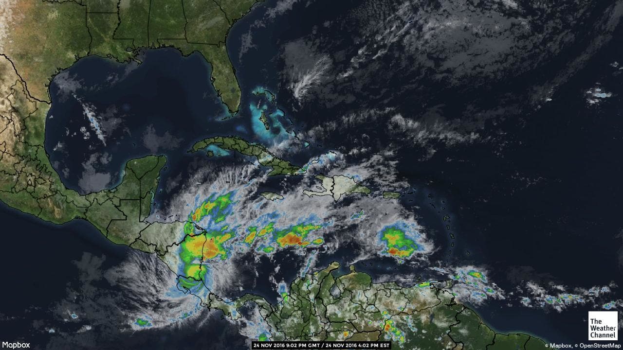
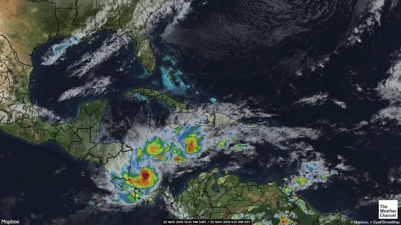
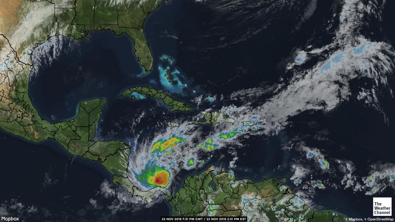
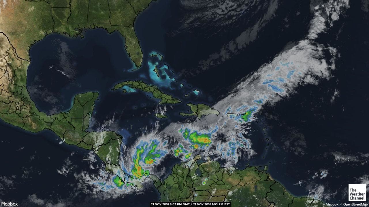
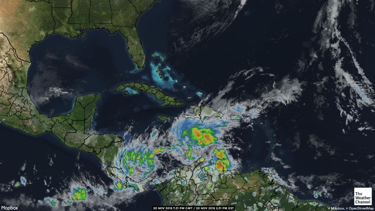
Otto has promoted himself to a catagory 2 hurricane and is now on the move into Nicaragua.
Our hurricane centre weather gurus from www.accuweather.com had the following to say:
Otto to bring life-threatening conditions to parts of Central America
11/24/2016 12:16:12 PM
Otto, a Category 2 hurricane with maximum sustained winds up to 110 mph, came ashore in southern Nicaragua mid-morning local time near the town of San Juan de Nicaragua. This makes Otto the southern most land fall for a hurricane on record in Central America.
Otto will continue to bring heavy rainfall to parts of Nicaragua, Costa Rica and Panama during the next 24 hours as it moves west and weakens. There is the high potential for life-threatening flash flooding and mudslides, especially in the higher terrain of these Central America countries. Rainfall amounts of 6 to 12 inches are likely, but amounts could reach close to 20 inches in some of the mountainous regions. Bands of rainfall will impact parts of southern Honduras. The orientation of the mountainous terrain and the orientation of the winds around Otto will limit the amount of rainfall over El Salvador. In addition to the flooding threat, damaging winds will be possible in parts of Nicaragua and Costa Rica, particularly along and just to the north of the system’s track.
Otto will emerge into the Eastern Pacific Friday as a tropical storm.