- Captain Albert's Website and Blog -

Ocean Liner History and Stories from the Sea, Past and Present. With an In Depth focus on Holland America Line

Category: excludeRecent (page 20 of 82)

18 November 2017; Puerto Chiapas, Mexico.

It is always nice when King Neptune cooperates with our wishes and desires. And he did today by directing the ocean swell to run along the shore and not into the breakwater and entrance to the port. Not too long ago this area had a heavy earthquake and although Chiapas on the coast itself was not hit that much it caused some underwater land sides in the estuary which reduces the depth. The dredgers had been out in force again to make sure that there was enough water again to get in and out………….. under normal circumstances….. but the depth was still a meter short of the standard. Which meant that if a swell had been running, we would have had at least one meter less to play with and that would have been a 10% reduction of the normal depth. Very nasty.

However we were in luck and we did not have to worry. The very minimum depth observed under the keel was 1.6 meters, or 5 feet, which is not much but if there is no swell, we can happily live with that. I have docked with less under the keel and as long as you move over the shallows at a slow speed then you can work with small margins without any difficulty. And thus without much delay we docked at the passenger terminal for a nice and sunny day in Mexico. Swinging around on arrival so we would have a clear shot out in the evening; just in case the wind would pick up in the afternoon.
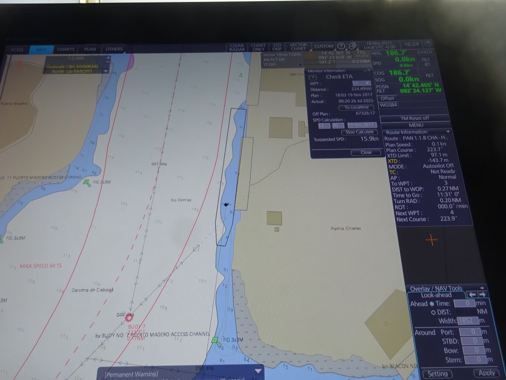
Still docked alongside. First part of the maneuver is to go sideways and get onto the dotted line, and what ever you do remain in between the red lines as they indicate the safety boundary’s.

Puerto Chiapas is also a port which is ideal to train new officers in conning the ship as sailing out only entails 3 small course changes and slowly increasing in speed while doing so. Ideal to get a feeling for the ship, especially when you are just starting with practical ship handling. Thus today the 2nd officer of the 4 to 8 watch was going to have “the conn” supervised by the Captain, the Staff Captain and the local pilot. In the good old days junior officers seldom got the chance to play with the ship and then were sort of stuck when they became close to being captain. In those days pilots did most of the maneuvering as it always involved tugboats so the captains themselves were not that experienced either. Then came the bow and stern thrusters and the whole ball game changed. In the beginning power was marginal so you needed a quiet day for training but now we have so much power that the captain can always carry out corrective action if something happens.
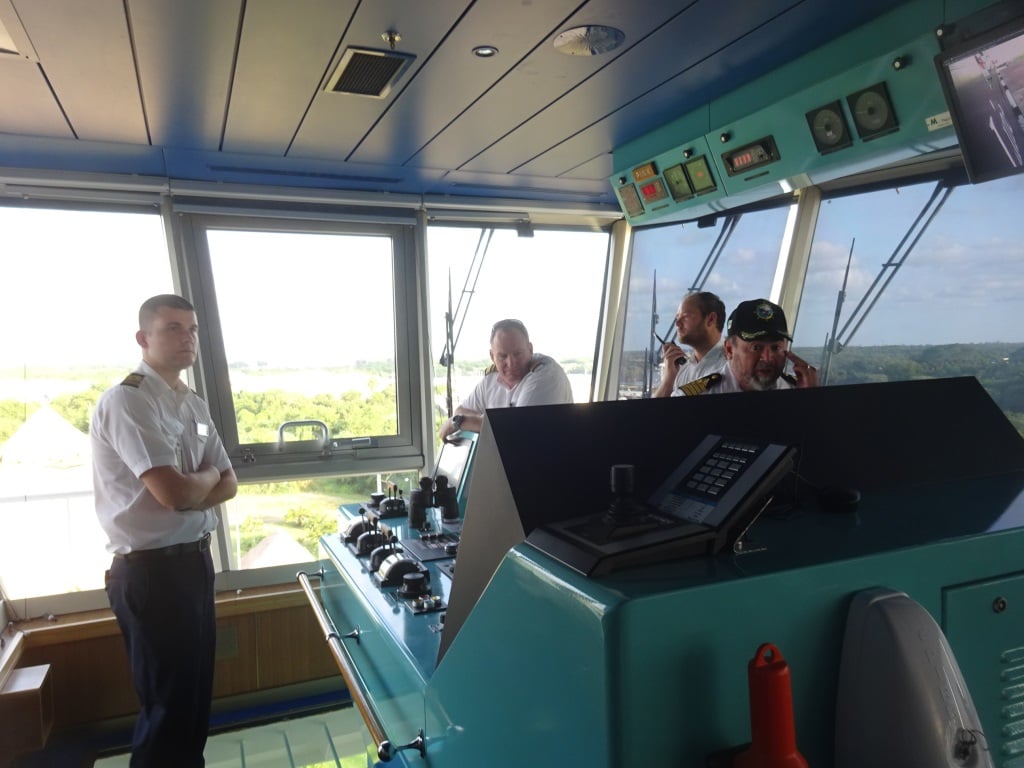
2nd Officer Brian Pas as Navigator, Captain Mark Rowden as supervisor, Staff Captain Wiebe Sypperda communication with the officers forward and aft. Captain Acurro, local pilot, communication with the shore side,

To give everybody a chance the bridge teams are nowadays built up in such a way that you can easily rotate without taking the overall responsibility away from the Master. Team members can just assume different functions.  So today we had:

Captain – Operations Director – oversight, Staff Captain – Communication with the mooring station, 2nd officer – navigator and conning, 3rd officer – Assistant of the watch / Administration and alarms,  Pilot – on the phone talking to the linesmen,  Quartermaster 1 – steering, Quartermaster 2 – Lookout and alarms.
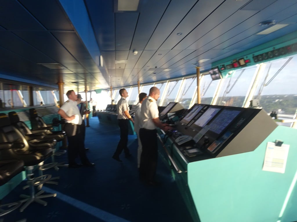
Once the ship is in the middle of the fairway, the whole team moves to the center of the bridge to sail the ship out.

The maneuver consists of going sideways off the dock until the ship is in the middle of the fairway and then after turning the pods forward slowly build up speed and stay in the middle of the fairway. Once passed the shallow “earthquake” patch, speed can be increased again until we come outside and settle on a speed between 6 and 10 knots to disembark the pilot.
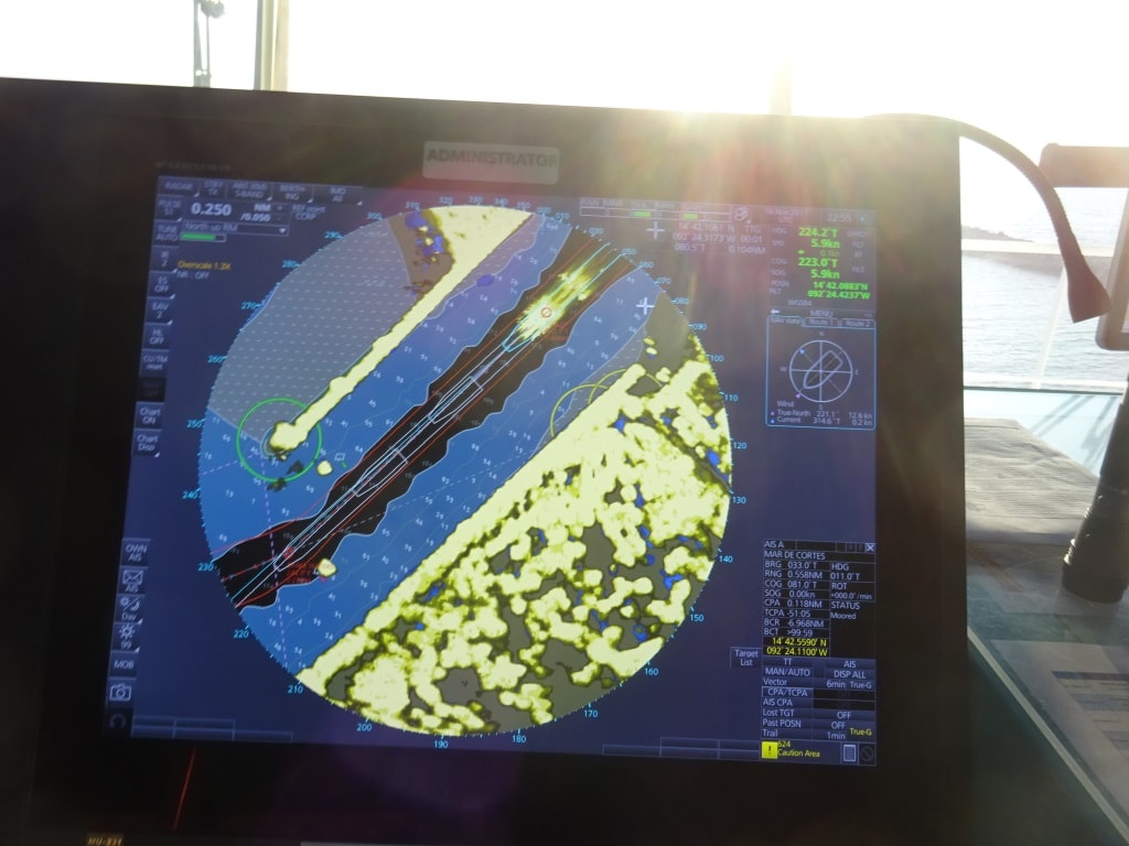
The Radar predicts the movement of the ship 3 minutes ahead based on course and current. As long as we stay in the black we are in good shape. As you can see there is not much room for error as the ship barely fits in the dredged channel.

We sailed outside exactly on the dotted line as planned and once the pilot was off, turned to the North West and headed for our next port of call Huatalco de Santa Cruz. There is a chance of a Tehuantepec wind starting to blow but to me it looks it that that will happen after we are well past the area. So we should have a nearly windless sailing and a great day tomorrow.
17 November 2017; Puerto Quetzal, Guatemala.

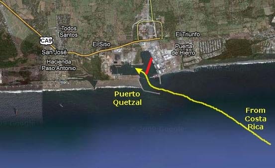
Remember our visit with the Nieuw Amsterdam about a month ago? We were supposed to dock at the passenger terminal but a day before a Tanker had taken the turn too wide and had damaged one of the dolphins. The Port Authority said that repairs were needed and would be accomplished in about 14 days’ time. So now coming back again with the Westerdam I was expecting that indeed the repairs would have been completed and the terminal dock would be available. Alas no. The floating dock was still not available and we were re-directed to the cargo pier. No doubt to the chagrin of a cargo ship captain whose ship was bumped back to the anchorage.  I am a little bit disappointed in the port people here, as normally they are very much on the ball and things tend to happen more the European way than the Middle American way in terms of time management.  The ship will come back here in the near future so we have high hopes.


Instead of going left (yellow) we had to curve to the right (red) and dock in the cargo terminal.

In the meantime it is an inconvenience for the guests who are not on tour as they have to be (shuttle) bused from the ship to the cruise terminal and either nose around there or go inland from there. Most of our guests are on tour and the majority of them are on a half day or full day visit to Antigua. This is an old Spanish town further inland and its main claim to fame is the old Colonial buildings which have been preserved here very well. Good enough to be assigned as a UNESCO World heritage site. Then maybe more unusual are the hot springs nearby; although the area is very volcanic so really it should not come as much of a surprise.  All this is about 60 minutes to 90 minutes away from the ship. For the rest there are coffee plantations and chocolate factories that can be visited, hence most guests are on a tour.

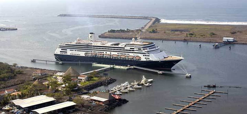
The cruise pier, the whole center section floats and thus the gangway height never changes. (Volendam or Zaandam alongside)

We do not like docking at the cargo terminal very much. First of all the pier is fixed so we have to adjust the gangway all the time for the height changes caused by ebb and flood. The cruise ship pier is a pontoon dock which goes up and down with the tides, so the gangway is always under a perfect angle. Secondly there is the ever present chance to get spilled over the decks, whatever the cargo ships on either side are discharging.  If it something like Tapioca or other dried and grounded fish products than it is not fun at all, as apart from the commodity blowing over to our ship, it also does not smell very nice.  Same for fertilizer, the ammonia “perfume” will penetrate to the whole ship if we are not lucky. As far as the other ships were concerned we were quite lucky. No smelly ships today as neighbors and it was wind still so all that was discharged went into the waiting trucks and not over our ship.  Today we had a bulk carrier docked in front of us, with the Belgian registration of Antwerp and they were discharging animal food for the farmers. I could not get out of the local at the gangway what it was, but it was “good for cow and chicken” so I assume that Guatemalan cows and chickens are on the same diet.  Wasn’t there somebody who said that butter, cheese and eggs all came from cows? Maybe we have special local animals here.

Docking at the commercial pier means the captains have to go through a decision making process. Docking with the nose in, or docking with the nose out. Nose out means swinging on arrival and that takes about 30 minutes as there is not much space spare once the ship is perpendicular in the port so it goes slow; but it saves time on departure. Or you can do it vice – versa. Today it was decided to go straight in creating more time to fudge around with the gangway, to get it in a perfect position and height before the first guests were going ashore. So we swung on departure and thus the guests could see the port; first from the starboard side and then from the Port side. Our next port of call is Puerto Chiapas just across the border with Mexico which is a short distance away.

The weather is looking good, same as today, the only concern is the swell, if that is running straight into port, then it reduces the depth of the fairway and that might bring complications.


16 November 2017; Corinto, Nicaragua.

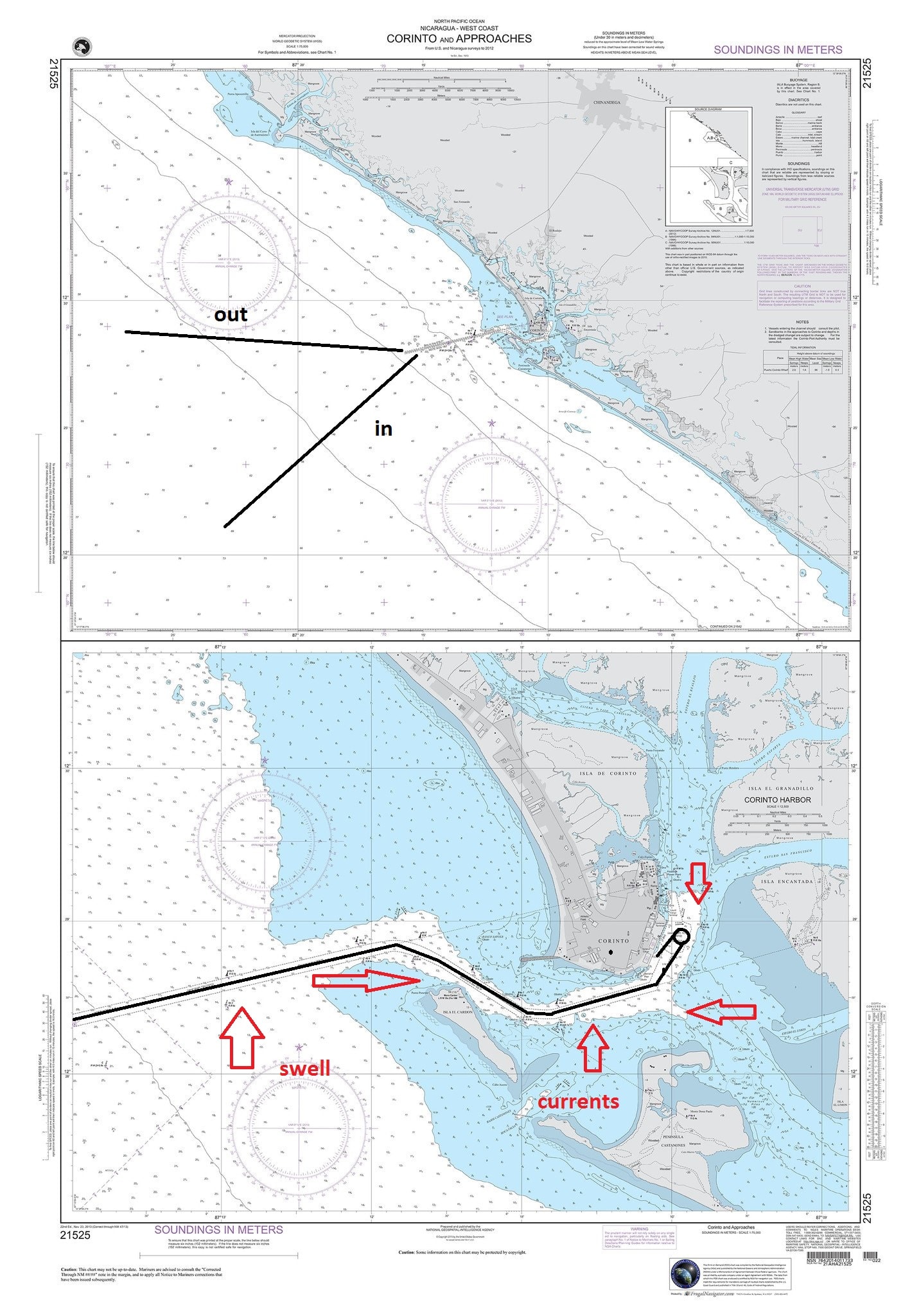
It is a high speed run from Punta Arenas (or Puntarenas) to Corinto and even with the pedal to the metal we can only just make the 09.00 pilot station time required for a 10 am docking. This is another port where a ship’s captain really sits down and has a deep think about. And again it has to do with current and swell.  The port itself is nicely protected behind a peninsula created by the outflow of several rivers which merge here. So once inside, it is wonderful.

The challenge arises first from the swell. Most of the time there is a long running ocean swell and that swell comes in under a 60 to 70 degree angle with the entrance course to the port. So the ship could roll, could roll considerably. Thus the best option is to keep the stabilizers out. But stabilizers need speed, at least 10 knots, and when we move into the approach course the ship has to start slowing down for the first turn.  There is a maximum speed limit of 8 knots imposed by the authorities.  Thus the ship has to plan to sail with 12 knots into the fairway / buoyed channel and then gradually reduce speed so it can make the turn (where we get the swell on a 90o for a moment) with 10 knots. Then down to 8 knots when it comes behind the first island which acts as a breakwater. From then on speed can be reduced to six knots for the next turn and then to three knots to initiate the turn to the dock.

The old -paper – charts in use for Corinto in the good old days.

The 2nd challenge is the current, or better said the currents. The port is subject to an out flowing current caused by the river and a in and out current caused by ebb and flood. The flood is stronger than the river current (unless there has been very heavy rainfall) and that pushes the river current back when the tide comes in. But these two opposing powers continuously battle for supremacy and it is impossible to predict where the influence of the one or the other prevails.  In some ways it makes sense for the ship to come in at full flood tide as then we only have one over ruling current to deal with. But the tides do not follow our cruise brochure so we go in when the schedule dictates.

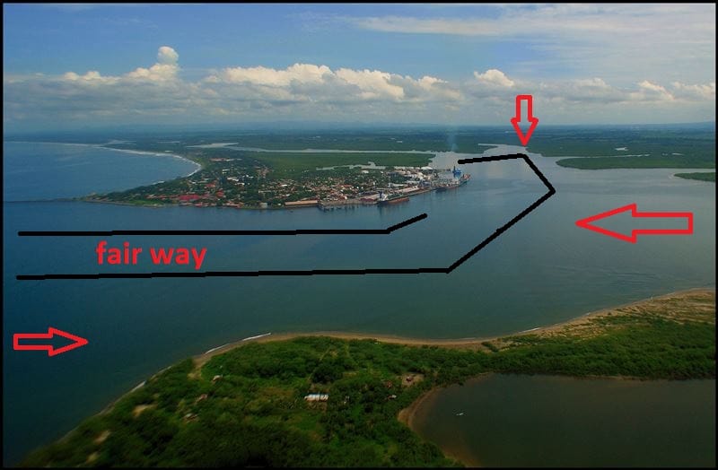
The current problem really comes into play just around the first corner when leaving the open sea fairway. Now we have just solved the rolling problem by keeping the speed up and the stabilizers out and then focus has to shift to the current. Best way to deal with current is to keep the speed up. The more speed the less drift there is as it diminishes the influence of the current. But we are now in the process of reducing speed from 8 knots to six and then to three knots. So while we are reducing speed we have to keep a close eye on the way the current affects the ship while we are making our 2nd and 3 turn towards the dock.

Approximate boundary’s of the deep water in black but it is not as straight as my drawing. Current arrows everywhere.

Normally we solve the problem by hugging either the high side or the low side of the channel based on the best prediction of where the current will be. Once we see the pattern evolving then we can adjust back more towards the center of the channel or stay where we are. Here the pilot boat comes into play, which is darting ahead of the ship and checking the current at each turn just before the ship gets there. The pilot gets the information and then passes it on to the captain with the words “a little bit more to the middle, a little bit more towards the red buoy or a little bit more to the green buoy”. On cruise ships the captain normally sails the ship in and uses the pilot as an adviser with the local information. For cargo ships (who nearly always need tugboats) it is a different matter, they go in and out of port much less often than we do and there is the local language barrier for the orders to the tugboats.

We stayed in Corinto until 1800 hrs. and had a bit of a hazy day with a layer of thin clouds above which was great as it just kept the heat bearable. The rain did not show so the guests could walk around town without being drenched.

Sailing out is a lot easier as you can make speed as soon as you clear the final turn and have the stabilizers do their work. From Corinto it is only a short hop across the border into Guatemala for a visit to Puerto Quetzal. Here we will arrive at 08.00 hrs. and as it is only 120 miles or so to get there, it will be slow sailing tonight. As it is so close the weather should be the same, Sunny, Dry, hot and humid.


14 November 2017: At Sea.

Today was a peaceful day at sea in the Pacific Ocean, which was also peaceful to a certain extent. Meaning that we did not have a storm.  Whoever decided to call this big ocean Pacific probably did not sail it very much because it not always quiet here. Today we were in a medium state of peacefulness. The wind came out at times with gusts of up to wind force seven but was most of the time content with a wind force 4 and blowing a lot of rain our way.  With the wind came the swell and on occasion we could feel that the Westerdam was a ship and not a hotel.  Even the brown boobies and the starlings that like to drift on the bow wind where having a difficult time of it and were continuously blown off course. They could not find much of a balance between wind and wind uptake and were forever “wobbling” while trying to stay at the bow. It also made it impossible for them to land on the deck and that pleased the Bo ‘sun as on this side of the Panama Canal the sailors are forever cleaning the “memories” of the sit down visits of the birds.

We are on a fairly high speed run to Punta Arenas as our docking has to coincide with slack tide. I have explained before that some deep thinkers built a cruise pier here, perpendicular on the current and with no protection to the surf that rolls in from the ocean. We always have to pray here for a day with little swell so the gangway will not move as the ship is not moving along the dock, caused by being lifted up by the swell. We used to go to Puerta Caldera which is only a cargo terminal but at least you could dock there without swell worries as that port has break water. But we are in the tourist business and thus we go where the T shirts are.

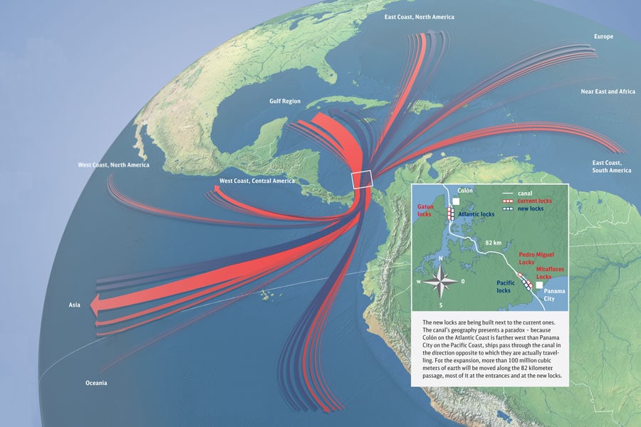
The route we take is simply following the coast at a distance of 12 miles. In the old days we used to sail much closer but now the main traffic zones have been moved off the coast to make it safer and also easier as we are now really looking at highways at sea. Nobody likes a tanker collision near their beaches and certainly not if it is caused by navigators looking for short cuts.  So today we saw land only from a considerable distance but we did see a lot of shipping traffic going to and from the Panama Canal. Not many people realize this but 95% of all freight and cargo that goes around the world goes by ship. Inland there might be some train and truck transport ….. and add to it some air transport, but most of it is by ship.  Because you do not see the ships anymore, the container and tanker ports have been moved away from the down town areas to industrial sites far away, not many people realize how crucial seafarers are to keep the world economy going. It has been calculated that if all seafarers would go on strike at the same time Walmart would not be able to stock 85% of their products within two months’ time.

The traffic flow through the Canal. Most ships are on the Trans Pacific run which includes the large container ships. (Photo courtesy unknown, there was nothing in the google)

Thus a Panama Canal cruise is really an optimum way to see how the world’s commerce operates and how ships are involved in this. It makes the Panama Canal and the Suez Canal two very important strategic locations and if anybody would be able to close one of those canals (as they did with the Suez Canal in the 1960’s) then the whole world will be impacted by it. We go through the Canal as a sightseeing excursion and for the company to get their ships up to and from Alaska but most ships have to go through to maintain their schedule and deliver the products that they carry on time. And that goes by clock work.  Now it is possible that from the moment a TV is being assembled in China to the moment it stands in a sitting room in a house in Finland, the period of time in between is not more than six weeks.

Tomorrow we are in Punta Arenas, where the weather is expected to be very Costa Rican, a bit of everything with quite a bit of rain in between. Luckily not too much wind is expected, unless we get a thunder storm, so it will be damp, muggy, warm and very likely wet.

13 November 2017; Panama Canal day.

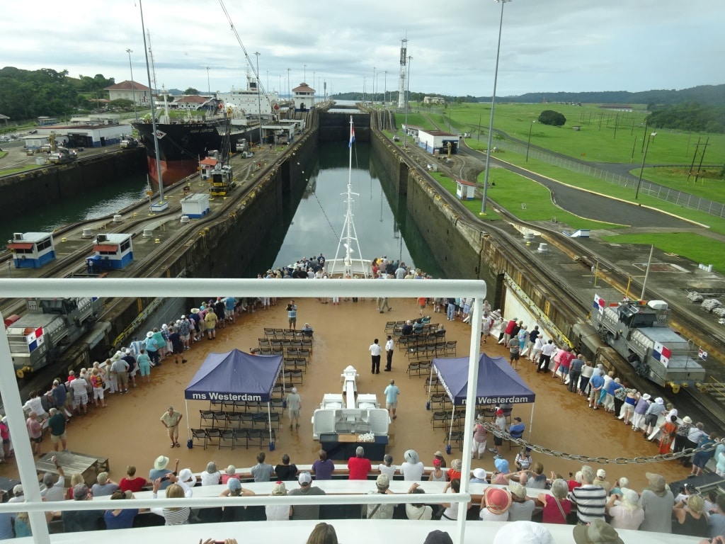
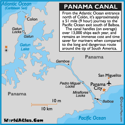
In accordance with the scheduling of the Panama Canal Authority we arrived early at the Sea buoy to take up our place in the convoy and go through the canal. We were ready for the Canal at 05.00 hrs……….., it was just that the Canal was not ready for us. Overnight fog had developed on the Pacific Side which caused a delay in the start of the Pacific Side convoy. The Canal routine has always been that the Pacific side goes through first. The Atlantic side can wait as they are in the wider part of the Canal. Until Gamboa, half way, the canal is wide enough to have ships pass each other, then coming close to the Continental Divide, it becomes one way traffic. At least until now. In the future they want to make the whole Canal two – way but that is still dreams for the future.  So we had to wait and drift. It was more than an hour later before we slowly were allowed to creep in.

Approaching the Gatun Locks. They have been adding to the locks again and now there is a large Cell Phone tower on the East side, right above the white light house tower / leading light.

At least it was overcast so the guests were not waiting under a scorching sun while we were drifting. But there is nothing you can do about fog or the scheduling of the canal, so we just had to wait and take it slowly. Once out of the first locks, we had to drift again as the Pacific Convoy cannot go faster than the slowest ship. Most of the slow movement is not due to the speed of a ship, most ships can do 10 to 13 knots, but due to the time it takes to get a very wide and deep ship through the locks. Transit speed of a lock depends on how fast the water can flow around the hull of a ship when it goes into the locks or out again.

Gamboa is approx. in the middle of the Canal. There where the lake ends and the actual canal begins. (Courtesy Worldatlas.com)

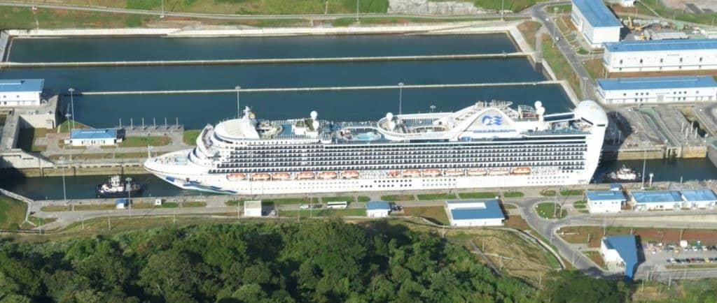
And thus the Atlantic convoy has to wait until the last ship of that slow moving convoy is past Gamboa and then the two convoys can pass each other and the Atlantic convoy can move into the narrow part. Now there could be a plan B if it was allowed and that would be to divert part of the convoy into the new locks. But that would cost a lot of extra water and the Canal authority tries to preserve as much as possible. Rain fall has not been too good in the past year and while there is enough water, there is no abundance of it and so we wait.  A few days ago the first cruise ship of our HAL Group went through the new locks. (The first cruise ship ever was the Disney Wonder, but she was not a Post Panamax; she just paid a lot more for the privilege) The Caribbean Princess from our sister Company Princess Cruises is a Post Panamax Ship which means it does not fit in the old locks.  And thus on 09 November the Caribbean Princess went through. The new locks have no mules (the little locomotives) to keep the ship in position and they use a tugboat forward and aft, although a cruise ship really does not need that.  But the Canal has always relied on its own people and its own equipment to get the ships through and they are not going to change now.

The Caribbean Princess in the new locks. Note the water reservoirs behind the ship.

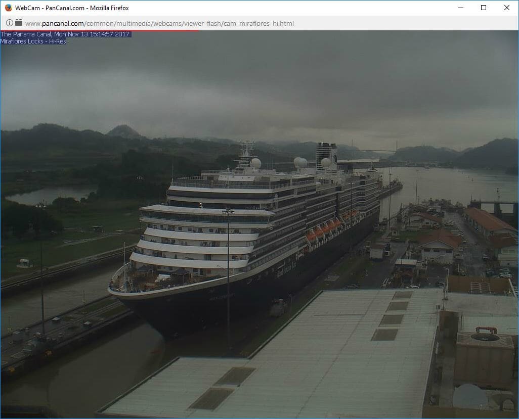
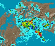
In the end we passed Gamboa one hour and 45 minutes later than expected and that put our Pacific side Sea buoy time well past 17.00 hrs. Nothing of a problem for the guests but for the crew involved in the transit it was going to be a long day. And a wet day. By the time we were past Gamboa dark clouds started to gather over the Continental Divide and while sailing towards it, the rain slowly increased from a little drip first to a torrential downpour not much later.  Enough to keep the Canal well supplied for another day. It looked that a lot of guests had planned for this possibility as suddenly I saw rain coats and poncho’s appearing everywhere.  Nobody was going deprive themselves from seeing the second and third set of locks.

The Westerdam entering the last sets of locks. (Photo courtesy: Lesley Schoonderbeek, taken from the Panama Canal Webcam on the Miraflores Locks)

We were at the sea buoy well after 17.00 hrs. But before sunset so the guests could see everything in good daylight. From the sea buoy the ship had to sail slow for 24 miles until it is well out of the busy shipping zone. Tomorrow will be a day at sea and we will spend a day at our next port Punta Arenas.  For those who are tired, the ship has arranged for the clock to go one hour back.

And this is what caused the rain in the afternoon.

12 November 2017; At Sea.

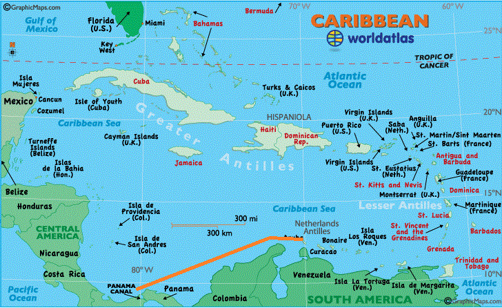
Today we sailed the stretch of water above Colombia to get from Aruba to Panama. This is technically still the Caribbean Sea but somehow it does not feel like it as we are away from the Caribbean Islands and now more surrounded by countries which we consider to be part of Middle and South America. The course line is quite simple, we first follow the coast of Venezuela and then make a turn to the South west once above Colombia. Here we pass the main cities Barranquilla, quite close by, and further to the south, Cartagena which is a favorite stop on most eastbound Trans canals. Cruise ships seldom go to Barranquilla although it is a large port but it is a cargo port. I doubt there is much culture to enjoy around there otherwise a large cruise terminal would have been established long time ago. So for Colombia the focus remains on Cartagena.


The run from Aruba to Panama. We are now completely away from all the Caribbean Islands and that begs the question, is this area still really the Caribbean Sea.

Although it is in my opinion not really a part of the Caribbean Sea, the Trade winds do not pay much attention to that and it was blowing quite nicely during the day. Wind force 6 to 7 for most of the time, although we did not notice it very much as we were sailing with the wind. We could see it but not really feel it; large white caps on the waves but because the ship was sailing the same direction with about 16 knots, the relative wind on deck was reduced to about 12 knots. That is a nice gentle breeze which brings some cooler air onto the decks. (Danger is then of course that guests forget that the burning sun is still there and that can cause a few unpleasant side effects.)

Once we made the course change to south west, the swell went from straight in the stern to ¾ on the quarter and then we got the corkscrew roll once in a while. Luckily not too much, to become an inconvenience. As explained in the past, this corkscrew motion is caused by a swell which is not a really swell on the beam and not really a real swell on the stern. So the ship does not know if it should pitch or roll and have the stabilizers take care of it. The stabilizers can do most of the job but occasionally the angle shifts just a little bit from roll to pitch and then this cork screw motion sets in. If the angle then shifts back the stabilizers can handle it again.


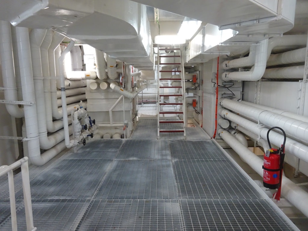
The Ac Stations are in the center of the ship. Forward and aft of the funnel uptakes. Most of them run up from deck 4 to deck 7

Today I was on parade in the ship with 2 quartermasters in tow. Due to a new regulation, all storage rooms and lockers need a sign indicating what sort of structural fire protection it has, what it is allowed to be used for, how to store materials in it and list a few examples of what is allowed and what is not. I am combining that with my ship inspection and thus can supervise the QM’s at the same time while they install the signs/ stickers. While on parade I was stopped by a guest asking me why in some locations there are inside cabins and then suddenly there are none and are only blank walls. She had figured out where the funnel uptakes were running and thus the big question was what is behind the rest of the blank walls.

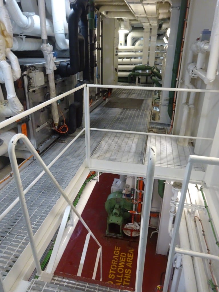
You might think that this is a lot of wasted space but the AC ducts cannot be smaller as they have to serve so many cabins and with always enough flow.

So I opened a door for her and she could look into a sort of factory going up 4 decks high. Behind the bulkheads are the Fan Rooms which take care of the A.C and the ventilation. These are not small rooms but large area’s 60 to 80 feet long 20 feet wide and open for 3 and four decks up and down. From large intakes on Deck 10 the fans suck in the outside air, send it through a cooling – A.C system, and then circulate it through the cabins. As a minimum requirement at least 75% of all air needs to be exchanged each hour (at home in your house it will not be more than 10% or maybe 25% with the garden doors open) and thus the fans work 24 hours a day, 7 days a week. And they better do as in the tropics it gets warm very quickly if you are sailing inside a tin can with no cooling.
Tomorrow we are in the Panama Canal. Schedule calls for a 05.00 hrs. arrival at the sea buoy and if all goes well then we should be past the sea buoy at the Pacific side before the 17.00 hrs. Most likely a bit earlier. Weather Mainly overcast and dry until we come to Gamboa and then there is a fair chance of showers and maybe something even more intense once past the Continental Divide.

11 November 2017; Oranjestad Aruba.

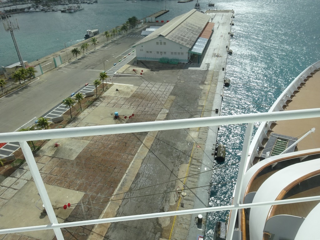
This is what we call ” a nice spread”. The ropes are on several bollards and also set in land giving a nice angle and good length to the rope.

By 07.00 hrs. in the morning we were at the Oranjestad pilot station and Aruba lay in front of us, covered in an early morning glare as we looked against the sun and as there was still a lot of moisture in the air so the light was a bit diffuse. The Freewinds was indeed in port but the Norwegian Dawn had cancelled its call and thus we were the only real cruise ship in port. (The Freewinds is run by the Scientology Church for its members only and is thus more a sort of a floating club) At the old container terminal, which is destined to become another cruise terminal, they had parked a ship specialized for the off shore industry, so we had to sail around it.  But we were the only ship and thus we had the whole cruise terminal to ourselves and could park right in the middle. And that is what we like as we can then set our mooring ropes the best way possible.

Today the winds were hovering around 20 knots but I have seen days here when it gusted up to 40 knots and that is not much fun. If the ropes break, you are very quickly at the other side of the fairway and onto the reef. Maybe a good location for a new hotel but it would be doubtful if we would get permanent planning permission from the local authorities. Thus a lot of consideration is given to how many ropes we will send ashore and in what configuration they will go onto the bollards.  The port is geared up to deal with this sort of wind and thus they have a number of heavy bollards set deeper inland so the ships can set breast lines (90o degree perpendicular on the ship) which offer optimum holding power against the Trade Wind which blows often full on the beam of the ship, and straight into the balconies. Not many people realize that balconies catch more wind than a flat wall. Better phrased a flat wall deflects and bounces away wind so the sustained impact is less. When wind blows into the ships balconies it blows into a lot of small boxes and there is no possibility to form a deviating current or air flow. The pressure stays or has to go out the same way as it came in.  Some-where there will be a wind specialist who can explain it better and can probably even calculate it. But when we maneuver we have to deal with this “grip” that the wind holds on the balconies.

But today there were no such issues, although the navigators and quartermasters kept a close eye on the passing dark clouds, as there can always be wind gusts in them. I suppose the only happy camper about the weather yesterday was the Bo ‘sun as it washed all the salt off the decks, including in the corners where it is hard for his sailors to rinse the ship down with fresh water. So today he took the opportunity to paint the now salt free surface of the ship’s hull.

In the old days we used Bo ‘sun chairs for that, which were lowered down the side of the hull with ropes. Now we use cherry pickers because it is faster and also much safer. Those cherry pickers are operated by the sailors and rented locally at a cost between 500 and 1000 dollars a day. Before we let the sailors play with them, they receive training and for that purpose we have a traveling trainer in the company. There is more than one, they are called Fleet Safety Trainers, and they rotate through the fleet for various detailed and in-depth training’s. The gentleman currently on board is giving cherry picker training, fork lift driving, proper safety harness wearing techniques, Genie Lifts (a sort portable small lift to replace ceiling lamps and do cleaning in high spaces) and how to work safely in enclosed spaces. The sailors receive theoretical and practical training which is then completed with a multiple choice exam.

We left Aruba behind us by 17.00 hrs. after all the tired shoppers had returned, most of them sun burned and exhausted as it was very warm today and set sail for the Panama Canal. We have to get there by 05.00 hrs. to fit in the convoy.

While uploading the tentative Panama Canal schedule came in:

0500 Pilot on at Sea buoy

0700 Entering Gatun Locks

0900 Exiting Gatun Locks

1200 – 1230 Passing Gamboa (pending opposing traffic)

13.30 Entering P.Miguel Locks

14.15 Exit P.Miguel Locks

15.00 Entering Miraflores locks

16.00 Exit.

1700 Pilot off at Sea buoy

All subject to EXTREMELY much change.

10 November 2017; At Sea, Day 2.

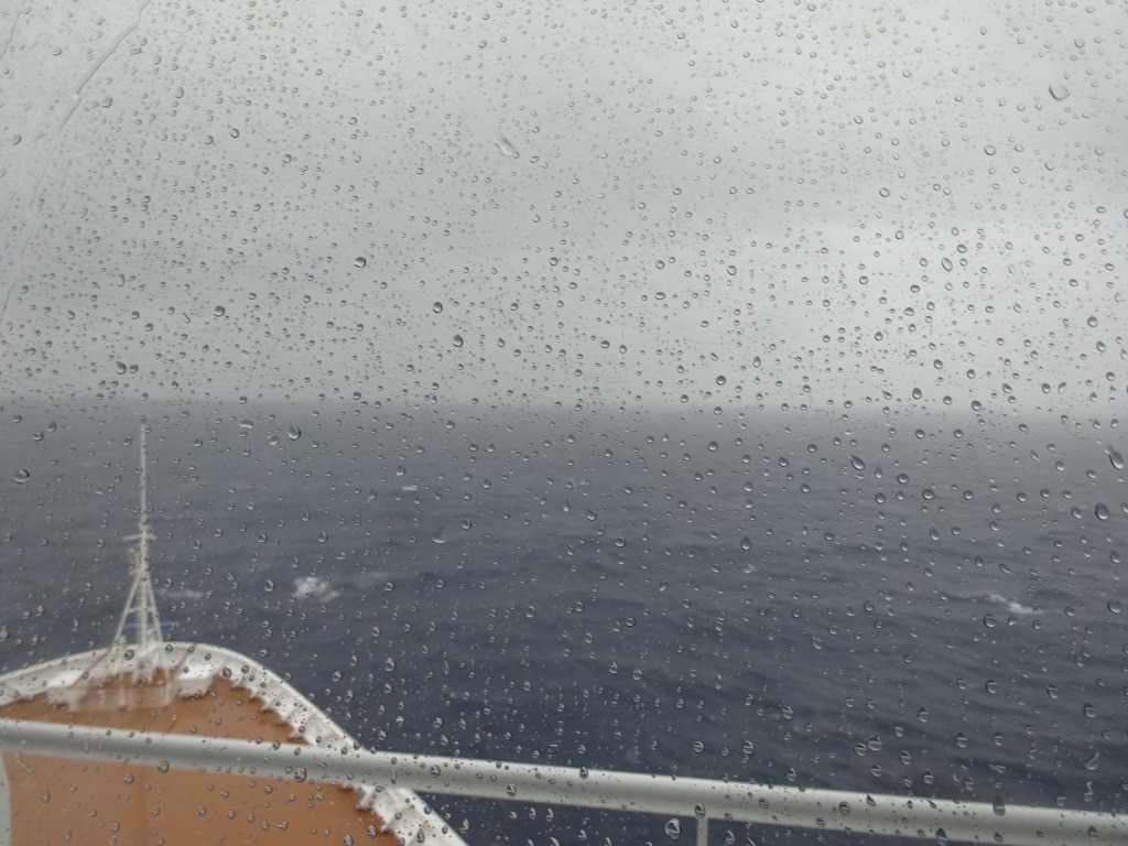
This morning between 0400 and 0700 hrs. we zig-zagged through the Windward Passage and into the Caribbean Sea. To do this we first hugged the East coast of Cuba, staying close to the Light house of Cabo Maisi and once out of the Vessel Traffic Separation Scheme we came closer to the West coast of Hispaniola.  Hispaniola is the name of the whole island to the right of Cuba and it is split in two halves. One is Haiti the other is the Dominican Republic.  Thus we saw the sun rise over the mountain range of Haiti on our port side. A bit of a watery sunrise as there were only a few rays and then it clouded in again.  From then on the clouds got thicker and thicker and by 10 am. we had a few torrential rain showers coming over the ship.  By noon that had tapered off to the occasional drop of rain but it took the remainder of the day to leave the weather front behind. Or better said the weather front to drift away from our course line as we are on a south south easterly course towards Aruba.

A rainy grey morning in the Caribbean Sea.

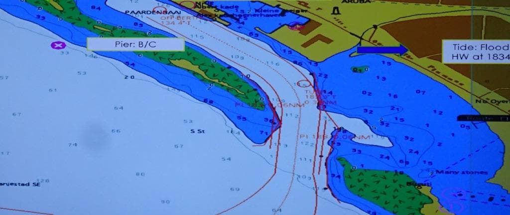
Although most of the navigators have been to Oranjestad many a time, there is still a very in depth voyage and arrival meeting the day before. Being Dutch we do this at Coffee time at 10 am. in the morning. This time the affair was enriched by Dutch Cookies which had been brought over from Holland by a new joiner. We have all sorts of cookies on board but not always the brand that is considered best by the experts. (That’s us) The whole officer team assembles including the Security Officer (in charge of the gangway setup) and then the arrival is simulated on a big TV screen step by step. Docking plans are discussed – where the ropes go- and the navigation officer has made  a cheat sheet for forward and aft mooring stations with photos from last time, so we can achieve the optimum mooring line configuration.

The approach into Oranjestads harbor, the “Paardenbaai”. As long as we stay between the red lines and do not hit the blue bump, we are in good shape.

Then the most important part is the approach to the dock, with the focus on what if. If you drive a car into a garage, you focus on that. We worry about the fact if the garage door might come down while we are driving in and what do we need to do to have –positive confirmation –so that will not happen. Maybe cynical but it saves paint scratches on the cars and lives on ships.   Thus “Plan B” is very important. For Aruba there are two challenges: One, when you sail in, you cannot stop anymore or drop anchor. It is too narrow. B. There is always a lot of wind which pushes you away from the dock.  Luckily the port has a natural plan B. There is an exit at the end of the harbor, so if the ship comes in and if you do not like the situation you just sail out again. I have done that once in my career, 14 years ago, when a sightseeing catamaran decided to sail westward between the pier and the ship, while I was coming in and was executing a maneuver to reduce the wind influence which was gusting up to 30 knots.    I could not slow down, the ship would have been set towards to reef to the south and I could not turn around so I just gave full ahead, sailed out, turned back to the West entrance and made a new approach.  It was quite enlightening to listen to the pilot who questioned the legitimacy of the boat skippers heritage, and that of his immediate family, fluently in three different languages. (English, Dutch and Local) After docking successfully the second time, I explained to the guests what had happened and asked those who were going on that tour boat to voice my displeasure. Which they did with great gusto. The tour boat skipper never made that mistake again.

The exit of the “Paardenbaai” giving the option to sail out if you do not like the situation. (Both photos are screen captures of the actual ships voyage plan.)

Tomorrow should be an average day according to our prognoses; winds of up to 20 knots, sunny but with a chance of showers, so the ship will put out a few extra lines to deal with wind gusts which might be hidden inside the showers. According to the agent we are the only ship in port but according to the Aruba port authority there are two more. The Norwegian Dawn and the Freewinds. Tomorrow we will find out who was correct.

09 November 2017; At Sea.

After all our trials and tribulations of yesterday, today we have a routine day at sea. The focus of the crew is back on pure guest satisfaction and everything else is on the back burner as most of them made too many hours yesterday according to the legal requirements. If this happens, then those extra hours have to be compensated with extra rest the next day. And so we did. This is not something that the guests will notice but any work planned for today behind the scenes was put on the back burner for another day.  I helped out today where I could and then started my own project of carrying out a full safety sweep of the ship on behalf of the Captain.  I do not expect to find much but history has taught us that small things can change into big issues and it needs an experienced eye to connect a small issue to a much larger challenge sometimes in the future.

When there are inspections going on like yesterday I cannot be involved as……… A. I am not officially a crew member and B. Legally I am in a bit of a vague position as what I say would carry authority but could encroach on the position of the Master and that is of course a No No. Plus halfway in the morning I get kicked off the ship to present myself to the CBP to show my Visa and dutifully declare that I am still not a danger to the safety and security of the USA. And you never know how long that might take; and yesterday it took a long time.

Wouldn’t it be nice if Cuba had a sort of North – South Panama Canal in the middle. I wonder if it would be profitable.

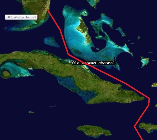
But the cruise has started and we are now happily on the way to our first port of call Oranjestad Aruba. Yesterday evening we sailed south towards the Old Bahama Channel and there we spend all of today. Tomorrow morning between 04.00 and 07.00 hrs. we will pass through the Windward Passage and then we are in the Caribbean Sea. Because we called at Ft. Lauderdale on a Thursday there was only the Koningsdam and the Crown Princess in port, plus a small intra-coastal cruise ship of American Cruise Lines. All went their different ways and thus we are sailing all by ourselves at the moment, not counting cargo traffic of course.

The Old Bahama Channel is the preferred route for going to the South and East Caribbean Sea. If you go all the way to the East, then going north of the Bahamas is shorter (= saves fuel) but you are completely exposed to the vagaries of the North Atlantic Ocean. Sailing the Old Bahama Channel offers protection by the Bahamas to the North and Cuba to the South. You might still get a strong, opposing, easterly wind, but you do not get the swell of the North Atlantic. Thus every cruise ship captain, who is concerned about his guests comfort, will look for an excuse to take this route as it will call for a more comfortable ride.When you go to the South Carib, then it is the only way to go, as going West around Cuba adds at least 80 miles to the route and you have to sail against the Gulf Stream until you pass Cabo San Antonio. That we only do when there are hurricanes in the way. But the hurricane season is more or less out of the way and thus we take the regular route. As it is so popular with everybody, the channel has been divided into traffic zones to keep opposing traffic nicely separated.  So going South/East bound we are hugging the Cuban side at a distance of between 3 to 12 miles, depending on how the Cuban coast is following our route.

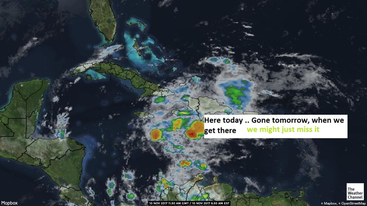
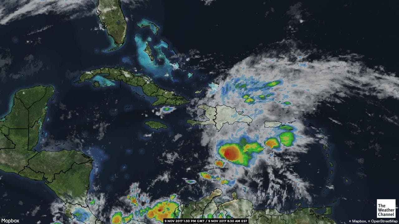
The weather is, what it promised to be. We are still out of the rainy area as the frontal system is now occupying the middle of the Caribbean Sea. But we can expect some heavy showers when are south of Haiti.

I expect that we will meet the tail end of the system and get some showers in the morning and miss most of it.

08 November 2017; Fort Lauderdale, USA.

It was the end of the cruise today and welcome to Florida and welcome to Mayhem. Controlled mayhem but the ship had a very heavy day. We knew what to expect and we were prepared to have all go as smoothly as possible. But with so many things going on, and with so many outside influences, the only approach from ship side can be to very minutely plan the operation and then hope that all the other stakeholders do their part of the job. And this time it did not work out completely.

As the ship had been away from the States from more than six months, we knew that we would have to go through a full crew inspection of the CPB and we knew that we had to do a Full year CVE (Control Verification Exam) by the USCG. So we were ready. We knew we might get an inspection by the USPH ( we are always ready for that) but we were hoping that they would come in the next USA port  as providing labor for that while the USCG drills were going on would be tight. And in the mean time we had to do the cruise turnover. On top of that we had a crew change of about 70 and while the old crew could not help anymore; they had to see immigration and then go to the airport, the new crew could not help either as they first have to complete the mandatory safety indoctrination before they are allowed to start working. This was all expected, we had planned for it and had all it organized.

Then we found out the CBP could only make 4 officers available at the start of disembarkation. This slowed down the full crew inspection but it also slowed down the Guest disembarkation. Nothing we could do about it, nothing they could do about it as the CBP is really strapped for manpower at the moment. I heard from the ground staff in the terminal that some of them were already on the job for 14 hours that day; then were supposed to take a few hours off and then go at it again for a full night shift.  And although they were trying to be as efficient as possible, it delayed the end of the disembarkation by more than an hour.

This had a knock on effect on the USCG inspection as the USCG officers like to wait with the drills until the guests are off the ship so it does not interfere with the disembarkation procedures. But now the guests were late and thus the drills were late and rolled over into noon time. That had a knock on effect on the boarding of the new guests as the crew was still in the drills. Cabins had to be completed, food for lunch had to be cooked, meet and greet setup etc. etc. So embarkation did not start until 13.30 hrs. and nothing we could do about it. While all this was going on, the USPH officers boarded for an inspection and that drew labor away from other tasks as now various Hotel supervisors had to be at their areas of responsibility while the inspections took place. In between we had to fully provision the ship, bunker oil, load water and had a large number of service technicians on board to service all the equipment. I observed coffee machine experts, a radar technician, an expert on water measurements, a juice machine repair man, and at least another 20 or so experts in one thing or the other. They all disappeared into the bowels of the ship, to ensure that everything would be in good working order while we make our cruise.

Based on all of this rolling forward, the Captain could not do anything else than to postpone sailing by an hour to get everything completed in a proper way. As always it all worked out. USCG returned happy to Miami and we got our CVE certificate. USPH declared our ship healthy and the CPB inspected all the crew and the guests going off and gave us the sailing clearance. Nothing stopped us from starting our Panama Canal cruise, with our first port of call Aruba, two days from now. Complements to all for a job well done as this turn over day was not for the faint hearted.

I am now staying on the Westerdam to help out with some projects for the Captain until Puerta Vallarta on 21 November, and then fly home for first a training course and then my vacation. I came Eastwards through the canal with the Nieuw Amsterdam 3 weeks ago and now will go Westwards with the Westerdam. I will have to sit down one day and calculate how many times I have done the Panama Canal since 1981. I know I am closer to or over a 100 of them so maybe I can apply for a discount as a frequent Canaler.

Heavy rain clouds coming over from the East Carib. (Courtesy The Weather Channel)

The weather for the coming days is a bit uncertain. There lays a large weather front over the East Carib and the North part of the South America and that is moving slowly westwards. If I read the chart correctly, we should get through the frontal system while on our 2nd sea day and then it should be gone by the time we dock in Aruba.  But that will depend on the speed it moves to the West.  Wait and see, the frontal system is too wide to sail around it so we will take the showers when we get them.

Older posts Newer posts