- Captain Albert's Website and Blog -

Ocean Liner History and Stories from the Sea, Past and Present. With an In Depth focus on Holland America Line

Category: excludeRecent (page 43 of 82)

05 Aug. 2016, At Sea.

Just after midnight we were back in open waters again and shortly after we disembarked the pilot. Then it was setting a southerly course towards the next port of call Rotterdam.  The weather is a mixture of overcast with dark and light clouds and blue skies peeping through on occasion and the good thing is that the very strong North Westerly wind is with us and is cancelled out by the ships speed. Thus the relative wind on deck is almost zero. Glad we are not going the other way. On occasion we see oil rigs on our starboard side and we passed one quite close this morning and could see a helicopter landing. Either bringing supplies or being involved in a crew exchange.
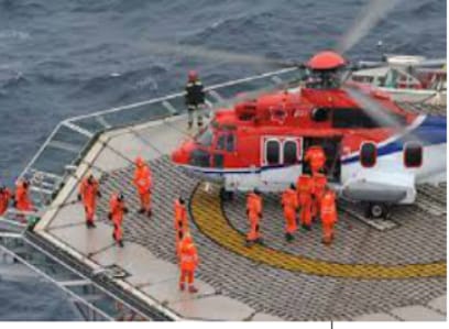
Crew change on an oil rig. Note the survivals suits they all have to wear (Photo courtesy: www.oilriginfo.com)

Crew change on an oil rig. Note the survivals suits they all have to wear (Photo courtesy: www.oilriginfo.com)

Most of the oil rigs in this area are being serviced from Bergen which became a real boom town once the Norwegian oilfields came in operation; but there are also ports on the other side such as Inverness in Scotland and Great Yarmouth in England that have become important centers to support the oil industry. If an oil rig is manned by crew that belongs to the British Isles then they can easily come over by helicopter from that way.  Only now on occasion crew exchanges take place by boat.  In the past this meant a hazardous climb up a ladder or using an external lift system but nowadays there are ships equipped with a crane & walkway which makes it possible to do this much safer and faster if still needed.
dfd

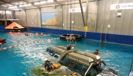
Helicopter water crash training for oil rig crew by submerging a mock up with seats into and under water. (Courtesy Falck Rotterdam)

If you are working on an oil rig, you have to go through training in the same way as all crew on a ship has to do. Additional to that, extra training is the need to be proficient in escaping from the helicopter in the water, in case one would crash. On the North Sea that on occasion still happens as here the helicopters sometimes have to fly on the margin of what is possible. This does not mean they take risks but the North Sea weather is sometimes so un-predictable that risks occur regardless. But those who were up and about this morning and outside at the right time witnessed a perfect landing with a helicopter. One of those moments that I berate myself of not having my camera in my pocket.
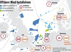
Wind mill areas in the North Sea. The ms Rotterdam sailed roughly from nbr 3 to nbr 96 on this chartlet and as you can see you can not miss them.

Windmill areas in the North Sea. The ms Rotterdam sailed roughly from nbr 3 to nbr 96 on this chartlet and as you can see you cannot miss them.

Apart from oil rigs which are mainly placed in the northern part of the North Sea we will see windmill parks in the southern part of the North sea, all the way down to the border with Belgium. There it stops as then the English Channel starts and there is no room anymore.  With the danger of fossil energy running out countries such as England, Holland, Germany and Denmark have started to build large numbers of windmills in their territorial waters. For some countries there is the aim to, by 2020, having reduced their reliance on fossil energy by at least 20%. For that you need a lot of Windmills or Wind turbine farms are they are now called.  They are built in allocated plots of sea, outside the shipping lanes but in some instances only “just outside”.

I was involved a number of years ago in the planning of one of these locations and it was interesting to follow the process which involved all stake holders. The interesting part was that the Shipping world had a good idea of what was needed to make it work but that the politicians and electricity companies did not really understand what ships did. They thought it was easy for us, just to sail a 100 miles around it all and were highly amazed that there was a link between fuel costs and the cost of a packet of cornflakes in the super market. For a country such as the UK where 95% of the goods which go in and out of the country go over sea a deviation by a ship will result in the transport price going up and thus the end cost in the supermarket. The result was quite some intense bickering about how wide the shipping lanes had to be and where they had to go. In the end the threat of collisions resulted in allocated shipping lines which worked for all parties.

The ms Rotterdam will arrive tomorrow morning at 03.00 hrs. at the pilot station and then make its way up the river. We should be docked around 07.00 hrs. Although you can hardly see that it is a river, at least the water is. But here the river Maas has been so canalized and dredged that it is called the New Waterway or Nieuwe Waterweg.

More about that tomorrow.
 

04 Aug. 2016; Eidfjord, Norway.

Eidfjord is located almost at the end of the EidFjord although there is a little bit more going further inland just around the corner from the town itself. The town & dock is located in a sheltered bend in the high mountain ranges which you can see on either side of the fjord. The mountain ranges are not as steep as when going to Gerainger fjord but still steep enough to lose our satellite connection for internet and telephone all day. If you wonder if it leaves the ship completely without communication, the answer is no, as the captain still has the iridium telephone connection on the bridge, which uses any satellite available. But you do pay $ 10 a minute for it so it is only in use as the Hot Line. And of course your regular cellphone /mobile phone is still working as long as you have Global Roaming.

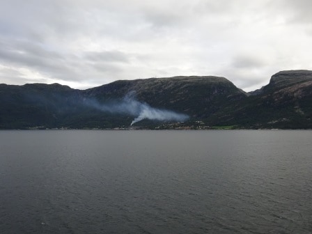
Strange thing today while sailing in. The wind pushes the smoke against the mountain and then it bounces back again with the wind.

Strange thing today while sailing in. The wind pushed the smoke towards the mountain and then it bounced back again with the wind.

But for the regular ships operations is was a quiet day as far as email traffic was concerned. We could not talk to Mama Main frame in Seattle and that reduced the number of emails going in and out to zero. With our lives nowadays completely connected (or entangled) with the internet it does upset the routine. You would almost get withdrawal symptoms.  I am somehow convinced that if our crew did not all have cell phones then there would be quite a few of the Generation Y and the millennials who would have had a tuff day to day. I think by 7 pm everybody who is not at work, will be sitting behind the computer trying to get contact with the rest of the world again.

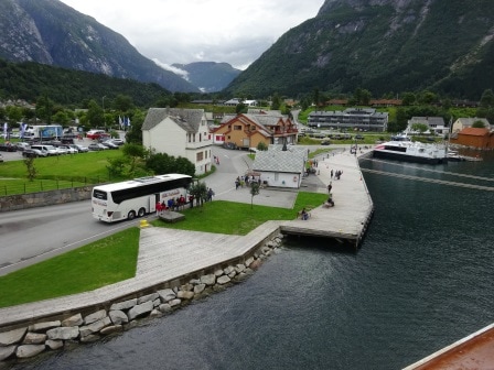
The town of Eidfjord. Not exactly a metropolis as things go.

The town of Eidfjord. Not exactly a metropolis as things go.

This does not stop anybody from having a great day in Eidfjord. The rain stayed away, apart from the last hour, for the whole day it just remained overcast. Being sheltered in the fjord means that there was no wind and thus it was very pleasant outside. This stop is really made to go on tour and explore the country side. Hordaland which is the county here is full of ancient stuff from the early days of Scandinavia. Even the little church of Eidfjord is from the 14th. Century.  The town itself has only 900 inhabitants but it is a tourist “processing point” for approx. 500,000 cruise ship visitors a year. If you come from the land side then it is a long travel with only limited hotel capacity and thus we saw a lot of campervans or R.V’s as the Americans say coming through. Right under the bridge at the dock there was a small camping and at one of those camper vans a German family was having a late breakfast as it was 10 am. the moment we docked. Not a bad way to see Norway.

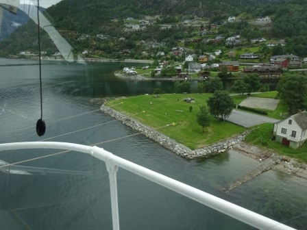
The dock is very short and thus have all the long mooring lines be even longer and go inland.

The dock is very short in length and thus have all the long mooring lines to be even longer and go inland.

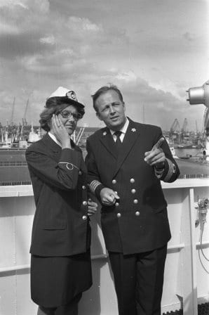
We had two pilots this morning, due to the distance, and one of them was a Lady. Although the world of shipping has been open to ladies for a long long time we still do not see Lady Pilots very often. I think most of the time it is a job which is hard to combine with children, as you can join pilotage only after you have your Master License (around your 30th.) and the cut off joining date is somewhere around the 40th – 42nd. birthday and that is prime time for having children. Therefore sailing remained for a long time really a men’s world although there was a Russian Lady Captain already in 1935, Holland America had its first lady officer/cadet in 1968 and since then we have had a regular influx of Ladies. The Rotterdam has currently only one on board, a 3rd officer from Flemish side of Belgium but sometimes there are two or three. We have now one Lady Officer who is Staff Captain and if things work out, the way we hope it will, she will be the first Lady Captain of Holland America Line.

A dip in Holland America history. The first female (cadet officer) in the company. Esse Rieke Agter. Seen here on with Capt. ten Kate.

A blast from the past of Holland America history. The first Lady (cadet) Officer in the company. Esse Rieke Agter. Seen here with with Capt. Ten Kate.

A side effect of the Ladies joining the seafaring community later in history has always been that our systems never took into account if an officer was male or female. You were simply a Navigator. So when the ladies started to join, we never had the issue which you hear about on the shore side that ladies get paid less than men.  Our wage scales are part of a union agreement and just state the remuneration for a rank and that is it. And that is the way it is should be.

We sailed from Eidfjord at 18.00 hrs. We sail under the bridge at the entrance of the Fjord around 23.00 hrs. and expect to be outside by 00.30 hrs. Then we have a day at sea before the ship spends two days in Rotterdam. About 140 guests will leave the ship on the 7th. but the rest will travel back to Boston on the 2nd leg of the Voyage of the Vikings. I will leave the ship that day as well but I will take the train to Amsterdam to transfer to the Koningsdam. In the meantime life goes on as emails will start to come again in the evening. Norway with its mountains is simply not constructed for modern day –interconnected- life.

(Eidfjord is a good fjord for blogging. At 1920 to 1940 hrs. there was a low section in the fjord making it possible to upload today’s blog)


03 Aug. 2016; Aalesund, Norway.

We had an early and a shorter day today as before; all docked by 07.00 hrs. and all gone by 16.00 hrs. Compared to the standard 08.00 – 17.00 call times. We moved the times forward here by an hour in order to make the next call at Eidfjord on time. Which is set for at 10 am arrival. The little town of Eidfjord is tucked away at the end of a deep fjord so it will take us some time to get there.

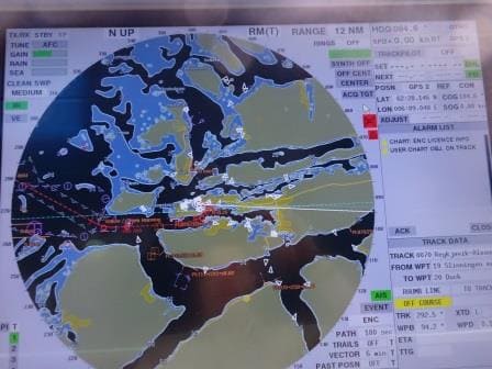
Following the dotted Red line it is about 14 nautical miles to the dock from the pilot station

Following the dotted Red line it is about 14 nautical miles to the dock from the pilot station

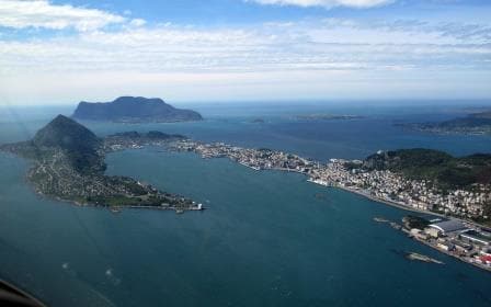
Aalesund took only an hour from pilot station to dock as it quite close to open waters but still beautifully sheltered; laying behind a high rock or hill and then in the inner curve of another rock formation.  Things must really be bad outside before it gets noticeable here. We were not the only ship in today, ahead of us was the Arcadia which is the fifth Holland America Line Vista Class but was handed over to P&O for completion. If this was done because they lately realized that a compass rose only has four main directions (Zuider – Wester – Noor – Ooster ….. dam) and not five or that some marketing insight decreed that P&O needed more ships. I do not know but the fact is number 5 went to P&O and is now the Arcadia. Nice thing about it is; P&O also keeps the tradition of using established names in their system and this is number 4. (1. Arcadia 1888, 2. Arcadia 1953, 3. Arcadia 1996) Being of roughly the same size as the Rotterdam she is also doing a similar variation of cruises, although while being focused on the British Market.

With her 2200 and our 1400 Aalesund was invaded by roughly 3600 visitors, not counting the crew. The cruise pier is right in down town: you only have to cross the street. Houses/apartments are built almost onto the cruise pier and thus this morning I could see a local lady doing the ironing while I was having breakfast. I am happy to report that a Norwegian iron just looks like a Dutch or an American one. There is a fairway which cuts completely through Aalesund with a small harbor in the middle. This also divides the two piers from each other, where we were docked today.  I think it is a natural connection, resulting in most of old Aalesund sitting on an island, but for small boats it is very handy to get from one bay and dock area to the other.

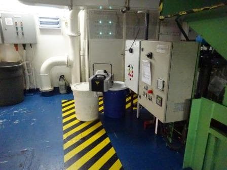
This is a corner of the Recycling Centre with the smoke machine at the ready. Note the 6 green lights and then look two photos down.

This is a corner of the Recycling Centre with the smoke machine at the ready. Note the 6 green lights and then look two photos down.

While the guests were ashore, the deck and engine officers were exposed to one of my special fire drills today. Solas requires that as a minimum the fire teams conduct a complete/drill/exercise once a week, and that exercise has to mimic a real life situation.  We do not have to create an actual fire on board but we should simulate it as best as possible. Setting up a good scenario, which really focusses everybody, is not always easy to do and that is where I step in.  Deck and Engine departments take turns and this week it was the turn of the Technical department to take the lead. To organize a drill for them is sometimes difficult as you cannot stop ventilation in the engine room as it can cause the lights to go out, if it starves the engines of oxygen.  Thus I try to find a space with technical equipment that is not so critical when it comes to ventilation or light.

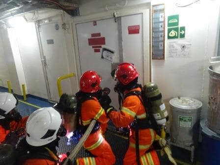
The Engineering Teams lining up for the attack, just before entering the smoke filled area.

The Engineering Teams lining up for the attack, just before entering the smoke filled area.

So today we drilled and trained in our Recycling Centre, less nicely named the Garbage Room, where everything that has been used gets recycled.  (Holland America has come very far and nearly everything on board gets recycled ashore after separation in this garbage room. The only thing that goes overboard are the five star food left overs for the fishe. Today things were complicated as the fire resulted in a chemical spill and a casualty who got caught in the spill. For those casualties we have a volunteer called Mr. Dummy who nearly permanently lives in the infirmary, recovering after each calamity after subsequent fire drills.

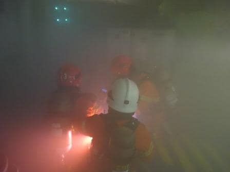
Approaching the source of the fire. Note the green lights at the top.

Approaching the source of the fire. Note the green lights at the top.

So we had smoke, smelly –chemical- air (I used a fragrant from the Spa Steam room) and a large area to search to find the source of the fire and the casualty. When Mr. Dummy was found it became complicated as Medical first needed to know the sort of chemical to advise the best way of handling. Medical is never allowed close to an emergency as we only have four of them and thus they talk to the fire team on location through a sort of mini assessment and then advise how to get the casualty out.

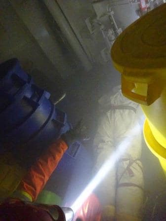
Mr. Dummy has been found. Teams now waiting for the heads up from medical.

Mr. Dummy has been found. Teams now waiting for the heads up from medical.

I like to switch off all the lights, whether it is realistic or not, as it is the only way to reduce the familiarity of the Officers with the area. Engineers know their engine room by heart but they always work there with the lights on. Lights off and they have to go a step slower and rethink the area in their mind.

So tomorrow we are in Eidfjord. We will be at the pilot station at 03.00 hrs. in the morning and then be docked just before 10 am. after a very scenic voyage in.  The weather looks a bit changeable with a good chance of showers and temperatures of 57oF or 13oF.


02 Aug. 2016; At Sea.

I think most guests have taken advantage of the 2nd day at sea, or maybe it was the 2nd hour forward, as early this morning it was a lot quieter in the Lido Restaurant than what I am used to. Normally by 06.45 – 07.00 on a sea day there are already a lot of guests going for an early breakfast but today it was not until 08.00 before I saw the same level of activity. Well I suppose that is what a cruise is all about you do not need the 6 am bus to get there and thus far we have not yet ever ran out of food.

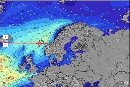
We had a distinctively wobbly night. The disturbance to the North is disappearing but the wind is pushing the wave system caused by it down. This caused the increase in swell during yesterday afternoon and evening. It must have been quite a strong disturbance as any swell is supposed to die out after the wind is gone, and the movement over the ocean should help the dampening even more, but the waves still deepened out to 3 meters (9 feet) and sometimes more, and just with the sort of length that made the ms Rotterdam pitch. If a ship has to pitch then we always hope for a steady pitch with a predictable pattern. Everybody on board can get used to it and it prevents incidents as people know when the next movement (“Lurch” according to most of the guests) will occur. However Nature seldom works that way and thus the ship occasionally lurches more than at other times and it feels as if the ship is going into a dip and then jumps out of it again.

The lighter the color the higher the swell. Where the ms Rotterdam currently is the height is 9 feet and over.

0 The lighter the color the higher the swell. Where the ms Rotterdam currently is the height is 9 feet and over. (Map Courtesy www. surf-cast.com)

This extra dip is caused by the way the waves, now called swell, as they are old waves, interact with each other. Not all the waves are running exactly at the same distance from each other. Now they have different speeds, different levels of height, they interact with waves which were already there and they can even merge and become a bigger wave among the regular pattern of similar waves.  When two of those waves meet, they can either cancel each other out (e.g. the 2nd wave fills the hole of the first wave) or it can enhance the other wave by adding to the existing wave height and wave depth. And that is what we had last night and today. Sometimes a very pronounced pitch, and then a sort of restful period with only minimal movement. And nothing we can do about it apart from going very slow. But we are already on a slow speed of 15 knots and 15 knots is needed to get to Aalesund on time and thus we “lurch” along our course line until we run out of this wave field.

I am talking of course about the “pitching” of the ship, not the rolling. There were the bow rises up and down because the waves/swell are coming from straight ahead or under a small angle on either side. At the moment this angle is about 30o measured from the bow. The more that angle would be going towards 90o, the more it would affect the rolling of the ship and less and less the pitching. Once the swell would be nearly perpendicular the ship would only roll. So with this angle of 30o we have both movements. Pitching and Rolling. We do not feel the rolling today as the ships stabilizers can completely take care of it.  Stabilizers normally take care off about 90% of the rolling movement of a ship. If we would have the current 10 feet of swell  90o on the beam then there would be a maximum of 1 foot influence on the ship. With the 30o angle there is no 10 feet influence and that  the stabilizers can easily control of what we perceive as rolling.

There is no cure against pitching yet. There is a large prize out there of several million dollars waiting for the person who comes up with a solution but thus far no takers. So we just have to pitch up and down until we come in the lee of the Norwegian Coast. That will be in the early morning when we approach the pilot station. Aalesund lies sheltered inside the coastline and thus it will take about an hour from the pilot station to get to the dock.

Aalesund has a very nice sheltered.

Aalesund has a very nice sheltered harbour. We dock at this side of the town, close to the down town area. (At least as of this moment!)

The plan for us is to dock in the south harbor which is on the Southside of the city. At the Northside there are docks as well and a smaller inner harbor which once is/was the fishing port. According to the weather forecast it is raining there today but sunshine and very little wind is expected tomorrow.  Temperatures will be around 54oF / 12oF which is a bit chilly for the time of the year but to be expected as long as the Northerly Winds keep blowing.


01 August 2016; At Sea.

After we left Reykjavik last evening, we sailed around the south side of Iceland. Which is the shortest route to go east while rounding the Island. For our Casino players it caused a bit of inconvenience as the Casino remained closed until close to 10 pm. Reason, the ms Rotterdam remained within the 12 miles zone for about 5 hours.  And nothing the Captain could really do about unless he made a very big detour and then the cost of fuel would never make up for any winnings there might have been. (And as it is a Casino you are never certain that the House would have won that evening)

Thus while the Casino addicts where having withdrawal symptoms the ship curved around the south side of Iceland until it finally got outside the 12 mile zone. Why the 12 miles zone? Most European countries maintain a no gambling rule inside the 12 mile zone. Regardless of whether the ship will call at a port in that country or not. For North and Middle American ports it is normally 3 miles and sometimes you can already open once the ship has let go all the mooring lines.  I have even been in the situation that we were allowed to have the Casino open in port as long as nobody from the outside could get on the ship. So the purser has to carefully check for each destination what the rules are to ensure the ship does not break a rule as the penalties can be severe.

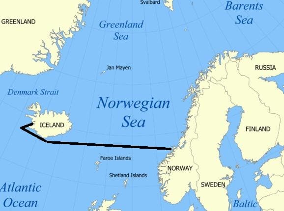
to make things complicated

Our route  to Alesund. To make things complicated mankind has decided that the stretch of water between the North Atlantic Ocean and the Arctic Ocean is called the Irminger Sea, the Denmark Strait, The Norwegian Sea, The Greenland Sea and the Barents Sea. And it is all the same salt water.

When we plan a cruise we try the stay outside the 12 mile zone as much as possible. And quite often we can do so, if we just tinker a little bit with making the shortest course line just a tiny little bit longer, but it does not always work that way. And thus the decision is sometimes, the Casino has to stay closed for a few hours until the ship comes outside the magical 12 mile zone.

The shops on board have often less stringent rules. Most of the time they cannot be opened in port with the exemption – sometimes – of the shop which acts as a Drug Store and which does not sell any duty free goods. Then there are situations where a local tax has to be levied onto any sale a shop on board makes if it is within a certain zone. Florida has such a ruling. Within the 3 mile zone from the land, local tax has to be added to any transaction. Whether it is shop purchases or drinks from the Bar. For the shops the situation is we simply keep them closed until we are out of the 3 mile limit. That is most of the time already very shortly after departure and by opening the shops at 18.00 hrs. with a 17.00 hrs. departure we solve all the complications.

Today we do not have that problem. Once we cleared the 12 mile zone we were in normal international waters again and we will remain so until we come to the Aalesund pilot station. During the night we will pass north of Faroe but we will stay well clear of those islands. No extra income for them.

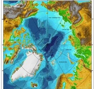
A Map view looking down upon the Northpole with Iceland to the South. The darker the blue color, the deeper the water.

A Map view looking down upon the North pole with Iceland to the South. The darker the blue color, the deeper the water.

The area we are crossing is part of the North Atlantic Ocean but is called here the Norwegian Sea.  To the North it is bordered by the Arctic Ocean and then to the south by the North Atlantic Ocean proper.   A chance of running aground we do not have here either as the water depth is well over 5000 ft. One of the reasons we do not see any oil rigs here,but something we will extensively see when coming down from Aalesund.   This area has always been water and was never dry land and thus no tropical forest which then through time turned into Fossilized Fuel. From Iceland the depth takes quite a plunge and only rises steeply up when coming close to the Norwegian continental shelf.

Today the weather was typical for this area. Due to the influence of the warmer water from the South which mixes with the colder water from the north, you can get quite unstable weather here resulting in summer storms. There was one here a few days ago and thus we have a slightly moving ship reminding us we are not on a coach trip. Mostly overcast skies although in the late afternoon it started to clear. Temperatures did not come much higher than 9oC/ or 45oF due to the cold wind from the North. Not good weather to sit outside for very long. But for that purpose Trivia Pursuit and Bingo was invented on the ships.

Tomorrow is our 2nd day at sea and to get in synch with the Central European Time we will go one more hour forward tonight and then it is done with moving the clock for the remainder of the cruise.

31 July 2016; Reykjavik, Iceland 2nd day.

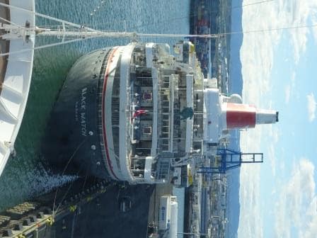
 Today was our 2nd day in Reykjavik and we were joined by another cruise ship. The Black Watch from Fred Olsen Lines which is about half the size of the Rotterdam.  It is an older ship and it started its life in the early days of cruising as the Royal Viking Star. She was one of three ships built between 1971 and 1973 for the Royal Viking Line and offered in those days the top level of cruising. This was in the early days when new cruise companies were founded. Royal Viking eventually folded and via a few other owners she ended up with Fred Olsen in 1996.

Our neighbour for today. In the centre of the Lido is a scuplture which is a trademark of Fred Olsen. These are "recycled" Bow figure heads of the old ferries of the the Fred Olsen Lines.

Our neighbour for today. In the centre above the Lido is a green bronze sculpture which is a trademark of Fred Olsen. These are “recycled” Bow figure heads of the old ferries of the the Fred Olsen Lines. Those not in use stand in the garden of the owner in Norway.

Fred Olsen is a 3 star company which mainly sails for the British market and specializes in the older clientele.  I was a little bit surprised to see her here as she was not on the cruise call list we had. Not that is unusual as often the schedules are based on the port bookings made two years in advance and later additions are not always added.  Holland America normally makes their reservations about 18 months in advance, as soon as the go ahead is given to print the brochures. Then a cruise is really set in stone and the cruise schedule has to be backing up the cruise planned. At least for as far as nothing changes in the period until the cruise starts. If we look what is going on in the world at the moment, we know that changes are constantly happening.

The weather turned out better than expected and the rain/showers are now being predicted for the tomorrow. It looks like the weather system expected has slowed down a little bit and that is good for us.
Part of my day today was spent  on training. I finished my ships inspection on behalf of the captain and the various departments are now following up whatever I found. Which was not much in perspective if you take into consideration how many lockers, compartments, nooks and cranny’s a ship has. So when I do such an inspection, then you look at everything you see, from the point of view: is it safe and is it in compliance with the company’s rules and regulations.   As I mentioned before, it is more about providing a fresh view from the outside than there is need, because the ship is having problems. Holland America Line operates on a very high level (even if I say so myself) and what we find during inspection is the really small stuff.  But then, if you catch a small item, it will not grow to it a big problem.

So my small problem catching phase is now over and we move on to the training bit. Every Cruise guest knows about the big drills. They are part of it themselves before we leave port.  Then during the cruise, sometime between 0900 hrs. and 12.00 hrs., there will be bells and whistles and announcements as the Captain and his team are creating / simulating mayhem somewhere. On occasion you might walk right into that mayhem if the emergency is simulated in the area where you happened to be. However those are the big drills where everything comes together. Underlying it is the small – on the job—trainings which prevent at least 90% of what could result in all those bells going off in reality.

We can this First Response Training. And every group on board who works in an –even marginally – challenging location will take part in these monthly trainings. Biggest focus groups are those who have to evacuate lounges such as dining room personnel or those who could create the danger themselves, such as the Galley Staff.  Thus every month we refresh the crew on location about what the routines are, what they have available to control an emergency (we talking fires normally) how to get backup from the Bridge and what to do if the issue is too big to handle by themselves.

Why are these refreshers needed? For several reasons; most of the crew is over 25 and thus we forget, so when we come back from vacation we have forgotten everything anyway (Ask any manager in any ship or in any hotel) and as we rotate from ship to ship where the layout might have been different and often the important buttons are in a different location than what a crewmember is used to. These trainings do not take long, 30 minutes on average and then everybody is back up to par again.

Tomorrow we are at sea and making the 860 mile crossing over part of the North Atlantic Ocean between Iceland and Norway.  It will take us two days to get to Scandinavia of which Norway forms the West side. We will also have two hours forward, which will put us tomorrow on British Time and then the day after on Norwegian or European time.

30 July 2016; Reykjavik, Iceland.

With a bright & sunny sky we approached the pilot station and the pilot hopped on board as scheduled at 07.00 hrs. Then it was only a short distance into the port and by 08.00 the gangway was in. We are using here a shore gangway as it is longer than our own and thus easier for when the tide goes up and down. The longer the gangway, the less steep the incline is when the ship goes up on the tide. The local authorities are prepared for this as the tide here can vary about 15 feet. Today it is not so extreme; the maximum difference is going to be about 9 feet. With the high tide being at 15.30 and the low tide happening about 6 hrs. later. In our case tonight at 10 pm.  That is a little bit more than 6 hours but then local tides always differ from the exact six hour rule due to the layout of the land and the inlets etc.

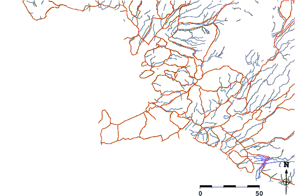
Looking at the coast around Reykjavik (just above the long finger sticking out) you need quite a few stations to get a good prediction.

Looking at the coast around Reykjavik (just above the long finger sticking out) you need quite a few stations to get a good prediction. The blue stripes are little river and nearly every little river has such a station nearby.

To get this information as accurate as possible, most countries have tidal stations along the coast which measure constantly the exact local tide highs and lows and eventually this results in tidal predictions which are very near what happens on the day for which the prediction is given. It is never a 100% as a bit of wind, or a slight change in current can put the real result a few minutes off, or create half an inch in height difference. That is something we can live with.

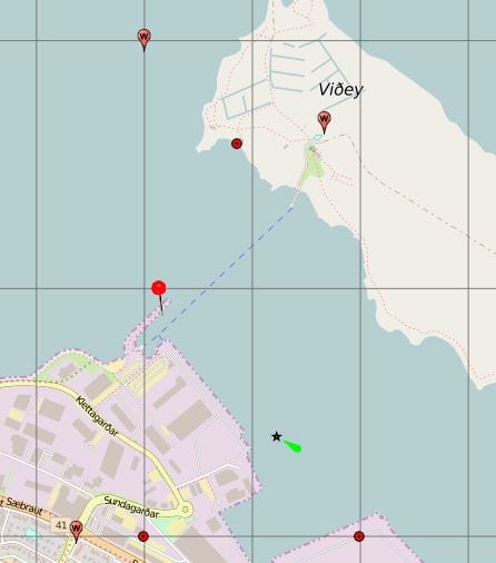
Commercial harbor. (Thank you Google Earth)

Commercial harbor. (Thank you Google Earth) The dotted line is the little ferry to Videy)

We are docking today at a dock which has the very Icelandic name of Skaribakki and the port area is called Sundahofn.  This is the outer harbor. If you are on a very small cruise ship you can dock in the old fishing port in downtown. But anything over 15,000 tons is already quickly moved to the commercial port. Makes sense as there is more room here for the buses, for supplies, for gate security and for the obiqious souvenir shop.  (Which is conveniently situated next to Security, so when you come back, you come back through the shop) But the hop on hop off bus stops outside the gate and thus we all should be able to live with it.

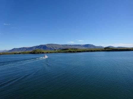
Little ferry to Videy. Maybe because of the nice weather but it was full all day.

Little ferry to Videy. Maybe because of the nice weather but it was full all day.

As it is Saturday there is not much going on and thus the port is quiet. The only thing we see on a regular basis is the small ferry boat which goes to the island of Viioey (Also spelled Videy). This island forms the Northside of the natural harbor entrance for Reykjavik. From the ship the island looks just like a grass covered hill with a large house at the west side and a large house at the eastside. But there is more to it than the eye sees. Yoko Ono has a work of art there (Imagine Peace Tower) and the house you see on the photo is the Videy house and this was the first building in the country to have been constructed from stone. I wonder where they got those stones from as Iceland is mainly rock and there is not much clay or sandstone out there.

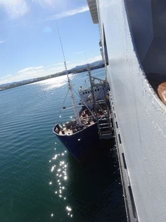
We bunkered 500 tons of MGO here and it came by a small coaster. With this weather not a bad job to do.

We bunkered 500 tons of MGO here and it came by a small coaster. With this weather not a bad job to do.

As we are here two days, the ship plans accordingly and tries to do most compulsory things on the first day so the 2nd day gives the crew more chance to go ashore. (Unless you are stuck with safety duty of course) Thus we had the bunkering going on and we had the lifeboat and liferaft drills. Today we also have crew change over, witch helps with a  2nd day as well, as it is all much easier if you have a day alongside to settle in.

I do not know what the crew will do in the evening, as transport is very expensive and drinks are even more expensive. But if they do, it will be strange to come out of the Pub or Dancing in the early morning hours and find it is still daylight. At least to a certain extent. We have the mid night summers day here, when the sun does not set and even now in late July (sunrise at 04.28 and sunset at 22.36) it does not really get dark.

So tomorrow we have a 2nd day in port and we will not leave until 17.00 hrs.  Yesterday I remarked that the 2nd day would bring rain but now it has improved to scattered showers with temperatures of 17oc / 57oF.  Thus it should still be a good day to go ashore but I hope everybody went to day as it was a gorgeous day.

29 July 2016; At Sea.

Today we have a day at sea, to get to Iceland and doing so we cross two time zones. So last night we went an hour forward and tonight we will do it again. No doubt the Beverage Manager is not a happy camper as hours forward are not good for the Bar Revenue. (And we get two more between Iceland and Aalesund Norway) This area benefits from the confusion of what it is exactly to be called. The area along the East coast of Greenland is called the Irminger Sea and the area closer to Iceland is called the Denmark Strait. And then the whole larger area is called the North Atlantic Ocean.

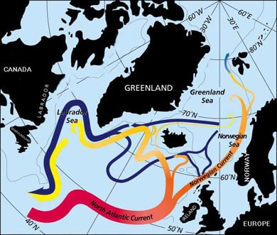
The weather has also changed and today it was a dull day with the wind and swell increasing in the afternoon. Whatever the weather here is, it is different to the west side of Greenland. This is mainly caused by the Gulfstream. Although the Gulf Stream predominantly flows at lower latitude across to Europe, and then goes under England along the coast of the lowlands; a smaller branch turns northwards and brings warmer water to the area we are now sailing in. For the time of year this means normally less fog as wind and water do not vary much in temperature. It would need a very cold northerly wind to accomplish something.

A minor branch of the Gulf Stream doubles back to under Iceland.

A minor branch of the Gulf Stream doubles back to under Iceland.

In the winter time the Gulf Stream does have a negative result, and it does that in conjunction with the Jet stream. The Gulf Stream generates about every three days a new storm off Cape Hatteras. It comes up right under the coast there from Florida and then goes across. While the Jet Stream propels these depressions across, their force is being nurtured by the warmth of the Gulf Stream.  Now whether Europe gets a storm or not, depends on where the Gulf Stream is going. If there is a High Pressure ridge over the Azores, the Jetstream tends to bend to the North towards Iceland and then they get the storm.  If this is not the case, then the storm goes straight across and makes a landfall either at Ireland or at the south west area of England.

Most winter storms go the Iceland way. Maybe another reason they do not have much in the ways of trees there. During the winter it blows here quite often (about every three days). If a storm makes it to densely populated Europe then there are fun and games. Especially if the storm arrives in combination with a Spring Tide. Then the water is already high to start with and then an extra push by a strong storm: and along the coastlines of England, Scotland and the Netherlands the alarm bells go off.  In Holland we had a very bad one in 1953 when the (weak) dykes broke through. As a result the Dutch really went to war and now the enormous Dykes and Water Barriers protect the areas where there are no dunes. A lot of tourists now come to see what has been done there and the “Delta Werken” are a standard part of a tourist tour through Holland.

But even in my little English Home town, tucked away in the east corner of England, we had fun and games fairly recently . In 2013 there was a spring tide, the wind was at the right (or wrong angle) and the sea barriers and Beach huts took a severe battering.  And that was away from the full force of this Spring Tide storm. I cannot post any photos of  this as otherwise I run into copyright issues with the English newspapers.

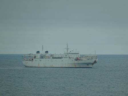
We did not have any bad weather today and the excitement on the bridge was limited to a ship we passed at 10 am. on our portside and which we could not identify. All ships over 300 tons are required to have an AIS on and then it takes one click on the Radar and we know who it is. They did not, naughty boys, and thus the guessing started. First idea was a fish processing plant as the ship was white and sitting just outside the 200 mile zone off the Greenland Coast and thus local fishing rules would not apply. We did not see a net but there was something hanging from the stern. The funnel colors were, yellow, blue grey and those colors I have seen on both USA and Russian companies. So we thought maybe it was a scientific vessel.

The Zeus cable layer for the US navy. I wonder if the US Navy is branaching oout in the TeleCom business.

The Zeus cable layer for the US navy. I wonder if the US Navy is branching out in the TeleCom business.

My guess was the US Sealift Command as that would explain the no AIS signal as military vessels are not required to use an AIS. So I turned to my friend Google and he knew the answer. It was the USNS Zeus (T-ARC-7) a cable laying vessel of the US navy.  As you can see never a dull moment at sea.

Tomorrow morning we should be at the pilot station at 07.00 hrs. and docked about an hour later. We are staying two days as there is too much to see and enjoy in Iceland to cover in one day.

Weather for tomorrow, Sunny with temperatures of 67oF/ 17oC and a bit of a breezy day. For Sunday rain is expected so hopefully nobody will leave it to the 2nd day to go ashore.

28 July 2016; Prince Christians Sund.

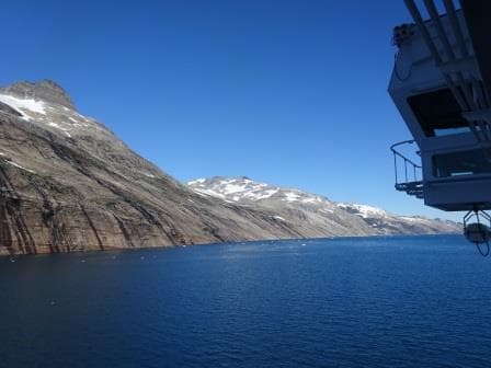
As soon as we had left the port yesterday we were enveloped in this white cloud again. But in the early morning it came to an end and we were greeted with a gorgeous view of the coast of Greenland. Clear blue skies and hardly any wind outside and thus no wind inside. Seas flat as a mirror.

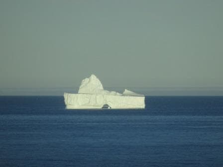
Finally a nice big Iceberg for all to see, marking the Western Approaches.

Finally a nice big Iceberg for all to see, marking the Western Approaches.

By 7 am. we approached the Western entrance which was nicely marked by several icebergs which had happily run aground there. Then we sailed in with the gentle speed of about 10 knots which resulted in a schedule of leaving again at the other side around 5 pm.  Our two pilots were in full swing, taking alternative turns in advising the bridge team of what would be the best way of going through. Most of us have been here now several times but pilots are normally crossing this area more often than we do.

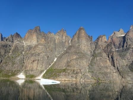
Ragged mountains peaks dominate the Western Entrance.

Ragged mountains peaks dominate the Western Entrance. And a sea as flat as a mirror.

On average the water is quite deep but there are a few shallows spots, which are not an issue as long as there is no ice in the deep spots next to it. Then there is one tight and narrow turn where it is easier also not to have an iceberg in the way. Luckily inside the Sund the bergs are normally not that big that it has ever formed a real problem. The real big icebergs are coming down from Upper Greenland area (Disko Bay etc.) and they float down the coast. It has been known to happen that a transit had to be cancelled as a Berg blocked the Western entrance but it is not really common. The Sound or Sund is named after Prince Christian later King of Denmark in the 19th. Century. (I might be a bit off as there one more than one Christian if my memory serves me right and I think was nbr 7 or 8) The Sund has a length of 100 kilometers or about 54 Nautical Miles and that is why we can trundle though at a very sedate speed and even stop at the Glaciers along the way.

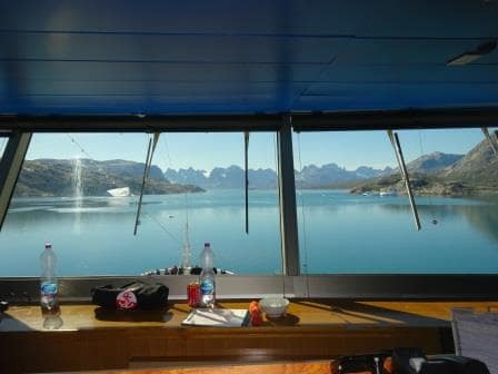
View from the Bridge. Two pilots and thus two bottles of water.

View from the Bridge. Two pilots and thus two bottles of water.

The Sund connects the Labrador Sea with the Irminger Sea which is the body of water between Greenland and Iceland. There is one (lonely) village in the middle of the Sund called Aappilattoq, with 132 inhabitants, and it is lonely because all around it the mountains go up to several 1000 feet. They have a helicopter connection with the outside world but for the rest contact is only by sea.  I remember that in the early days a cruise ship once stopped there to land medication, as the village had been cut off for some reason from the outside world for some time.

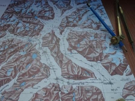
The Navigation chart of the Sund. As you can see it is not a straight channel but here it almost doubles back on itself.

The Navigation chart of the Sund. As you can see we do not follow the straightest route possible but almost double back on ourself. We follow the deep water & glacier route which results in going around a long island.

As mentioned yesterday, this area is not covered yet by the Electronic charts system and thus the navigators went back to the good old days and verified the ships position by bearings plotted on paper.  The area has some semblance to Alaska with Glacier Bay but the fjord is generally tighter (narrowest point is about 1500 feet wide) and it looks different as the rocks are of a different composition. Here we have mainly white granite which gives the mountains an elephant greyish hue while in Glacier bay it is more black or sometimes red (streaks of iron deposits) It is not a National Park and thus no Park Rangers for the commentary. That is done by our own Travel Guide Barbara who has been here many times and has no problem to explain all that comes floating and flying by.

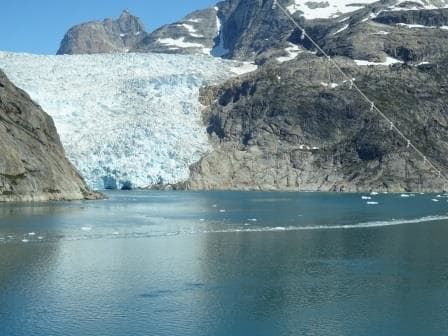
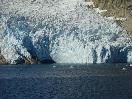
One of the several Tide water glaciers coming down from the Greenland Ice Cap.

One of the several Tide water glaciers coming down from the Greenland Ice Cap.

The biggest difference between the West side and the East side is the way the mountains are shaped. At the west side they are very ragged and sharp as normal mountains have not been touched by the grinding motion of water or ice. The East side has been and thus the mountains are more rounded and shapely. Greenland is still covered with ice but during the ice ages it must have been very impressive here as even these rounded mountains reach a considerable height.

The mountains on the East side are more rounded courtesy of Glaciers polishing the tops down.

The mountains on the East side are more rounded courtesy of Glaciers polishing the tops down.

This was the best Prince Christian Sund transit I have ever seen and I hope the guests will appreciate it, as it is not always the case. It can rain, there can be no visibility, there can be an un-expected storm, you never know. Or an Iceberg can block the Sund somewhere. Today was really good: 10 points out of 10.

Tomorrow we are at sea, crossing the Irminger Sea on our way to Iceland. There we will stay two days as it takes more than one day to explore this fascinating island.

Weather: We are still close to Greenland so it can be anything. Maybe the captain has to blow the horn again; maybe he will have an un-interrupted nice sleep. We will see.

Close up. Every glacier has a river under it which transports the melt water and also helps it to slide down the mountains. This is a big tunnel / river exit.

Close up. Every glacier has a river under it which transports the melt water and also helps it to slide down the mountains. This is a big tunnel / river exit.

27 July 2016; Qaqortoq, Greenland.

The officers on the bridge are not having an easy time. The nice weather with the relative high temperatures creates prolonged periods of reduced visibility and thus the ships whistle kept going all through the night. Only when entering the bay of Qaqortoq did the curtain suddenly open up and was it clear again. Less cold water enters the bay, the rocks maintaining the warmth overnight and the mountain ridges shelter the area from the cold wind. In the bay it was as clear as a whistle but outside the white wall remained all day long.

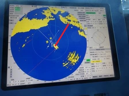
This time a shot of the Radar without a chart which shows the area. The red line is the tender route to the dock.

This time a shot of the Radar without a chart which shows the area. The red line is the tender route to the dock.

Greenland has not been much in the picture of the maritime world yet as the area has still not been digitized as far as the sea charts are concerned. We can now sail over most of the globe with the chart on the Radar, so the radar picture overlays the chart (and hopefully merge exactly) but not in Greenland’s waters. To go onto the Radar, the charts have to be digitized and also verified for the correct standard of digitization. Greenland is not there yet and thus for the coming days, we have to pull out the paper charts and do it the old fashioned way with ruler and pencil. But we also had the two local pilots on board who ensured we stayed on the dotted line.

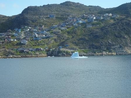
This is as close as we have come to an ice berg thusfar. A poor lonely boy which has ran aground and is now melting away.

This is as close as we have come to an ice berg thus far. A poor lonely boy which has ran aground and is now melting away.

We were supposed to see Ice bergs, but as it was a small white world, we did not. Luckily with the modern radars the larger ones do show up on the Radar and also the pilots have the ice forecasts and they know where the big boys are drifting to. We had no big boys and only saw a few smaller ones which had run aground in the bay and were slowly melting away. The more north you go, the more you see them and on occasion they can block off the complete harbor of a town. Some towns have a tugboat available to pull the Bergs that want to get into the harbor, back to open waters again and then hope for the current to push them away. And maybe to the next town.

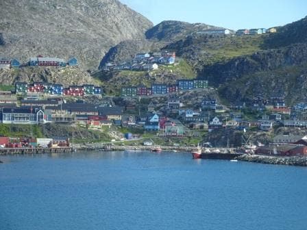
The whole village is built against the mountain range so getting anywhere is good exercise.

The whole village is built against the mountain range so getting anywhere is good exercise.

We had a beautiful day here, with the ship being in port from 10 am until 18.00 hrs. As is with most villages and towns in Greenland, Qaqortoq is very isolated. There is an air strip but nearly all traffic along the coast is by means of three ferries which run all the way from Qaqortoq up the coast, via Nuuk the capital, to  IIulissat the most northern harbor which can be reached all year around. We cannot do any tours in Qaqortoq as there is nothing outside the town, unless you want to make a 9 hour trek to a sheep farm further inland. A lot of people do this, but this not a ships shore-excursion you can do.

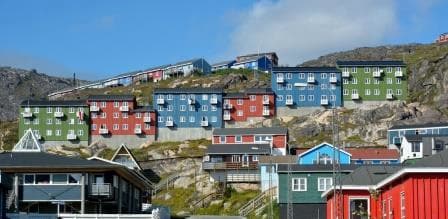
In scandinavian style, the houses and aprtment buildings are multi colored. The only color I could not find was Orange. (Very disappointing for a dutchman)

In true Scandinavian style, the houses and apartment buildings are multi colored. The only color I could not find was Orange. (Very disappointing for a Dutchman)

Thus the guests had to make do with the town itself. But that is also the attraction here. Greenland is completely different again than Newfoundland, as the houses are more in the Scandinavian style, there is a strong presence of native culture hence the name Qaqortoq, as the Danish name is: Julianehab.(Which means Juliana harbor).The Inuit name for the town means “White” which refers to the white granite of the mountains and hills.

Qaqortoq is the fourth largest town in Greenland with 3,200 in habitants. Nuuk the capital is the largest with 17,000. I find Sissimut (2nd largest city with 6,000) personally the most fascinating one as it manages to have a Coffee museum which might not be the most northern museum in the world but it is certainly one of the most difficult ones to reach. The Danish and as a result the Greenlanders as well, are great Coffee aficionado’s and thus is there a lot of coffee history, folklore and memorabilia to find everywhere. Enough for a Museum, even for a remote place like this.

We will sail at 18.00 tonight and then tomorrow we are to transit Prince Christian Sund. So we have to wait and see if we make it. There are normally three challenges to overcome: one: very bad weather, two no visibility, or an iceberg blocking the entrance or exit. Holland America had it all through the years, so we find out tomorrow how lucky we are going to be. We are not expecting bad weather so we are already up to 33% of going in.

Older posts Newer posts