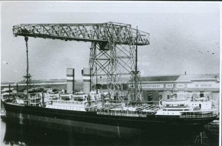
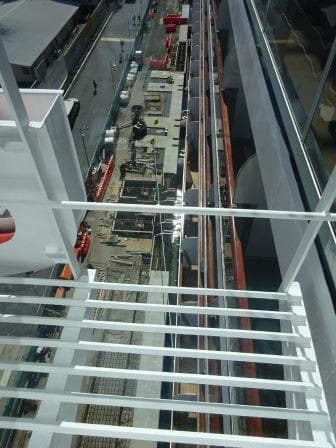
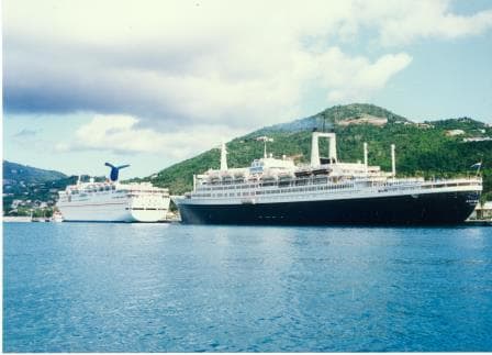
Being on a cruise ship has some advantages that guests do not always realize. One of them is having preference of arrival in Port Everglades. Today was a busy day for the port with container ships going in and going out. They have to be scheduled for non-cruise ship days, which are normally the weekends, as the cruise ships also dock at the container friendly docks. But these ships have to wait when a cruise ship is arriving. So the captain of a cruise ship sends his ETA (Estimated Time of Arrival) to the port agent and the harbor master and if the timing is not too outrageous, then he gets it. If a poor cargo ship captain wants the same time, then he will have to wait or come earlier. Continue reading
Category: HAL History (page 3 of 4)
Yesterday I ended my blog with the remark that this cruise was not POSH. That does not just apply to this cruise, but basically to all cruises, unless you are on a world cruise which only travels one way. POSH comes from the old days of the British Empire, when company’s such as P & O Lines maintained regular liner services to the colonies in the Far East. P & O still exists as P & O Cruises but the British Empire is long gone. In the heydays of this travel between the colonies there was no air conditioning on board and even worse, many of the ships had a black hull. Continue reading
With a brightly shining sun the ms Zuiderdam continued its return part of the voyage to Fort Lauderdale. We have already left the North western part of the Caribbean with the Yucatan Channel and by 16.00 hrs. we were abeam of Havana Cuba in the Straits of Florida. In the Straits the navigators start searching for the most optimum speed by trying to find the center of the Gulf Stream. For this we are aided by current charts which we receive every day from the NOAA and from other Meteorological authorities who collect Satellite Data, then turn the data into charts and beam them on a daily basis to everybody who can receive them. Continue reading
We left Hamburg in the early morning and turned the ship around as I explained yesterday. Such a maneuver is not done “ off the cuff” but carefully planned so all the officers know exactly what the captain, or his designate who carries out the maneuver is going to do and when. If the officers fore and aft have the exact maneuver also in their mind then they can report in what they see fore and aft while retaining the same mental picture.
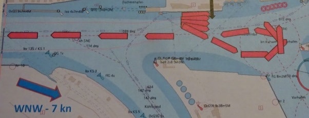
Departure Hamburg during the ebbing tide. As usual we try to use the current as our friend. Put the bow in the current and have it pushed down stream while keeping the stern in position with the main propellers.
Then we sailed down river and just after 9 am. made the sharp turn to starboard and into the Brunsbuttel locks of the Kieler Kanal. Although the official name is the Nord- Ost See Kanal, the name Kaiser Wilhelm II Kanal is also used after the Emperor who opened the canal. It was opened in 1895 but was between 1907 and 1914 already widened due to amount of traffic and larger ships. Holland America has a claim to fame here as the Rotterdam III was the first commercial ship (Commodore F.H Bonjer) that sailed through the Canal following the imperial yacht Hohenzollern with the emperor on board. A Dutch flagged ship was chosen to avoid international bickering about who was more important. The Kingdom of the Netherlands was neutral in European matters so it was the best way out for Germany to keep France, Russia and Great Britain from complaining. The Canal was officially built to reduce the time for ships traveling from the Baltic to the ports in lower Europe and vice versa. Otherwise you have to go all the way around Denmark. The un-official reason is that the Canal was very handy for the German War Fleet to get from the Baltic to the North Sea and vice versa without giving Denmark or Sweden the chance to make things difficult by closing the narrow through fare off between Helinsingor and Helsingborg.
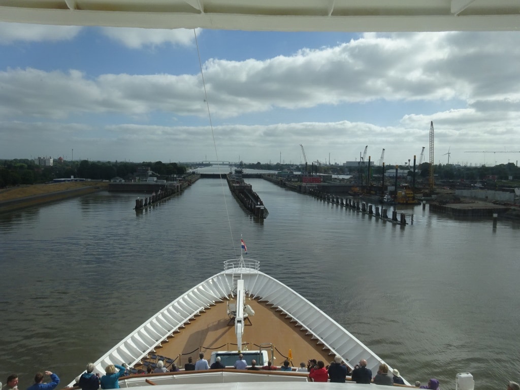
Entering the locks at Brunsbuttel at the Elbe River side. There is a second set of locks to the far right, which is at the moment under re-construction.
There is ample space for the Prinsendam and also larger / read longer and wider ships / to fit in the locks and go through the canal. That is not the problem. The challenge is the height of the ship above the water. There are a number of fixed bridges over the canal and we have to go under them. The Prinsendam is prepared for it as she can lower the top of the radar mast. Some ships also have to lower the funnel (they do that by tipping the top over) but the Prinsendam funnel is low enough. When we book a transit for the canal, one of the things we have to do is to send in a certificate which is approved by Lloyds and which clearly states how high the ship is above water including the draft variations. In the past it has happened a few times that the measurements forwarded to the canal authority where not exactly correct and a bump was the result. Since then a Lloyds Certificate is required.
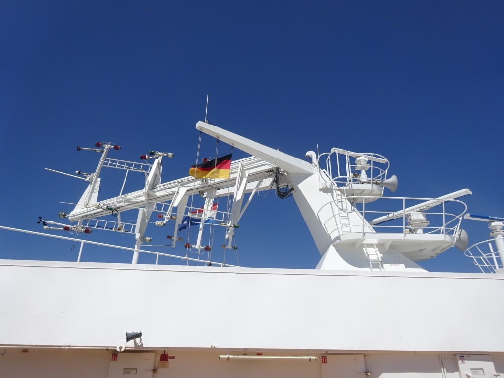
Folding down the top of the Radar Mast to avoid bumping into the bridges.
The Kanal has a length of 98 kilometers and the average speed going through is about 10 knots, with stretches where the ship can do 12 and there are some – inhabited areas where the speed has to go down to 7 or 6 knots. Then there are moments that big ships have to pass each other and then one ship will go against pillars at the side of the canal and lean against it. The 2nd part of the canal is the smallest, the part towards the Baltic, and there no traffic can pass each other, so ships wait at moorings until the North bound convoy has passed. In similar style as in the Panama Canal where ships wait in the Gatun Lake. While going through the Canal we have a pilot, who changes half way through the canal, but the pilot also brings helmsmen to steer the ship. They know exactly how to stay in the middle of the canal or to slow or to veer off the center track when there is opposing traffic.
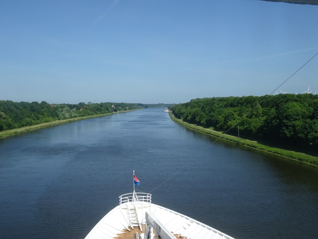
Entering the narrow part of the Canal. There are only a few bridges and the only other way to cross is by small ferries which can be found along the Canal at regular intervals.
By 1830 we were at the end of the Canal at the Holtenau Locks which give access to the Ost See or in English the entrance to the Baltic. This area is called the Kieler “Bucht” or Bight and when we exit the canal it has served the purpose for normal ships of not having to sail around Denmark and for us to have had a very nice scenic day. And we did have a very nice day. With the combined experience of Captain Dag and I we can say that this day was one for the record books. Sunny but not too hot, a gentle breeze but not windy, and a transit all the way on schedule. It is not often that we have all those elements coming together in one day.
This evening we will sail past Kiel and in the lower Baltic and then follow the German coast by going North West towards Tallinn, were we are spend the day, the day after tomorrow.
Expected weather for tomorrow: Sunny, low sixties or around 16.17oC and a gentle breeze. And that gentle breeze should (hopefully) just be enough to keep those low hanging white clouds away.
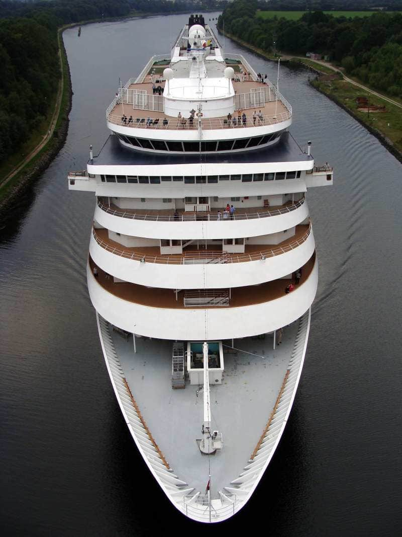
A view of the Prinsendam from one of the bridges. Taken in 2009 while going through the smallest part of the Canal.
And thus real life started again and I returned to sea by means of the ms Prinsendam. I was supposed to join the Koningsdam first, but the Prinsendam will be celebrating her 30th. birthday on June 11 and I was asked by the ship to do a few lectures in relation to HAL and our Elegant Explorer. Thus we juggled the schedule around and here we are combining work and hobby-pleasure. Before we dive back in the real world; a small side step with something that happened while I was at home. Also in relation to the history of the company and in relation to the original reason we have a Veendam sailing in the fleet.
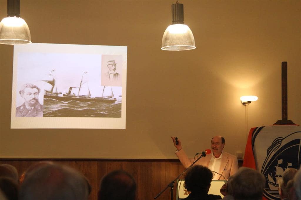
Explaining who W.A Scholten was. This is the ship from 1874 with it’s first Master, Captain Hus Top right and its last Master Captain Taat Lower Left. (Photo courtesy Mr. Ruud van Deventer, son of ex HAL Captain Van Deventer)
Back in the grey mists of time, 145 years ago, Holland America was founded and went public with having a listing on the Dutch Stock Exchange. Out of nowhere a rich industrialist from the Northern part of the Netherlands popped up and bought so many shares that the company was able to finance a complete ship from it. Thus the company named this ship after him. Mr. W.A Scholten was inspired to invest in HAL because he only saw German shipping posters at the various railway stations he used while traveling between his various factories in the Netherlands and as far as Poland. The ss W.A Scholten sank in 1887 but the company replaced it very quickly. By that time the DAM naming system had come in vogue and thus they could not repeat the personal name. But no problems here, Mr. Scholten had factories nearby and lived in the town of Groningen and Veendam was the nearest “DAM” town in area. And thus in 1888 the ss Veendam (I) started sailing for the company. And for most of our history we have had a Veendam in the fleet. The current Veendam being nbr IV.
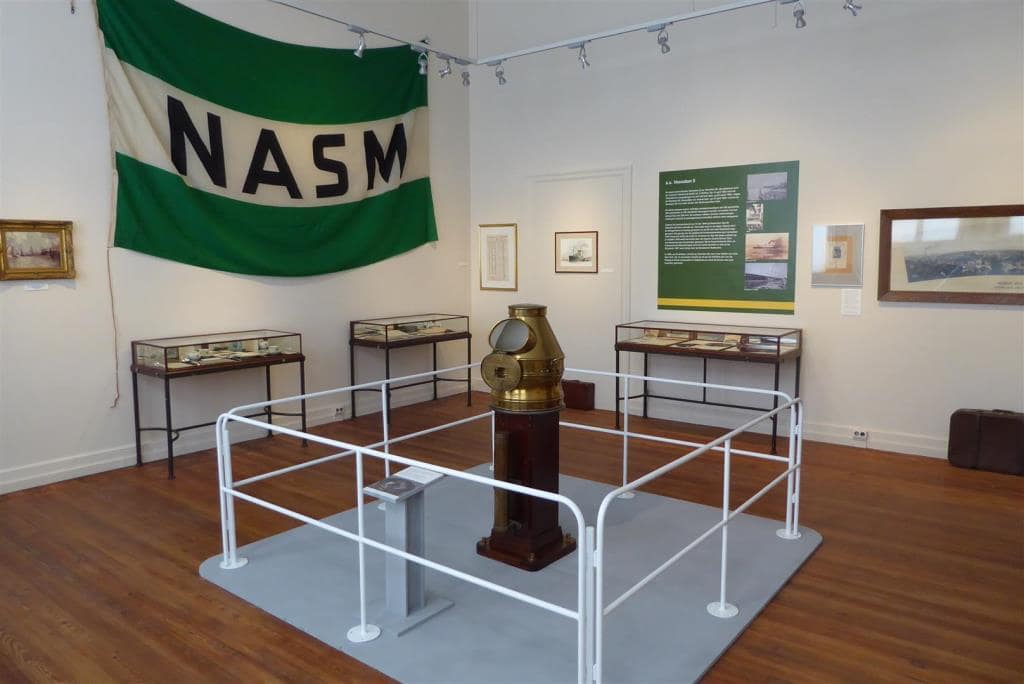
There are big collectors and there are small collectors. I am a small collector but the museum found a gentleman who had managed to salvage the magnetic compass of the Veendam II when it was scrapped in New York. He is a big collector as this compass was only a very small part of his private collection. (Photo courtesy Mr. Ruud van Deventer, son of ex HAL Captain Van Deventer)
In this home town, Veendam in the province of Groningen, there is a museum which is dedicated to the rich shipping history the town once had and also its relation with W.A Scholten. And thus with Holland America being 145 years young and W.A Scholten and the four Veendam’s it was decided to create an exhibition about it all. But then you need material to exhibit. In this case this museum asked the collectors and historians in the country if they could help. And of course they were willing. Every collector likes it when his/her things go on display and most collectors are much easier to work with than the red tape of official museums. And that brought the organizers to me and recognized a sort of unique situation: A Holland America Line historian and collector who also had been the Captain of a Veendam. Some of my collection went on display (and that was not much compared to what some others were able to bring in) and I was quite happy.
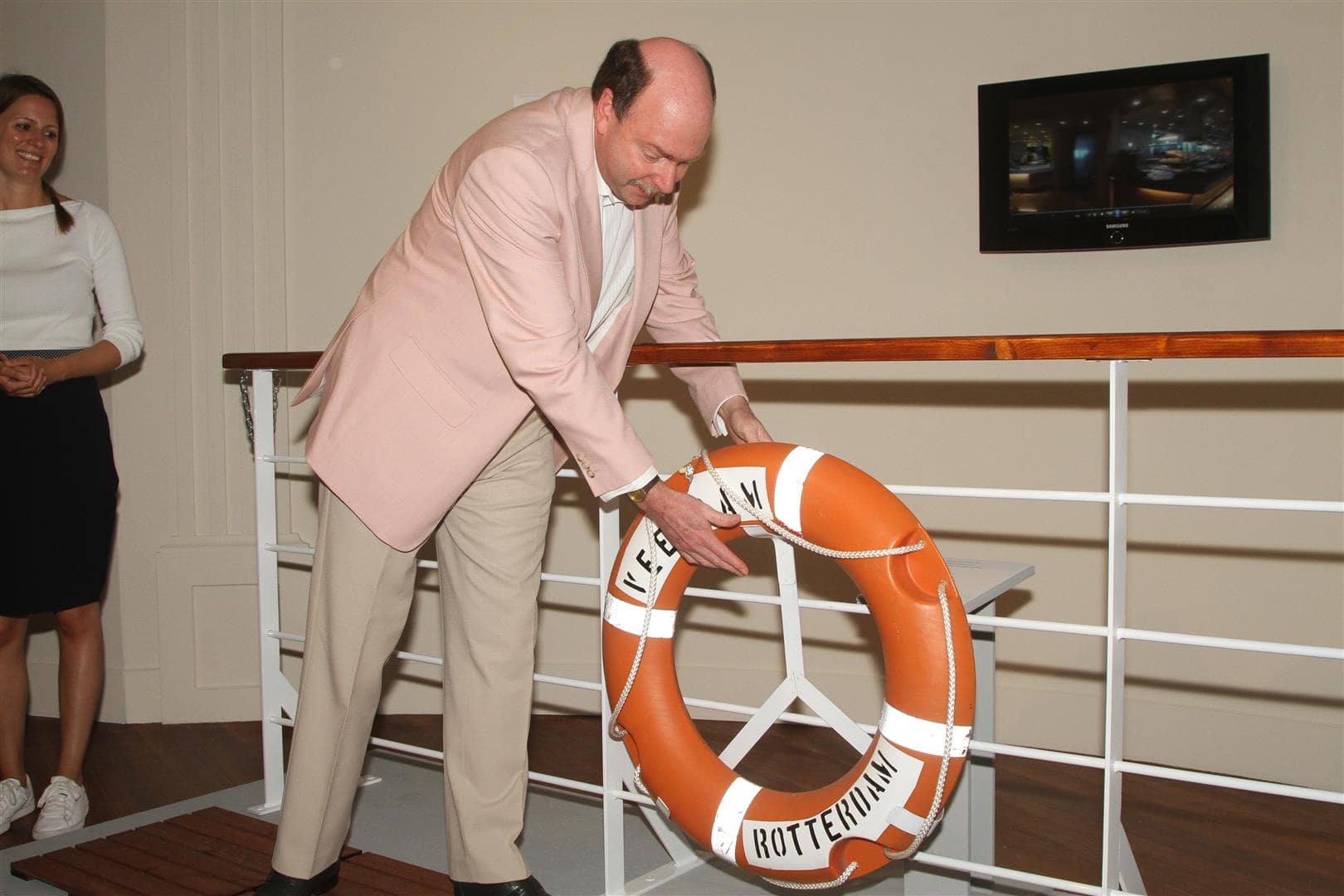
Normally when a sailor has a life buoy in his/her hand it is because somebody has fallen overboard. It is quite unusual to use a lifebuoy to open an exhibition. (Photo courtesy Mr. Ruud van Deventer, son of ex HAL Captain Van Deventer)
Then there was the un-expected next step. As the Dutch King, nor Queen, nor the Prime Minister or any other highbrow official was available (the opening being on a Sunday afternoon…………….), it was decided that I should do the opening. A cruise ship captain’s life is never dull but I do not think that this happens very often. So in the last week of my leave I drove to the far north of the Netherlands, to Veendam to open the exhibition. No ribbon cutting with golden scissors but sailor style with hanging a lifebuoy on a fake railing. For those who read this and have the option to visit, it is well worth to do so, not only because of this exhibition but also for the rest of the museum and for Veendam which is a delightful little town to spend an afternoon in. (https://www.veenkoloniaalmuseum.nl/nl/in-het-museum/tentoonstellingen/veendam-in-de-vaart-1)
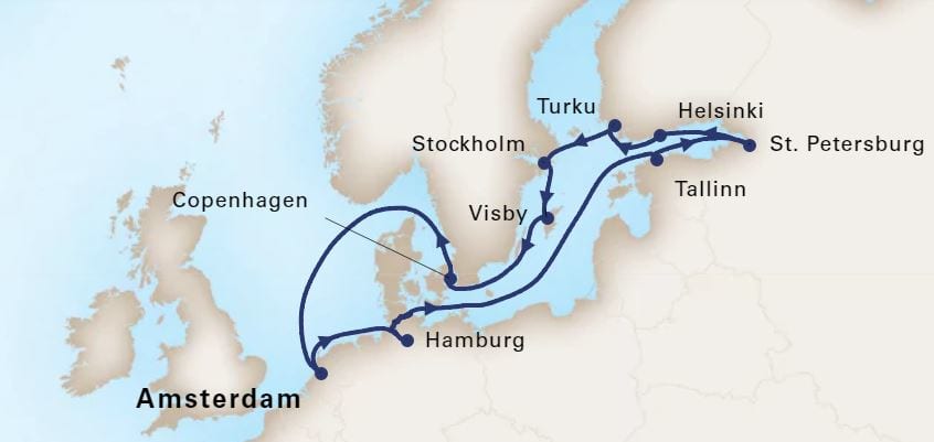
Our current cruise 02 June to 14 June 2018
The ms Prinsendam started today a 14 day round trip to the Baltic and will also call at Turku, where 30 years ago the Royal Viking Sun, now Prinsendam was built. Apart from Hamburg and the Kieler Kanal it is doing a regular Baltic cruise with calls at Tallin, St.Petersburg and Helsinki. The ms Prinsendam is the only HAL ship which fits in the locks of the Kieler Kanal and we have guests on board who have booked this cruise especially for that purpose. I am keeping my fingers crossed that we will have good visibility. Today on departure it was hazy and a white curtain came down the moment we left the locks at Ijmuiden. But tomorrow we are supposed to get a bit of wind and that should change the balance between air and sea temperature somewhat and hopefully that will result in being able to see the whole world again.
Today is the 2nd of our three sea days although the first one was not planned but due to the swell inside the port of Puerto Limon. As far as I have heard it is still not good over there and we can feel it here as well. There is still a high swell running from the North East and on occasion the angle is just wrong for the stabilizers and we are reminded of the fact that we are on a ship. The wind has slightly diminished but is still very strong.
The route we are taking brings us west of Grand Cayman and we were abeam of the islands at 17.00 hrs. Local time. Not that we can see the islands, they are much too low to come above the horizon. Then it is going past Cuba, sometime tomorrow morning. Keeping Cuba on the Starboard side and sailing through the Vessel Traffic Separation scheme past Cabo San Antonio and then we will be flushed into the Straits of Florida by the Gulf Stream.
So tomorrow we will also pass Havana on Cuba. Now the island is being opened up and relations are being normalized it is “safe” to also blog about it. Carnival Corporation, and also the competition, is now sending cruise ships to several of the Cuban ports. We had the Adonia from P &O going there under the Fathom banner and she is now being replaced by a Carnival ship sailing from Miami. European companies have already had ships there on a regular basis but they did not call at a USA port. We have no insight yet if Holland America will start calling there in the future, it might happen when the time is right.
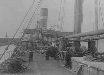
A deck view of one of our early steamers the ss Andijk (1) from 1909. This photo was taken to show the damage on deck after a bad weather crossing. Note the open bridge.
We do have a long history of going to Havana. Our first ship which called there was the cargo ship the ss Andijk in 1912, with Captain A.B Jochems in command. This ship in-augurated a new cargo service to the American and Mexican Gulf Ports. Before that time HAL cargo ships only called at ports on the American East Coast but by 1912 the company started to expand its services.
Then it took until 1922 before the first HAL passenger ship arrived. This was the brand new ss Edam (IV) under the command of Captain J de Koning. The ship inaugurated a passenger liner service which went from Rotterdam via Portugal to the Caribbean and the Gulf of Mexico ports. This new service was caused by the implosion of the Emigrant Trade to the new world after the First World War when the Dillinger Quota Act was approved by Congress. So HAL had again to diversify again as the emigrant trade did not bring enough revenue anymore.
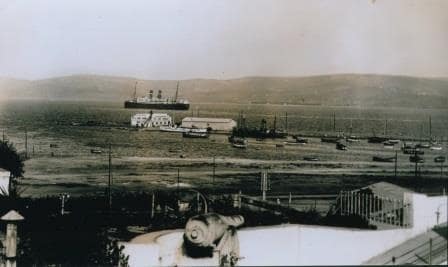
The ss Veendam II somewhere during a cruise. Note the gun in the fore ground. I am still trying to find out which port this is.
The ss Veendam (II) was the first Holland America ship that made a cruise call at Havana. Under the command of Captain Watze Krol it called in 1926 at Havana during a cruise from New York to Panama, the West Indies, Cuba and Bermuda. These cruise ships calls by HAL ships continued for years, even during the depression, when cruising did not come to a near halt as the North Atlantic trade did.
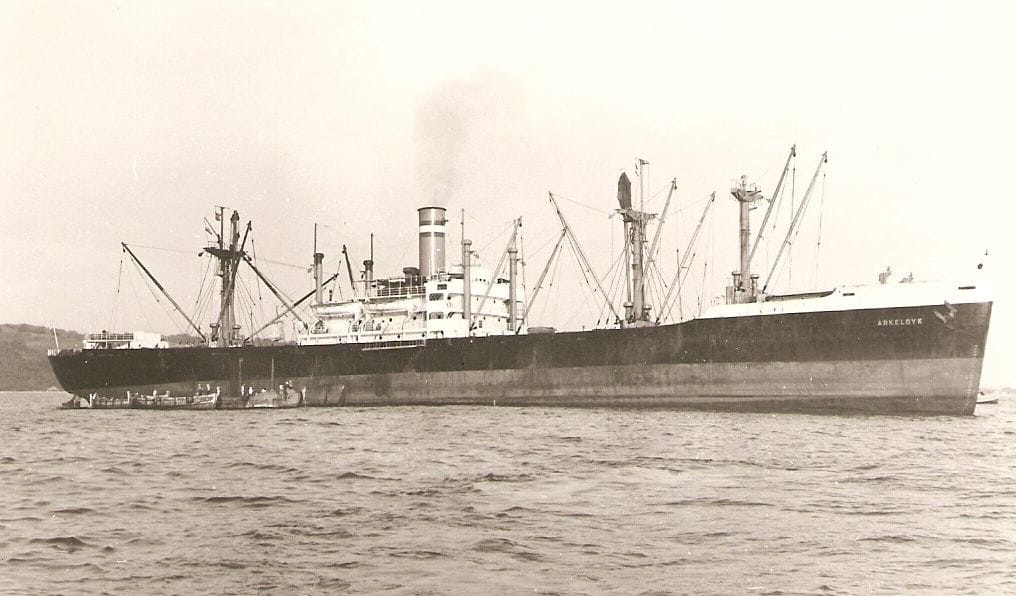
The ss Arkeldijk was one of 11 cargo ships the company bought right after the 2nd world war when they were no longer needed for the war effort.
Then came the Cuban troubles and eventually Holland America could not call any longer at Cuba and it was the cargo ship ss Arkeldyk which made the final call in 1962 under the command of Capt. J.A.J Reedijk. For 18 years it was all quiet until something peculiar happened during the world cruise 1980. Then the ss Rotterdam (Captain F.H van Driel) called at Havana on 15th. of April for a full day near the end of the cruise. As far as I understand there was some “détente thinking” going on in Washington and HAL got an exemption permit. The call was never repeated as the political tide swayed the other way again.
I have never been to Cuba, apart from sailing into Guantanamo Bay for a Medical Evacuation but hopefully I will see the day that a HAL ship sails into one of its ports. Cuba has beautiful ports, great people and the local beer is not bad either.
So tomorrow we are at sea for the final day and the guests are hoping that the ships movement will reduce a bit. It should as we will be coming under the Cuban coast.
Today we are in Charlotte Amalie in the natural harbor they call Havensight. So good and so sheltered that in the good old days the pirates sought a safe haven here. Nowadays there are two cruise ship docking locations. The one here at Haven sight , which can handle four medium size ships or 3 big ones, and Crown Bay which can handle two medium to large ships or four very small ones. Crown Bay was an addition in the late 80’s and was originally known as the Submarine Base where the US Navy had a station. When they moved the docking area was redeveloped with the help of Carnival money to create an over flow dock incase downtown = Havensight was full. In the beginning it meant that the Holland America ships went there and the Carnival ships remained at Havensight. Then we were joined by the Princess ships. Now we are going the other way again as the Mega Liners from RCI are directed to this dock. Such as the Oasis and Allure of the Seas.
As a result the ms Eurodam docked at Havensight nbr 1. All the way in the corner. Behind us was one other ship, the Norwegian Gem which had been with us yesterday in San Juan as well. What happened to the 3rd one I do not know but if it had been known there were only two ships in, then we could have docked more to the middle and that would have been a lot easier. I already mentioned in my blog in December, when on board the Oosterdam, that the pier section in this area is under repair and it still is. The mess is just less big than last year. The whole pier is been restructured and new and stronger bollards are being installed plus new fenders. Very good for all of us but at the moment the ships are docking in a building site with only a little bit of space left for the gangway. And as most of the old bollards are gone there are not many left to put the mooring lines on.
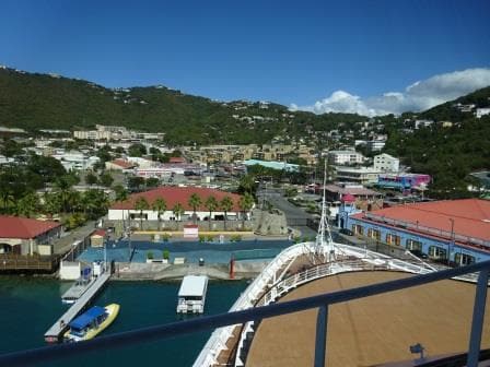
Where once the Pink Hotel was and to the left, where the blue canopied boat is, used to be a very nice Bar.
I remember docking here in the 80’s with the old Statendam which had a draft that allowed it to be put all the way forward and later did the same with the N ships. This berth was always more shallower than the other berths and thus a selection was made on draft. Our old Rotterdam had 32 feet of draft at the stern and had to dock in the middle or near the end of the pier. There was not always space as larger ships – more passengers – would be given preference and thus we had to anchor very often in the bay. The good thing about that was that the guests were taken directly to downtown by ships tender, the bad thing was you had to wait for a tender to go and to return.
When we could dock, the draft still caused a problem, which the captain solved by giving the ship a list of 1 or 2 degrees so the draft on the high side was 3 feet less and then we would winch the ship against and sometimes a little bit up the sand bank until the gangway could reach the dock. On departure we gave slack on the lines and the ship then slid back into deep enough water. You just had to make sure to arrive on lower water than what you had on departure. If that option was not possible then we had to rig up a long gangway, which we did not like as it was very narrow and tended to sag.
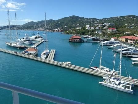
Is it a new Bar Restaurant ??. It looked closed and no details could be seen from the Eurodam bridge
The whole area has now been developed and the old pink hotel has gone, being replaced with more shops and also the old Bar & Restaurant on the end of one of the Marina Piers is also gone and replaced with new docks. That Bar was in the 1980’s a real meeting place for yacht and passenger ship crews as it was for everybody in walking distance, sometimes crawling distance, to the yachts or cruise ships. The ships now have Alcohol policies and St Thomas Real Estate policies so the Bar is no longer there. It looks that they have built something new, a sort of octagonal Dove Cote, but it looked very closed so I could not know yet if it is going to be a shopping hut or if it will be a Bar and Restaurant. It does have a perfect location.
St. Thomas is the furthest point we go on this cruise and now we will sail North West again, retracing our route and then call at Half Moon Cay the day after tomorrow.
The weather prediction of yesterday came partly out. The wind did turn but earlier than expected. It did so at 09.00 and Charlotte Amalie got a downpour straight away. But then it was sunny for the remainder of the day. Going back we will have the Trade Wind behind us and that will be good for Half Moon Cay, where you need Easterly wind to have a swell free beach. If we had gone to Half Moon Cay on the first day of the cruise, we would most likely have had to cancel as the swell and wind would have rolled directly into the Bay. But things look good this time.
A short update:
Although I had originally published a date of 1 Febr., to return to sea and to start blogging again, however due to some “dental challenges” this had to be postponed to Febr. 18. First ship still being the Eurodam.
I have updated my sailing schedule (still subject to extremely much change) and also uploaded the bio’s of the two captains of the Oosterdam under current captains and the bio’s of Captain van Roosendaal and Captain Slierendregt under captains from the past.
One ship has been added, the emigrant ship ss Groote Beer.
Best regards
Capt. Albert
Sometimes I think that our weather guru’s just put a bit of rain in the weather forecast to make sure they always have it right. Again today a bit of rain was forecasted but we have not seen anything yet. It was a beautiful sunny day with a very occasional cloud coming over but that was about it. I do not know if anything will change during the dark hours as we are here until 23.00 hrs. tonight but for the time being it is very nice. We are docked at the mega pier which is located outside the port and was inaugurated a number of years ago when it became clear to the authorities of Curacao that the new large cruise ships would start to bypass the island as they did not fit in the port and/or under the bridge when coming into the port.
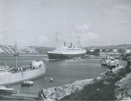
Not an inspiring area; Caracas Baai. Where dock now is much better. This is the ss Nieuw Amsterdam II, around 1950.
In the old days there was the option to dock at Caracas Bay just around the corner. This is a secondary port for Curacao and mainly used for oil tankers and cargo ships. It is much wider but it is a long way from port and bussing in 5000 cruise guests would be a nightmare. Hence the new pier. There is now talk about building a second one for the even larger ships. The Oosterdam with a length of just under 300 meters fits comfortably alongside this pier and can set good mooring ropes under the optimum angles. Our Koningsdam which is 12 meters longer would already have to deal with all the forward or stern ropes becoming breast lines and that is with the predominant , strong, Trade Wind not such a nice thing.
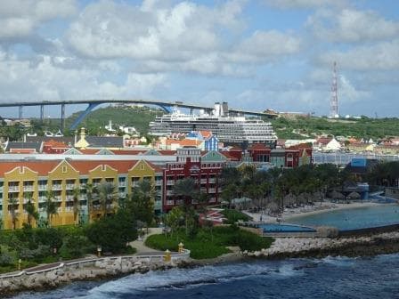
The ms Zuiderdam towering over Otrabanda the left bank of Willemstad. If needed the ship does fit under the Juliana Bridge seen in the distance.
We caught up-to-day with the Zuiderdam who calls here before it goes westwards towards the Panama Canal. She docked in the port or better said just inside St. Anna Baai at the west side to the entrance channel to the inner bay. Which means her guests are closer to downtown than ours. So why would she be there and not us? Well, she leaves at 17.00 hrs. and that gives the guests less time. We stay until late in the evening and thus our guests have plenty of time to walk to town (it is only 5 minutes more) and to come back. There is a local bus service and taxi’s galore so it is not as if we are cut off from the world.
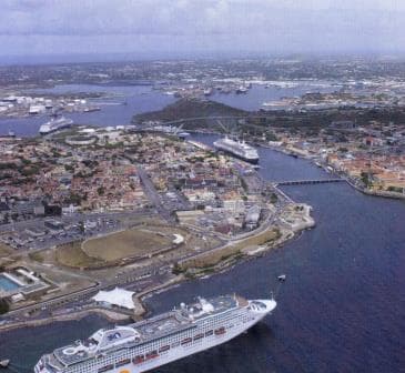
A busy day in Curacao, as it can be. Below at the mega pier a Princess ship,in port two R class ships and under the bridge a Celebrity ship. Today we only had Holland America in port.
Willemstad has been a cruise port since a very long. Already around 1900 there were the German cruise ships (The Hamburg Amerika Linie had the first dedicated cruise ship constructed called the Prinzessin Victoria Luise) who came here in the winter months before the first world war. I have a story about her on my blog. If you click Cruises from the past, and then click: the first real cruise ship.
Holland America showed up in the late 20’s and 1930’s when especially the ss Rotterdam came here on a regular basis while making cruises from New York. She docked at the same spot, the Mathey werf where the Zuiderdam is today. Later on when the Nieuw Amsterdam came, she went to Caracas Bay as the available tugboat power was not deemed strong enough to bring her in. That problem has been longtime solved and the ss Rotterdam of 1958 which was bigger than the N.A just sailed in docked anywhere in the port. Now they bring in very large tankers who are going to the repair shipyard located in the inner bay called the Schottegat.
Docking at the Mega Pier is a fairly easy gig. When coming from the East, as we did, you just make a wide turn, stop in front of the pier, make sure you keep the nose in the sometimes very strong current and go sideways. Going into port, into St. Anna Baai, is a lot more complicated because you sail 90o on the current which can run up to 4 knots. The wind is from the same direction and that does not help either. When wind and current are strong together it is quite tricky to enter into the fairly small opening. Thus it takes some planning and thus we saw the Zuiderdam stopping well outside the port, assessing the drift and then quickly moving forward to dock. Once you know the effect of wind and current on the ship you can figure out the drift, and then compensate for it. Which normally means steering a course which makes it look like as if the ship will hit the shore when it makes it approach but the current then pushes it back onto the course line at the moment you enter the Baai. While going in, the current will have less and less influence on the ship and then you have to reduce the drift angle until you are back on the normal course again.
We will sail tonight for Oranjestad Aruba at 23.00 and which is only a small hop to make as Aruba lies just west of Curacao. Here we will experience a Drive Inn, Drive Out harbor as the harbor is protected by a big sand bank with an opening to the NW. and a exit to the SE. (and vice versa) Weather for tomorrow, ……………………… more of the same.
As we were going to dock nbr.1 (That is all the way in the corner) we were in position by 07.00 hrs. due to the other ships following us, well ahead of our scheduled docking time. In the old days there used to be the “Pink Hotel” and a nice open air Pub on the pier but it had all been taken over by new buildings with shops. But Shops bring in more money than yachtie’s who come for a drink, so progress has to be. Also in the Good old days the pier could easily handle four cruise ships of the Statendam size but now it was a tight fit with three. Behind us was the Norwegian Epic and later on the Regal Princess showed up and thus the whole pier was full.
I went ashore for about 20 minutes as Havensight has a very nice bookshop with normally a good selection of shipping books. According to the internet the shop was still there but when I arrived the wooden doors were firmly shut and not a soul, let alone a librarian, was insight. Well at least it kept the world in balance. They did not sell anything and I did not buy anything. Normally I also try to buy the latest postcards, but there were issues from 10 years ago as nobody sends postcards anymore. The post office on the dock is gone because of it and instead the Pubs now advertise “Beer with free Wi-Fi”. I wonder if they also have that available in Tin Cans or in Bottles.
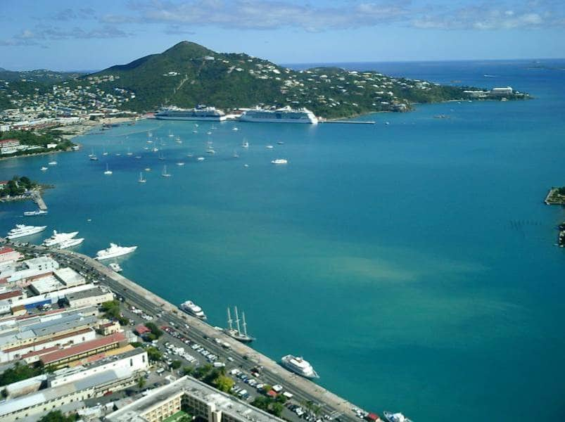
The sheltered harbor of Charlotte Amalie. This photo is from a few years ago before they extended the pier so it could take three much larger ships.
Charlotte Amalie has a beautiful natural and sheltered harbor and thus it has always been an important place in the Caribbean. First it was a shelter for pirates, we still have the name Bluebeards Castle as a result of it and when the Danish took it over it became an important trading post. They called the place Charlotte Amalie after their Queen, although it was originally called Taphus (house of draft) meaning there was a brewery there. So the Danish had their priorities right, you first built a pub and the town around it will grow by itself. In 1917 it was bought by the USA and since then it is American territory. The cruise boom here started very slowly to gather pace after tourists could not go to Cuba any longer. Before that time cruise ships called here as well but it was marginal. Holland America came here already in the 1930’s and one of the captains (Commodore Barendse) had a house here not far from where the Cable Car now runs. He had bought it together with a passenger of Dutch decent and each time the ss Statendam (III) would sail in, he had a house boy raise the Dutch flag.
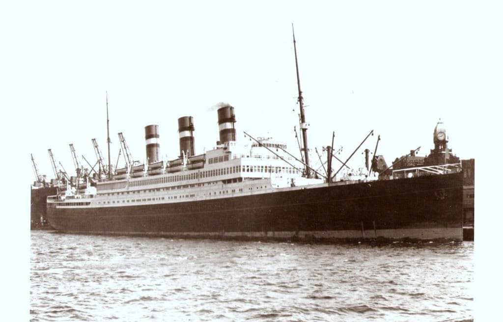
The ss Statendam (III) used to cruise extensively to the West Indies during the winter months of the 1930’s.
Slowly but steadily the tourist trade increased not in the least because Charlotte Amalie is a Freeport. No taxes. This was instigated by the Danish and the Americans left it as is. Thus in the 70’s when RCCI and Carnival start to bring mass tourism to the port, cheap booze was a big draw. When I went there in 1981 and 1982 and if we were at anchor, we had to make one or two tender runs to load all the booze for the guests. If we had 7000 guests then there were at least 300 boxes. Invariably there was then a freebie box for the Captain, the Hotel manager and the Cruise Director. As we, the deck department who had to do the work did not get anything, it was standard procedure that either the Hotel manager or the Cruise Director lost a box during transport. (It depended on who was the least popular………..) Then in the 90’s the emphasis shifted more to quality shopping and we saw a large increase in Jewelry and Electronics shops. Now with the mega ships it has become a complete village which easily handles 5000 people on the Havensight dockside, let alone what downtown can take care of as well.
We will sail this evening for St. Johns Antigua. Today we were supposed to have quite a bit of rain but most of it bypassed the harbor and I hope for the same tomorrow as the weather will be similar. It cannot be much different as Antigua is not that far away. Again it will be warm to hot 82o F / 28oC with a fair chance of showers. Also here we will park right in downtown.
© 2025 – Captain Albert's Website and Blog –
Theme by Anders Noren — Up ↑
