Today we had our first sea day with beautiful weather and it looks like it will remain so. The frontal system of yesterday dissipated and the next one coming will only bring thunderstorms on Monday and we will be in Ft. Lauderdale on Sunday. And that should be a warm day as normally between systems the wind dies down. The route we are taking runs roughly along the east coast of Costa Rica, Nicaragua, Guatemala and Mexico before we reach Cuba and the Straits of Florida. I use the word roughly as it is not a straight course. Continue reading
Page 25 of 234
Puerto Limon is one of the two major ports in Costa Rica. There is a 3rd one Porto Moin but I have been told it is too obscure for cruise ships. One port is located on the west coast, Puerto Caldera with attached to it Punta Arenas cruise terminal and on the East coast there is Puerto Limon. Limon is not really much of a port. It is just a corner of a large bay with a cargo pier at the north side and a newer pier with two berths next to it. The cargo dock is lying inside the natural sea wall and that is not for nothing. The coast here is a real surfer’s paradise with swells that built up very high and then roll freely into the bay. Very exciting for surfers who come in droves to this coast to ride the waves. Continue reading
The Zuiderdam has been sailing on this service for quite a while and hence the Captain and his team have become experts in dipping into the Panama Canal and out again. So today was pure routine, although it was a hot routine. Although it was somewhat cloudy at times, the sun burned down upon us all day and there was not much wind to help cool things down a little bit. That was a pity; but on the other hand it is also good as a cool breeze gives the impression that it is not so warm and then the next morning you find out that it was very warm and sunny when you start to imitate a well-cooked lobster. Continue reading
When there is bad weather in the offing, then as a captain you always have to decide: how much are you going to tell the guests, how much detailed information to be given, what is enough to prepare them without confusing the message. Once you have done that, the waiting game starts until the bad weather comes through and you can find out how good your predictions were and if real life –ship in storm- equates to the guests perspective. The understanding achieved by the warnings given. There is no captain in the world who minds to be called a liar if the weather is less bad than he/she predicted but at the same time there is the nagging feeling of will they believe me next time or will they just think that I am always exaggerating. Continue reading
11 Feb. 2018: At Sea.
Yesterday I boarded the ms Zuiderdam in Willemstad after having been on vacation since December 18 after leaving the ms Nieuw Statendam when it ended its maiden voyage in Ft. Lauderdale.
During my vacation time, the IT gurus of Holland America have been moving my blog to a separate server for operational reasons. It should not have affected anybody as I am still linked through via the HAL blog but you can also reach me via www.captainalbert.com.
Never a dull moment when you work for Holland America. Continue reading
Thus today we have the final day of our crossing and also the final day of our cruise. They say that all good things must come to an end unfortunately, and thus also this cruise. I think it has been a good cruise as the weather was very good for a December crossing and the guests all look happy and the comments are positive. So we can say without doubt that the Nieuw Statendam will be an appreciated new member of the Holland America family for many years to come.
The last remnants of the frontal system of yesterday passed by through the night and today we had a regular nice sea day with partly cloudy skies and pleasant temperatures. The storm chart only gives flat seas; the rain chart does not give any rain at all, except for the system we have already passed. Also Fort Lauderdale is promising to be a dry day. With 25oC / or 73oF. and very little wind.
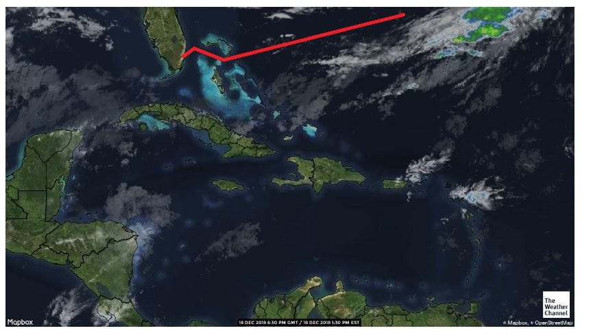
The Radar chart with the cloudiness in the area. There are some rain clouds far away but they should only reach Fort Lauderdale after the ship has departed.
This evening at about 18.00 hrs. we will enter the Bahamian chain of islands and then sail through the North West Providence Channel towards Fort Lauderdale. For that we have to cross the Straits of Florida. As Fort Lauderdale and its port, Port Everglades, lies a little bit south of where we come out of the Bahama Banks, we have a South Westerly course to aim for. That course will become more and more south westerly as we have to compensate for the Gulf Stream which is pushing north. The Gulf Stream is our friend and sometimes our enemy. Depending if we sail with the current or against the current.
Now we are dealing with the current under an angle, so the navigator only has to figure out the right course to compensate for the drift. The second interest is to find out where the axis of the Gulf Stream is located, there where the current is at its maximum velocity. This is called the Gulf Stream axis and if you can find it then you will get the benefit of the “big push” when sailing in the same direction. If you go opposite then knowing the location helps you with devising a course as far from it as possible. The NOAA normally publishes a 3 day update as the Gulf Stream moves on occasion in the Straits and that can really be from all the way up the Florida beaches to all the way against the Grand Bahama Bank. And nobody really knows when it moves and why it moves. If some clever clog would be able to figure it out, then we would be able to get much more accurate data than we have now.
So crossing the Gulf Stream is basically a task of keeping an eye on the ships position and the “set” of the ship to the north and compensate for it accordingly. Normally we are out of the Gulf Stream influence when we are about a mile away from the Port Everglades Sea buoy but I have seen it that the current ran full force just outside the breakwaters and that we went into the port under a considerable drift angle. So much that even the local pilot got nervous. The simplest solution is then to go in a bit faster as that reduces the drift angle. Once inside the breakwater there is more than enough distance to slow down again. The harbor master likes 10 knots in the channel, but if the current or wind is strong, the ship will go a lot faster to reduce the drift angle.
For the purpose of sailing under an angle and remaining in the middle of the fairway, they have installed a set of leading lights to help. The only challenge is they sometimes have parked a tanker in front of it and then the lower light is obscured. When the light was put in, the tankers were not as wide as they can be nowadays. We will be lining up in those leading lights tomorrow around 03.40, a few minutes after we have boarded the pilot. From there it is only a short hop to the dock as the captain has decided to go alongside starboard side, nose in, at Pier 26 and thus we do not have to swing on arrival. Once alongside that whole circus will start which I described a few days ago. I will be helping out to make that all go smoothly by getting off the ship ASAP and thus ensuring that the zero count does not get delayed.
And that brings me to an end of my blogging period on board the ms Nieuw Statendam. I hope you have enjoyed my daily musings about the progress of the ship towards its completion and the first two cruises which proved that the ship is a great success and a genuine asset to the company.
In January my blog will be relocated to a new server. This should not affect anybody at all but in case there is a hiccup you might have to refresh your automatic link to the blog. My first ship in 2019 will be the Zuiderdam which is on the schedule for Feb. 10. and that is also the date that my blog will recommence.
Thank you for your interest and support and Happy Holidays.
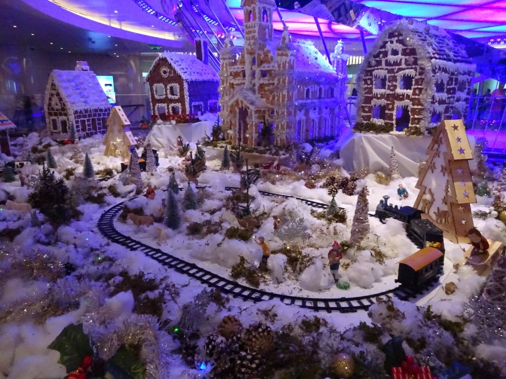
This is the magical piece of Christmas nostalgia which the Pastry Department on board has created. This is only part of the whole display. It is about double the size, including two trains. Setup outside the Grand Dutch Café for all to admire.
Today we are exactly a week at sea and we are almost there. North West Providence channel is now rapidly coming closer and that is where we will see land again for the first time. Bahamian Islands to starboard and to port, visible to eye if the weather is clear.
Here at sea the weather was not very clear and Mother Nature had decided not to listen to what the meteo guru’s in their infinite wisdom had pulled out of their computers. On a wide open ocean, it does not take very much to change a regular pattern of weather. And that is what happened last night. I was bravely hoping for a real Caribbean day, with lots of sunshine, and what we got was still a Caribbean day but the rainy version. A long band of rain had been laying over the east coast of Florida and it was supposed to come over tonight. No problem for us, everybody inside enjoying the music walk and the Bo ‘sun outside enjoying that his ship was de-salted free of charge.
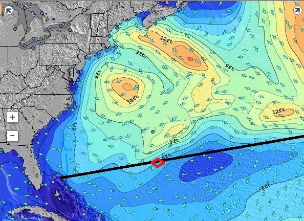
Quiet times at Cape Hatteras. Patches of 12 feet of swell is really nothing compare to what it is capable of.
But the frontal system decided to speed up, most likely caused by the fact that it is unusually quiet at Cape Hatteras at the moment and the weather system was not pulled that way. So it came our way and all morning dark and gloomy clouds were surrounding the ship and on occasion also descending upon the ship. By lunch time it started to clear up but it will not be before tonight that it should all be gone. Unless the weather front decides to stall, then we will still have some of it tomorrow. But still, the seas are fairly calm, we just have some chop and wind caused by the weather front and the ship is riding nicely through it all.
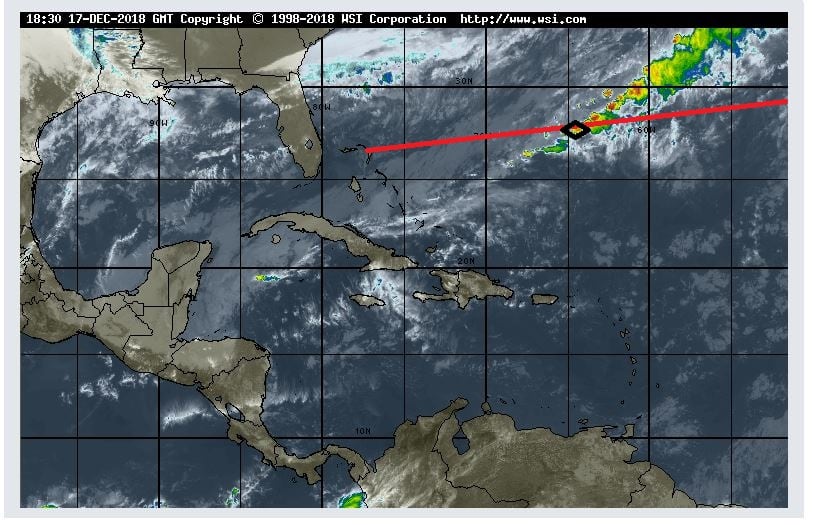
And this is the rain picture we sailed today through the lower tail of the weather system. (Photo courtesy www. Weather.com)
A guest commented today, that he has seen so few ships since leaving Funchal, and he was correct. Although there are plenty ships out there the area is so vast that even if they go the same way, they might just be outside the range of the eye. The earth curves and thus you can only see so far. On the bridge which is about 75 feet above water, we can see between 10 and 15 miles depending on the clarity of the air and the size of the object. At night we can see ships about 6 miles away as that is the requirement for the strength of their navigation lights. On our commercial radars we can pick up a ship at 48 nautical miles and sometimes even up to 96 miles. The Navy has much better gadgets again and can do several hundreds of miles without any problem.
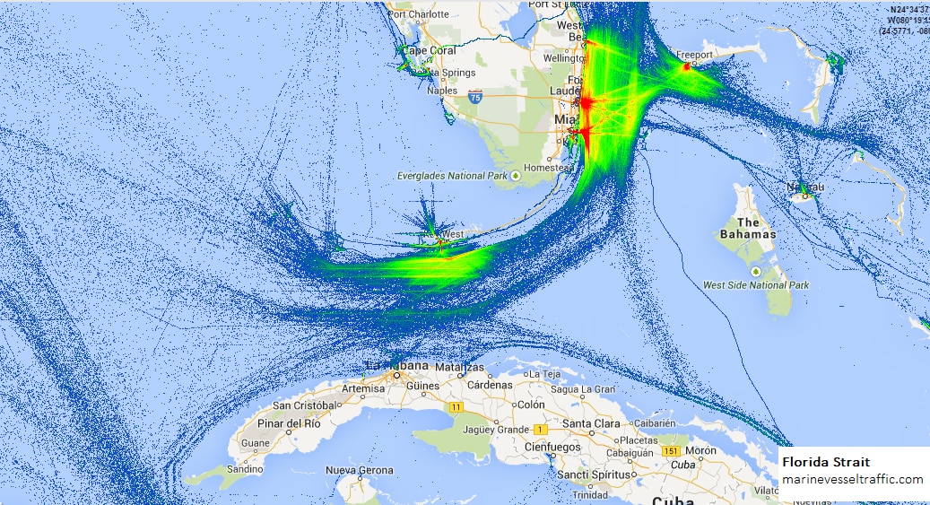
This is a shipping pattern that you can plot if you keep adding the transponder trails to the same route over a period of time. It shows most of the traffic near ports and a general trickle going South East of Freeport, there were we are coming in.
But the main reason for not seeing many ships is, that our route is not a main shipping route. There are not many ships who ply between Funchal and the Bahamas and thus we are really alone. This route only sees traffic in spring and autumn when the cruise ships are migrating. Most ships coming from or going to the American continent, follow the Gulf Stream and make an educated guess between sailing in the nicest weather (and making good speed) or taking a bit of turbulence (and losing some speed) if in the balance they still make the best time. Cargo ship engines are the most efficient when going full speed. So those ships race full speed to their destination and when they arrive, drop the hook if they have to wait for a berth. Then the expensive main engine goes off and a small auxiliary or donkey engine provides the little bit of power that is needed to keep the ship going. So for them it is not so important to have nice weather but combined circumstances that equate to the lowest fuel consumption. The Gulf Stream in the back helps them save a considerable amount and thus they start their crossing most of the time just under Cape Hatteras. That does not give the best of weather but they will have following storms and that does delay a ship much less than have to battle against a storm.
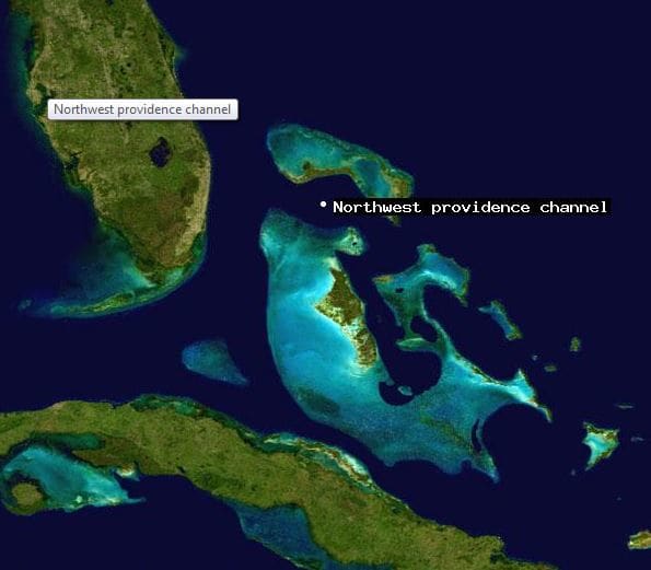
A nice aerial photo which shows the Grand Bahama Bank, the islands and other sandy patches. (Photo courtesy NASA, so I assume this was taken from space)
Tomorrow is our last day at sea. Then in the late afternoon we will enter the Bahamas, between South Abaco Island to the North, and Eleuthera Island to the south. The body of water is called the North West Providence channel and are near the gap on the Abaco Island side is called the “hole in the wall” quite appropriately.
As promised by the weather forecast, the wind and swell out there indeed abated. The wind shifted from the West (the very last tail of the storm system) to the South East (the beginning of the Trade winds) and is now behind us but it is not blowing very strongly. Swell can only die down when the wind abates and when that happened in the early morning the swell came down as well a few hours later. Out there the ocean is still not flat (whenever have you seen an ocean that is flat?) but we are now down to the long low rolling low swell of a North Atlantic at its most tranquil. We still see the occasional white cap, indicating that we have winds somewhere between 3 and 4 Beaufort and that is also normal North Atlantic weather. If you get real calm weather in this area, when the winds are completely becalmed and the seas look oily, then you better brace yourself as that indicates that “silence before the storm”.
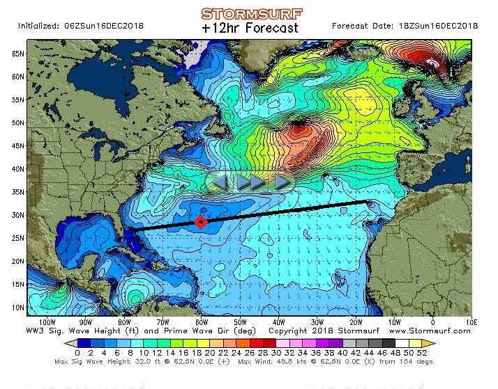
The wave/ swell chart for today. Look at all that nice blue. As long as that green stuff near Cape Hatteras is not coming down we will have flat calm weather all the way to Florida.
There are areas around the world where it can be very wind still. But that is not normal for this area located just south of the North Atlantic storm fields. Here you always have a little bit of wind, either being remnants of storm systems, or the northerly rim of the Trade Winds. And we are coming closer and closer to the Trade Wind area. Most people identify the Trade Winds with the Caribbean Sea and that is not incorrect. But the Trade Winds are not there because of the Caribbean, the Caribbean area is simply in the way of the Trade Wind system.
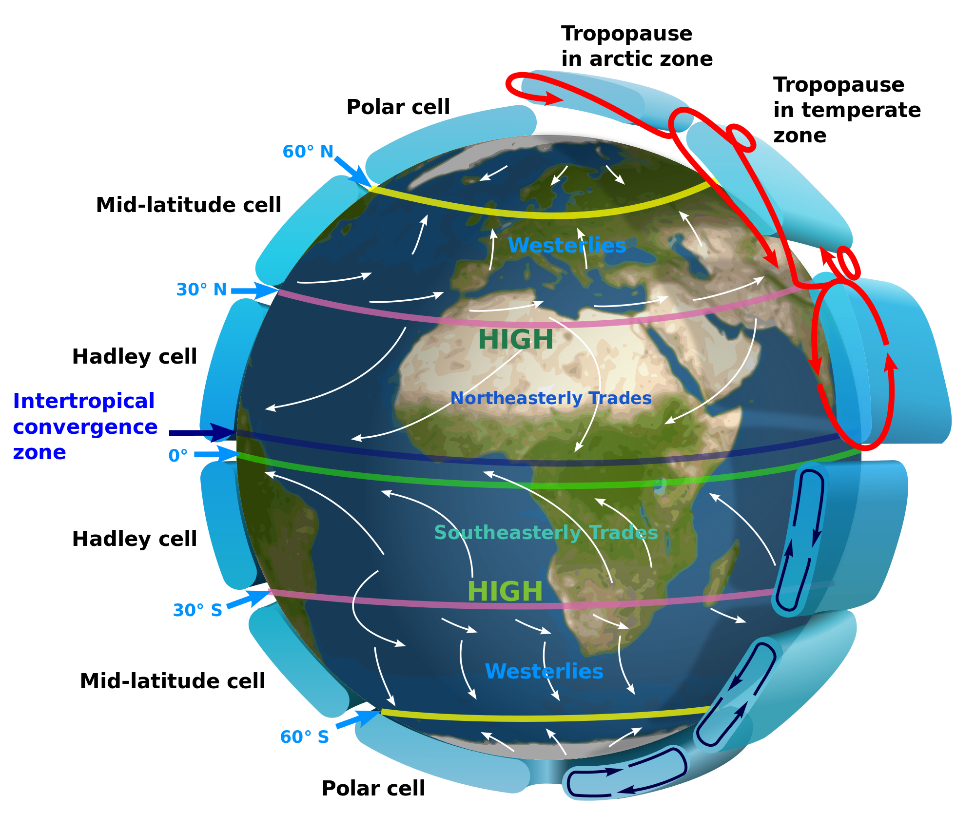
The worlds wind system. As you can see it all curves west ward at the equator. Thank you NOAA.
But let’s first look at the bad weather and swells. Most people will have heard about the roaring forties, furious fifties and screaming sixties. Names out of the good old days of the Tall ship sailing. These names refer to the sea areas in the southern hemisphere between 40/50, 50/60 and 60/70 degrees Latitude. Here the vast open ocean spaces let winds build up unhindered and push the swells up very high and that could make life very unpleasant for the men of steel on their ships of wood. While there is some land in the North (Iceland, Greenland) to the south it is all wide open all the way to Antarctica. That is the reason that there are no cruise ships down there in the northern summer time (which is the southern winter time)
All this wind is blowing in area’s close and closer to the poles. Around the equator things are more benign and that is caused by the inter tropical convergence zone. This area around the equator is also known as the doldrums. The North East Trade winds and the south East trade winds cancel each other out. The old time sailors were not happy in the screaming sixties because the wind blew their sails to shreds, they were also not happy here as the sails did not catch any wind and they would drift around aimlessly. Sometimes for months if they were unlucky.
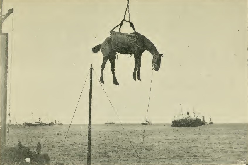
A rather undignified way of landing a noble animal.
Did the men of steel from those days gone by also have a name for this as well: Yes, they called them the Horse Latitudes. Because when a sailing ship would be becalmed here for a long time and fresh water supplies would run low, the first things that would be killed off to reduce water consumption would be any horses that were on board, bound for the new world. And sailing ships used to carry a lot of horses for the armies in the new world. Some were even landed in the Caribbean. The main port of Aruba at Oranjestad is called Paardenbaai, or Bay of Horses, where they used to come ashore.
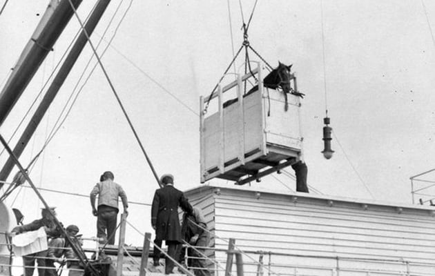
But very often horses went by box. an early form of containerization.
We are now just touching the Northern edge of the North East Trade winds and this is a planetary wind which means it blows all year around from the same direction. Where does this wind come from? Well the storm system that went past us to the north for the last few days is moving East pushed by the jet stream on the higher levels. But while doing so, it also displaces air ahead of it and that air/pressure is deflecting down, and then flows back West at a lower latitude. Hence the area we are now entering always has this wind coming from the Sahara area and ending up in the Caribbean.
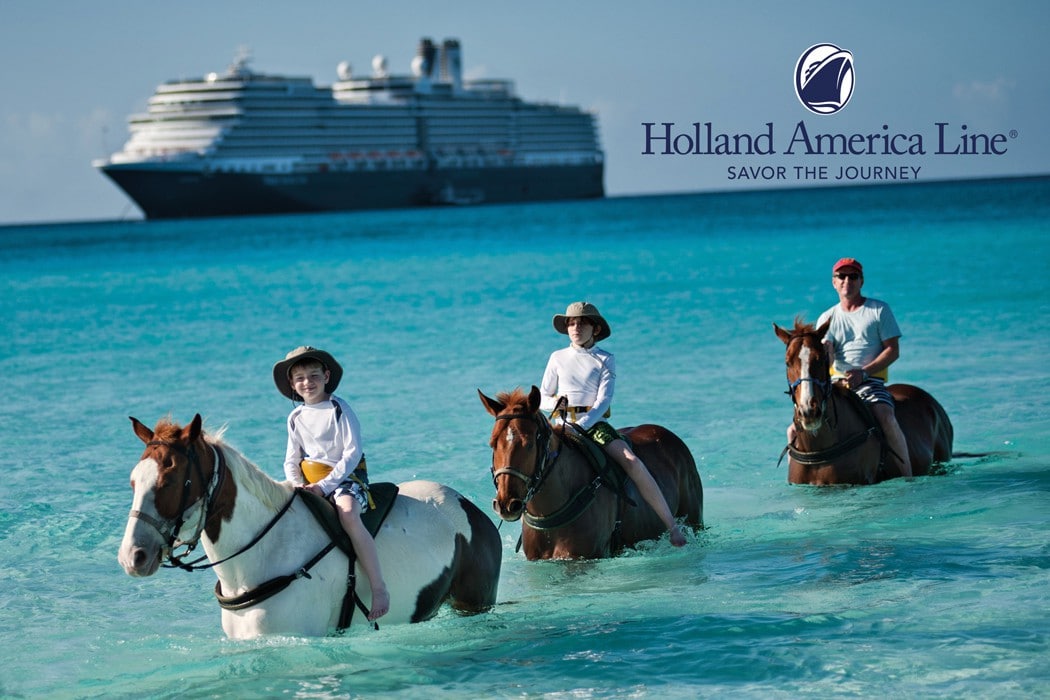
Holland America Horses, seen here at Half Moon Cay, came the posh way. They walked ashore from a landing craft and live in their own hurricane proof horse shelter. The ship in the background is the ms Eurodam. (Courtesy Holland America Line)
That makes taking the southerly route in the winter so ideal. You avoid the North Atlantic storms, and you get some wind and current in the back while in the Trade Wind Area. Why do we like the more northern crossing in the summer? Unless the cruise schedule calls for Madeira or the Cape Verdes, it is a shorter route and we get a considerable push from the Gulf Stream.
Also we now get a nice push from the elements; I do not think our guests are in a hurry to get home early as the weather is now turning our Trans-Atlantic into a Caribbean Cruise.
We are running away from the nasty storm that passed us far to the north. But they say the sting is in the tail and the tail just got us. The wave field came down a bit further and because we were past it already, the waves were now coming behind us. When the swell hits a ship either on the port quarter or the starboard quarter, then it can develop a cork screw motion; so the ship starts to yaw. It is not a completely regular moment as it depends when and under which angle the following swell will catch the ship and lift it up or let it go down. How much the ship is affected depends on how much speed the swell/wave has and also how fast the ship travels. In principle the ship could go at the optimum speed and would ride the waves, or better said, surf the waves and there would be no movement at all. But as the velocity of the waves is seldom constant (normally there is interference from other waves) it is nearly impossible to make that work. But we are running away from the wave field and thus the ships motion already started to come down around lunch time, the accompanying wind, started to abate as well and we should really enter very quiet waters now. As the captain said during the voyage from the bridge, this is very good weather for December, and I can only agree with him.
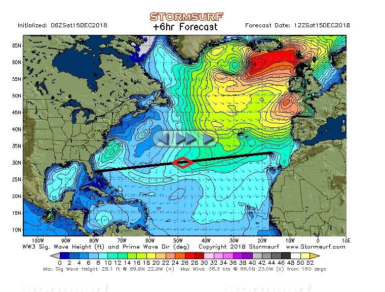
The wave picture of today. You can see how much the wave field has spread out, and as we were expecting a few days ago that we would just skirt the edge of it, we are now somewhat inside it. But it will not for long. (Courtesy www.stormsurf.com)
This means that the ship can count on a normal crossing for the remaining days and we are heading for a 03.30 arrival at the pilot station on the morning of the 19th. That is quite early and we will be together with the Caribbean Princess and the Costa Deliziosa. Around those three Queens of the Seas is a whole slew of cargo ships going in and out and then we had better be early than too late. On top of that we will have our first USCG inspection. Of those there are two each year but this is a special one as it is the first time as the ship is entering a US port for the first time ever.
The USCG inspectors will arrive at 08.00 hrs. and will stay all day long until just before departure as they will also want to witness the Guest Boat drill. The ship will also have a full CBP crew inspection as it is also the first time the NSDM crew comes into an USA port. These full inspections take place every 90 days and require a face to face verification of crew member against passport. The CBP normally starts with a cruise ship inspection after 06.00 hrs. and thus it helps if the Nieuw Statendam is fully ready by 06.00 hrs. It will take a while for all 1000 crew to get through and in the meantime leaving guests will have breakfast and then disembark, the ship will have a turn over to get ready for the new guests and all the activities of a regular turn over day will take place.
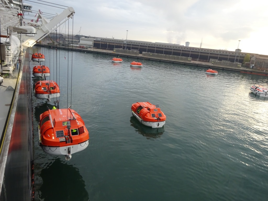
Crew boat drill. All starboard side lifeboats are being lowered in the shipyard during trainings. The boats go down in alternating sequence so they will not sail into each other when sailing away. From the moment the captain orders “abandon ship” we have 30 minutes to get everybody inside and the boat into the water.
And then as soon as all the disembarking guests are off, the famous moment of the zero count, the USCG will want to see a full emergency drill, Fire, mustering, and abandon ship; all the legally required routines. So the turn over activities will dramatically slow down while all 1000 crew will be on hand to show the USCG that they are fully proficient in their duties. I will not be involved as I have to “help” with the zero count. Because I hop from ship to ship, traveling over USA soil (most of the time crossing the dock from one side to the other) I have a special Visa that allows me to do so. Normal crew has a visa that just allows them to travel to ship – straight in, and then leave the ship—straight out. That does not work for me, so I have another sort of Visa which allows me the freedom to travel from ship to ship inside the USA. But that Visa means that I am not regarded by the CBP as a crew member, I am considered a non-revenue Pax. And thus I have to disembark with the Guests in the morning, so the ship can reach the zero count as quickly as possible.
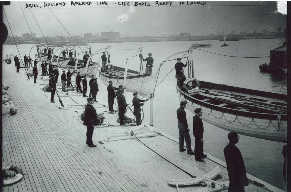
Holland America has being doing boat drills for a very long time. This is a drill on board the ss Statendam (I) around the turn of the century. We had the lifeboats so we exercised but in the days before the Titanic the rules were not so strict, hence it was not required for the crew to wear life jackets, or safety harnesses against falling over the side. (Own collection)
After the drill, the USCG inspectors will want to see all the safety equipment. See if all watertight doors are closing and if all the fire screen doors are closing etc. etc. And that will take all day. For a big ship, there is normally a group of about 8 or more who will attend. They are very good in working with the ship to ensure that the guests can still sail on time and normally that works out very well. So behind the scenes the crew is preparing and refreshing their memory from the pre sailing drills in Italy and all will be ready.
But we still have 16, 17 and 18 December to go and the last few days of the crossing promise to be very good. But then the past 5 days since we started the crossing from Malaga have not been bad either; certainly not for December.
Today we have another nice day at sea. The weather followed the weather forecast and the bridge reported that indeed some rain did fall. But in accordance with our wishes did fall during the night and today is another dry, nice and partly cloudy / partly sunny day. The “swell tail” of the storm system did come down a bit more to our location and the waves increased in a few feet height. But the direction of the waves also turned more towards the bow and thus we now have the occasional pitch. Although it is still very minimal for the time of year. So we are still lucky and the weather forecast looks very good. The nasty storm system is moving rapidly north and nothing new is brewing, as of yet, off Cape Hatteras so we can expect seas to smooth out and winds to abate. Who would have expected that in the middle of December?
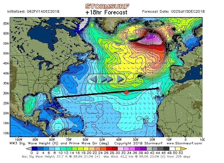
As you can see they were having a nasty day in Ireland. The wave front came a bit further down than expected but we are sailing away from it. (Diagram courtesy www.Stormsurf.com)
The day at sea continued with all the regular ships activities. A few highlights:
09.30 Coffee with the Ladies at Sea. Our crew is made up of about 30% female crew members.
10.00 EXC talk: Cuba, then and now, with a guest speaker.
11.30 Get creative in the Microsoft Studio. (= learn to impress your grandchildren)
13.00 America’s Test kitchen
15.00 EXC talk: French, Canada to Colonial Empire, with a guest speaker
Trivia games in the morning and afternoon
16.30 Tiny Little Big Band plays.
19.00 Pool movie & Music Walk gets going.
All comes in the daily program called When & Where and which has recently been revamped again to a nice format that fits in the pocket.
And then I do not mention what shops, Spa, Casino, Art, wine, and other interesting things are taking place. And today there was also the Mariners lunch……… which must have been busy as we have a very high number of Mariners on board.
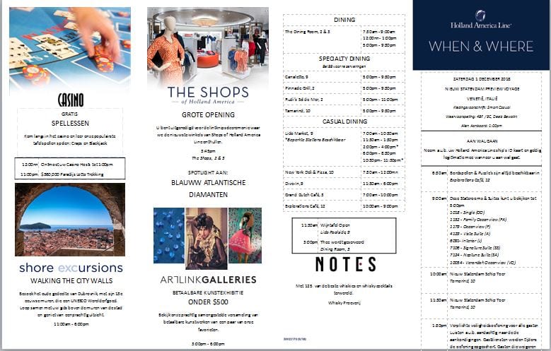
The When & Where. It can be folded like a Harmonica along 4 folds and fits then perfectly in the pocket.
My highlight of the day was checking seaman’s books. The Dutch law has some very strict criteria about controlling seaman’s books and compliance with certification and once during my tenure on board a ship I go through all of them, to ensure that the Crew Office has it all complete. If something is overlooked, then we still have time to correct it before we arrive in Fort Lauderdale. The basic things every crew member needs are: Health Certificate, Labor contract, a safety certificate, and then it goes up by the seniority and the severity of function. Especially the Deck and Engine Officers bear the brunt of those certification requirements as they have to be proficient in firefighting and in safety training and have to have their licenses to do their job. Last time I counted I had 23 certificates of various standing, either legally required or required by the company. Our company has a whole training system via computer learning to ensure that crew members are aware of the latest company requirements and are knowledgeable in everything that goes on. Courses in ethics, basic safety, Noro virus, are related to all, and then specialized trainings such as wine courses for the BLD department. Of all those licenses the COC or Certificate of Competence is the most important one. This indicates that the flag state has recognized that the bearer of a COC had all the underlying certificates required and is qualified to carry out the function he/she has been appointed to. All compulsory certificates have a 5 year renewal date and thus much to our regret we lose every year 14 days or so from our vacation time to go on refresher courses. The company also has a slew of required or desired certificates but most of the time they can be refreshed on board.
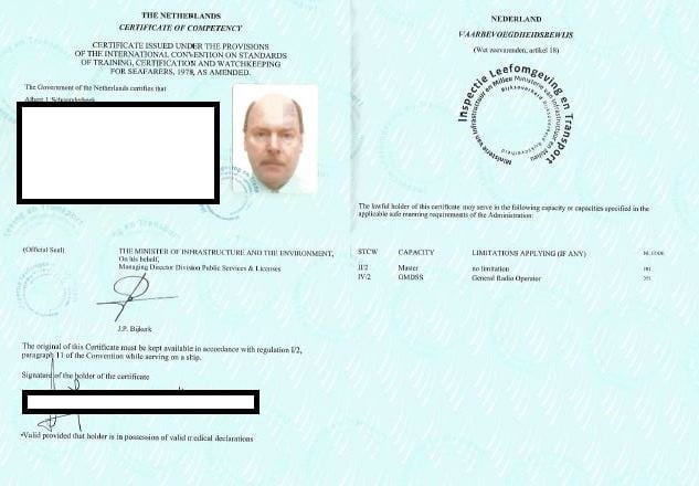
This is my driving license, my Certificate of Competence, for any ship in the world as it is without limitations. But the Flag State might require some additional things for special ships such as tankers.
So the good ship Nieuw Statendam is sailing with the nice speed of 16 knots towards Fort Lauderdale and we have another four glorious sea days to go. The guests seem to be very happy, although I had one guest asking if there was any option to do a bit of sightseeing while on the way, so there was something else to see than just waves. I promised him that I would take it up with the head office and that we would do our best to have a large mountain on the route, next time we come this way.
© 2025 – Captain Albert's Website and Blog –
Theme by Anders Noren — Up ↑
