- Captain Albert's Website and Blog -

Ocean Liner History and Stories from the Sea, Past and Present. With an In Depth focus on Holland America Line

Page 35 of 234

29 June 2018: Civitavecchia, Italy.

Civitavecchia is a major cruise port for everybody who wants the visit Rome while on a cruise ship. But it is also a turn around port for cruises due to the availability of Rome airport. And then of course there are a lot of ferries going in and out; calling at ports along the coast and the various islands, the same as what happened yesterday in Naples. That makes for a busy port. We were today in port with 2 other cruise ships, the Costa Diadema and the Celebrity Reflection. We were at the Breakwater side which can take two big ships or three medium sized ones, while the Reflection was at the Container Terminal, which is not easy for the crew to get in and out so we were well off today.

Civitavecchia is since the 15th century the major port for Rome and important enough to have a large fortress built here a 100 years later by Michelangelo. This time no statues or other art but high walls, tricky corners to make defending easy and with nasty defense moats. The moat is gone and replaced by a road and a roundabout. Before Civitavecchia, the main port of Rome was Ostia, now known as Ostia Antica and now more in use as a seaside resort. Apart from the fall of Rome, the port and river also silted up and thus the ships had problems getting in and out. The only setback is that Civitavecchia is about an hour’s drive from the airport. The roads / motorway are very good but the drive is a bit boring as the land in this area is mostly flat.
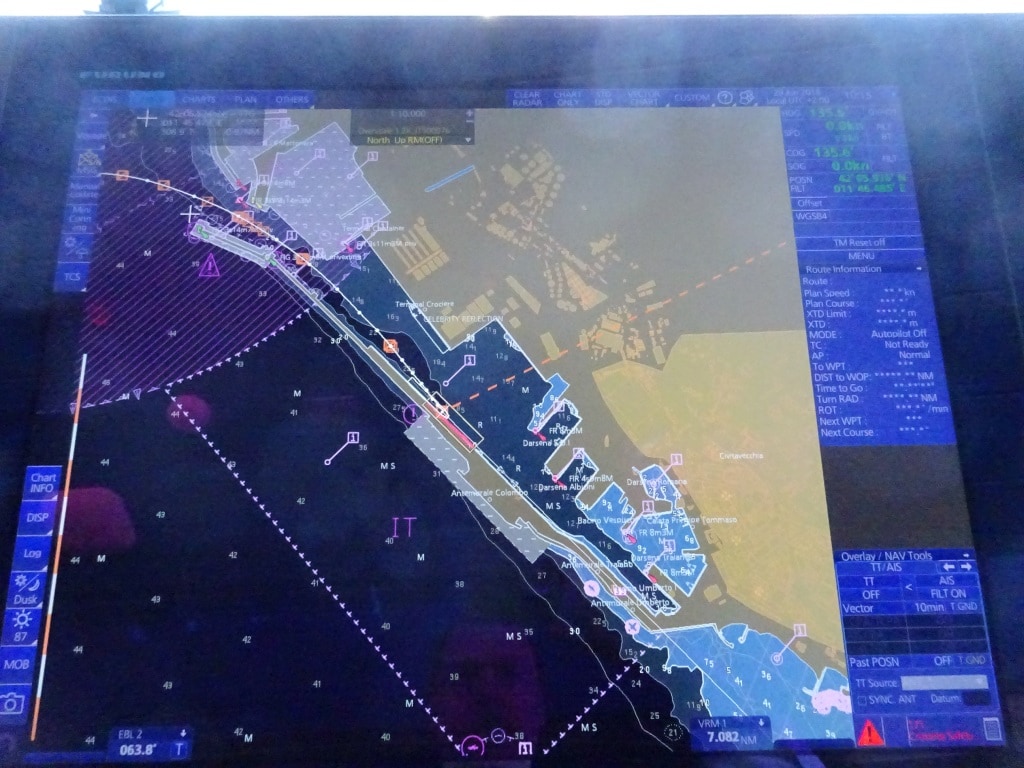
The port of Civitavecchia. As you can see straight line in and out. although it can be a very nasty place when the wind is blowing.

For a navigator, sailing into the port, is quite an experience. And that is not the sailing in itself. That is just bending around the corner and braking on time. No it is the pilots. Together with the Messina Pilots they are the most hurried pilots I have ever seen. Very skillful but also very hasty. They hop on board at the last possible minute, run through the bridge, say a quick hello and then start doing their job. They have all been Ferry pilots it seems as they want to charge into the port as fast as possible and then put the brakes on only at the last minute. Not unsafe but we are normally not that much in a hurry. So part of the captains job is to calm the pilot down and take it a bit gentler. Once the ship is alongside, they normally want to leave sea-side so they can drop straight into the pilot boat and race off to their next job. Only once in my career I managed to get one of them to say yes to having breakfast on board after arrival; and then only if he could have his wife come and join him as he was going off shift. He indeed called his wife and she was in a hurry as well; I have never seen anybody driving a Fiat 500 so fast over the dock as she did.  (The pope drove one of those little bubbles, when he visited the USA a few years ago and it looked like shopping trolley when he followed Obama who was sitting in The Beast)
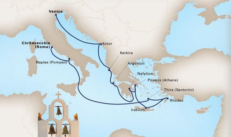
Today we said goodbye to about 90% of our guests and by 11.30 the new guests were arriving. And they are going on a 12 day cruise around Italy as we will end up in Venice eventually. But we will also call at the Greek Islands, Dubrovnik and Kotor. If everything goes well e.g. according to the port scheduling, we will have the luxury of docking in Kotor which is not that usual for larger ships. So we will see and hope. Dubrovnik is also going to be of interest as the authorities are in the process of reducing the crowds. Thus far, not yet with blocking ships or overland buses from coming in but by asking the tour company’s and cruise companies to stagger their arrivals. There are days of 7 cruise ships and at a certain moment of the day all of those on board are in that one square which makes up the center of the old town. That is not good for anybody, let alone those who live there, and thus the authorities trying to deal with it,……….. but with a gentle touch.

This evening, we will retrace our steps and go back to Naples. We will be sailing at least an hour late due to late arriving guests but for that we have leeway in the schedule. It will only make the chief engineer unhappy as he has to crank up his beloved engines a bit more. I think I have never in my whole career left Rome / Civitavecchia on time. Not during a regular call (coaches stuck in rush hour traffic in Rome and on the motorway and neither during a change over day, guests coming late from the airport and still stuck in traffic.)

Weather for Naples: Another warm day 85oF / 29oC and no clouds or wind expected.
28 June 2018; Naples, Italy.

It was warm today but it was also a sort of perfect Naples day. Not a cloud in the sky and when the guests walked ashore they could see the sun brightly shining on the City and the Castle which guards the city since about 800 years or so. They are still working on the metro.

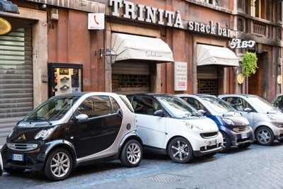
If you car is small enough you can always find a space. Even in Italy.

There was a very large hole in front of the Stazione Marittima when I was here in the autumn of 2017 and they have since progressed to making the big hole a bit smaller. And if you make the hole smaller what do you do with the available space: you put cars on it. I think that here in Italy they are all striving together to get the Guinness world record book of how many small cars can you put in one space. Most Italians, who live in the city, buy a small car so they park sideways and have two cars fit in one parking space. While the rest of the world gets 200 cars in a car park of 200 spaces; the minimum for Italy is at least 400 not counting what then still fits in areas with white – no go – stripes. Everyone can park on these stripes, as it seems that the Italian Traffic Code says, that No Go means that your neighbor can not go there, not you.

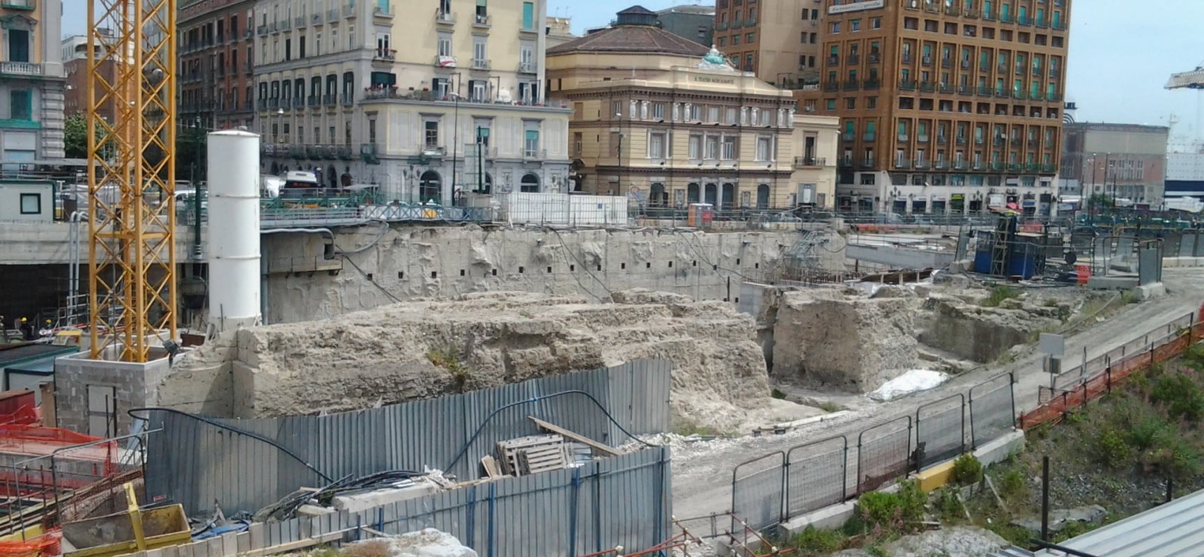
One of the reasons for the slow progress of the metro is because of the slow digging. With each inch they go deeper into the ground, they find more and more of the past and that has to be excavated and researched first. Not just what is found from the Romans days, (old fortifications and even ship’s cargo) but also from later dates as Naples had quite a turbulent history.

I pulled this one off the internet as it shows the ruins of the days gone past. It is part of the original settlement of Naples and it is the plan to keep this on view once the metro is finished and it will then be surrounded by a park.

My Italian is not that good but I saw not too long ago a headline in the newspaper indicating that the construction of the Metro had gone over budget. I am not amazed. How can you budget without knowing how much you are going to find back from the old days, apart from knowing that it will be plenty? So I expect it will take some time before we can walk off the ship and use the new station.

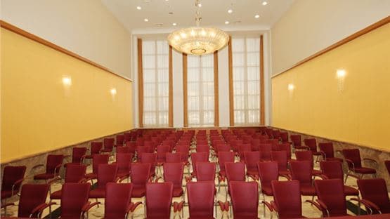
If I re-collect correctly, this used to be the first class customs hall. As in the good old days a first class suitcase did not mingle with a 3rd class bag.  There were separate handling areas for the classes.

I tried this morning to get into the old part of the Terminal. The Stazione has been refurbished in the last few years and there are now restaurants and shops but certain areas are still original and used for meetings and civic activities. But the old architecture in Mussolini style has not been touched. The rooms were in the old days where the passengers waited in 1st, 2nd and 3rd class waiting rooms or where they went to immigration and customs when arriving. For an historian as me; fascinating to see. But my trying was in vain as all the rooms were booked for the day so I will try next week again.

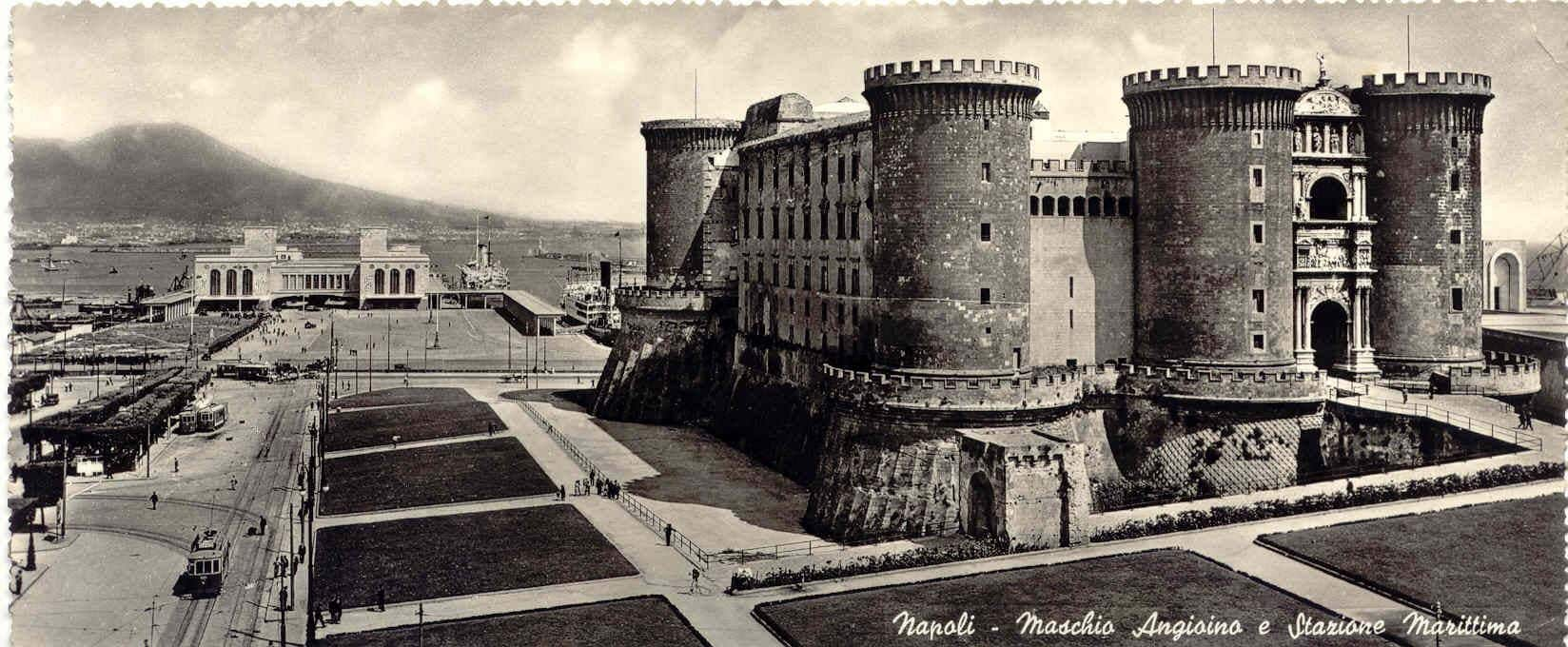
The way it looked when the terminal was only just built. They want to try to return part of the piazza back to a park as it once was.

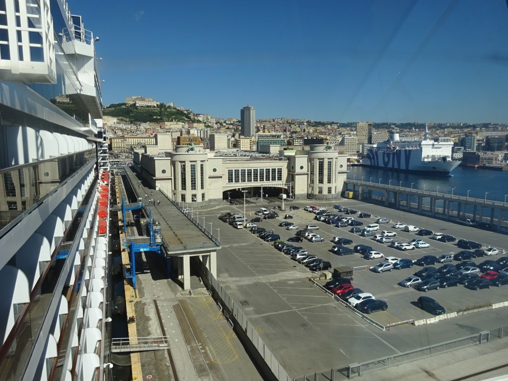
The port of Naples has always remained the same. Towards Vesuvius they have added container docks but the passenger terminal and the ferry terminals are still as they were 80 years ago. At the west side are the small ferries going to Capri and the other islands and at the east side the large ferries connecting with Sardinia, Sicilia and Corse. (Plus a lot of other destinations). But the passenger terminal is now the cruise terminal and all cruise ships have to go there. We were by ourselves today but with a bit of organization they manage to get 4 big ones alongside and even more small ones. The port and the city can absorb an infinite number of tourists (going in the city itself or to Capri or to Pompeii) the terminal is another matter. They have made a gallery on each side of the terminal and installed gangways so it is easy to get off the ship. But at each end there is only one Elevator down to ground level. And that elevator does not always works. There (for those in the know) is a personnel elevator around the corner but not really well sign posted. Thus when there are more ships in, the areas around these elevators become a real mobility center with each and every variation of scooter, rollator and wheelchair on display. I have always found it too embarrassing to take a photo but I have seen traffic Jams of irate guests trying to get out or back in the terminal while using an elevator with a mind of its own. And there is very little that can be done about it as the terminal is a listed historical building and they cannot just glue another one onto the outside.

The Oosterdam alongside with the gangway on the catwalk, basking in glorious sunshine. Today the elevators were all working; at least this morning when I was briefly ashore. Note the bronze horses on the top of the roundels. all original from pre WWII. Parking inside here is only for (important) permit holders so there is always space.

Tomorrow we are in Civitavecchia, gateway to Rome. Most of our guests will be leaving us here and the ms Oosterdam will start voyage 656 which will lasts 12 days and will include ports in Greece.

Weather for Civitavecchia: Warm and sunny with 80oF / 27oC and 1% chance of rain.

27 June 2018; Palermo, Sicily, Italy.

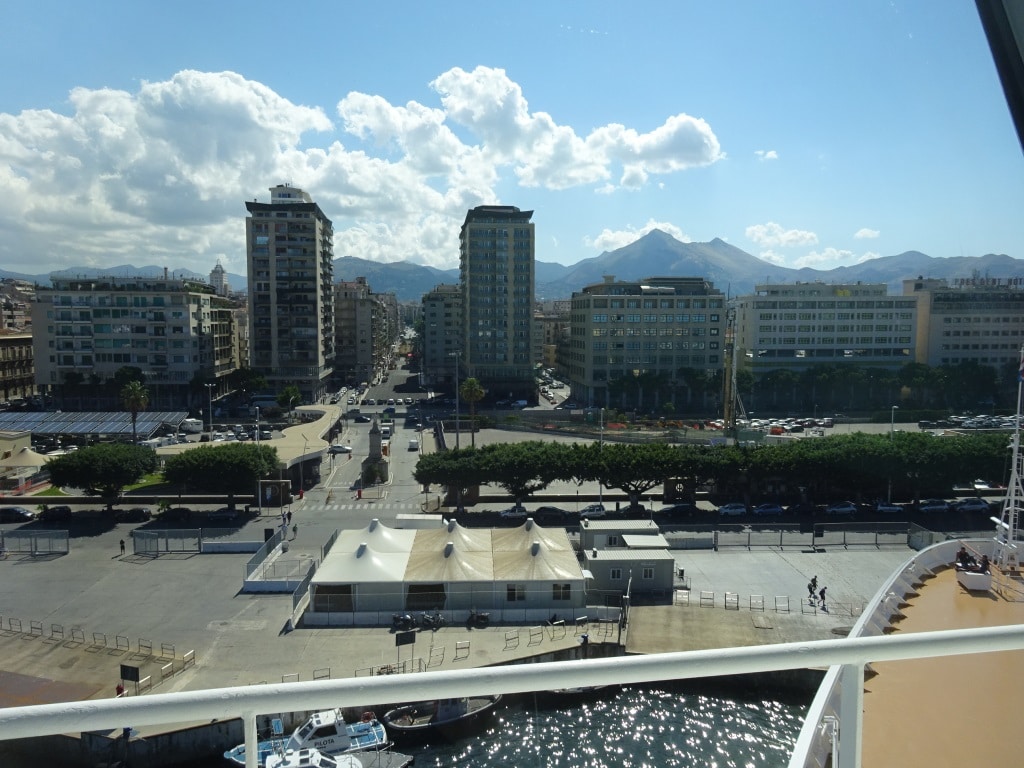
The nice thing about most ports in this area is that we dock with the nose right into downtown. There is a security gate but that fence is the only obstacle between the ship and the city itself. Today was no different. The ms Oosterdam parked itself right at the foot of the city again and from the gangway it was not more than 800 feet; before you had the chance to be run over by a speeding Italian scooter. “Colour Locale” they call that. I have not posted this time our cruise diagram as I hopped on board right in the middle of the current cruise. After Palermo we have only one more port to call at, Naples, before this cruise ends in Civitavecchia. From there we will start a 12 day Civitavecchia to Venice cruise.

How close do you want to be ? Palermo at your feet.

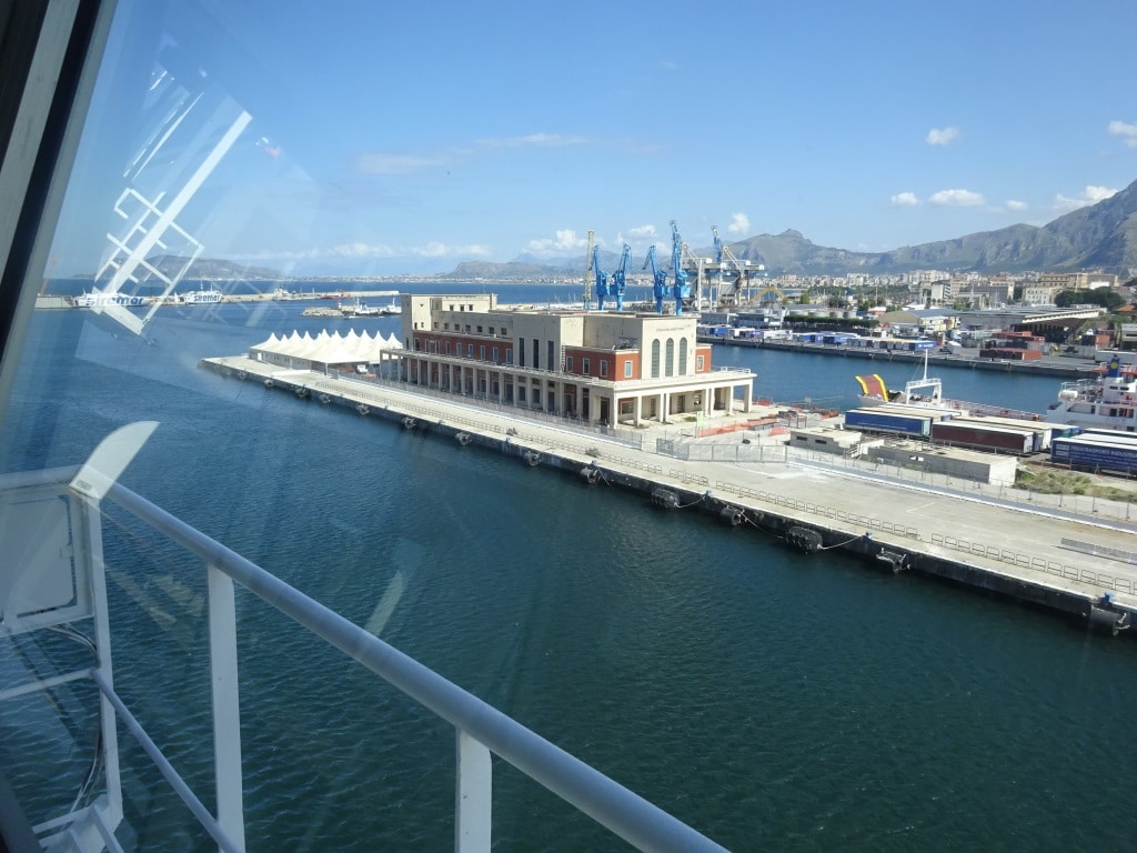
To my utter amazement we were the only cruise ship in port today and still we docked at a cargo pier. It turned out that the Stazione Marittima is under reconstruction and Restoration. Looking at what is going on; it turned out to be some sort of expansion with fixed marques and new parking. It is clear that the old building from the early 20th century was not big enough for the mega liners. The ms Oosterdam is not a mega liner but we only just fitted alongside one of the old piers right in front of the city. But because we were docked at the cargo pier, we could not look at a beautiful passenger terminal but had to make do with a series of very ugly grain silos that had all seen better days.

The Official Cruise Terminal, once the regular passenger terminal for ships sailing to the rest of the world. Many Sicilians left from here for America.

Palermo is considered an easy port to get into if you have good ship handling skills and a bit of experience; easy…….. as long as it does not blow hard with wind. Today we did not have much wind and then it is for the Captain an excellent chance to let a junior officer do the driving: as A. not much can go wrong that cannot be quickly corrected and B. it is still difficult enough for a junior to need to have his/her wits about him/her while bringing the ship to the dock. Today it was only a him, as the deck department of the ms Oosterdam does not have a Lady in the team at the moment. Very unusual for our fleet.

So, what is making this such a nice port for training purposes? Well it has a wide open approach, a fairly wide entrance but you have to make two 90o turns to get to the dock. If the navigator overshoots, then the captain does not need to get a heart attack as there is still plenty of room to play with and thus plenty of time to correct.

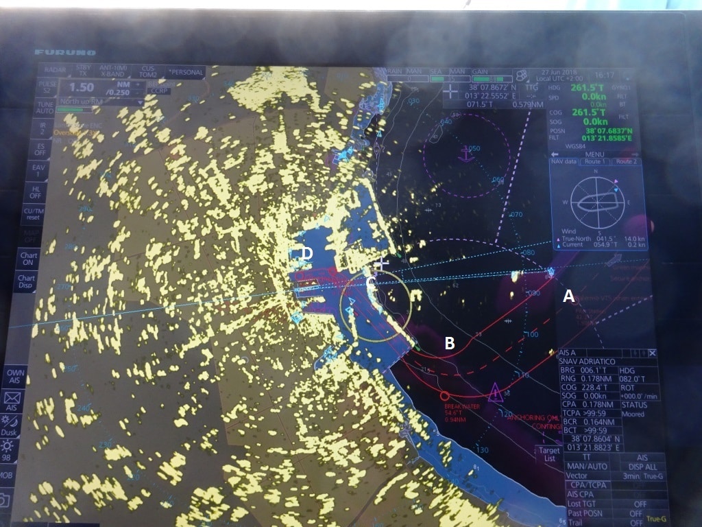
The overview of the port on the nautical chart with the radar overlay.

To plan a proper maneuver you first look at the overall picture. Oversight: for Palermo you have to make two 90 turn’s and slow down from about 12 knots outside to about 3 knots when turning to the dock. Then you start looking at the details by breaking up the approach maneuver. Every captain does it slightly different but I would split this approach up in four significant steps.

  1. Approaching the pilot station and slowing down so the pilot can step on board. Meet with the pilot. Here in Palermo the pilot is often quite happy to just assist and does not need to sail the ship in. Absorb the latest news from the pilot, tell the pilot what the plan is, and continue.
  2. Here we have two things; we have to slow down to about 6 knots to make the turn and we are going from wide open water to more confined water. We now have to figure out how fast we turn the ship, to stay on track, and sail gracefully around the breakwater located on the starboard side.
  3. The turn at B will helps us to slow down automatically but now we have to figure out how to get down to 3 knots or maybe 2 while not losing too much time by slowing down too early. Big question is here; do I start the turn on the Azipods or do I push the bow over with the bow thrusters. Both options work, it is a matter of preference.
  4. We are now entering the slip, the stretch of water between the two docks. Because of the length of the berth we have to push the nose all the way forward. We have to maneuver close to the dock so the linesmen can receive the ropes and at the same time we have to listen to the officer forward who is calling out about how far we still can go, and the officer aft who is calling out about how far we still have to go. Then we also have to listen to the security officer at the gangway, who does not want a bollard in front of the break door as otherwise his gangway does not fit. And then please stop on time, so the ship does not go…bump.

So junior has enough on his mind, while pulling at the handles, to make this for him a challenging port while the captain has a plan B up his sleeve for each situation.

What is the plan B at each step?

A = turn the ship around

B = help with the thrusters or the Azipods to control the turn, if the ship turns too fast or too slow

C = there is room to go straight forward in case the turn is started too late and if started too early, one touch of the thrusters and we are back on track.

D = A timely kick to full astern will ensure we do not bump with the nose into the boulevard.

Tomorrow we are in Naples where we once again dock almost in downtown. Only difference is that the Stazione Marittima is much more elaborate and bigger.

Weather for Naples: 28oC or 82oF, no clouds and no wind. It is going to be a sweltering day inside the old town. I hope most guests have opted for a tour into the country side (with sun block 35) or a visit to a castle which is always cool inside.


26 June 2018; Valetta, Malta.

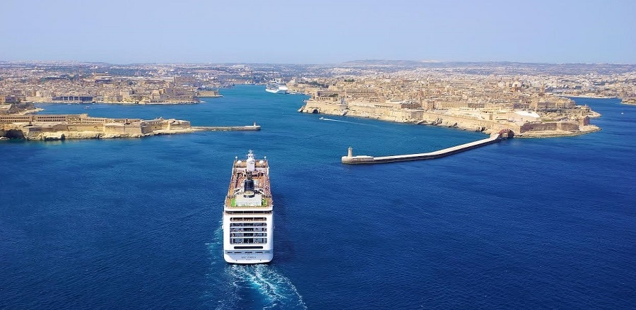
Valetta with its Grand Harbour is one of the most spectacular ports to sail in and out of and also to stay in. There are hardly any restrictions for a ships size as the port entrance is wide enough and only becomes a challenge if there is a Northerly wind blowing. The entrance through the breakwater has a sort of turn in it, which can be a challenge for long and wide ships if they have the wind full on the beam. That wind would then set them upon the South of East breakwater right when they slow down to go through the turn. During those rare occasions a ship will have to wait outside but cruise ships are seldom affected. Those ships that wait outside are normally tankers which go to Malta dry dock. During our call there was no big tanker in dry dock but two oil rigs and they are not small either. Not so very long but very wide and very high. I assume that they came in on a windless moment.
A cruise ship entering the Grand Harbour. The entry looks almost straight but it has this small turn in it, which is an issue for long ships if there is wind blowing. The two breakwater piers are so constructed that they keep the swell out from any direction.

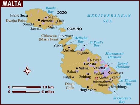
The ms Oosterdam had come in yesterday morning at 08.00 hrs. and then was scheduled to stay until this morning 06.00 hrs. then it was to hop over to Mgarr at the south east side of the west island called Gozo. There it would run a tender service until 15.00 hrs. and then sail for Palermo where we will be tomorrow morning.

When I arrived at the Oosterdam, late yesterday afternoon, and went up to the Captain’s Cabin to pay my respects it was at once clear that not all was well in “The State of Malta”. Captain Robert Jan Kan (you can find his photo and biography on the blog site under current captains) was concerned about the expected westerly wind which would start to breeze up around noon time and then continue to strengthen. By 14.30 it was predicted to go up to 35 knots and then it is not easy to maintain position in that fairly tight corner with local ferries darting around you. An additional concern, which I experienced while being there with the ms Prinsendam, was that when the wind has been blowing for a while the waves which it has started to generate, tend to bounce back from the West side of the larger island and then you have a real issue with keeping a good lee. On one side you are making a lee to keep the wind out so the tenders can use the gangways at the other side and then that other side gets harassed by reflected waves. Not a good position to be in.

Malta is made up of three larger islands. And when we go to Mgarr on Gozo we anchor with the ship in the narrow passage between Mgarr harbor and the island of Comino.

So it was decided by the Captain to happily stay in Valetta until noon time today. Then we had to sail as our berth was to be taken by a NCL ship which was at the pilot station around 12.00 hrs. The decision was validated this morning at 10.30 when we already saw white caps forming outside the Grand Harbour; a good 2 hours earlier than forecast. It would not have been pleasant for the guests to have been in the tender coming back to the ship as when we left, the wind was building up to a wind force 7 to 8 already.

Gozo is a wonderful little island and very unspoiled, at least compared to the main island which bore the brunt of the 2nd world war fighting, but not much fun if you cannot get back on board your own ship again.  But Valetta itself with its enormous history, nice downtown area and wonderful weather made up for it more in one way. So instead of the guest having to wait for the tender to take them ashore, they could just walk again off the ship and be there. Waking up and having breakfast against the wonderful scenery of the Grand Harbour is already a good reason just to be here.

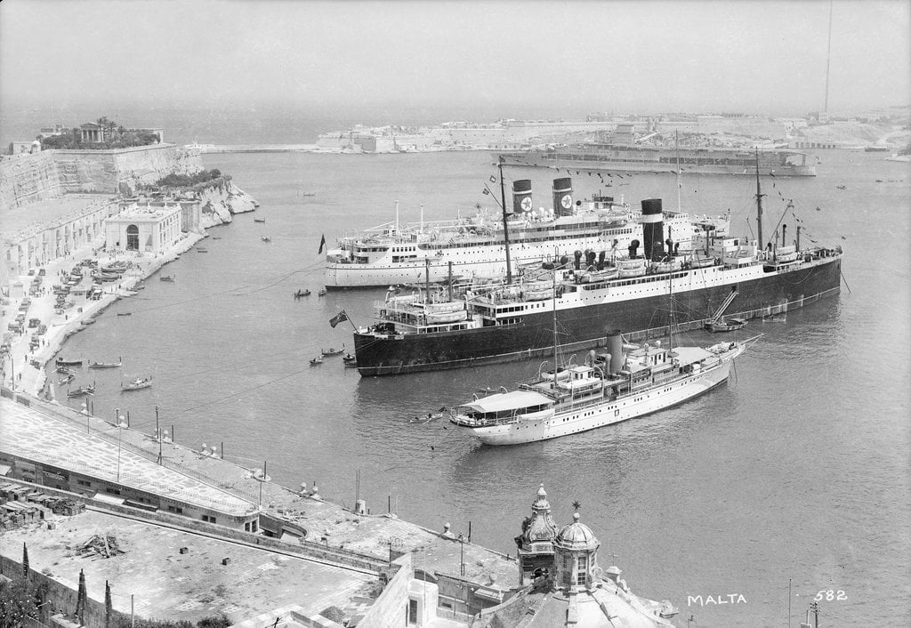
Because of it great harbor, its history and its shelter, cruises have been coming here since the turn of the century. Here we have a blast from the past with the ss Arandora Star of the English Blue Star Line and the ss Letitia of the Scottish Donaldson Line. The yacht in the front is from American owners as far as I know. These ships were anchored “style Mediteranee” exactly in the same spot where the Oosterdam was today.

Valetta was made great by the order of the Knights of the Templar, which still exists in Malta but are now more business men than warrior monks and then it became a strategic harbor for the British Royal Navy until Malta went independent. All were here because the island was so strategic. Controlling North/South routes in the Med. And East /West routes as well. There has been a lot of fighting over it during the last 2000 years. For those who follow the news the area is once again in the spotlight due to the refugee exodus from Africa to Europe. A tragedy for which there is not a direct or good answer, whatever Europe has been trying to do thus far.

So we sailed out at noon time and headed with a gentle speed North West to sail around the West side of Sicily to arrive at Palermo tomorrow morning. A very important port for me, as my suitcase was left behind in Amsterdam while transferring to Air Malta. They are making arrangements to have it forwarded to Palermo.

Now we are sailing against the Gale force winds but they are supposed to abate tonight and by tomorrow morning we should have: sunny skies, 77oF / 27oC and a breezy afternoon.

23 June 2018; North Cape and Hammerfest.

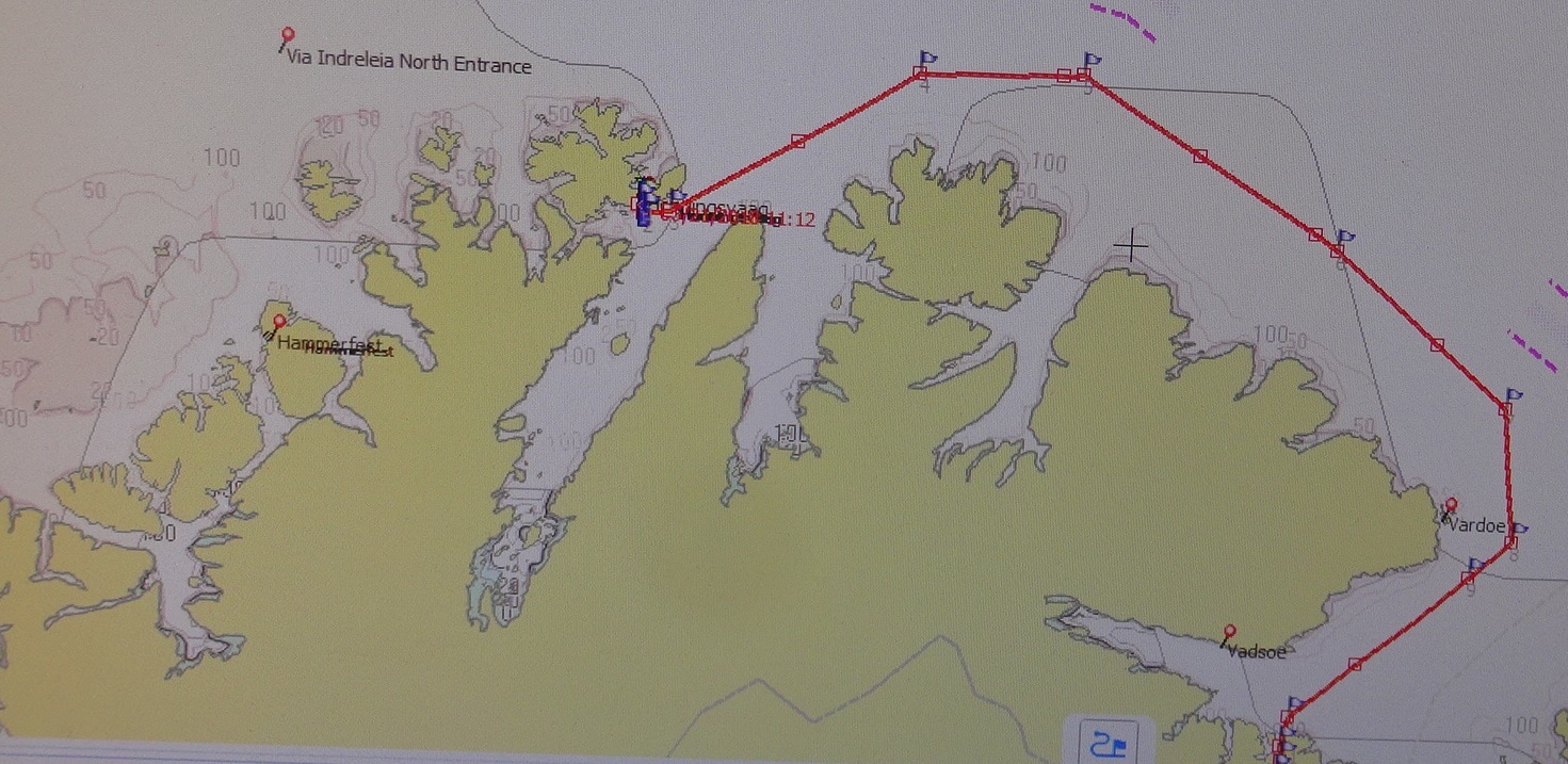
Our route from Kirkenes to the old landing place of the cruise ships of the early days. A still present path leads all the way up the mountain,.

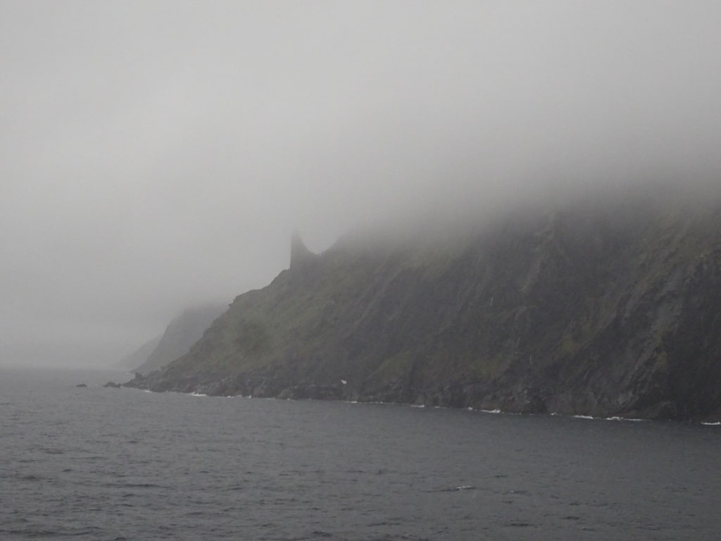
On departure from Kirkenes we saw wind. Normally we do not like wind but now it might be our friend. A good bit of wind might blow the (rain) clouds away and if so we could see the North Cape. So with hope in our hearts we traveled back up the coast during the night; also reaching our highest point of the cruise and hoping for a bit of visibility. Good news was, it was not completely foggy; bad news was the rain clouds were still enveloping the top of the North Cape. So we had to make do with a small rock formation called the horn or horngrunner in Norwegian which is sticking out on the side of the North Cape.

The horn a rock formation protruding from the side of the North Cape.

The one thing everybody could see was the fact that the North Cape is not the most northerly rock of Europe and Norway, but that is a rock formation a bit more to the west. Not so high and not so spectacular. The good ship Prinsendam sailed by with slow speed even stopped near the inlet where in the old days, the cruise ships landed their boats as there is a path/ stairs all the way to the top, and it was not always a short drive from Honningsvag to the North Cape.

It is not an apartment building at the end of the street, it is the Prinsendam.

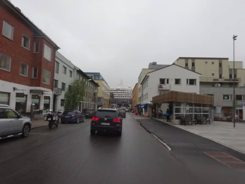
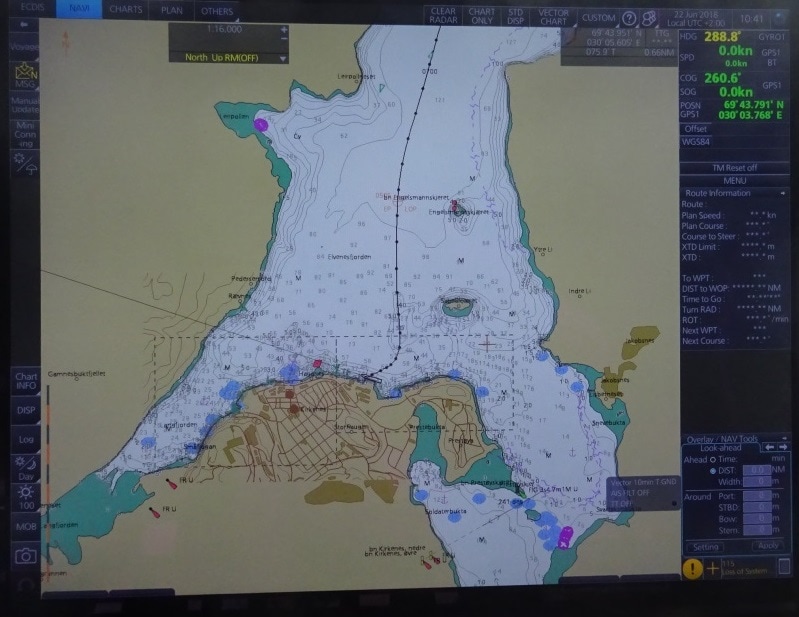
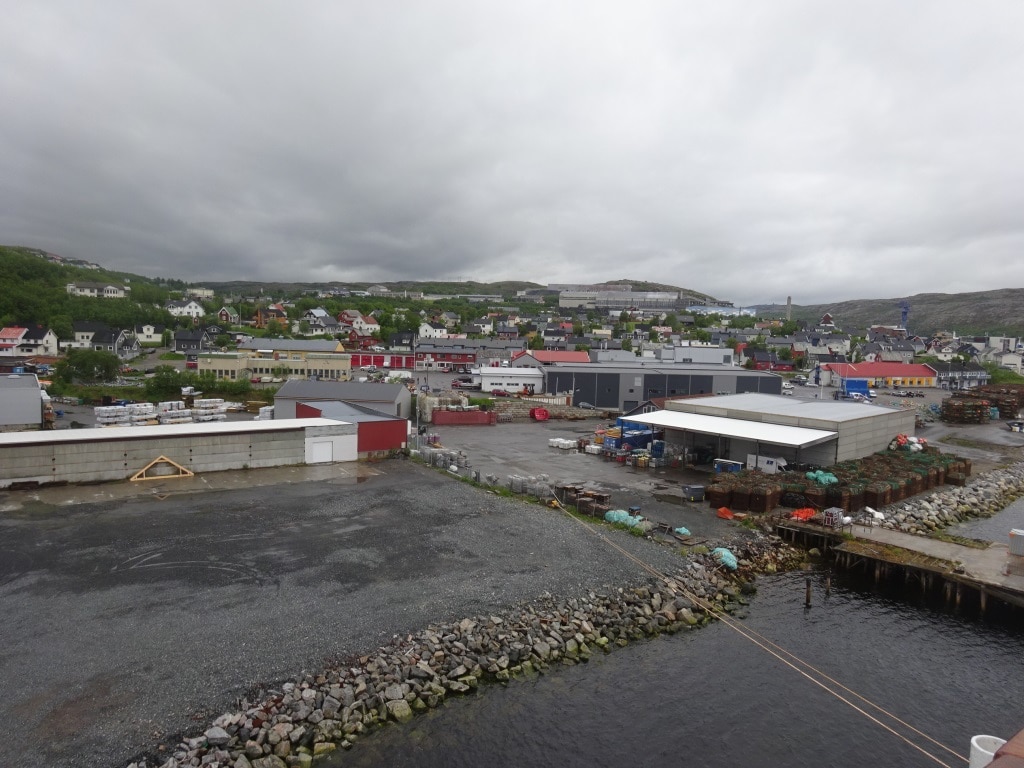
And then we continued to Hammerfest. Here we were scheduled to arrive at 13.00 hrs. But we had to wait as the Mail boat one of the Hurtigruten ships was not yet ready with loading the mail, passengers and cars. Still waiting for 20 minutes was much better than having to dock at the other side of the bay, where the Aida Sol was berthed. The port authorities had provided shuttle buses for those guests but it all takes time. Once the mail boat had departed, the Prinsendam could dock right in down town. And I mean right in downtown. The gangway was literally an extension of the main street, leading up the hill to the high street where all the shops are. It is not often that a small cruise ship can dominate the port, but today we did.


The polar bear is omnipresent in Hammerfet. Not only in the museum but in downtown as well. There is even a polar bear walk, made up by white painted paws on the pavement.

Right outside the dock, is the tourist information which also can make you a member of the most Royal and Ancient Polar Bear Society which is the coat of arms of Hammerfest. I am a member of the order of the sou’wester (Sydney, Nova Scotia, only open to senior mariners) and the order of the dolphin (Sydney Australia, only open to people who drink) and those are on invite only, but the everybody can become a member of the polar bear order, and some 250,000 people have already done so, so I did not join the queue. But it has a nice museum with a full size polar bear on display.

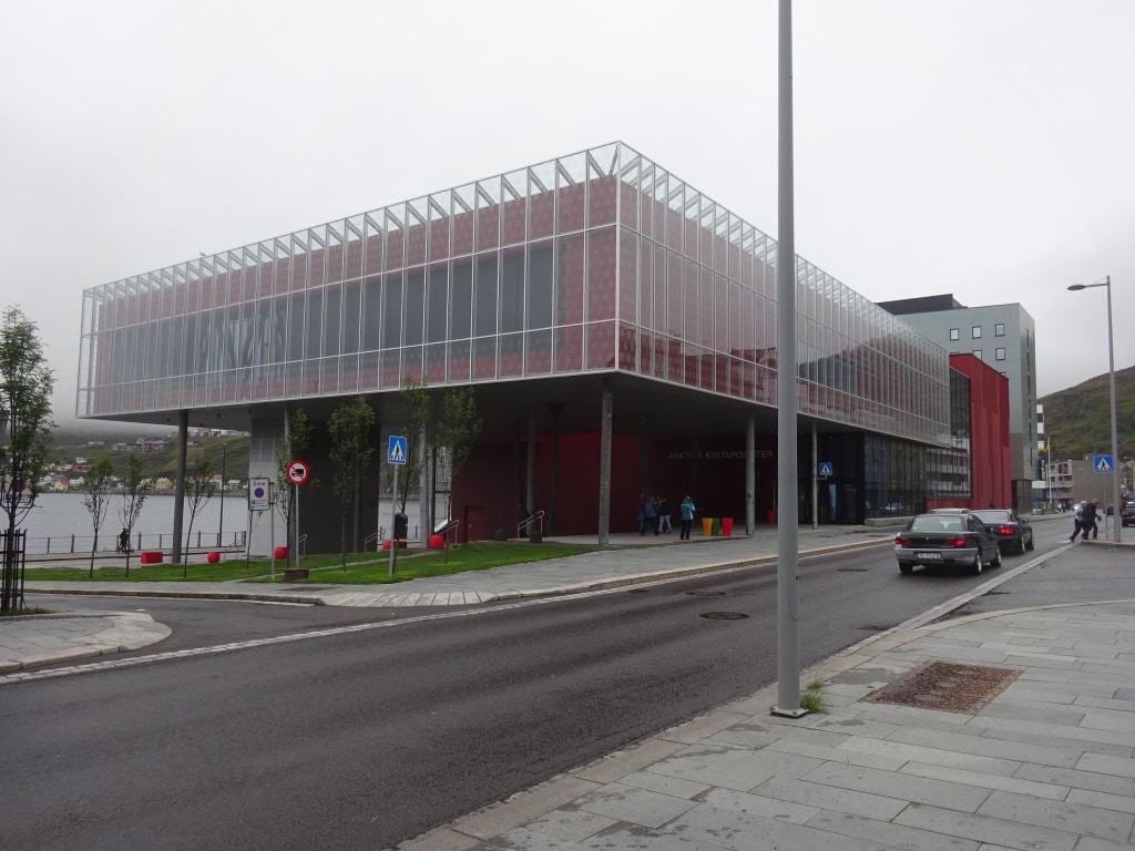
Hammerfest must be a rich town as it is thus far the only place in the world, where I have seen those using Lexus cars as taxis. I have a Lexus at home and they are not cheap. But if you have to pay a lot of money for a ride anyway you might was well sit in luxury. It is an old town or city as it has more than 5000 in inhabitants, just over 10,000 to be precise and is thus a lot bigger than Honningsvag. When you walk around there is not much “old” to see as the Germans burned the whole city down when they retreated from here in 1945. They had used Hammerfest as their submarine base for attacking the Murmansk convoys. Only one chapel survived the burning.

In bright red the Artik Kultur Center. It must make for a wonderful Christmas card, the red against the snow on a dark winters night.

Thus walking through the streets, is basically walking through a small modern market town, Nordic style. There is a museum and thanks to the influx of petro money a large cultural center which dominates the downtown area. No church to dominate downtown, a new, post 1945 church was built on top of the hill overlooking the town. An old grave yard is nearby so I assume that they built the new church on the location of the old church. With two ships in town, the majority of people walking the street were the cruise guests, and thus only German, English/American and Dutch was heard. At least those who were not on tour as the tours take you inland to reindeer and Sami camps and other nature related excursions.

The ship will sail tonight at 21.00 hrs. as the next port of call, Tromso is only just around the corner. That will also be my last port of call, as I will be living the Prinsendam here to transfer to the Oosterdam. There are no direct flights between Tromso and Malta and thus the journey will take me two days. Hence the next blog will be on the 26th. of June. Whatever the weather will be when I reach the Oosterdam. it will at least be a lot warmer than here in Norway.


22 June 2018; Kirkenes, Norway.

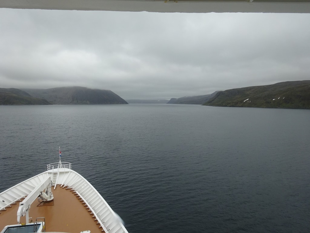
Maybe some of us have been naughty boys and girls in the recent days as the weather Gods are still not with us. We were all very hopeful while docked in Honningsvag that the weather at the North Cape would be half decent but it was not to be. The moment the ms Prinsendam poked its bow around the corner of the east end of the town area, a dirty grey wall was lying over the water. Due to a remnant of the Gulf Stream reaching all the way up here, the water in the Barentsz Sea can have just a slightly different temperature than the waters more inland. If it is a sunny day than the low hanging clouds that hang around the North Cape burn away and a stiff cold breeze from the Arctic will do the same. Neither was happening today. There was a bit of wind but nothing drastic and a dense cloud formation remained over the North Cape area. So no North Cape to be seen and hence the plan was aborted and we trundled on our next port of call Kirkenes.

You can reach Kirkenes from open water through its own fjord.

Kirkenes is tucked away deep in a fjord which gives it a nice shelter from the raging elements in the winter. The name of the town is derived from a church built here in 1862 and it means Church Headland. Its claim to fame is fishing like most other Norwegian ports but there is also an amount of mining going on which can be seen from the dock.  Although being very small, roughly 2000 inhabitants, there is quite a bit to see and for a tourist as the town was much involved in  2nd world war and was liberated by the Russians.

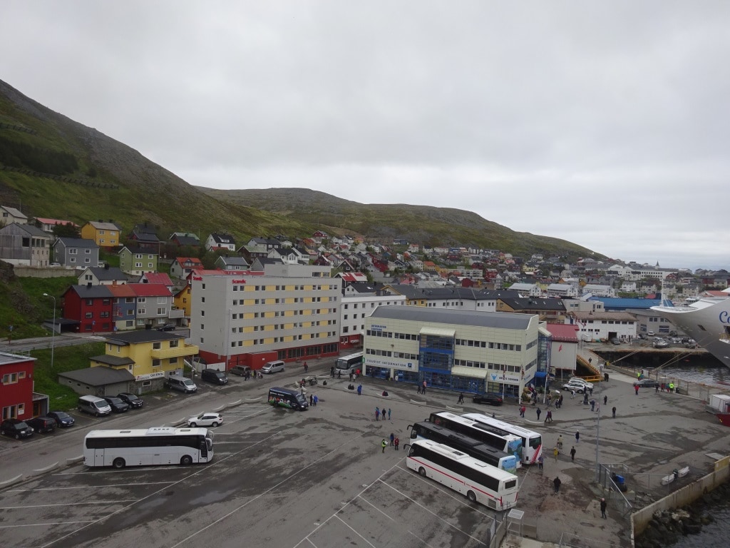
The Red doors are the local fire station and the church or kirk of Kirkenes can be seen as the brown top towering over the town center at the right hand side.

The border is only just down the road. The town is named after the church but when looking from the ship it looked as if at least the port area was built around the local fire station.  I suppose necessary as this area has dry spells as well but taking the weather of the last days in consideration I think that Mother Nature is much faster in extinguishing fire than the Fire brigade. But as it is in most countries the fire brigade does much more than just messing around with fire; they double up as paramedics, and in areas where there is a lot of water, they are often involved in fishing people and items out of the water. Here in Kirkenes they have an extra duty and that is the one of linesmen.  Yes, they were the gentlemen who tied is up this morning. To my disappointment, no roaring fire engines and flashing lights on the dock, not they came walking as the fire station is across the street.  Sensible I suppose as a regular fire engine is quite heavy on petrol consumption.

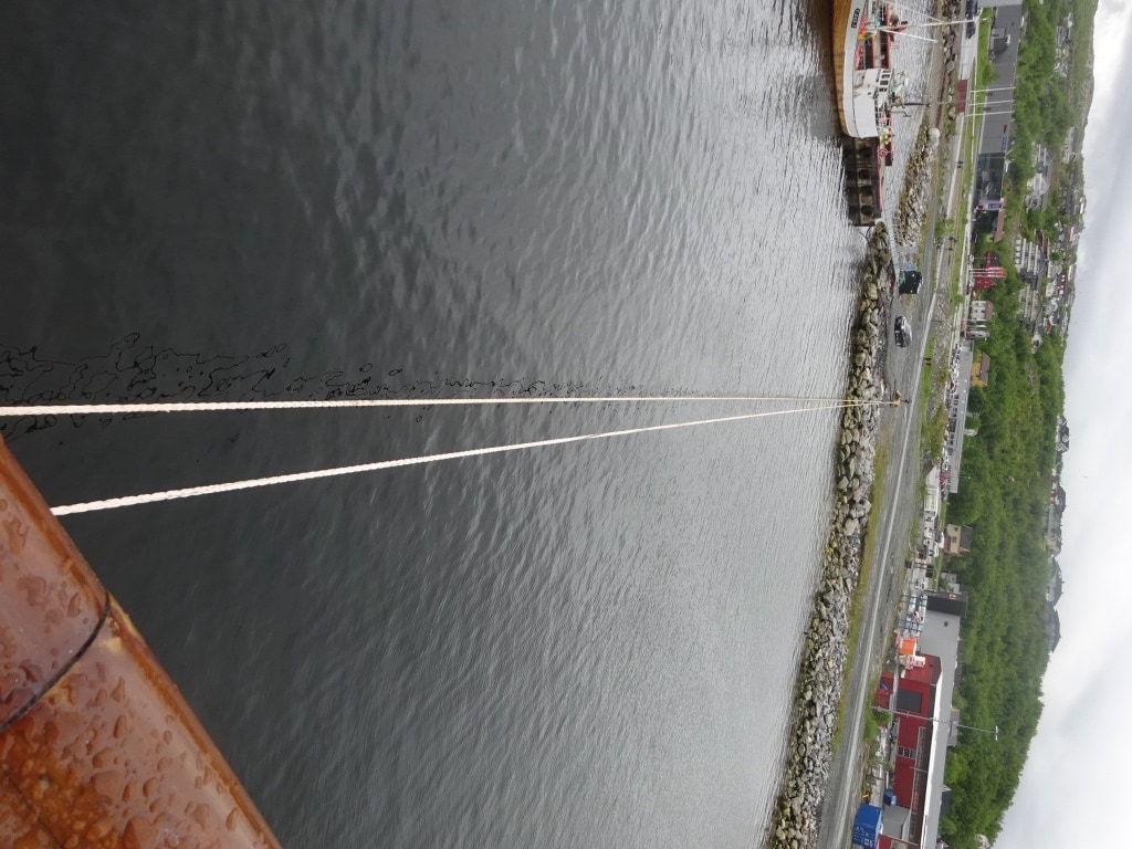
This is what I mean with long lines. It kept the bo’sun and his sailors busy all morning, as there is a good tide over here as well, courtesy of the fact that the port is laying deep in a fairly narrow fjord and that pushes up the water coming in.

Tying the ship up today was a rather long winded affair. Not because of the fire brigade, they were professional enough, but because the dock was too small, even for our Elegant Explorer. And that meant long lines to the main land away from the dock. Most docks in the smaller ports of Norway are created to fit the size of the local ferry system called the Hurtigruten. That was the case yesterday as well. The Costa Pacifica next to us was only alongside with 50% of the hull sticking out and the stern lines were all going on buoys, installed especially for that purpose. And it has been the same in all the other smaller ports I have visited in the past, with the exception of Oslo, Bergen, Alesund and Stavanger, which either have a lot of deep sea traffic or are deeply involved with the North Sea oil drilling.

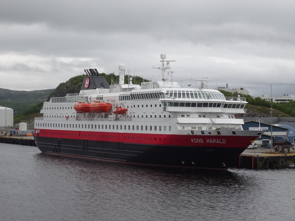
One of the local ferries belonging to the Hurtigruten system. As a lot of people now take the ferry service as a cruise, they start to resemble more and more a cruise ship. But even in the current days of airports everywhere, they still form a life line for the isolated communities.

One of the local ferries came in this morning, the Kong Harald, named after the King of Norway and if you look at the size, you can see it is compact so it fits in all these little ports. The Hurtigruten ferry system runs from Bergen up to Kirkenes and back again and makes daily calls. As they can sail most of the inland fjords, their service is very reliable even during bad winter storms. My lord and Master did two cruises on one of these little cruise/ferries as the newer ones double up as cruise ships to see the Northern Lights. If you ever plan to make a cruise with them, three pieces of advice: 1. Bring your own booze with you, (Prices for a G&T are astronomical) 2. Book a cabin away from the gangway as these ships are on a time schedule as regular ferries and also dock in the middle of the night sometimes just for a few hours. 3. Take lots of warm clothing and more than you think that you will need. (You need to layer yourself as it gets really cold here in the winter)

Tomorrow we are in the port of Hammerfest which seems to be even smaller than Kirkenes. I say seems to be as I have never been there. Weather: Overcast with a fair chance of showers. Temperatures a balmy 08oC or 47oF with a gentle breeze.


21 June 2018; Honningsvag, Norway.

Once we were through Lofoten the plan was to go outside again and to sail past the North Cape. But the swell was still running high and that provided a few challenges. If we went to the North Cape then we would have to slow down to avoid the heavy pitching of the bow on the waves and that would result in at least being an hour late in Honningsvag. And that would have a knock on effect on the tours and everything else. So a decision had to be made. Pilots were available and we could go back inside and………….. arrive in time; but we had to forget the North Cape. And then we saw that the tops of the lower mountains were already covered in low hanging clouds and that meant you could not see the North Cape anyway. Thus we went inside; which is very nice and scenic and we docked nicely on time.  If the clouds lift, then we will try the North Cape this evening after departure as the sun does not set anyway. (We passed the 66oN two days ago and so we are in the land of the midnight sun)

The Norwegian Inside passage near Honningsvag. It has some similarities with the Alaskan Inside Passage but the vegetation is different. Less trees and much more grass.

Of course we are not the only ship on the coast, although thus far we have been alone except in Geiranger. Now we were in port with the Costa Pacifica which with 3800 guests is one of the bigger ones. Honningsvag had in 2017 a population of 2484 inhabitants so this ship alone sends more guests ashore than there are locals. Plus our 750 guests on top of that. So a busy day in downtown. Who says that cruising is not popular that so many cruise guests go all the way to the top? The town is quite compact nearly all the locals live in an area of 1 square mile, so guests do not have far to go unless they go on tour. When all the tourists are gone Honnigsvag is a fisherman’s town, as so many other Norwegian ports. We docked at the best pier in town, but also right in the location where a lot of the fish is brought ashore. And the moment you stepped outside, you could smell that things were fishy. Luckily the smell was not strong enough to be able to permeate into the air conditioning. The town holds the distinction of being the most northerly fishing village of Norway.

The metropolis of Honningsvag, which doubled in size today due to the influx of cruise ship guests.

What can you do around here? Most popular are the tours up to the North Cape, where there is a large visitor’s center and from there you can walk to the edge and look to the North Pole or look down into the water. The North Cape is not the most northerly point of Norway, that is the cliff next door but it is a steep cliff of 1007 ft. high (Not 1008 ft. so somebody must have measured it very carefully) and from there you look down upon the water of the Barentsz Sea or any ship which has stopped there to look up while you are looking down. The Barentsz Sea is a body of water between the Norwegian Sea and the Arctic Ocean. I am proud to say that the sea has been named after Willem Barentszoon  a 16th. Century Dutch explorer who was trying to find the Northerly Passage around the world. That he did not manage and he had to spend the cold arctic winter on the island of Nova Zembla, near Spitsbergen by building a log cabin with wood from his ship. It was not until very much later that the North West Passage was completed navigated and nowadays in the summer time, regular traffic is possible and even cruise ships now make the journey. Icebreakers are more powerful but also the current Global Warming makes the ice cap melt & diminish and leave open waters in the summer time.

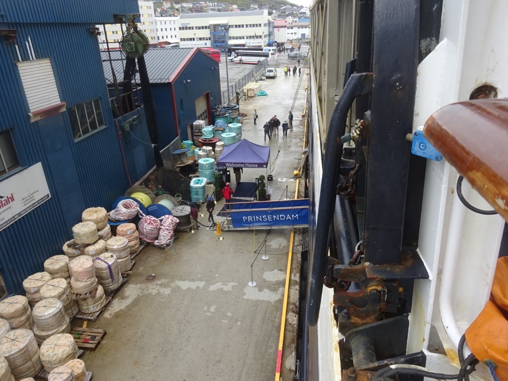
Luckily the locals do not take cruise business that seriously and have built a pier somewhere far out in the wilderness. So we just push our gangway right in the storage area for a local rope factory.

We will sail from Honningsvag at 20.00 hrs. and then try to make for the North Cape which is just around the corner. Hopefully the clouds will have lifted so we can see the top. That is another Captains dilemma. You want to go close to the Cape so you can have a good look at it but due to its height you can then not see the top. If you stay further out, you can see the top with the monument, but you cannot get a good view of the cliff itself unless you have powerful binoculars.

Tomorrow we are in Kirkenes and the original plan was for the ship to anchor. But the local authorities counted their docks one more time and there is room for us so we go alongside. Today it was dry, at least after arrival, but chilly and tomorrow it looks the same. 51oF / 11oC overcast with a light breeze.

20 June 2018; At Sea off the Norwegian Coast

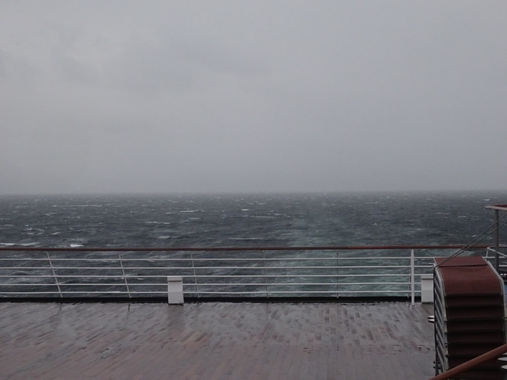
Until 3 am. we sailed the inside coastal route, which still follows the coast but behind mountainous islands and that gave us some protection from the severe storm that was blowing. Still we had a wind force 8 to 9 while in this sheltered area but it was a following wind and the waves generated by this wind did not do much to the Prinsendam as she was happily surfing along. By the early morning the winds hit the 70 knots (that is hurricane force) but abated down to force 8 quite quickly so the ship could poke its nose outside and with following seas and swell it was doable. Also once passed Trondheim, where we had by now arrived, the Inside Passage is not much of an inside passage anymore and the protection of the land is minimal. Outside is the straightest route at this location. Thus we moved about a little bit until the mid morning as the swell was not completely on the stern so the surfing of the ship did not cure all our problems. On occasion we had it ¾ on the stern and then you get this corkscrew combination motion of sometimes a pitch and sometimes a roll (a lurch is what landlubbers call it) and sometimes we had confused seas as well, as there was still a remnant from the last storm left.

This was the wind and sea at 21.00 hrs. last night. Already at a wind force 8, but as you can see not much swell as we are in the protection of the land. (Which is hiding somewhere in the rain)

By the late afternoon the Captain could & decided to go back inside again and sail via Lofoten as we were catching up with the storm and its wave field of 20 ft. and now we could not surf anymore but had to plow into it. That is not nice for guest and ship and it costs a lot more speed than veering back inside and having smooth seas and be able to keep the speed up. Tomorrow we will find out what our delay will be, if any, but at least the guests will have had a comfortable ride and no accidents.

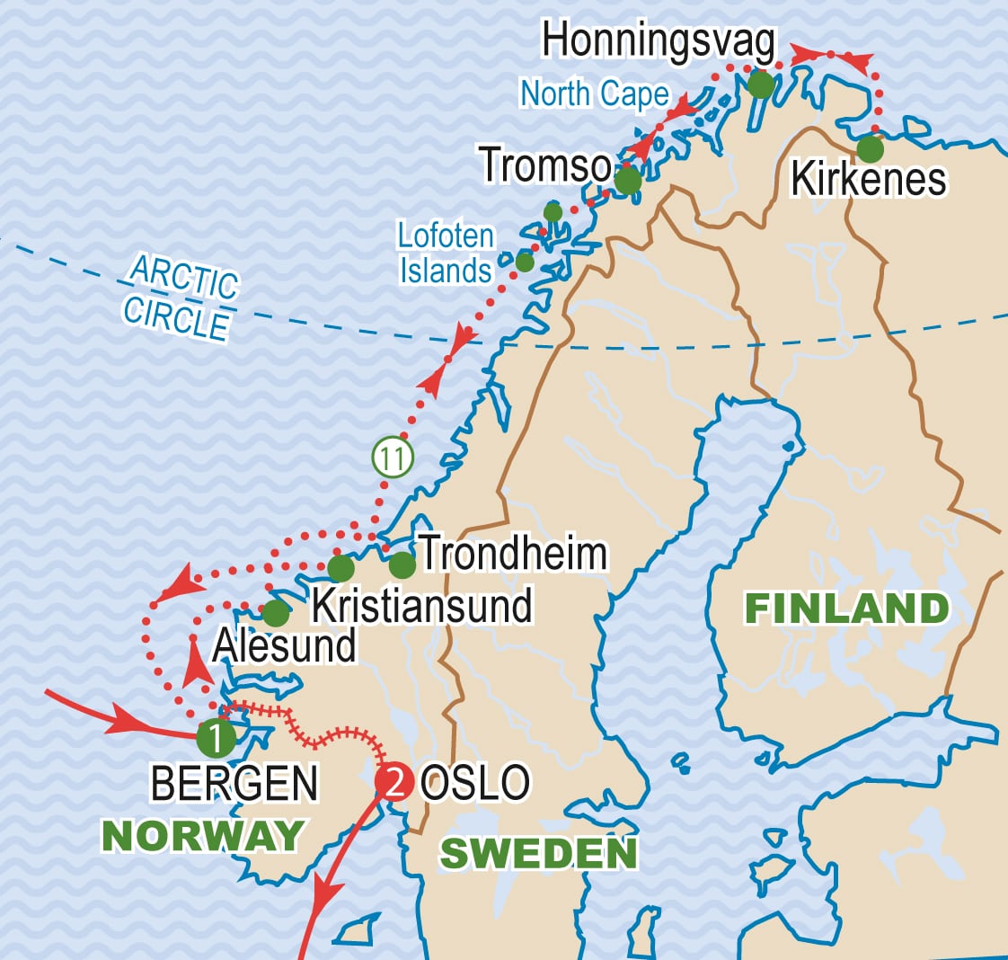
Blog the Norwegian Inside Paasage. We went out to open sea at Trondheim and came in again south of the Lofoten Islands. (With a thank you to the unknown maker of this map from the internet)

It sounds so easy, deciding to stay in, to go out and to go in again but as it involves pilots, arrangements have to be made. We were lucky in this case that pilots were available and that our Norwegian Captain could make arrangements in his own language. Norway is a small country and most in the seafaring community know each other. It is “the old boys club” and it is really useful. I had the same opportunities in the past when calling at Dutch ports, when most of my school and HAL colleagues when saying goodbye to the sea, either went into pilotage or into Flag State related functions. Nothing happening under the table of course but it is easier to ask a friend for help than an unknown entity who hides behind form 1A to 37B (with appendix……..). My own old boy’s network is slowly fading as those in pilotage retire at 56 years old, those in civil service around their 59th. and those at sea, including me, see that day come closer as well. But there are reunions where we then as real old boys can remember the good old days.

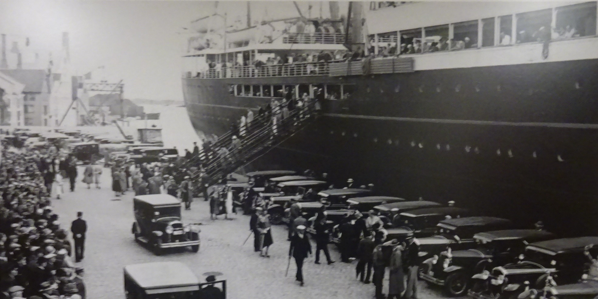
The ss Rotterdam in Stavanger on 11 June 1935 and the guests going ashore for tours by limousines. Note the public to the left. It looks as if the whole town has come out to see these strange people who can afford a cruise during the depression years.

We have on board a lecturer who was in his working days the managing director of the Oslo Maritime Museum, Bard Kolltveit and a source of knowledge on Norwegian shipping including Passenger ships so directly up my street. That hit me with the question, when did Holland America go to Norway and Scandinavia for the first time (not counting the passenger ships we sold to Sweden). When checking my database, it turned out that the first ship was the Nieuw Amsterdam (I) voyage 99 Capt. van den Heuvel which on the return voyage after the Armistice stopped in Bergen on 30 Nov. – 01 Dec. 1918 before continuing to Rotterdam. I still have to find out why that exactly was; as I do not think they went cruising less than a month after the end of the hostilities. But then in 1934 and 1935 the ss Rotterdam (IV), Veendam (II) and Volendam (I) and the ss Statendam (III) all made Norway cruises. Due to depression, cruises brought in some extra income as on the North Atlantic there was not much work. I have a photo of the ss Rotterdam. Docked in Stavanger when she made a Norway cruise between 07 and 13 June 1935

This will be the storm swell at midnight, still well up to 18 feet. So a good thing that we are going inside.

Tonight things should be fairly quiet as the islands of Lofoten will keep the ocean swell away from us and then tomorrow morning we will curve around the North Cape for our call at Honnigsvag. It will be a cold day of 48oF or 09oC but the rain should be gone by then. Good news is we are scheduled for the downtown dock nbr 1, which means you can walk straight into the super market once out of the gate.

I am not a good photographer but once in a while I am lucky when clicking away. I think this shot catches the old lady at her best. Geiranger fjord in the early morning.


19 June 2018: Geiranger, Norway.

Geiranger is tucked away deep inland at the very end of a fjord with steep cliffs at either side. That makes it very scenic and at times also very un-pleasant as the steep cliffs of the fjord can cause a funnel wind, reaching up to hurricane force, which makes staying there impossible. Then there are other days that it is a picture postcard location and the scenery is awesome. Today we were somewhere in between. There was no wind but it was chilly and the drizzle & light rain which started shortly after arrival and made it cold and bleak (a green version of bleak as the fjord at all sides has very green pastures running up the steep mountains)

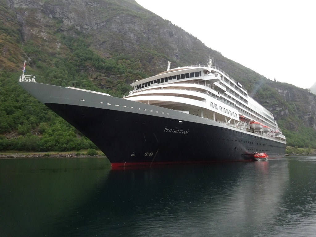
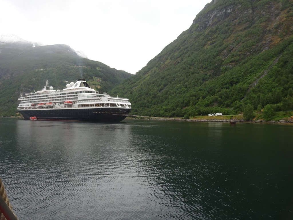
The ms Prinsendam at anchor in Geiranger Fjord. Anchor down in 70 meters water and the stern on the buoy with 4 mooring lines.

We had to anchor a little bit further out as we were together with another cruise ship; the Aida Aura, which is a German Operator but also belongs to the Carnival family. They were coming in later but as they make more calls than the Prinsendam, they get the best anchorage (Plus they have more guests on board). They were supposed to go on the downtown anchorage and use the Sea Walk (a long walkway which can be extended for about 300 feet from the shore line) but for reasons unknown they stayed further from the shore. Maybe the captain was worried about the storm wind veering into Geiranger fjord. So we dropped the hook in 70 meters deep water and put mooring lines ashore at the stern, which stops the ship from swinging on the wind. ………….. as there is no space to swing around at any of the anchorages in the Geiranger corner. The Aida Aura kept her engines going to avoid the ship from drifting towards the rocky shore.  There are no any shallows here, the cliffs, the rock face, goes almost straight down to the bottom. Under water the cliffs are as steep as above water.

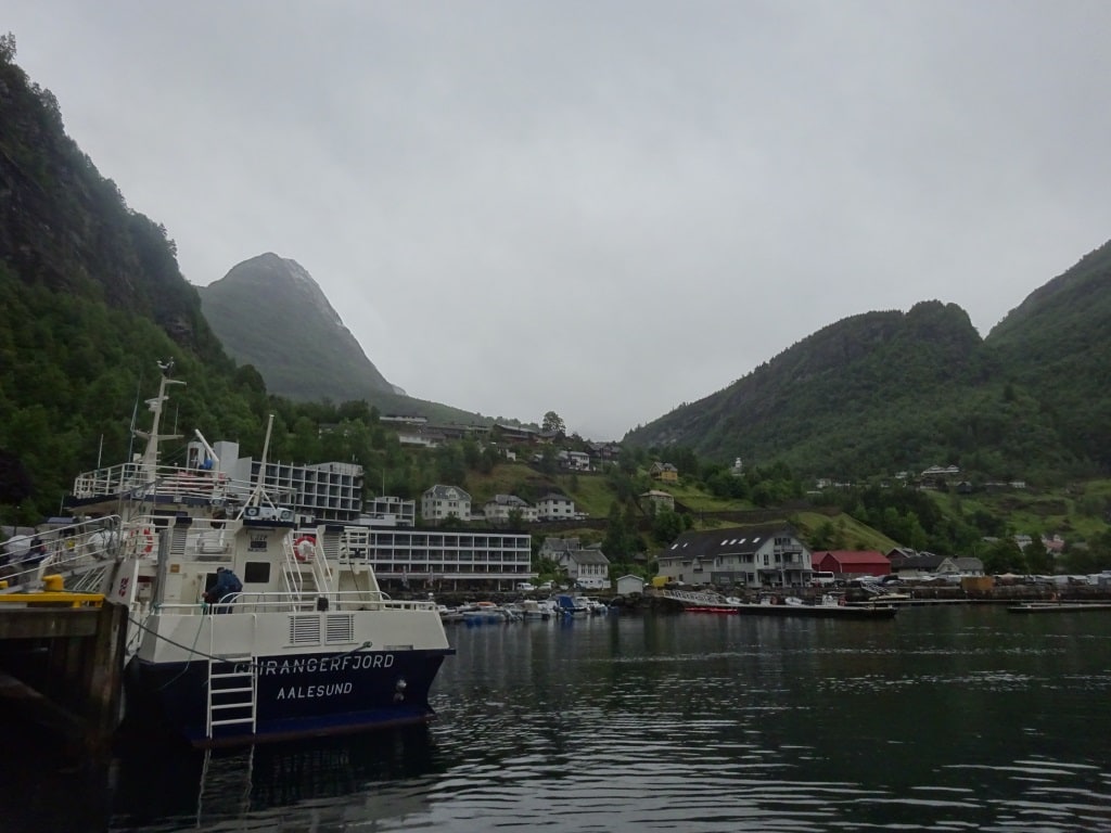
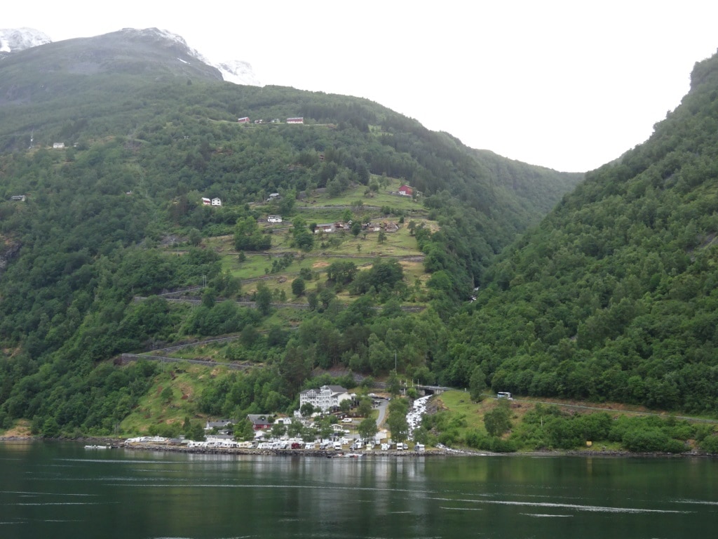
The town of Geiranger. The Campers are just of the photo to the right. This photo was taken at 07.00 in the morning while I was examining the tender drivers. By 08.00 hrs. it started to drizzle and rain.

Geiranger is a little village with houses against the steep mountain face and it is dominated by a large hotel next to the tender dock. What was also very dominant was the large number of RV’s (for our USA readers) or Campers (for our European readers). There was a large parking area below the Hotel and if I am not mistaken the Hotel has facilities for these camper people to shower and go to the toilet. Then there is a nice souvenir shop with a café/restaurant. So for us Geiranger is a tour stop and a good one as there are ample parking areas for the coaches and it has one of the best tender docks I have ever seen.  It can handle 3 tenders at the same time, so today it was all peace and quiet between Germany and Holland as we did not have to fight over tender landings.

I think that every tourist who has visited Geiranger has been either up or down this road. the sharpest turn is about 3/4 up and the bus drivers take a delight in asking everybody to look out of the window………….. and you see no road, just the abyss.

While the guests were enjoying the sharp corners on their tours going up and down the mountains, the rain got steadily worse and worse but the 90 turn in the Geiranger fjord kept us sheltered from the wind. That changed when we sailed at 15.00 hrs. and we came around that corner. The white caps steadily increased. But for a smaller ship as the Prinsendam, there is often a plan B, and also here. We have the option to stay inside and follow the coastal route for part of the journey. For now at least to Trondheim and then the Captain will have another look. The hope is that the swell will diminish so much that it does not matter anymore or that we can join the swell…… with having the swell in the stern. A following swell. The Prinsendam is a ship that can surf. Which means if she goes with full speed, 18 to 19 knots, then the waves do not hit her but she rides them. I have done that often myself in the past and it works very well. While a larger ship with a square stern would have very un-comfortable moments, the Prinsendam just rides from white cap to white cap.

That nasty storm has not hit the Norwegian coast. the Captain is alleviating the impact as much as possible by staying inside. Which means we will only feel the motion of the ocean when we pass a gap in the mountains/islands between the open ocean and the coastal route.

Tomorrow we have a day at sea while we surf/ race north to our next port of call Honnigsvag. So how we fare there will all depend on the quickness with which our bad weather system will fall apart or blow itself out.

In Honnigsvag they have nice weather at the moment, same as we had in Alesund. Their silence before the storm. But they should be ok again when we get there.

18 June 2018; Alesund, Norway.

Alesund is a sort of perfect smaller port for cruise ships. It is sheltered and not too deep inland. It takes hours to get to Oslo and to Geiranger (where we are tomorrow) but Alesund is nicely hidden behind a mountain range and it takes less than an hour from the pilot station to the dock. A very clever clog who decided to put a town here. Because it straddles a sort of land tongue it has a port on both sides of the city and a sort of Canal / channel setup in between for small boats. This means that ships can dock at both sides of the town and still be close to downtown. Ideal for cruise ships and ideal for Cruise Company’s as there is room for quite a few cruise ships. We docked in the old harbor today as we were the only cruise ship in port.

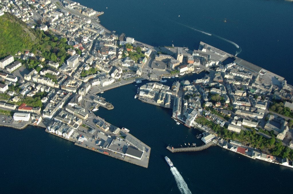
Alesund from the air with the inner harbor and little channel which connects both dock areas of Alesund.

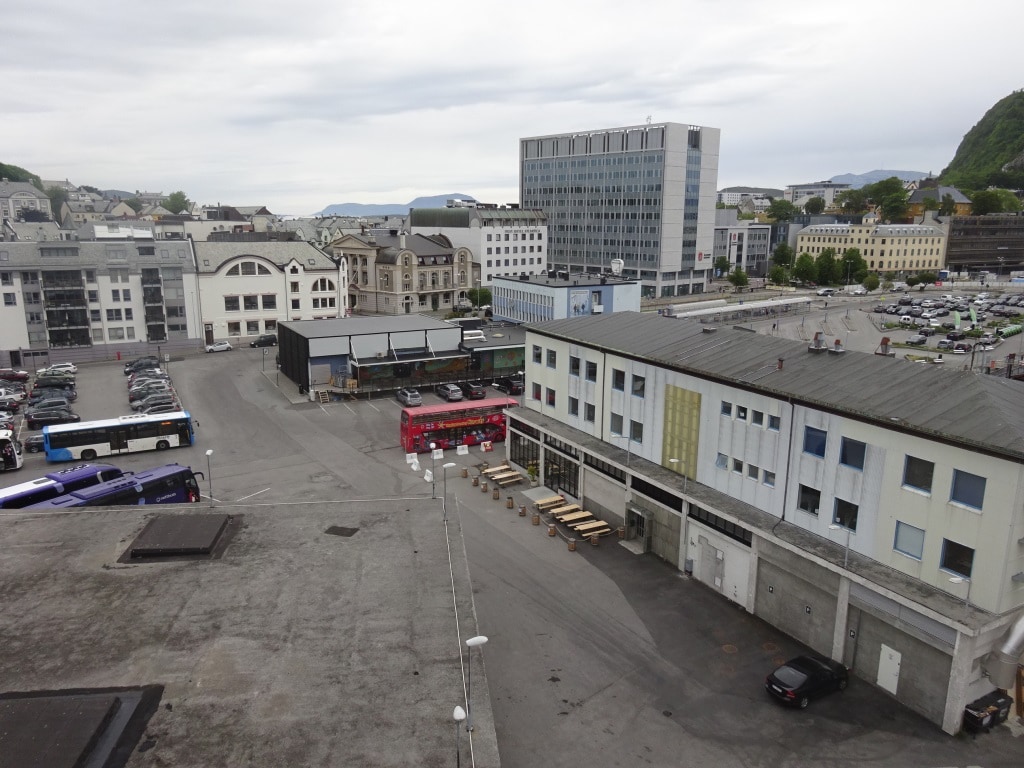
Is there enough to do for the guests? Only the fact that they have a big red hop on – hop off bus making the rounds should be enough to stop that argument. It is also one of the reasons by the Prinsendam is staying longer here than normal. As we do not sail until 22.00 hrs. 2nd reason is tomorrow we go to Geiranger which is about 60 miles up the fjord and that fjord starts here at Alesund. So no reason to hurry or to sail early.  I have done the city tour here some years in the past and that is really a fascinating thing to do as only by going on a tour with a good narration it gives you a good perspective of what Alesund was and is. It is my favorite Norwegian port and that is because of the large numbers of buildings that were designed and built in Art Noveau style. This happens to be my favorite years of Ocean Liner history and my interest has sort of spilled over into buildings. And you can lay close connections between the design of the ships interiors and of buildings on land.

The older Art Noveau buildings near the dock in between more modern architecture.

The reason for this concentration of buildings all of the Jungendstil or Art Noveau School is because in 1904 almost the whole (wooden town) burnt down. The German Emperor who used to vacation in this area sent a lot of help with materials and know-how and the town was rebuilt in what was then the cutting edge of Architecture.  So although the area is very ancient in years of occupation the town itself is in image not much older than 100 years.

But I did not get the chance to do some admiring of the downtown area as I was responsible for creating a lot of mayhem on board today. Every 7 days we are legally required to stage a fire, mustering and abandon ship drill and when on board, I normally get involved as I can give the ship something more elaborate in scenario’s and un-expected things. I have the time to organize it and can keep it to myself so nobody really knows what to expect. In real life a fire does not announce itself either and thus the more you prepare for the un-expected the better it is. Today we focused on CO2 procedures for the Engine Room and then for the ripple……… that flows away from that occurrence and affects the whole ship. If there is a big fire in the main engine room it might stop most or all of our power and when not stopped quickly, could cause the end of the ship.

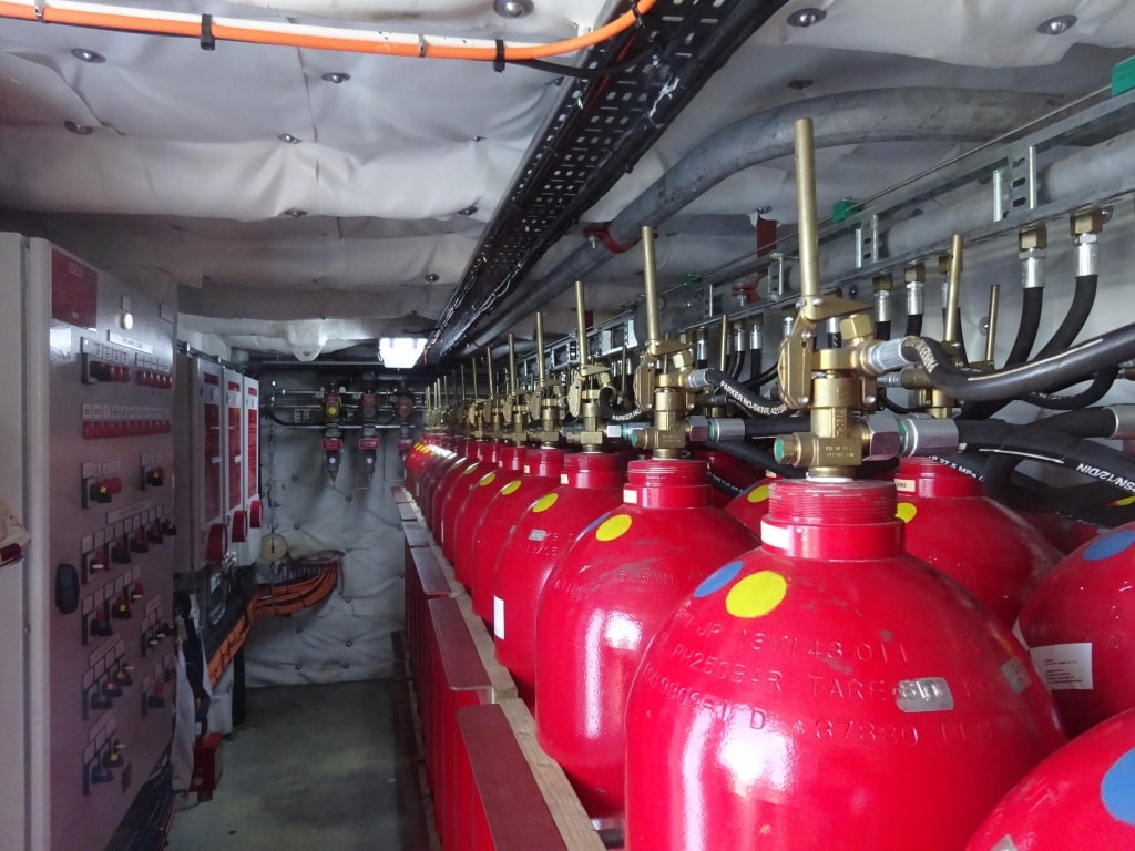
Not as pleasing to the eye as Jugendstil or Art Noveau, but highly efficient. It takes 60 of these bottles to flood the main engine room of the ship.

Golden Rule is, if there is an engine fire and you are not certain in the first 2 or 3 minutes that you can stop it without CO2, and then you should release CO2. In the past there was always a sort of reluctance to quickly engage CO2 because it could cause the lights to go out and the ship loose its option to maneuver. (Quite important in bad weather or close to rocks and other shallow patches) Through experience companies have learned that you should release CO2 the moment you are in doubt because at least you then have a good change to save the ship and all on board. And that we did this morning. A simulated big fire and based on the scenario provided, the Chief Engineer had 3 minutes to decide what his options were and then to contact the Captain for discussion so the Captain could make a quantified decision. The Master of the Vessel makes the decision whether to release CO2 and when, as he is the only one who has the complete oversight; of Navigation (info by the Navigator) the ships safety (info by the Staff Captain), the Engine situation (info by the Chief engineer) and the guest/hotel situation (info by the Hotel Director) Unless there is direct danger of hitting the rocks, Captains will be very fast in ordering CO2 release. The industry norm is to have a total flooding of an area with CO2 within 15 minutes of the occurrence of a major engine fire.  Releasing CO2 is easy, you basically pull a handle and it goes. But you want all engineers and others out of the affected spaces, you want to only flood the affected areas, you want to make sure you have monitoring teams in place and you want to make sure that the guests are well aware of what is going on. For that we look at a maximum of 10 minutes before we go for it. That needs a well-trained team with good communication and that we trained on this morning. The only thing we could not train was the waiting time before we are allowed to re-enter the affected space (Could be as long as 24 hours), we could only simulate that as at 11.30 Guest lunch started again.

Tomorrow we are in Geiranger, nicely sheltered deep in the Geiranger Fjord. This is an anchor port and we will use our little shuttle tenders to and from the ship.

Weather for tomorrow does not look that great. With the rain that has come through and the approach of the storm system, we are expecting frequent showers, temperatures around 10oC or 50oF and a chilly but light wind. Double socks for me tomorrow.

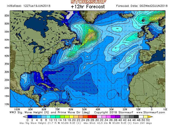
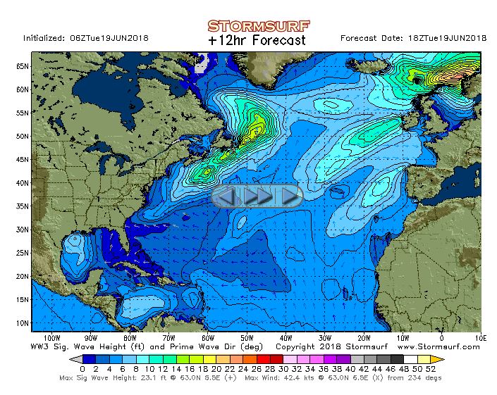
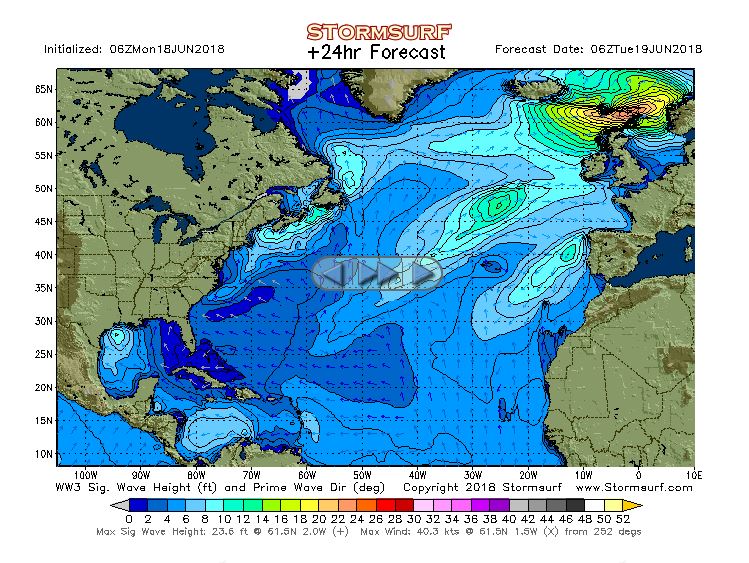
And during tomorrow we will keep a close eye on the weather, as the storm has not dissipated but is still coming closer. This afternoon the rain band in front of it came over, and it is a game of wait and see how close it will come to the Norwegian Coast and how much swell we will have to contend with.

See top right, some nasty stuff is approaching Norway. the one thing we do not know is will it stay the same or will it dissipate when touching the coast; and how much will still be there when we have left Geiranger. (Courtesy www. Stormsurf.com)


« Older posts Newer posts »