Tallinn has developed itself, since the Iron curtain was lifted, to one of the most popular ports of call in the Baltic. As far excursions it cannot offer as much as St. Petersburg but it certainly makes up for it in quality. Plus the people are very nice and friendly and they have been working very hard in restoring their city as much as possible. When I came here for the first time in 1993 it was quite a grey place and the streets where not in a very good shape. When I came back in 2001 the old city had already been spruced up considerably and they had made a start with the roads in and out of the city and started looking at the more normal houses. Now the place is a jewel among the Baltic cities. As a result of all that hard work, Tallinn remains the preferential port for a lot of cruise ships before they head to St. Petersburg or when they are coming from St.Petes. Helsinki is then the other port option in the same way as we will do after our two days in St. Petersburg. I am really waiting for ports such as Riga (Latvia), Klaipeda (Lithuania), and Gdansk (Poland) to start attracting more cruise traffic even if they are not that close to St. Petersburg.
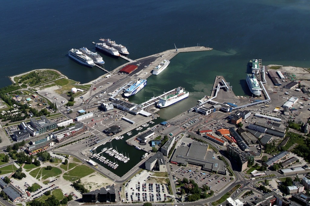
The port of Tallinn, stock photo from the internet. 2 Hall ships, an RCI ship and an Seven Seas ship at the cruise piers, with one Seabourn ship in the old port. The rest are ferries and some of them are the same size as a medium cruise ship.
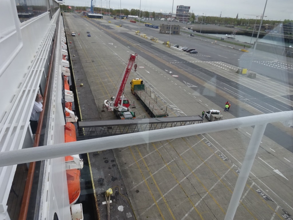
Tourism is helping a lot and cruise ship tourism as well. In 2001 when I came here with the old Noordam, we docked in the old harbor and had to take our turn in between the arriving and departing ferries and also having to deal with nervous pilots who were afraid that we would not dock quickly enough and would hamper the next ferry coming in or going out. Ferries had preference as they were on a (tight) sailing schedule and they still have preference. Now they do not have to deal with the cruise ships anymore as the port of Tallinn has built two beautiful long cruise piers which can handle the longest cruise ships that are out there. Not that this was needed today, we only had three “small” ships in port. The Viking Sun, the Windstar and the Prinsendam. (48,000 tons, 10,000 tons and the PRDM 38,000 tons) All ships meant to provide high quality cruising and together they put no more than 1900 guests ashore and that meant a quiet day in Tallinn. They are used here to having something 4 mega liners in port at the same time, releasing over 10 to 12,000 “invaders” during one day. But when they built the piers they did something right. The cruise piers are as close to the old town as the old port, now the ferry port. So if you are ambulant then it is an easy walk of about 10 minutes to get into the city walls.
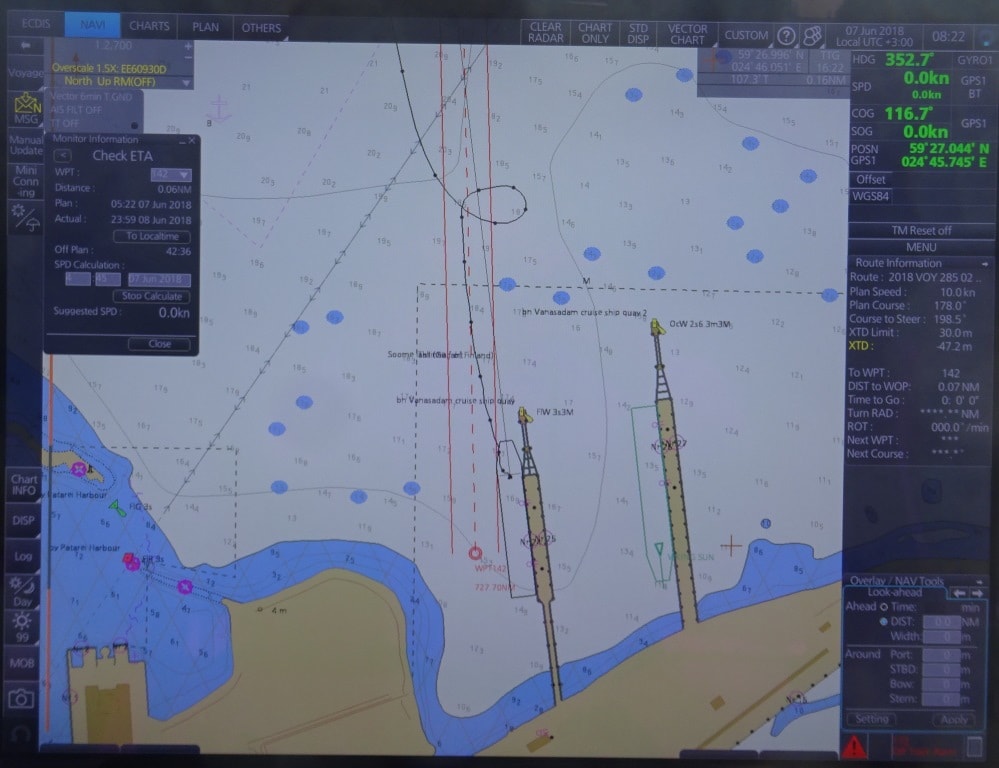
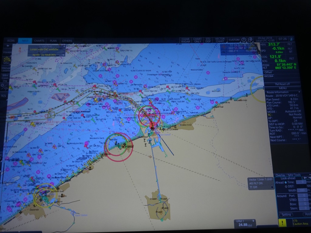
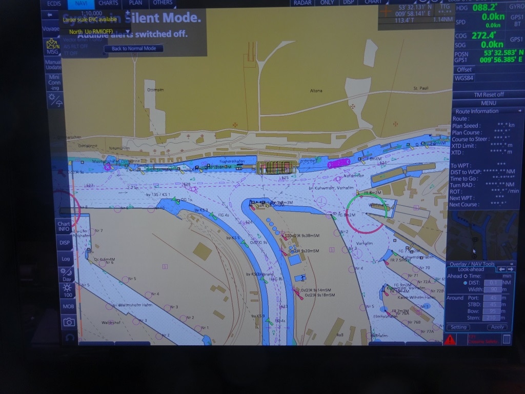
Our approach to the port of Tallinn. Swing around just north of the piers and back in.
We started approaching the port just before 7 am and it is quite a long approach as we take the west route between islands and reefs, while most ferries come in from the North West which is open water. But it is best to stay away from our ferry friends as they can get quite excited if they think we are in the way. That approach takes about 30 minutes and then you can shoot straight in or first swing around and dock nose out. We did the latter, so we could shoot straight out on departure. As explained before, if possible, nose out is always the best solution. If you never know if the weather will take a turn for the worse or if something unforeseen happens during the day and then it is better if you can get away without delay.
I did not make it ashore today as there were safety drills to assess in the morning and the proficiency of our tender drivers to evaluate in the afternoon. But I will be back as there are quite a few maritime attractions still to visit as thus far (in all those years) I have only visited the Maritime Museum which is housed in one of the big city guard towers. But we will be back.
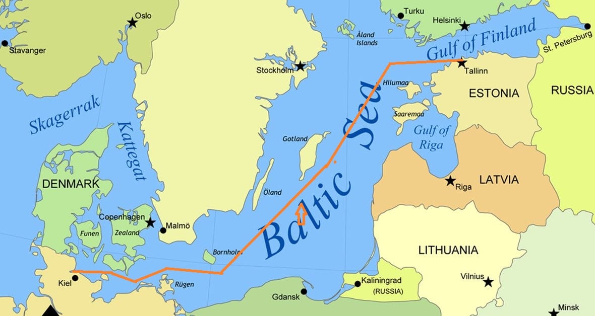
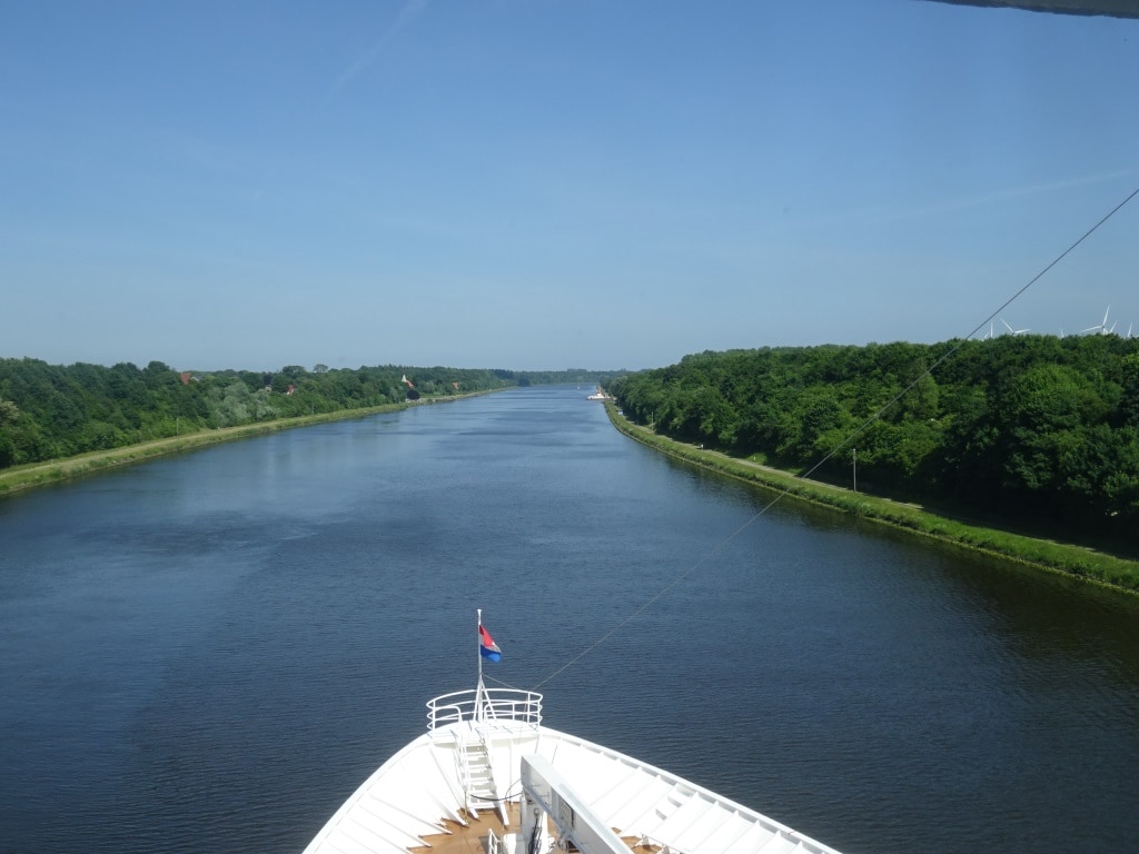
After departure we will go straight up the west coast of Estonia and then bear right into the Gulf of Finland heading towards the pilot station of St. Petersburg. We will board the pilot at 04.00 hrs. and then it is 2.5 hrs. through a narrow canal towards the dock.
Weather for St. Petersburg: 57oF or 14oC and partly cloudy with a light breeze. If the schedule of the port is correct then we will be the only cruise ship in port. The summer season is only just starting so the port is having every day only one ship. By next week it is already two a day on average and by July the cruise port will be full every day when all the cruise ships have arrived for their Baltic Season.
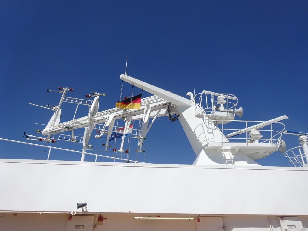
 The good ship ms Prinsendam is in the capable hands of Captain Dag Dvergastein who has been commanding cruise ships for the last 30 years and came to us via Seabourn. The company is slowly starting to mix the officer teams from both company’s and we now have two HAL captains with Seabourn and a Seabourn Captain with HAL. Late last evening the white curtain lifted and the Captain could switch off the fog horn much to the delight of the guests who occupied the suites right under the Radar Mast. You get the best cabins on the ship with the suites and also the best view from your balcony but you then also have to accept that you live close to the navigation part of the ship and that includes a lot of honking on the horn if weather or traffic so demands.
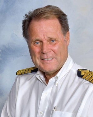 The good ship ms Prinsendam is in the capable hands of Captain Dag Dvergastein who has been commanding cruise ships for the last 30 years and came to us via Seabourn. The company is slowly starting to mix the officer teams from both company’s and we now have two HAL captains with Seabourn and a Seabourn Captain with HAL. Late last evening the white curtain lifted and the Captain could switch off the fog horn much to the delight of the guests who occupied the suites right under the Radar Mast. You get the best cabins on the ship with the suites and also the best view from your balcony but you then also have to accept that you live close to the navigation part of the ship and that includes a lot of honking on the horn if weather or traffic so demands.