- Captain Albert's Website and Blog -

Ocean Liner History and Stories from the Sea, Past and Present. With an In Depth focus on Holland America Line

Category: Uncategorized (page 6 of 9)

22 June 2017; Skagway, Alaska.

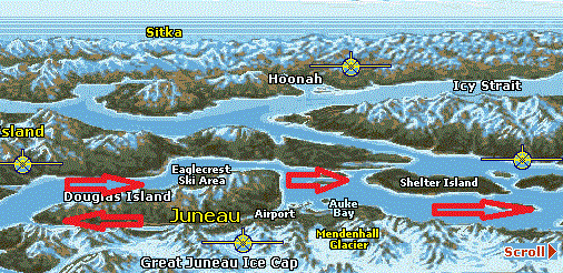
You have to sail around Admirality Island to get to Lynn Canal. (Map courtesy, Alaska E commerce on Line)

If there was a channel or fairway between Juneau and Skagway, we could cover the distance between the two ports in a few hours. However there is a big mountain range in between which means we have to sail in a big curve around it. First retracing our steps by sailing out of Gastineau channel again, the only way in to Juneau, and then sailing up and into Lynn Canal. We will have to repeat that sort of maneuver again when we leave Skagway as Glacier Bay is also “just on the side of the mountain” but we have to sail all the way south out of the Lynn Canal and then go north again.

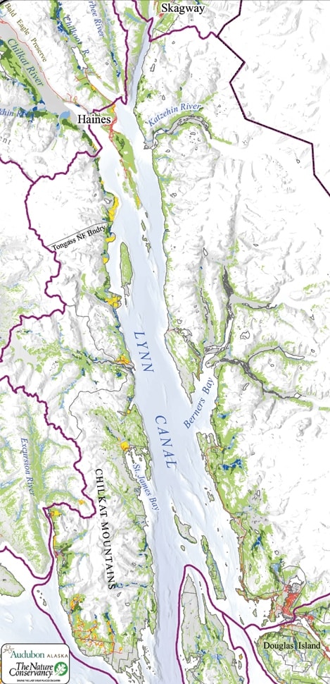
90 mile long and narrow Lynn Canal with Haines half way up. (Map courtesy see left corner)

The name is Lynn Canal but it is not a canal at all. There are no locks nor is there any landscaping on the side of the water way which would suggest any human influence. So the “canal” connection mainly comes from the fact that is looks almost like a canal as its width does not vary that much. It is basically very straight with only a small bump in the middle, just north of the borough of Haines, half way up. Thus the proper name would be Lynn Fjord. It is also the deepest fjord in North America, going down to more than 600 meters in depth at places.  In Norway there are fjords which are deeper but then the Norwegians invented them so that sort of makes sense.

Lynn Canal is named after King’s Lynn in Norfolk England. This is a nice old town and located about a 45 minute’s drive from where my apartment is. That is 45 minutes if there is no “Farmer John” on the road. Otherwise it might take two hours, as Norfolk roads are not very wide and also not very straight. The first – non native – man who explored and surveyed Lynn Canal was Joseph Whidbey, who served with George Vancouver, and who came from Kings Lynn. He would also still recognize the roads on which we drive to King’s Lynn.

At the very end of Lynn Canal the town of Skagway is located. Home to about 400 inhabitants in the winter and about 1200 in the summer; when an army of shop attendants descend on the town and occupy a sort of camping in the valley behind the town. Skagway is mainly the result of the Klondike Gold Rush and then its existence continued with ore export coming down from Canada. There is still an ore dock and on occasion a bulk carrier will call in, but now the main source of income is tourism. Skagway is handy as it fits nicely into almost any cruise schedule. You can reach Juneau, Sitka and Glacier Bay from here in one night sailing and even Ketchikan if you plan in a late morning arrival.

For that tourism, we are there to help. And the cruise industry does indeed help; to the extent that all the docks were full today. We had the Noordam on Rail Road dock fwd. The Emerald Princess on Rail Road dock aft, the Grand Princess on the Broadway dock, the Disney Wonder on the ore dock and the very tiny American Spirit (sister to the American Independence , see my blogs about Bar Harbor) at the right side of the ferry dock. In late afternoon the Alaskan Marine Highway Ferry called in as well and thus all docks were full. Roughly 11,000 guests were ambling about or going with the train up and down the White Pass. History galore as many a gold prospector died while trying to go through this pass on the way to the Yukon to strike it rich.   Now these prospectors have been replaced by shop keepers and they do seem to strike it rich.
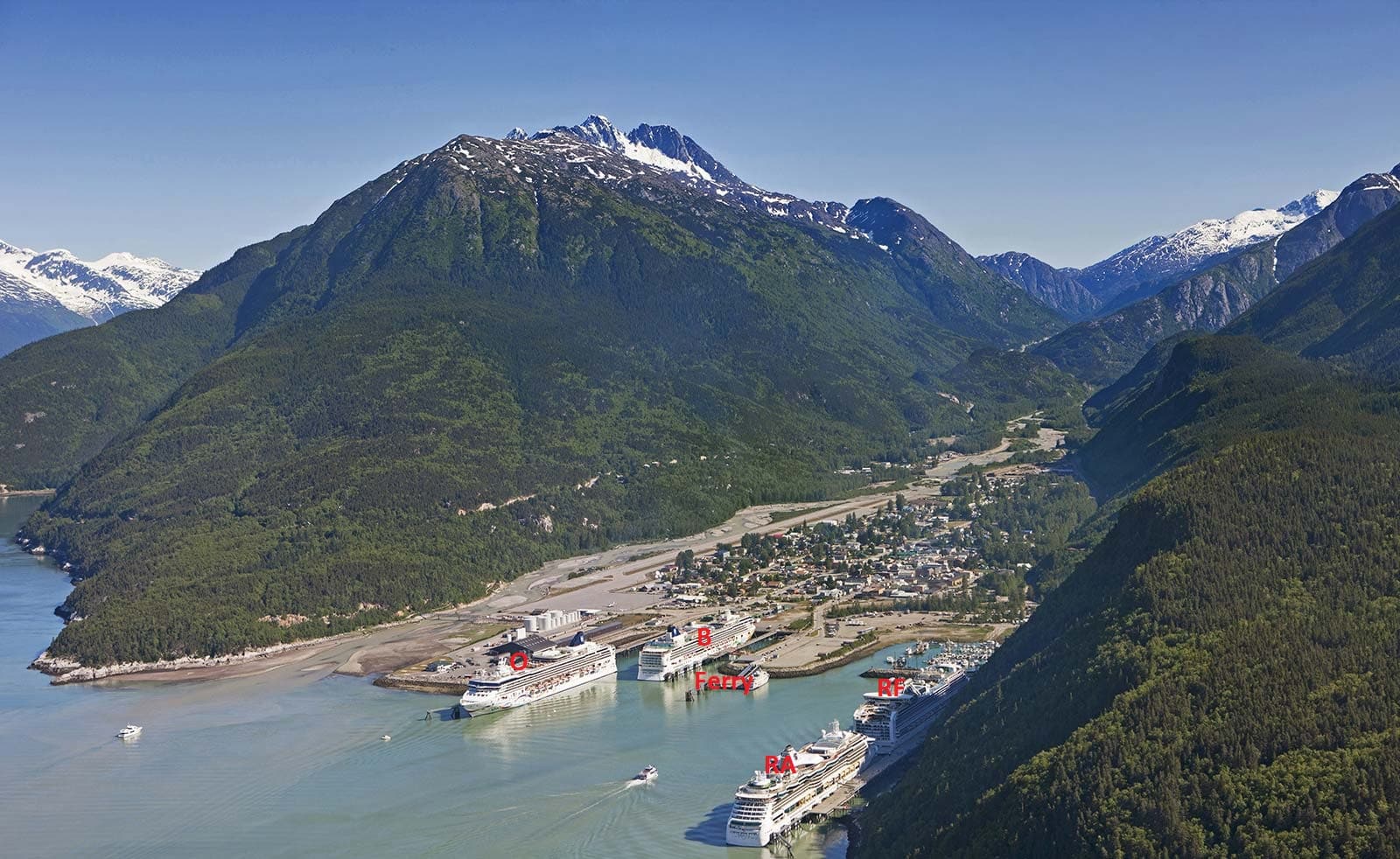
Stock photo of Skagway Docks O = Ore dock, N = Broadway dock, Ferry = left side ferry side, right small cruise ship side, RF and RA = Railroad forward and aft.

The Noordam was docked at the Rail road dock, which is handy as the guests can walk straight off the ship and onto the train. Also the town is not so far from here although then it is a little bit easier to be at the Broadway dock for that purpose. We stayed here until 21.00 hrs. partly to give guests the options to enjoy the excursions or to walk around the town. Glacier Bay is just next door and the only thing we have to do for that is to sail back down Lynn Canal again. We will be there by tomorrow morning 07.00 hrs.  During the day the sun came out and the temperature at once jumped up to the low sixties. We are expecting a similar day tomorrow.
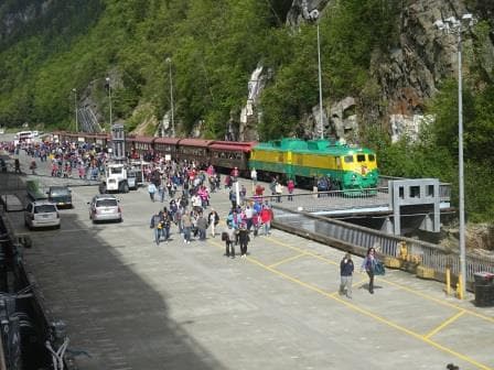
Guests disembarking from the returning White pass train excursion.

18 May 2017; New York, USA.

And thus real life began again. Yours truly arrived last night in the Big Apple and joined the ship today. This time I stayed in a hotel in Jamaica which is part of Queens and thus had an 80 minute taxi trip to make to get to the ship. On normal days that takes about 25 minutes but Queens has a bottle neck where all the roads are coming together to go over the bridge into Manhattan. And today it was a bottle with a very loooooooooong neck. Not that I minded this as I had never travelled the whole length of Queens Boulevard and as New York is a true melting port, there is always lots to see. Plus I can now remove one item from my bucket list and that was travelling over the Queensborough Bridge (Also known as Ed Koch Queensboro Bridge). My experience was thus far limited to the Brooklyn Bridge but my New York Bridge’s experience has now increased by 100%. Next to this bridge are cast iron pillars located for a cable car crossing but I did not see any cable cars so I have the impression that it is not operational.

New York Cruise Terminal just after departure. to the left the Crystal Symphony is just visible.

The good ship ms Maasdam was docked in port together with the Crystal Symphony. This ship was on a port call only stop but the Maasdam also had a partial embarkation today with guests coming on board for the Canadian Maritime cruise. They hopped on board in New York instead of having to travel to Boston. In the Boston we will have a change over again with guests finishing their Trans Canal cruise. The Maasdam is coming from the west coast where it also made a South Pacific cruise. Now it will start a series of cruises to Montreal from Boston and back.

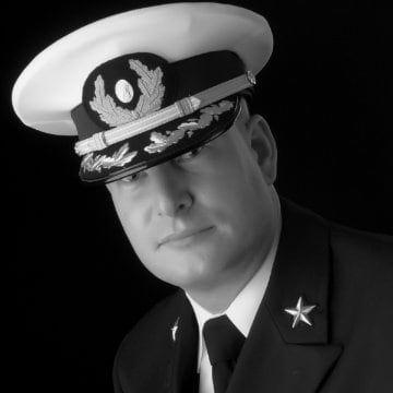
Captain Bas van Dreumel, Master ms Maasdam.

The Master of the vessel is Capt. Bas van Dreumel who until recently was on the ms Nieuw Amsterdam. But he has the same take on the job as I have, you have to rotate ships to stay fresh and so he opted for the change of going from the one but newest ship to the oldest one (excluding the Prinsendam) and also a much smaller ship. But smaller ships have a charm of their own and the Maasdam is making some very nice cruise and varied cruises.

I will be on the Maasdam for three weeks, until June 10 and then transfer to the Noordam. (Subject to very much change as usual) During that period I will conduct a number of trainings, run a complete certification course of Lifeboat attendants and carry out some internal audit work for the Captain. In the coming days I will explain what a Lifeboat attendant course is but it involves messing around with boats big time, so I am keeping my fingers crossed for nice weather.

Today started well, the weather was almost too nice. 97oF with only later in the day a bit of S/E wind picking up. If that continues then I will be a happy camper, but my colleagues on the bridge will not.  Sunshine means very low clouds when in open sea and the whole area from New York to Boston to the St. Lawrence River is prone to a lot of fog if the weather is nice. The combination of warmer Gulf Stream water to the South, cold water to the North and warm air above land can create dense fog, very dense fog.  For the guests normally not much of a problem, unless you bought a cabin right under the whistle, as it normally are burns off in port…………. And then it comes back as soon as the ship returns to open water.

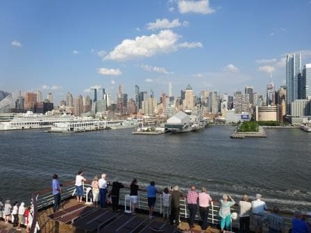
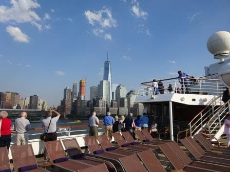
World Trade Centre Area. With to the left the Empire State building just visible.

Today we sailed at 17.00 hrs. from the New York cruise terminal. That departure time being important as it is slack water at this time. I always call that “theoretical” slack water, as the time of real slack water seldom is the same as the real moment. But you try to arrive and leave as much as possible on the slack tide when the current is zero or almost zero as otherwise it is a lot more difficult to avoid bumping into the piers located on both sides of the ship.  Today we sailed at slack tide but even then the ship had drifted considerably by the time it was in the middle of the Hudson River where it could swing to the south and head for open sea.

Tomorrow we have a sea day and the weather looks good and if it warms up quick enough, then we should have good visibility and see some wild life. There are normally lots of whales in this area.

Note: the blog still has some challenges so the coming posts will be without photos until this has been corrected.

28 March 2017; The blog is still in Dry dock.

Dear Readers,

My apologies but from a “few days” of the blog being down, it has now gone to more than a week.

The Holland America Line Community Blog site/layout was supposed to  migrate to a new location. All was to be accomplished in a few days but it seems that there is a hiccup somewhere.  Because of this migration I was asked to refrain from making my daily posts. When it has been migrated, then life is supposed to continue as normal.

Cyberspace is beyond my understanding so I just have to wait until the computer gurus have seen the light, or whatever they have to see, to make the migration successful.

I have just transferred from the Zuiderdam to the Westerdam and the plan is to facilitate a school class here for six new navigators. The ship is scheduled to be in Fort Lauderdale on the 30th. of March and I am keeping my fingers crossed that the blog issues will have been resolved by then.

Best regards

Capt. Albert

Watching approx. 18,000 guests & Crew going ashore in Grand Cayman.


20 March 2017; Blog in dry dock.

Dear Readers,

The computer gurus and experts who ensure that the Hal community blogs and related publications work and continue to work both night and day are putting the blog in dry dock for an upgrade.

During that period, I will not be able to post, my apologies, but same as a ship needs a new coat of paint once in a while so does the computer business needs to refresh its “electrons”.

I will be transferring to the Westerdam on March 24, so I expect that my next blog will be coming from that ship. You will get your “daily ping” again as soon as they allow me ” back on board”.

Best regards

Capt. Albert

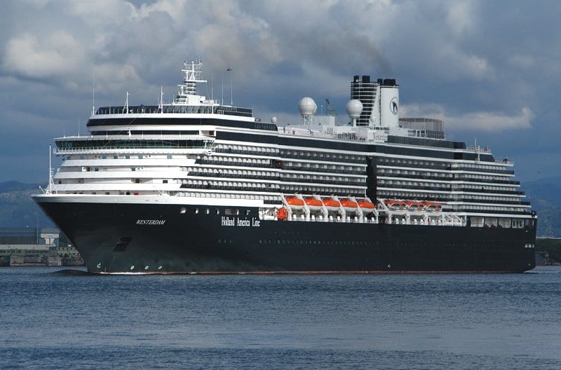
The ms Westerdam.

The ms Westerdam.


28 Feb. 2017; Oranjestad, Aruba.

Today we are back in the Netherlands, although Aruba has a “Status Aparte” which means that it is part of the Kingdom of the Netherlands but not governed by it. A sort of Commonwealth situation but with a Dutch twist. Not that anybody is concerned or interested in that here on board; of much more importance is that there is a big Super market here that sells all the Dutch treats which are hard to get in other places.  Thus yesterday whole expeditions were planned (especially with the eye on sharing a Cab) of how to get to the super market during the off time and also in getting back on board on time to let somebody else go. We are the only cruise ship in today, so there is no danger that another ship would be emptying the shelves before we get there.

I should explain this system, of staying on board, as it is industry wide a standard but not everybody knows how it works. It is called In Port Manning or I.P.M and ensures that at all times there are enough sufficiently trained crewmembers on board to protect the ship and to respond to emergencies.  For Deck and Engine that number is 50% so we can always man 2 fire teams and supervise one whole side of the ship in case we have to lower boats.  For the Hotel department it varies with 50% in the higher ranks and 33 to 25% in the lower ranks but always with the minimum needed to lower all the lifeboats on the sea-side of the ship. Normally that is not a problem except in ports such as Oranjestad where everybody wants to go ashore, if not for shopping, then for a drink or for dinner. Then officers have to swap and share the slots available and that results in long planning sessions in the Officers Bar.  If you try to get off the ship while you are on IPM duty then the check-out computer at the gangway will beep and security will stop you.

We see the same thing when we call at ports in Indonesia or the Philippines where we observe something similar. As the ships still have to provide service not everybody can get away. If it is a two day call, then we normally do a 50% split but if it is only a one day call, then you have challenges as some will miss out. The ships have solved that problem long time ago by letting family come on board. Normally with a maximum of four guests per crewmember. Then it is always funny to observe and find out how many Pilipino crew have Indonesian family in Bali and how many Indonesian crew have Pilipino family in Manilla. Of course the captain knows the game that is being played but it says nowhere in the rules that your guests have to be your real family. Only that the Photo ID is correct and with it the relevant security information. Having a 1000 family on board below decks makes for a very atmospheric day and lots of happy faces.

For Aruba it is different, the happy faces will be on board later, when the Dutch goodies are being consumed. I try to stay away from that super market as my one weakness is Dutch liquorice and they have nearly all the variations (approx. 50) available.

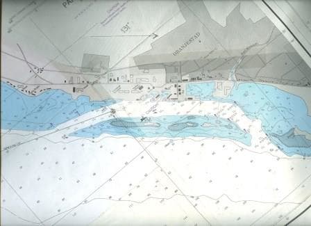
The nautical chart of Oranjestad Aruba. Clearly visible is the reef which protects the Paarden baai

The nautical chart of Oranjestad Aruba. Clearly visible is the reef which protects the Paarden baai (Bay of Horses) in which the port is located.

With running full speed, the Zuiderdam just made it on schedule to the pilot station on the west side of the island. Oranjestad has a natural harbor and the docks are protected by a large reef / sandbank. That gives an entrance and an exit. Something we really like because if something happens we can just sail out again without any issue.

I only observed that only once here, long long time ago. The good old Statendam IV was an old and tired steamship by the year I joined her in 1981. We had regular blackouts and a lot of other things went wrong as well. But she was calling at Oranjestad and as she did not have a bow thruster or a stern thruster; we had two tugboats to push us alongside. So we were happily sailing in, and then the bridge ran slow ahead (6 knots) on the ships telegraphs from the half ahead (10 knots) we were making. And nothing happened. The captain ordered a double ring, to wake those @#$%^*@……  down stairs but still nothing. So we sailed with two tugboats attached to the ship straight out of the port again.

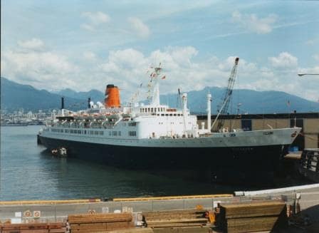
The good old ss Statendam seen docked here in the summer of 1982. She was handed over to a new owner in October of the same year.

The good old ss Statendam seen docked here in the summer of 1982. She was handed over to a new owner in October of the same year.

It turned out that the manoeuvring wheel for the steam reduction on the port side engine was stuck and it took about 30 minutes to get it going again. So we sailed back to the west entrance and went in a second time. This time we docked as planned. The company sold the ship shortly after.

We will stay in Oranjestad until 23.00 hrs. tonight and then we sail to Willemstad Curacao, which is just next door.  If the planning stays the same, then we will dock inside the port. Weather: more of the same standard Caribbean weather. Warm, windy and a chance of a local shower.


27 Feb. 2017; At Sea.

As was expected we got more wind and thus more swell today; from the moment onwards that  we cleared the Windward Passage and entered the Caribbean Sea. As a result the ship is showing a little movement. No real rolling, the stabilizers will prevent that, but a general jitter as if the ship wants to go one way and it is not allowed to.

Last night we sailed from the Bahamas southward and then this morning we had Cuba on our port side. Clearly visible as we were no more than 4 miles away. The whole Windward Passage is 45 miles wide, but the regular steamer tracks are all close to Cuba.  In the old days when things were not regulated it could be mayhem in this area and a lot of collisions took place here. Ships coming from the Panama Canal and going North would cut as close as possible under the coast to save miles. Ships coming from the north and while going south would hug the Cuban coast as well and on a regular basis, ships were not adhering to the wise rule of port to port and not to cut in front of each other.

This did not only happen near Cuba but in many places in the world which were much busier, such as Dover Strait and Singapore Strait. Eventually the IMO (The International Maritime Organisation) brought regulations into force by creating highways at sea. Simple setups with two lanes, just like a regular road. The rules are simple, if you do not want to be in the Vessel Traffic Separation or VTS, then you have to stay away from it completely but if you want to sail through it, then you have to follow the rules.  Stay in the right lane, stay out of the middle zone and do not cut over at the end of the VTS. Worldwide there was a great reduction in ships playing bumper cars as a result of this, and I have not heard of a single collision around Cabo Maisi since the implementation of the VTS systems since 1974.

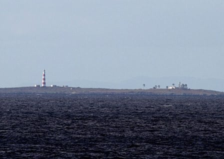
Cabo Maisi during day light (Courtesy University of Carolina who had this link.. for some reason)

Cabo Maisi during day light (Courtesy University of Carolina who had this link.. for some reason)

Cabo Maisi is of course the most eastern point of Cuba and I have to say it looks much more impressive at night than during the day time. There is whopping bright light on top of a high lighthouse which shows the Cape and during the night it is visible from a long distance. You can almost feel and touch the sweep when you are standing on the bridge wing. During the day time, with clear weather, you see a beach with a mountain range rising up behind it but that is about it. If we would go much closer than we might see a few more things but the rules are that you stay out of the 3 mile territorial waters unless you have a good reason to be there, like sailing to and from a port.

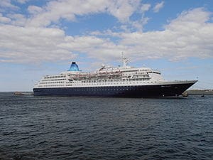
The Saga Saphhire ex ms Europa.

The Saga Sapphire ex ms Europa.

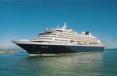
We have left the Eurodam long time behind us as they had only a speed of 13 knots to make, while we need 19 knots to be on time. But this morning at Cabo Maisi we overtook the Saga Sapphire of the British company Saga. To a certain extent comparable to Holland America on the longer cruises as far as the age group is concerned, but they sail nearly exclusively for the English Market.   What gives this ship a bit of a history is the fact that she used to be the ms Europa of Hapag Lloyd and was once considered the most luxurious cruise ship in the world. Built in 1980 she was of the then standard size of 30,000+ tons and carried between 600 and 758 guests. She was then hailed to be the most luxurious ship afloat. That lasted until 1986 when the Royal Viking Sun came on the scene. She is of course now our ms Prinsendam. But both ships are a credit to their designers, that even after so many years, and with an absolute boom in new cruise ships, these ships still can sail full and keep a faithful audience who returns to them time and time again.


ms Prinsendam as she was in 2002 when she came into the fleet.

ms Prinsendam as she was in 2002 when she came into the fleet.

During the night we will continue crossing the Caribbean Sea and then we should be docked in Oranjestad Aruba by lunch time.

Not much to say about the weather. It is regular Caribbean weather at the moment. Partly Cloudy, a bit breezy and warm.

26 Feb. 2017; Half Moon Cay, Bahamas.

I mentioned a few days ago that the weather normally happens on a three day cycle; and if you hit it right you can have perfect weather. Last cruise with the Eurodam we caught the wrong day for Half Moon Cay but things were getting better during the afternoon. That showed in Fort Lauderdale which had the last of the wind during the night and then a very nice day.  That was day 1. We sailed with that nice weather towards Half Moon Cay, day 2, and thus we are now in the middle of the best.

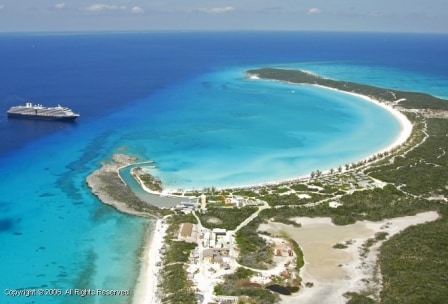
Half Moon Cay as it was a number of years ago. The company is continually developing and offering more facilities.

Half Moon Cay as it was a number of years ago. The company is continually developing and offering more facilities. Photo Courtesy Holland America Line.

And it was a Grand Day, as the Irish would say. The sea was as flat as a mirror, the sun was shining and we did not have a care in the world.  4000+ guests and crew could enjoy themselves today on the white sandy beaches or participate in any of the activities which our private island has to offer. I mention 4000+ because we were together with the Eurodam for this call. Two ships is the maximum Holland America allows at the island at the same time. More and there is the danger that the island gets crowded and people cannot enjoy all the facilities anymore.  The Island is also open to other company’s under the Carnival umbrella but only when there is no HAL ship calling. So we will never be together with “those who choose another company”.

klkkl

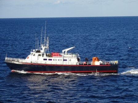
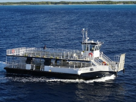
The Half Moon Clipper acts as a supply boat for the ships. It was built for ferry service in Nova Scotia so it can handle a bit of rough weather.

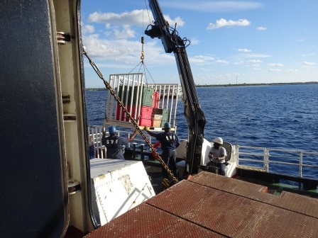
The call at Half Moon Cay is a tour de force in organization. Even more when there are two ships. The ships supply everything for the island as the refrigeration capacity there is limited to day storage and what the island needs for itself.  Thus when we arrived the Half Moon Clipper, the local ferry and supply boat, came alongside to collect everything. Most of the time the ships work together and one ship will supply all the food and the other ship will supply all the beverages as that makes it much more simple to keep an inventory and to return the left overs (very few) to the correct ship.  Then crews from both ships go ashore for the service. Apart from them also medical goes ashore as they man the first aid post in the village. The watersports, shops and other activities are staffed by local Bahamians under the direction of the island manager. Most of these staff live on Eleuthera and come over in the morning with the Half Moon Clipper.

Transferring supplies from the ship to the Half Moon Clipper.

Transferring supplies from the ship to the Half Moon Clipper.

If there is one ship, then the whole business of ferrying the guests to and from the shore is done by the shore tenders, the Annie Bonny and the Henry Hudson and they are also helped out by the Glass bottom boat before tours start.  When there are two ships then one ship has to use their own tenders to supplement the shore tender capacity. Normally the captains of both ships then have a little chat of how to help each other the best way. Normally that works as follows: The largest ship (today the Eurodam) gets the shore tenders. This ship goes to the anchorage which is the furthest away from the port. The smaller ship (today the Zuiderdam) will stay on the engines and float right of the entrance. Here is no anchorage but the shorter tender distance is of great help if you have to use your own tenders. And then of course they mix and match the use of the shore tenders when needed.

The Henry Hudson one of the two purpose built passenger tenders for the island. Each can take about 300 guests in one go.

The Henry Hudson one of the two purpose built passenger tenders for the island. Each can take about 300 guests in one go.

This scenario worked to perfection today and the guests had a great time, as was borne out by none of the ships leaving on time.  So both ships had to crank up their engines a bit more to get to their next destination on time. The Zuiderdam is heading towards Oranjestad in Aruba, which is a high speed run, so from the moment of departure it was pedal to the metal. Tonight we will sail in between the various Bahamian Islands and then in the early morning we will cross the Old Bahama Channel to enter the Windward Passage. This is the gap between the east end of Cuba and the west end of Haiti and from there we enter the Caribbean Sea. Then the day after tomorrow we will arrive at Aruba around noon time for a late evening stay.

Weather for tomorrow, more of the same; but we are coming under the regular influence of the Trade Winds again, and an easterly breeze should establish itself with the chance of a rain shower. The captain announced rain bows at noon time tomorrow during his departure speech. So let’s see if he is right.

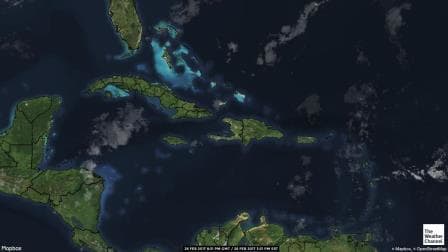
A satellite photo of  the Bahamas and the North Caribbean sea. Not a cloud in the sky. (

A satellite photo of the Bahamas and the North Caribbean sea. Not a cloud in the sky. (Photo Courtesy. www.weather.com)


25 Feb. 2017; Fort Lauderdale; Florida, USA,

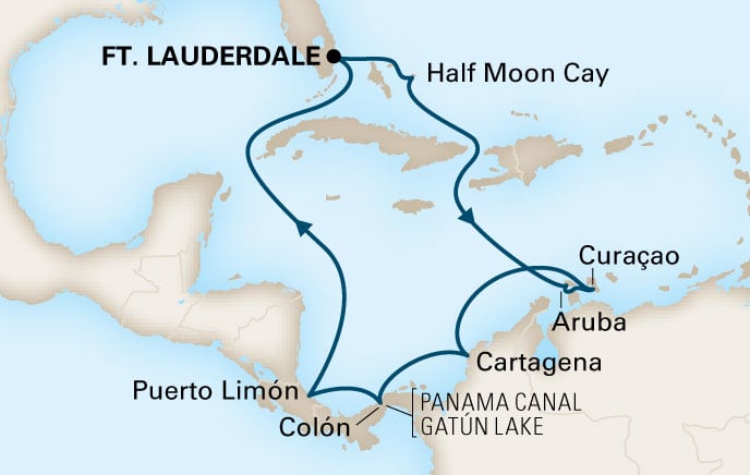
As planned I crossed the street today walking from Pier 26 to Pier 21 and transferred from the ms Eurodam to the ms Zuiderdam.  If nothing changes, then I will be here for 3 weeks until March 19th. The ms Zuiderdam is making 10 and 11 day cruises from Fort Lauderdale. Calling at Half Moon Cay, Oranjestad, Willemstad, Cartagena (11 day), Panama Canal (Gatun Lake) & Colon and then back to Fort Lauderdale. If you have the time on your hands these are the cruises to make; not too short and not too long and they give a nice balance between sea days and port days. A lot of our guests really like sea days and that makes this a perfect cruise. Perfect enough to be sold out for this departure and the next ones are already booked close to capacity as well. Captain in command of the good ship Zuiderdam is Captain Bart Vaartjes who was my staff captain for a number of years on the S class ships, so he has been around with us for a long long time.

Our route for this cruise. for the 10 day cruise the ship does not call at Cartagena.

Our route for this cruise. For the 10 day cruise the ship does not call at Cartagena. Thus we have on board quite a few guests who are doing a back to back: both the sunfarer and the wayfarer cruise to catch all the ports.

When we came in this morning, it was a really small world, with some very low hanging clouds over the port. My wife tried to follow me on the webcam of Fort Lauderdale when the ship was coming in but she could only see the Zuiderdam which was coming later and at that time, the fog was starting to lift and things got a little better. But it took until 10 am. before the last of the haze was gone and it was really something that we could have expected. No wind to bring warm or cold air over the area as there was hardly any wind at all and thus the sea and air temperature were close enough together for the moisture in the air to condensate and turn into clouds.  We call it fog because we are sitting right into it but it is nothing else than a low hanging cloud; a cloud that touches the surface of the planet; but if you fly over it then it looks like the top of any other cloud. It is necessarily even flat. There where the temperature varies a bit there might even be a billowing cloud rising above the general surface cover. A sort of cloud we call Cumuli Nimbus when we can see them in the normal blue sky, high up, during a normal summers day.

Tonight the Eurodam and Zuiderdam will be sailing in tandem from Fort Lauderdale to Half Moon Cay. Both will arrive at the same time and both will depart at the same time. Then they will follow each other until they are under Cuba. From there the Zuiderdam continues south, aim for Oranjestad and the Eurodam will curve to the south west and will aim for Grand Cayman. Because 10 + 11 is 21 days the ships will see each other again on the 19th. Later on the Eurodam goes to Alaska and the Zuiderdam will go to Europe. In Europe she will make a mixture of Baltic and other European cruises before returning to the East coast of the USA & Canada for the Fall Foliage season. By October she will be in dry dock in Freeport where she will get the same upgrade the Oosterdam and Eurodam already have received. Removing the Disco and replacing it with a Gallery Bar and introducing the Billboard on Board with the Duelling Pianos and the Lincoln Classic Music setup. At the same time there will be an upgrade for the cabins and the installation of the interactive TV in the cabins.

I will spend my coming three weeks focusing on crew training, drills, reviewing procedures and making a complete walk through of the ship. That will keep me happily occupied for the coming period and then the ship should be more than ready to deal with anything the auditors might throw at them.

Dealing with auditors is always a sort of chess game. You know what they try to find, so you make sure there is nothing to find and then the auditors have to start digging in the rules and procedures to see if they can find something else.  These audit process are already going on in our company for a number of years and thus is there less and less to find.  Audits are good as it sharpens the knowledge and procedures of everybody on board; on the other hand you cannot always be aware of every little minor and miniscule rule or procedure somebody has dreamt up and hidden way somewhere in an obscure directive so auditors will always find something. The game is just that they should not find anything they could be really proud about.

The weather tomorrow should be back to normal. North Easterly wind although not much of it but it will enable both ships to lay with the bow to the island side by side and conduct a regular tender service. But the little wind will make it very warm on the island, so I think it will feel much warmer than the 79oF / 26oC which is forecast. I hope the shops have enough sun block 35 in stock.

24 Feb. 2017; Half Moon Cay, Bahamas.

This time the weather forecast followed the forecasted schedule and we got exactly what was expected. Based on that, the captain could also decide to make the call and stay for the day. When we arrived things were pretty miserable with strong winds from the South West and a lot of rain around us. During the night the winds had been very strong here and thus the waves were still quite high. But shortly after 8 am. the rain was gone and the winds slowly started to abate. Making it possible for the shore tenders to come alongside and start ferrying the guests over to the Island. With a bit of a bumpy ride, but a very short bumpy ride.

The winds will continue to die down during the coming night and on arrival Fort Lauderdale it is supposed to be nearly wind still. So by next cruise the ship might be on a 3 day cycle which will help us dodge the strong a wind days in port. We will see, or better said the ship will see, as I will not be there.

I am transferring tomorrow to the Zuiderdam until March 19 and then hope to return to the Eurodam to continue my work here. The Zuiderdam has asked me to come over and help out with preparing for an inspection and as “higher up” thought that was a good idea, there I go. So tomorrow I will walk off the gangway, turn right cross the road and will walk straight up the Zuiderdam gangway. (After of course having successfully navigating security)

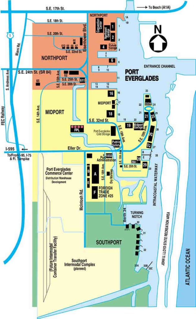
The Zuiderdam is on berth 21 and we are at the usual Holland America Line berth at 26. These berths get assigned by the harbor master office and if there are only a few ships in, then it is an easy gig. They all go to their own terminal and the only thing the harbor master has to do is to decide the entry sequence in such a way that it makes it as easy as possible for the pilots and captains to bring the ships in. Some – times that requires for a ship to arrive earlier than the captain had intended but so be it.

The lay out of the port of Port Everglades.

The lay out of the port of Port Everglades. Berths 7 to 15 are normally tanker docks and anything higher than 26 is normally for cargo ships and tugboats.  29 is also a cruise terminal but only used when it is very busy.

It gets more complicated when we have 6, 7 or 8 cruise ships in. Then ships are sometimes moved to other berths, depending on their size.  With ships the size of the Oasis class, there is only one berth (nbr. 18, 17, 16) which can handle them and thus the whole setup has to be worked around them.  Also a Carnival ship takes up 2 berths, 19 and 20 and if they want to have that berth then they have to come in before an Oasis Class and before a ship scheduled for 21. Once in, then it is very difficult to get out again as nbrs. 18 and 21 take up a lot of space from the middle docking basin. Princess is normally on 6, 5, and 4 and will always have one ship there. Then that leaves the rest. Holland America has medium sized ships compared to the big boys and thus we are sometimes moved to the other berths. 21, 22, 24, 25. Tomorrow there are only five and as a result the puzzle was solved as follows:

Ship                                                       Pilot                       Berth

Harmony of the Seas                      05.00 hrs.             18 portside alongside. (Biggest cruise ship in the world)

Eurodam                                              05.30 hrs.             26 Starboard

Caribbean Princess                          05.45 hrs.             02 Starboard

Zuiderdam                                          06.00 hrs.             21 portside (Smallest cruise ship in port)

Independence of the Seas          06.15 hrs.             25 portside

As you can see all ships are fairly early and that has to do with the fact that they all want to have the gangway out by 07.00 hrs. when CBP and Longshoremen are starting their regular day.

Thus tomorrow the Eurodam will finish her cruise at 07.00 hrs. and start embarkation at 11.30 hrs. for the next cruise. This will be a sort of “around Cuba” cruise, sailing via Half Moon Cay and then down to Grand Cayman and Cozumel.  The Zuiderdam will also call at Half Moon Cay at the same day but then dive into the south Caribbean to visit Oranjestad as their next port. I will let you know in the coming days how they will “dive south”.

23 Feb. 2017; At sea.

Today we are sailing back towards Florida and are on our way to Half Moon Cay our own private island. We are taking the outside route again, aiming for the North side of the Bahamian Islands. Then at the last minute we will dive inside and sail along Cat Island towards Half Moon Cay. That is not really the islands name; it is officially Little San Salvador, as it is a smaller version of San Salvador Island which lays more to the North East. San Salvador Island is supposedly the island were Columbus discovered the new world. I say supposedly as there are several other islands which lay the same claim to the same fame.  And nobody really knows the truth. Columbus did land somewhere in the area in 1492 and did discover the new world although he thought he was in India. He only later found out that he was not there but had stumbled into a new piece of Real Estate and nobody really understood what it was.

That honor came to a gentleman called Amerigo Vespucci, he figured out that this newly discovered land was not part of the Far East but something separate and as a result the Americas are now named after him and not after Columbus.  Maybe not fair but then the Vikings were there way before Columbus and maybe it should have been called Erickson land. On the west side the Chinese came to the Vancouver area before 1492 and thus the land should have been named after the Chinese admiral who led the (large fleet) that got there. But as is the case most of the time, the guy who is the best in public relations gets most of the credit. As Amerigo was also a cartographer he could put any name on new land and thus put his own onto it.

The chance we still find new land, even if it is only a reef, is very remote as with satellite cameras and with google world Omni present, each piece of land has been well photographed. There are still new names given to certain features; it is a tradition to give long serving Environmentalists and scientists who work in Antarctica the name of a glacier. There are still plenty out there without a name so no scientist has to despair for the time being. Although the question is, with the current warming up of the earth, if there will be enough left in the future to continue this tradition.

For sailors the only real option left to have something named after him or her is to find a reef or something similar. That can be done by running onto it (not appreciated by the boat owner normally) or to try and get it officially approved by the Cartography industry such as the NOAA.  I have been told, anecdotally, that the rock which Capt. Schettino found while sailing passed Isla Giglio is now named by the locals after him. Probably the result of so many tourists asking the locals were it exactly is and how to get there to take a selfie. I do not think that I would want to get immortalized that way.

As it is now so long ago I can tell a little story: I tried it myself a long time ago. Not to run aground but to get my name on the chart. In 1986 when I was 3rd officer on the ss Rotterdam, I saw in the chart a rock which was called the Api Rock, in an area called Red Wood Bay north of Cape Decision. My nick name in those days, a Dutch short cut for Albert was Appie, so here was my chance. I submitted to the NOAA a request for a spelling correction Api to Appi and waited to see what would happen. A friend of mine in the USCG kept an eye on its progress as he thought it was quite funny. Well it made it through the first review and I kept my fingers crossed. Then there was somewhere a cleaver clog who checked it out and it did not make it to the approval for the next chart issue. As a matter of fact, the name Api Rock disappeared for a time completely from the chart.  I do not know who or what Api was but that was not the idea either.

Tomorrow the captain is not going to try to get a reef named after him, as a matter of fact we are not going to anchor at all but stay on the engines to avoid that chance. We were supposed to have Easterly winds which would have kept the ship behind the anchor; but we have a new cold front coming through from the North West and that means if we would anchor, the ship would drift onto the beach. By staying on the engines we can make a good lee for the shore tenders and stay nicely in deep water. The first tenders will come alongside and start ferrying the guests ashore by 08.00 hrs.  So the weather is going to be a mixed bag; windy but later subsiding, dry with a chance of a shower during the day.

Older posts Newer posts